- Brief description
-
The most famous stage race in Switzerland only stops at the most beautiful places in Graubünden. On the Swiss Epic Circuit you can put yourself and your bike to the test in the pristine mountain world of the Surselva.
- Difficulty
-
difficult
- Rating
-
- Starting point
-
Laax, Murschetg
- Route
-
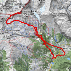
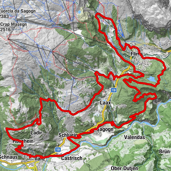
Murschetg (1,083 m)Larnags1.3 kmHerz-Jesu-Kirche5.7 kmFalera (1,213 m)5.7 kmUstria Encarna5.9 kmRestaurant Casa Seeli6.0 kmEncavridas13.0 kmRuschein (1,155 m)14.9 kmSogn Gieri15.1 kmCrusch Clis15.6 kmQui17.9 kmPrau Fri18.3 kmIlanz (702 m)18.8 kmCasanova19.4 kmKästris (722 m)20.5 kmSchluein22.3 kmSagens (779 m)25.7 kmTuora30.8 kmTuora31.4 kmFlims (1,081 m)42.3 kmFlims Dorf42.4 kmFoppa (1,424 m)45.8 kmSalein46.9 kmStartgels47.6 kmRunca Höhe50.9 kmFlims Waldhaus53.8 kmMurschetg (1,083 m)56.4 km
- Best season
-
JanFebMarAprMayJunJulAugSepOctNovDec
- Description
-
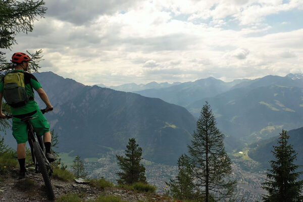
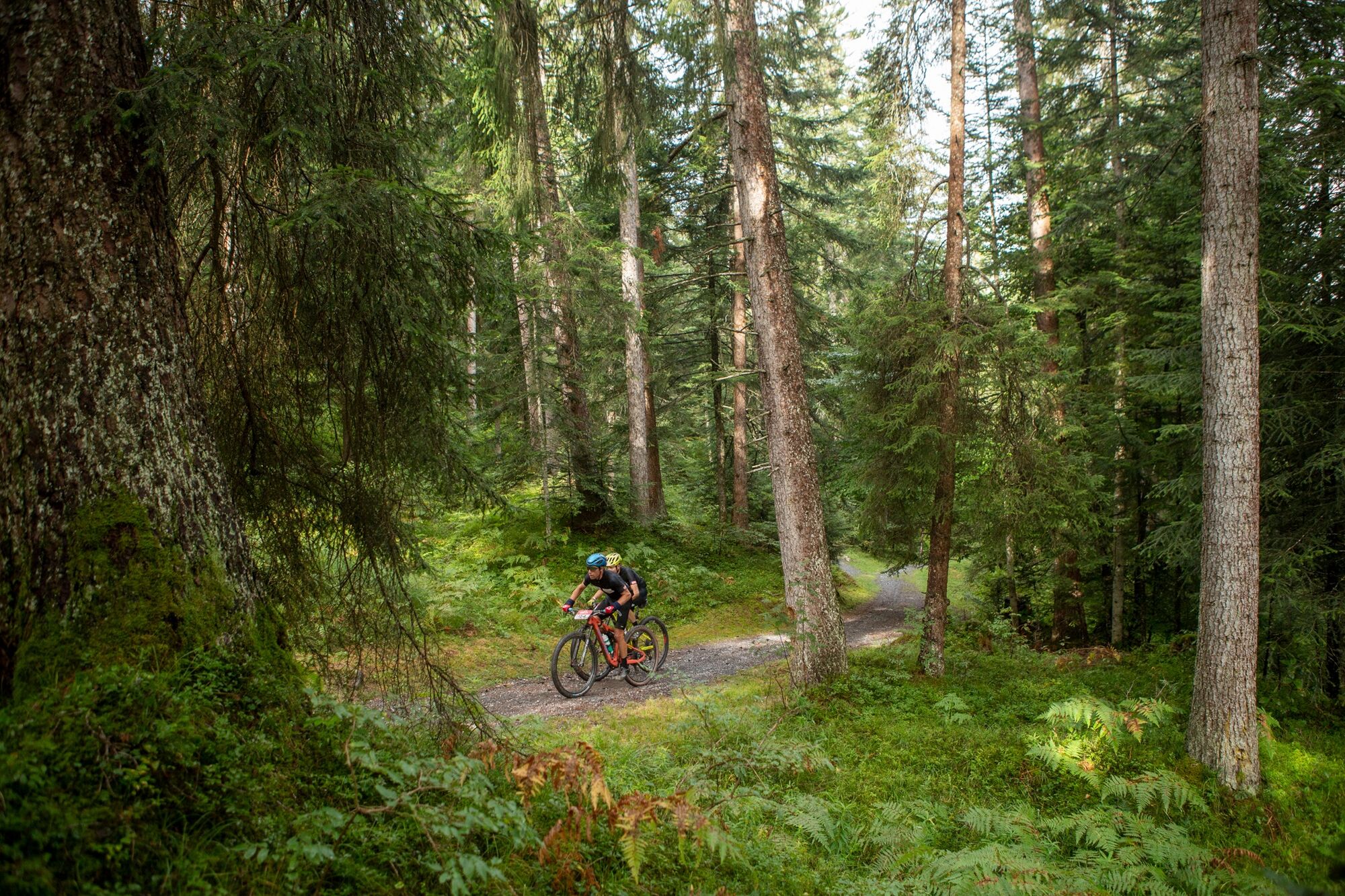
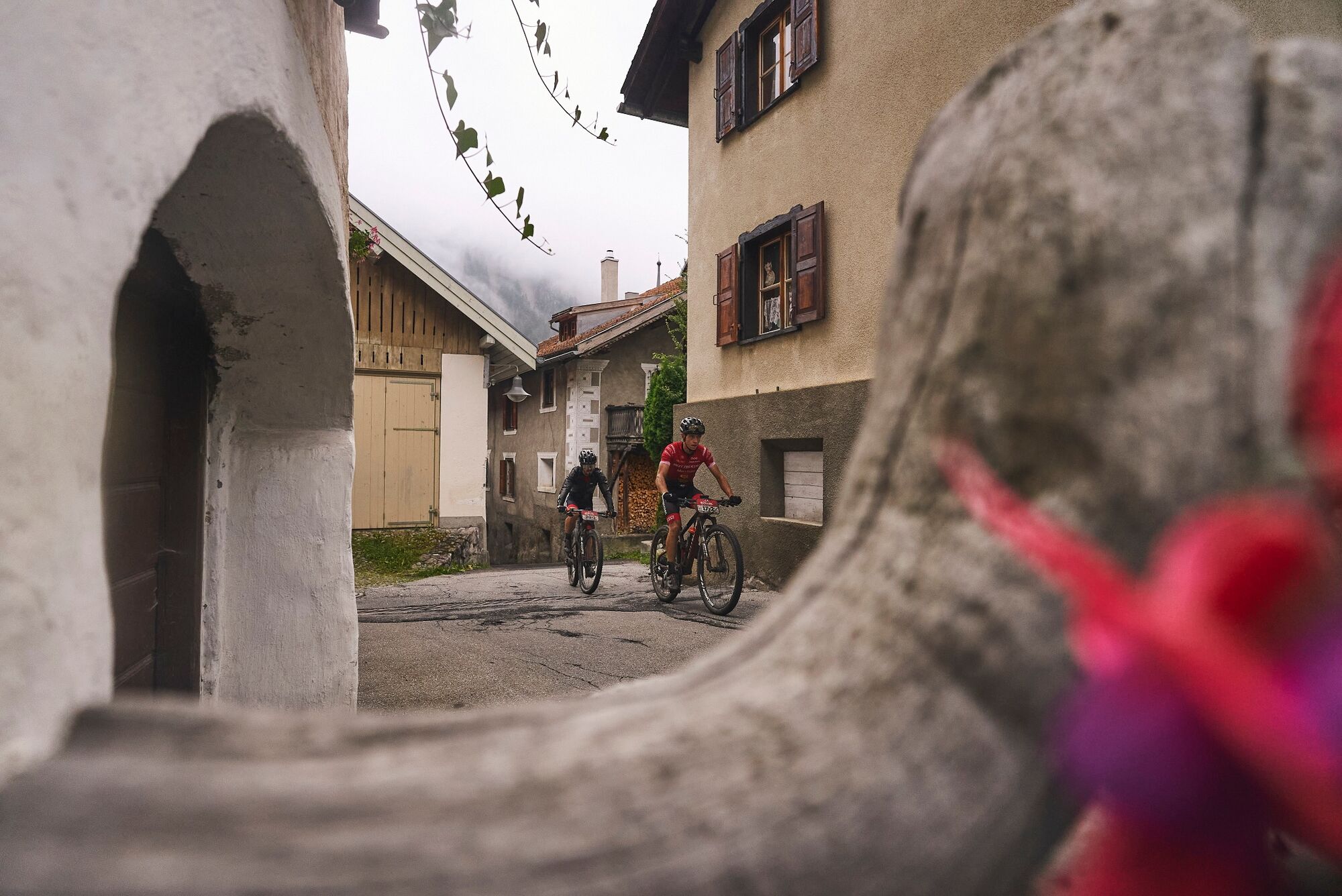
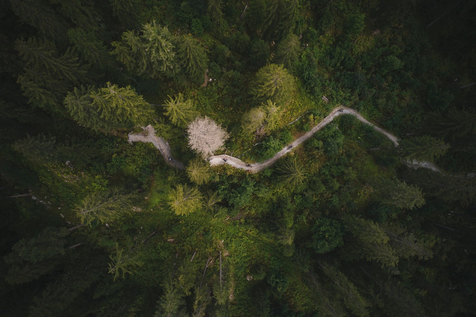
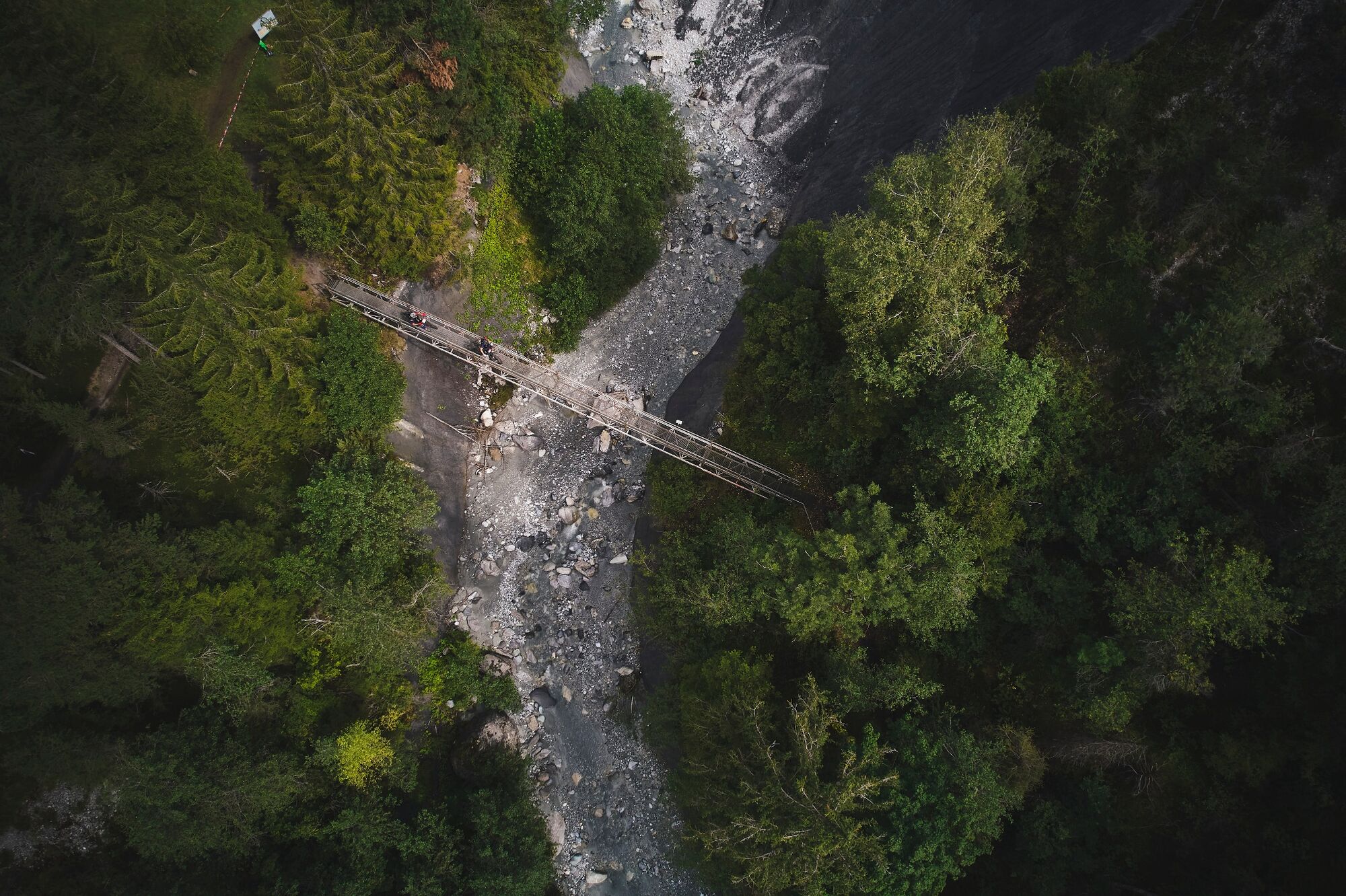
A leisurely ride from Laax up Murschetg, the tour takes you across the slopes of the Surselva to Falera and Ladir. Past old farmhouses, small chapels and through the unique panorama of the Grisons mountains. In Ruschein, a short stop at the village church allows you to fill your bottle with fresh well water before you start the descent to Ilanz. The wide trail is flowing and suitable for riders of all levels. Passing the Dominican nunnery, the route initially follows the Rhine for three kilometres until it starts to climb again. The trail climbs steadily through the Flims forest towards Lake Cauma and back up through Flims to Alp Foppa and Startgels, the highest point of the tour.Here you enter the Runca Trail, over waves, doubles and tables of the seemingly endless eight-kilometre flow trail down to Flims. This descent was the highlight of the week for the Swiss Epic participants.
The tour is only digital, and not signalled in the terrain, it is suitable for beginners and advanced riders and is also easy to ride with an ebike. Safe riding on alpine single trails is a prerequisite.
Translated with www.DeepL.com/Translator (free version)
- Directions
-
Laax Murschetg - Crap Sogn Gion - Crap Masegn - Grauberg - Nagens Trail - Runca Trail - Caumasee - Laax Murschetg
- Highest point
- 1,587 m
- Endpoint
-
Laax, Murschetg
- Height profile
-
 © outdooractive.com
 - Equipment
-
Repair and first aid kit belong in the rucksack
- Safety instructions
-
Watch out for hikers. In the canton of Graubünden we share the paths.
- Tips
-
Highlights: In advance Glacier & Tectonics Arena Sardona & Lake Cauma
- Additional information
- Directions
-
By car on the A13 motorway from Zurich to Chur, exit 18 Flims
- Public transportation
- Parking
-
Parking spaces in the Laax Bergbahnen car park

- Author
-
The tour Swiss Epic 2020 – Stage 1 is used by outdooractive.com provided.


Surfaces
General info
-
Glarnerland
339
-
Flims Laax Falera
222
-
Castrisch
120


")