- Brief description
-
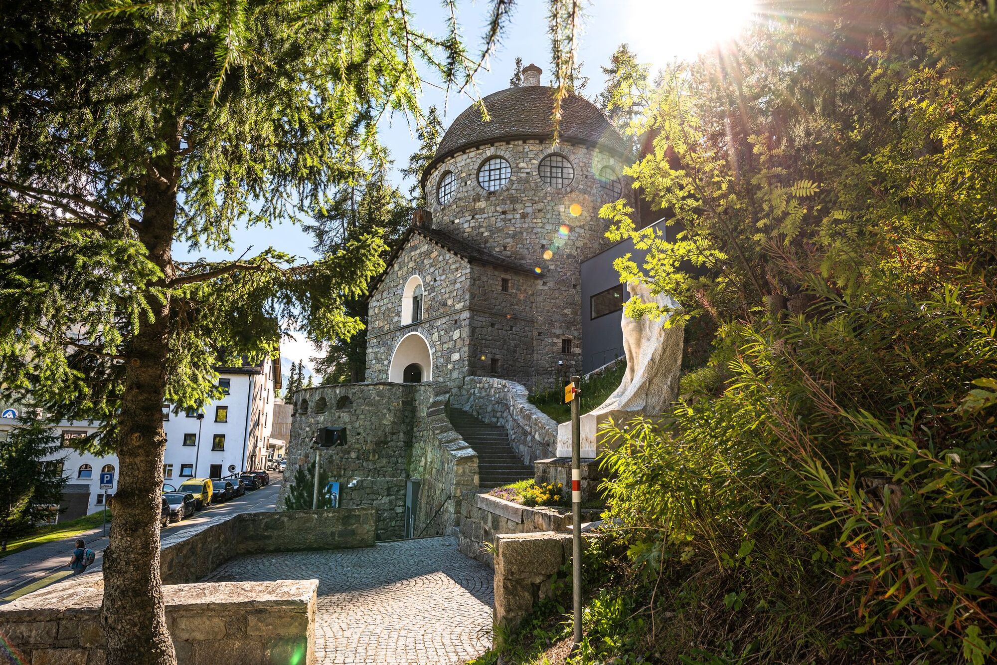
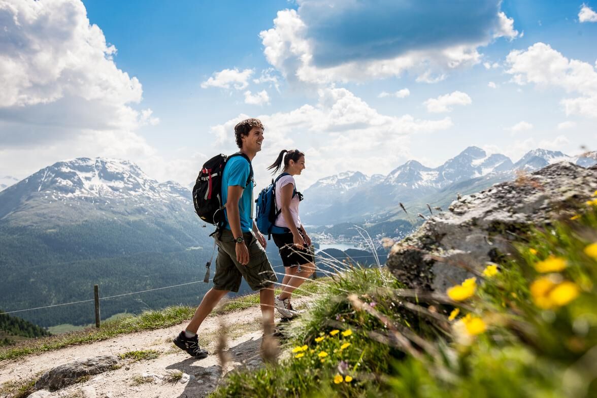
The Senda Segantini is a unique hiking route through the incomparable Engadin and Sursetter mountain landscape. It follows the footsteps of Italian painter Giovanni Segantini (1858 -1899), the great master of combining realism with symbolism.
- Difficulty
-
medium
- Rating
-
- Starting point
-
Savognin
- Route
-
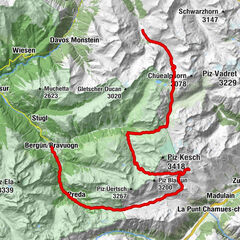
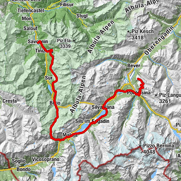
Savognin (1,207 m)Tinzen (1,232 m)2.9 kmLa Ruigna11.2 kmLais11.5 kmCuorts (1,963 m)12.0 kmCotti Agricultura12.4 kmTgalucas12.5 kmTga d'Meir13.3 kmTigias13.5 kmHotel Piz Platta13.5 kmSalategnas14.2 kmPardeala17.1 kmAlp d'Iert17.4 kmAlp Natons (1,963 m)17.9 kmBaselgia San Giagl20.7 kmBivio (1,769 m)21.0 kmGravella21.0 kmReformierte Kirche Bivio21.1 kmCurtinfess21.4 kmTgavretga22.3 kmNagrign22.9 kmPrevostign23.1 kmFumia23.4 kmFranca's Beizli - Besenbeiz23.4 kmSeptimer Pass (2,310 m)27.8 kmSeptimerhütte28.2 kmCasaccia (1,458 m)33.4 kmCavril (1,551 m)34.9 kmMaloja (1,809 m)36.5 kmMaloja Posta36.5 kmSchweizerhaus36.5 kmKirche St. Peter und Paul36.6 kmLa Motta37.0 kmCresta37.2 kmPlan Cuncheta38.0 kmIsola (See) (1,810 m)39.8 kmIsola (1,811 m)40.5 kmIls Barchiröls42.1 kmSils/Segl Maria Barchiröls (1,802 m)42.2 kmPizs42.8 kmSpuonda Laret42.8 kmSuot Crastas43.0 kmSils im Engadin (1,803 m)43.0 kmAlpenrose43.0 kmReformierte Kirche43.2 kmBar Cetto43.7 kmCrastas Dadour43.8 kmPas-chs43.9 kmCrastas44.1 kmCrastas Dadains44.2 kmSurlej49.1 kmSilvaplana (1,815 m)50.2 kmClavanövs50.7 kmSt. Rochus52.7 kmRestaurant Talvo by Dalsass52.8 kmPrimula52.8 kmChampfèr (1,825 m)52.9 kmSankt Moritz Bad55.1 kmSankt Moritz (1,822 m)56.2 kmSt. Moritz (1,775 m)56.8 kmLandgasthof Meierei58.3 kmHotel Restaurant Stazersee59.2 kmSan Spiert62.9 kmPontresina (1,805 m)62.9 kmSegantinihütte68.8 kmSchafberg (2,647 m)69.2 kmMargun70.9 kmMuottas Muragl (2,453 m)72.2 km
- Best season
-
JanFebMarAprMayJunJulAugSepOctNovDec
- Description
-
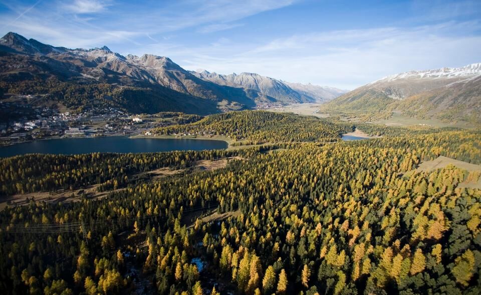
Every section of this route from Savognin to the Upper Engadin leads past places with ties to the artist. From the actual views that inspired him, to the Segantini Museum and where he died. Those taking this route experience the natural beauty of the region twofold: through their own eyes and from Segantini's perspective.
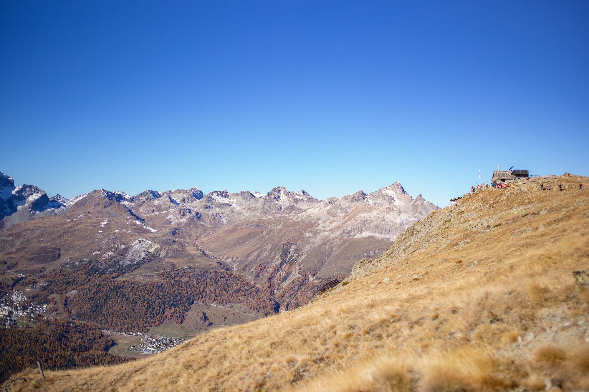
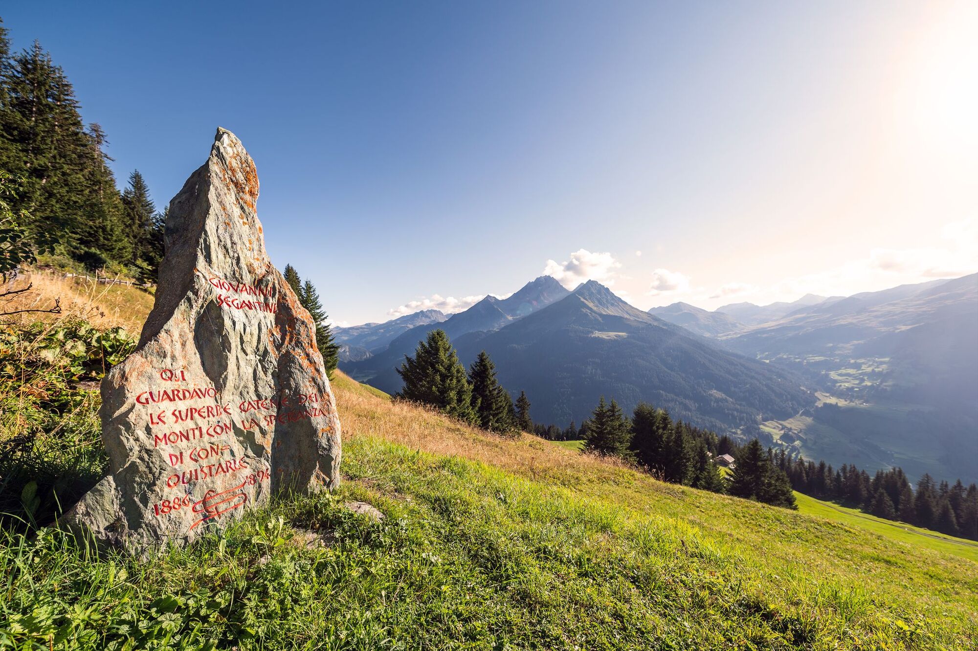
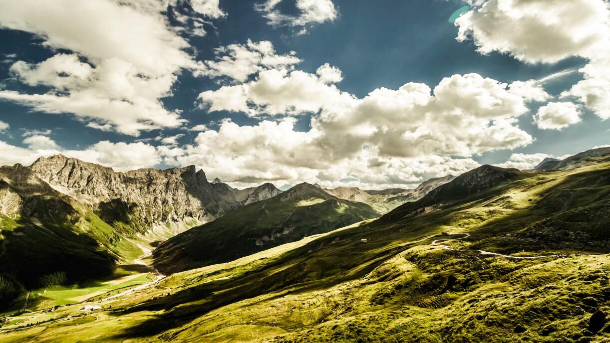
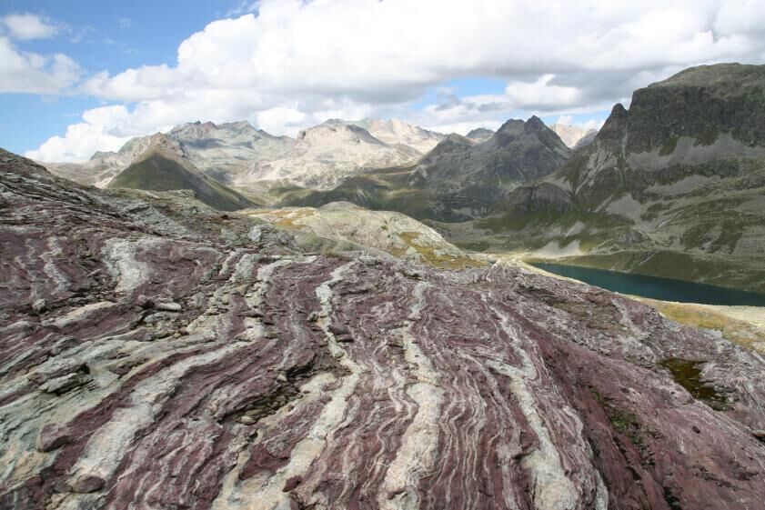
Giovanni Segantini was inspired by the Sursetter and Engadin landscape and the light prevailing here. The Senda Segantini still exists from this natural scenic setting. The route is lined with picturesque highlights, with Alp Flix, one of Europe's most important high moorlands, the Engadin lake landscape and Schafberg at the foot of the Piz Muragl.
The Septimer and Maloja passes ranked as key trading routes as early as Roman times and thus have much to offer in historical terms. Also of considerable importance: the three-way watershed Lunghin from which water flows into three European seas: the Black Sea, North Sea and Mediterranean. - Directions
-
Stages:
25.1 Savognin–Bivio
25.2 Bivio–Maloja
25.3 Maloja–Pontresina
25.4 Pontresina– Muottas Muragl - Highest point
- 2,728 m
- Endpoint
-
Muottas Muragl
- Height profile
-
 © outdooractive.com
 - Tips
-
Book online
- Additional information
-
Booking:
TourEvent GmbH
Bündastrasse 14
7260 Davos Dorf
Tel. 081 420 40 80
info@tourevent.ch
www.alpen-trails.chInformationcenter:
Savognin Tourismus im Surses
Stradung
7460 Savognin
Tel. +41 81 659 16 16
Fax. +41 81 659 16 17Engadin St. Moritz
St. Moritz Tourist Information
Via Maistra 12
CH - 7500 St. Moritz
T + 41 (0)81 837 33 33
F + 41 (0)81 837 33 77
stmoritz@estm.ch
- Author
-
The tour 25 Senda Segantini is used by outdooractive.com provided.


General info
-
Veltlin / Valtellina
853
-
Engadin St. Moritz
782
-
Silvaplana
338