
- Brief description
-
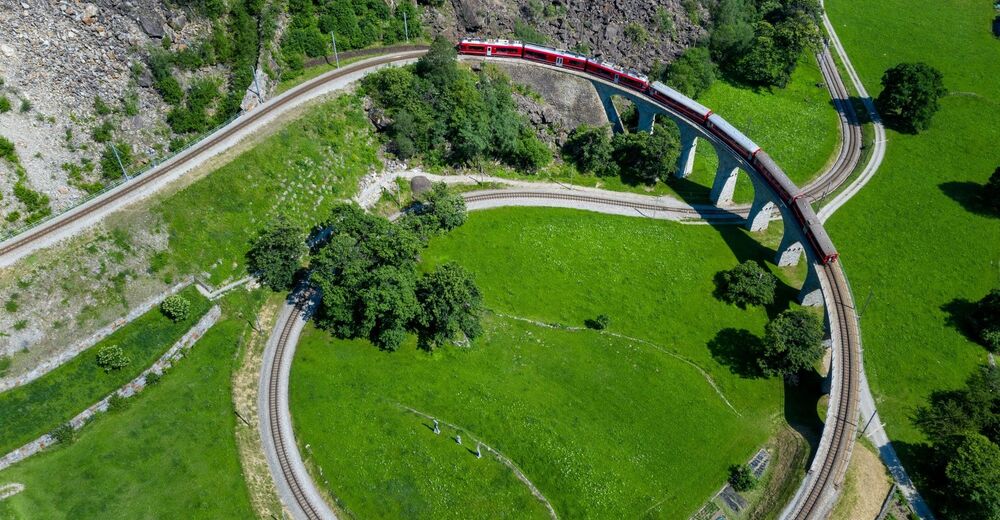
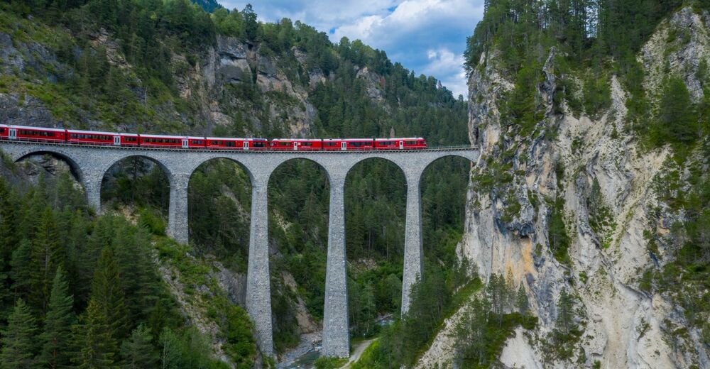
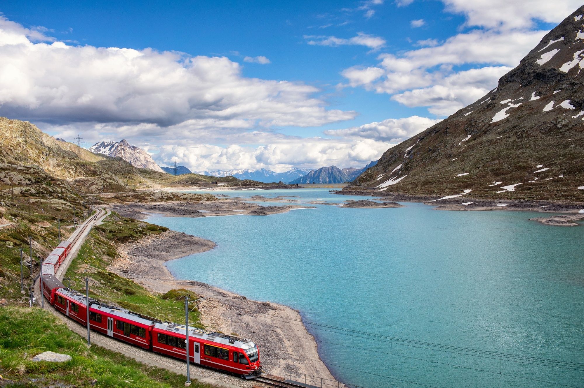
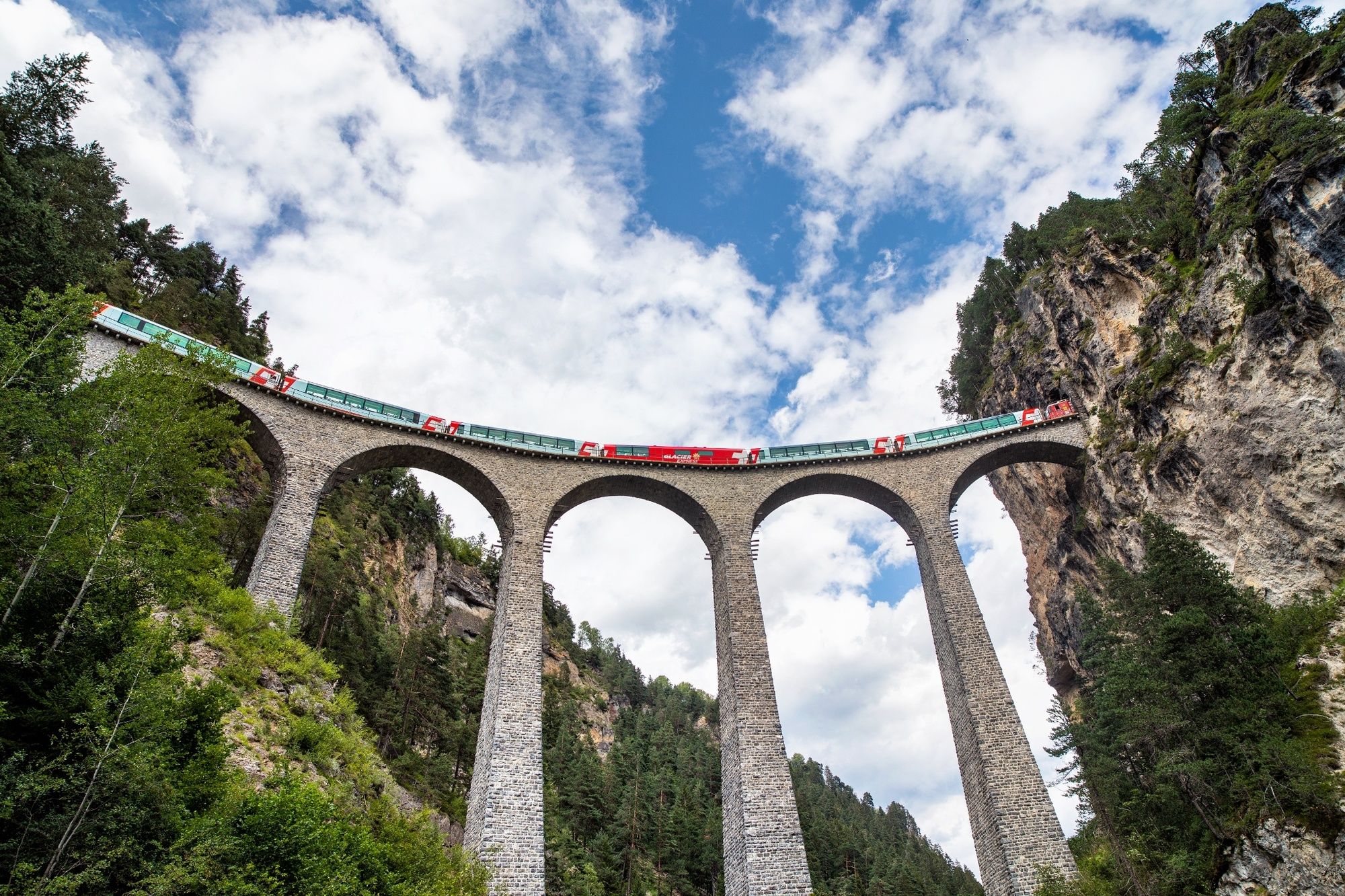
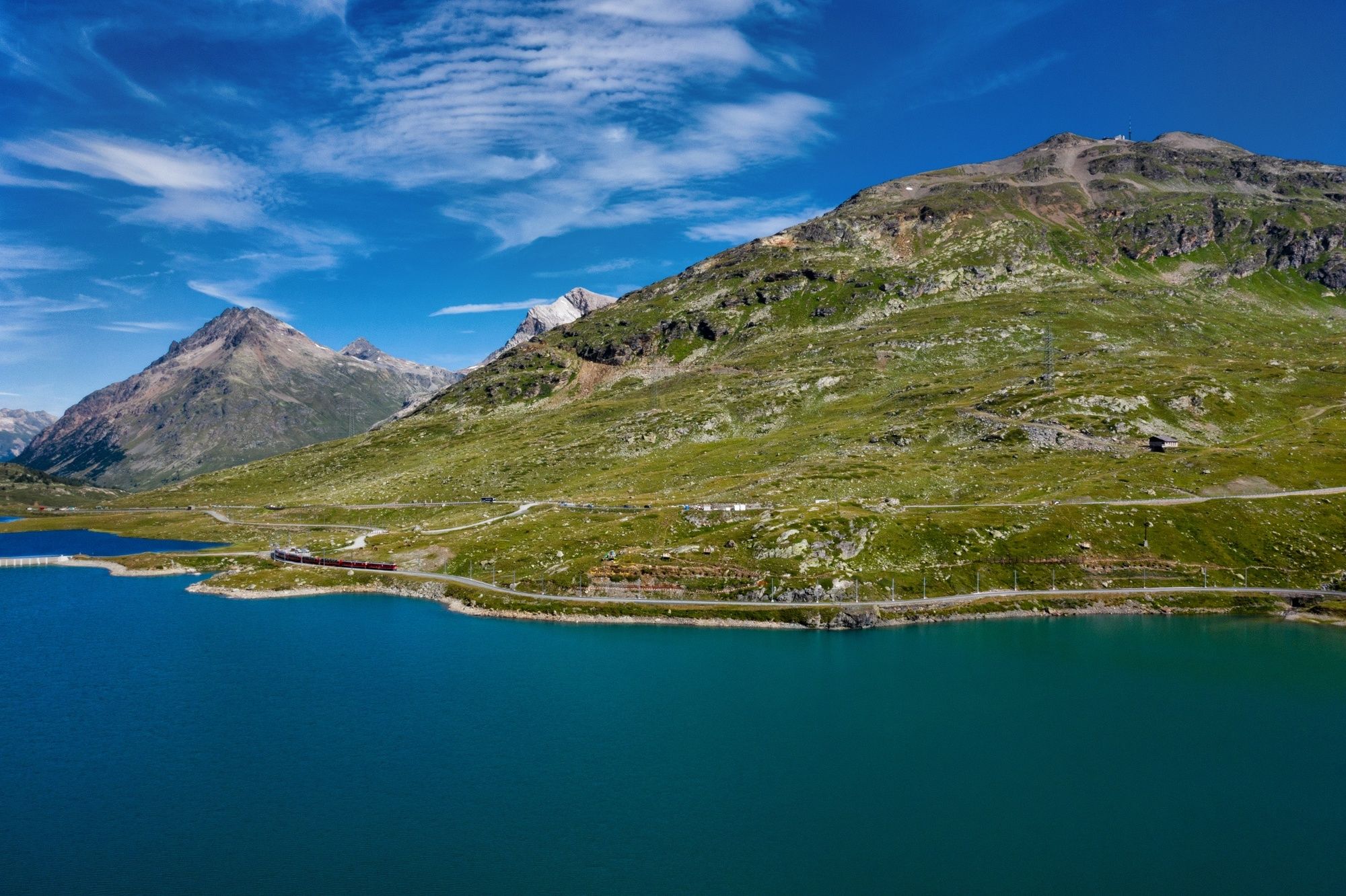
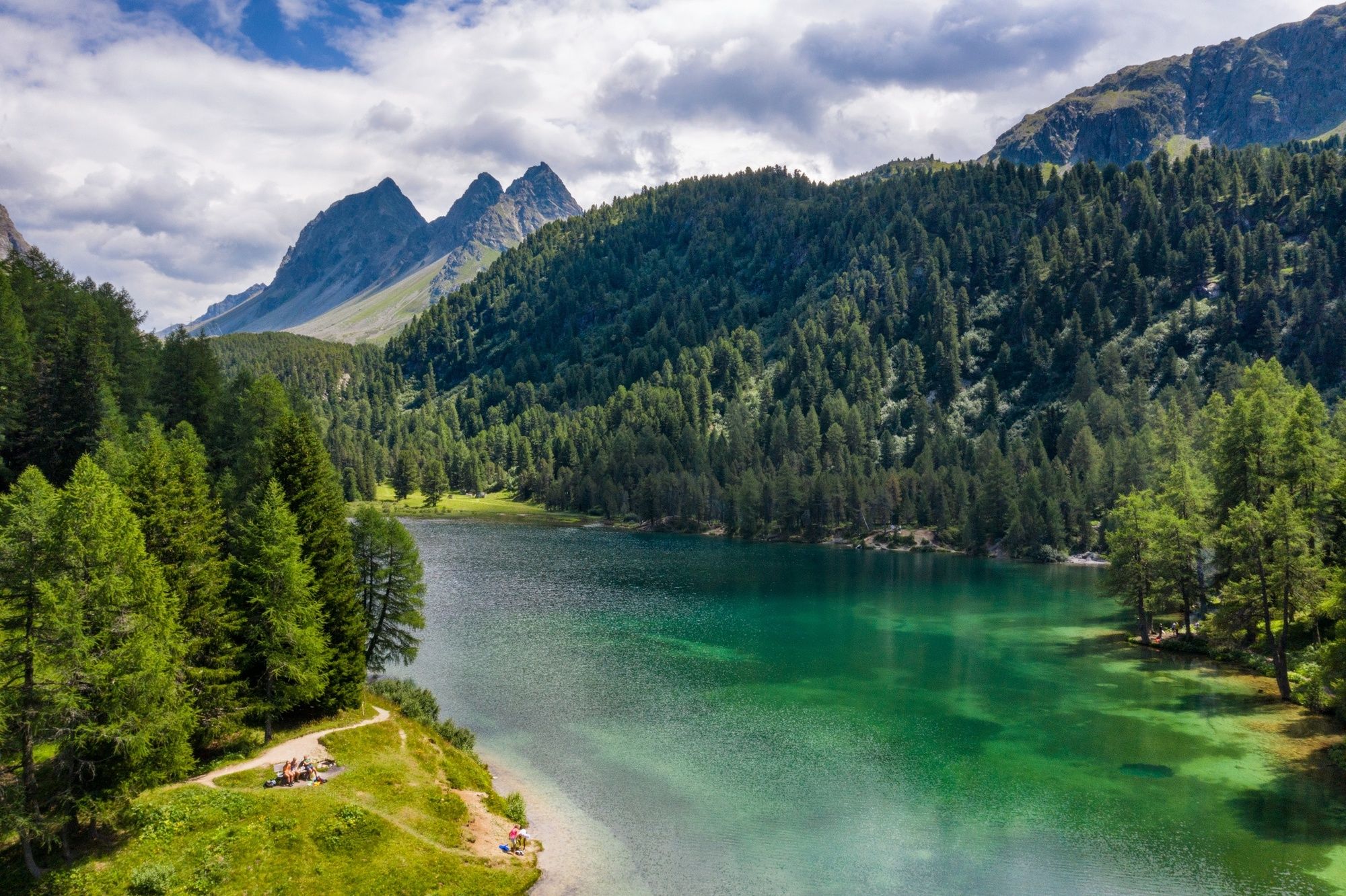
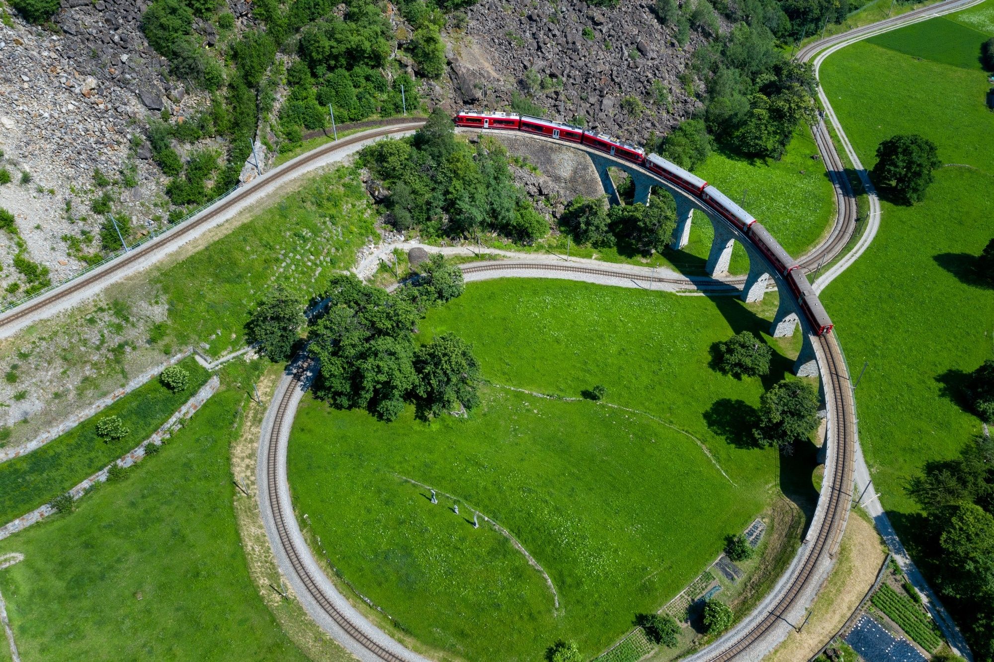
The hiking trail along the UNESCO World Heritage section of the Rhaetian Railway runs as near as possible to the Albula and Bernina railway line, regularly affording enchanting open views of an over 100-year-old total artwork in stunning Alpine scenery.
- Difficulty
-
medium
- Rating
-
- Starting point
-
Thusis
- Route
-
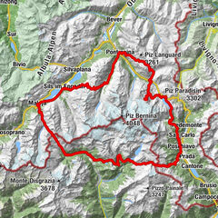
Tosanna (720 m)Übernolla0.5 kmSils im Domleschg (633 m)2.1 kmMuldain11.5 kmAlvaschein (1,001 m)15.7 kmAlpenblick16.0 kmMistail18.1 kmSt. Peter Mistail18.3 kmBistro Casti19.5 kmTiefencastel (884 m)19.5 kmTiefencastel (859 m)19.9 kmAcla digl Eppi21.7 kmPro digl Daia22.4 kmPlaz la Lenna23.0 kmStretg23.1 kmSurava (904 m)23.2 kmVal Raschèr23.7 kmArasa launga24.1 kmPlan digls Bovs24.2 kmOislas miez24.5 kmAlvaneu Bad (957 m)26.5 kmFilisur (1,080 m)31.2 kms'Bahnhöfli31.2 kmHeiligkreuzkirche31.5 kmFilisur (1,032 m)31.6 kmStuls (1,551 m)37.9 kmBergün (1,372 m)40.4 kmBergün (1,367 m)41.0 kmTect41.3 kmNaz46.5 kmPreda47.2 kmFuorcla Crap Alv54.7 kmSpinas (1,815 m)59.1 kmBerggasthaus Spinas59.3 kmVal Bever60.5 kmBever (1,708 m)63.0 kmDa Primo63.0 kmSamaden (1,721 m)65.4 kmCelerina (1,730 m)68.1 kmCelerina (1,714 m)68.2 kmCelerina Seglias (1,730 m)68.4 kmShuttlecock Corner69.7 kmSt. Mauritius70.2 kmChiesa riformata di Sankt Moritz70.8 kmSankt Moritz (1,822 m)70.9 kmSt. Moritz (1,775 m)71.4 kmLandgasthof Meierei72.9 kmPontresina (1,774 m)77.8 kmSan Niculò78.5 kmPontresina (1,805 m)78.8 kmSan Spiert79.0 kmSurovas (1,822 m)79.5 kmMorteratsch (1,896 m)84.7 kmMorteratsch84.8 kmCascata da Bernina85.8 kmBahnhofbuffet Ospizio Bernina95.2 kmOspizio Bernina (2,253 m)95.3 kmAlp Grüm101.3 kmAlp Grüm (2,091 m)101.5 kmAlbergo Ristorante Stazione Alp Grüm101.6 kmStablini102.4 kmCavaglia104.1 kmBuffet Diego104.4 kmStazione Cavaglia104.5 kmCavaglia (1,692 m)104.5 kmCadera107.4 kmPoschiavo (1,014 m)110.5 kmScalino112.0 kmAnnunziata113.0 kmPrada113.0 kmPagnoncini114.0 kmSpinadascio114.1 kmCantone114.8 kmChiesa San Francesco115.2 kmLe Prese115.2 kmMiralago (965 m)118.3 kmAlbergo Ristorante Miralago118.4 kmSankt Gotthard118.4 kmMiralago118.5 kmBrusio (780 m)121.8 kmLi Canvi122.0 kmCasai122.9 kmCampascio123.5 kmLi Geri124.4 kmCampocologno (553 m)125.4 kmTorri125.9 kmTirano (441 m)128.7 km
- Best season
-
JanFebMarAprMayJunJulAugSepOctNovDec
- Description
-
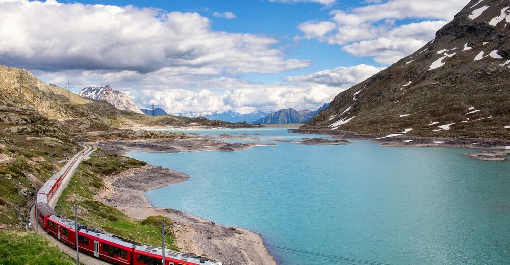
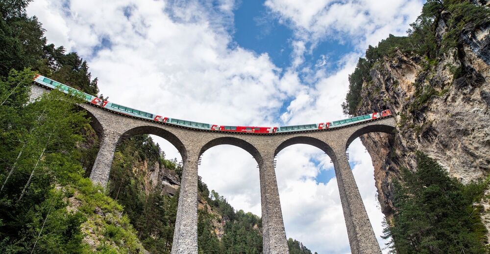
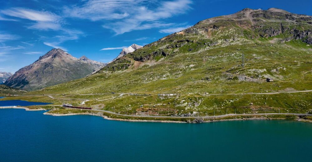
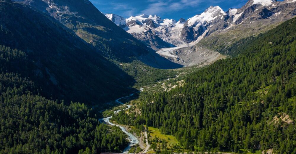
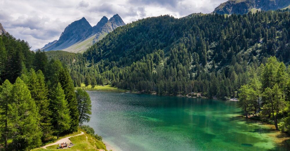
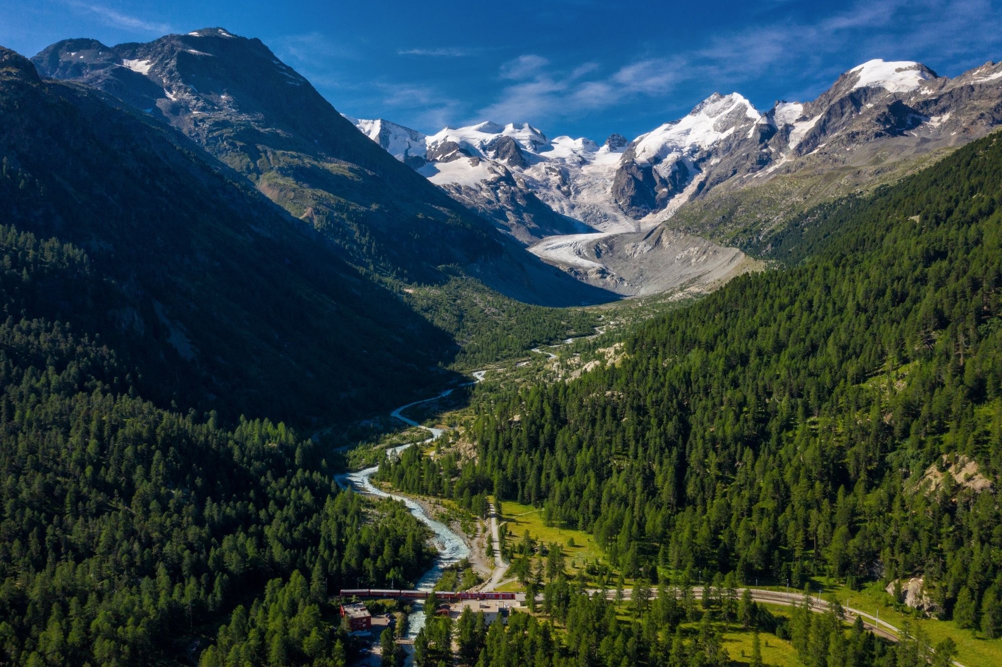
In terms of solving structural- engineering problems and the harmony between their encroachment and nature, the Albula/Bernina railway line is a masterpiece from railway pioneering days. The first part of the hike leads along the Albula line from Thusis, north of the Alps, through the Albulatal valley via the Fuorcla Crap Alv into Val Bever and through the unique Upper Engadin high plateau to St. Moritz. The southern four sections continue over the Berninapass into Val Poschiavo and finally reach Tirano in the Italian Veltlin.
Making the journey on foot through one of the most varied natural and cultural landscapes between high Alpine, Alpine and sub-tropical zones, continually accompanied by the Albula and Bernina railway, is one of the most wonderful of all hiking experiences. The UNESCO structures, such as bridges, viaducts (helical) tunnels and stations set in wild natural Alpine surroundings can best be discovered on this hike in total harmony with nature. Three language regions, numerous landscape gems and places with special character round off this hiking experience.
A long-distance hike for everyone, as it constantly crosses the route of the Rhaetian Railway, providing the assurance of being able to climb aboard at any time and thus arrange and adapt the one-day stages to suit individual fitness levels and interests. - Directions
-
Stages:
33.1 Thusis–Tiefencastel
33.2 Tiefencastel–Filisur
33.3 Filisur–Bergün
33.4 Bergün–Preda
33.5 Preda–Spinas
33.6 Spinas–St. Moritz
33.7 St. Moritz–Ospizio Bernina
33.8 Ospizio Bernina–Cavaglia
33.9 Cavaglia–Le Prese
33.10 Le Prese–Tirano (I) - Highest point
- 2,474 m
- Endpoint
-
Tirano (I)
- Height profile
-
 © outdooractive.com
 - Tips
-
Book Albula/Bernina trek online including luggage transport under www.graubuenden.ch.
- Additional information
-
Guestinformation Viamala
Bahnhof / Schalter RhB
7430 Thusis
Tel. +41 (0)81 650 90 30
info@viamala.ch
Ente Turistico Valposchiavo Stazione
7742 Poschiavo
Tel. +41 (0)81 844 05 71
Fax +41 (0)81 844 10 27
info@valposchiavo.ch
www.valposchiavo.ch

- Author
-
The tour 33 Via Albula/Bernina is used by outdooractive.com provided.


General info
-
Engadin St. Moritz
782
-
Corviglia
348