
- Brief description
- Difficulty
-
difficult
- Rating
-
- Starting point
-
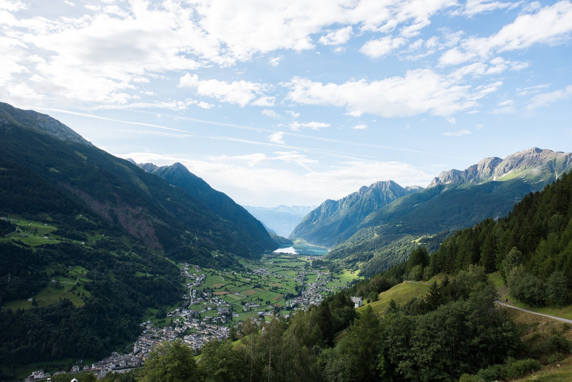
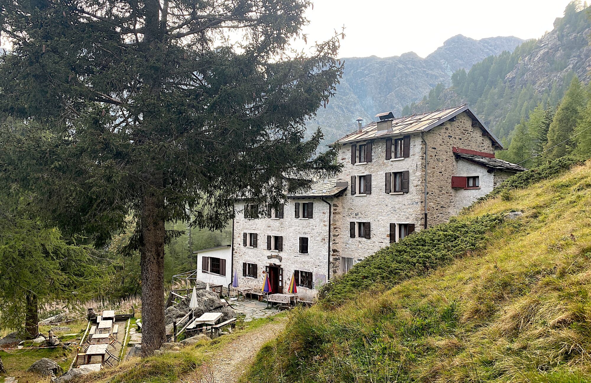
Poschiavo
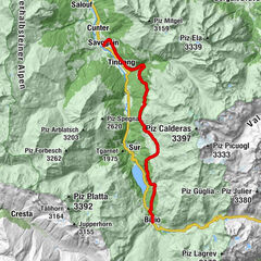
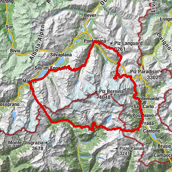
- Route
-
Poschiavo (1,014 m)Cadera3.1 kmStazione Cavaglia5.9 kmCavaglia (1,692 m)5.9 kmBuffet Diego5.9 kmCavaglia6.3 kmAlbergo Ristorante Stazione Alp Grüm9.2 kmAlp Grüm (2,091 m)9.2 kmAlp Grüm9.5 kmBelvedere9.6 kmOspizio Bernina (2,253 m)14.2 kmBahnhofbuffet Ospizio Bernina14.2 kmDiavolezzafirn (Bergstation)22.3 kmDiavolezza (2,958 m)22.6 kmBerghaus Diavolezza (2,976 m)22.8 kmLanguard (2,326 m)39.1 kmAlp Languard39.2 kmLanguard39.6 kmPontresina (1,805 m)42.1 kmSan Niculò42.3 kmFuorcla Surlej53.6 kmMurtèl55.9 kmAlp Prasüra62.2 kmCrastas Dadains62.9 kmCrastas63.1 kmCrastas Dadour63.2 kmChrist-König-Kirche63.2 kmReformierte Kirche63.5 kmAlpenrose63.7 kmSils im Engadin (1,803 m)63.7 kmSpuonda Laret63.7 kmPizs63.7 kmSuot Crastas63.7 kmSils/Segl Maria Barchiröls (1,802 m)64.6 kmIls Barchiröls64.7 kmIsola (1,811 m)66.3 kmIsola (See) (1,810 m)67.0 kmPlan Cuncheta68.9 kmCresta69.6 kmLa Motta69.9 kmSchweizerhaus70.3 kmKirche St. Peter und Paul70.3 kmMaloja Posta70.4 kmMaloja (1,809 m)70.5 kmAela70.9 kmLan Palü71.4 kmOrden d'Ent (1,797 m)72.0 kmCavloccio74.4 kmAlp da Cavloc (1,911 m)74.7 kmPlan Canin76.2 kmStrenciuri78.6 kmPian del Lupo (1,622 m)85.8 kmAi Portoni86.3 kmChiareggio86.4 kmCiaz88.0 kmAlpe Senevedo Superiore88.6 kmPalo Lungo (1,650 m)89.4 kmBraciascia91.7 kmBarchetto (1,800 m)93.3 kmLa Zocca (1,844 m)93.6 kmRifugio Lago Palù94.6 kmBocchel del Torno (2,203 m)95.9 kmRifugio Musella100.4 kmAlpe Musella100.5 kmRifugio Mitta100.5 kmAlpe Foppa (1,830 m)102.4 kmCampo Moro103.9 kmRifugio Poschiavino104.2 kmRifugio Zoia104.4 kmPiano di Campagneda106.5 kmPasso di Campagneda (2,628 m)109.3 kmPass da Cancian (2,498 m)110.4 kmPoschiavo (1,014 m)120.1 km
- Best season
-
JanFebMarAprMayJunJulAugSepOctNovDec
- Description
-
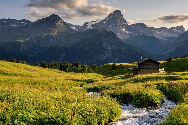
The Bernina-Tour offers wonderful views of all the glaciers in the Bernina mountain range. The route leads from Mediterranean-style Poschiavo over the Bernina Pass and the Diavolezza to Pontresina, and then further up to the Fuorcla Surlej, with views over the Engadin’s lake-strewn landscape. From Maloja, the tour continues over the Muretto Pass to the southern side of the Bernina mountain chain on Italian soil and then back to the starting point in Poschiavo.
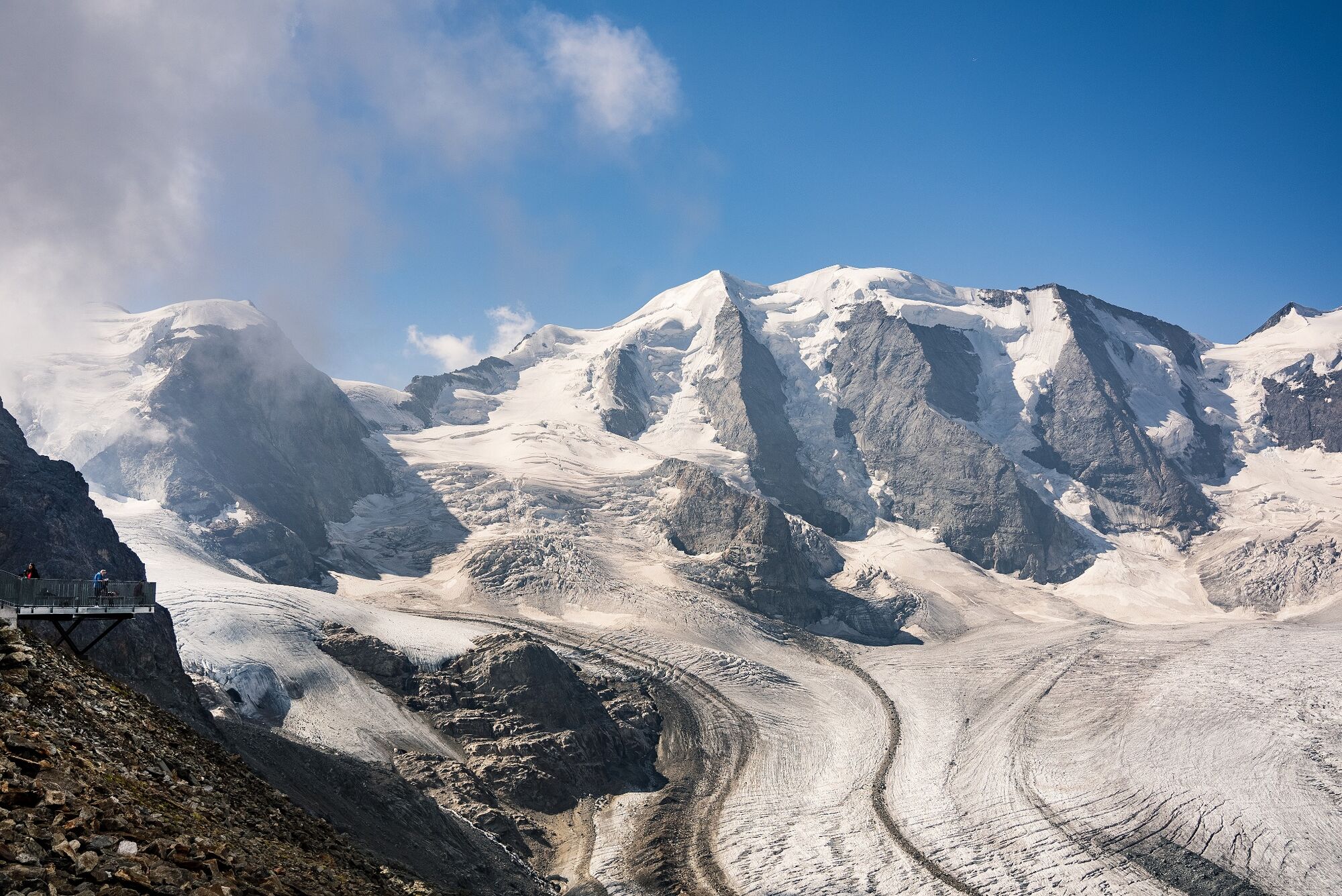
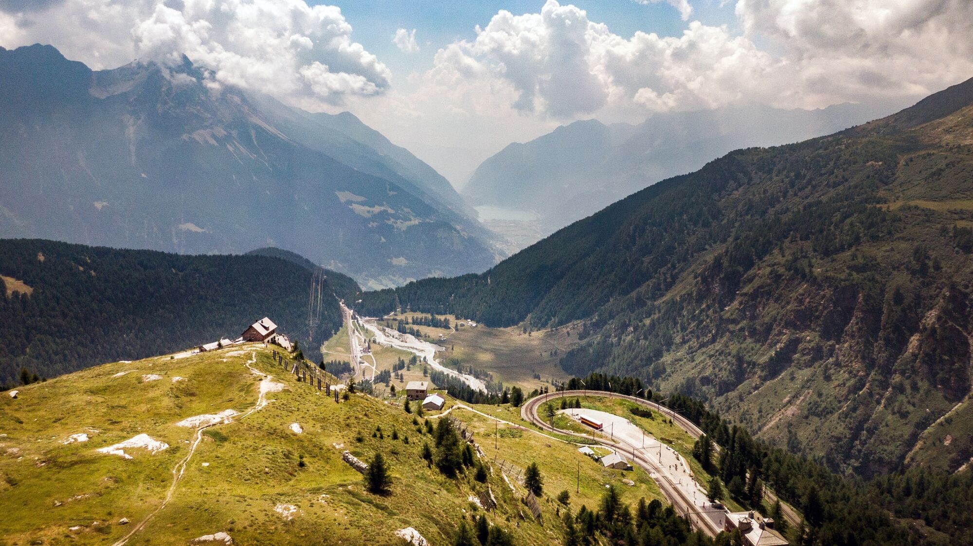
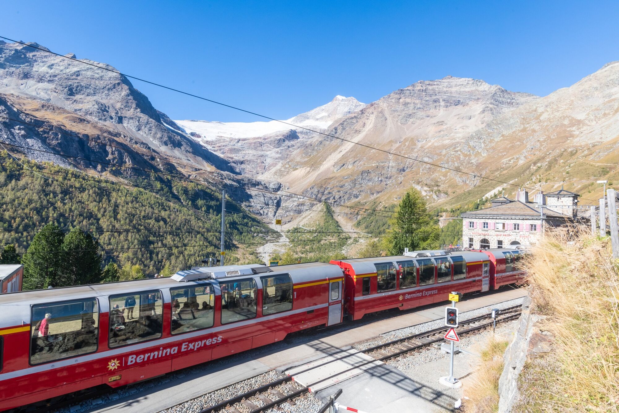
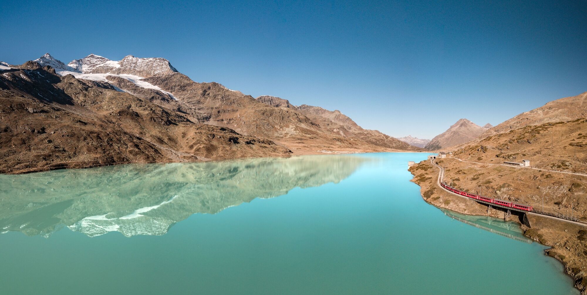
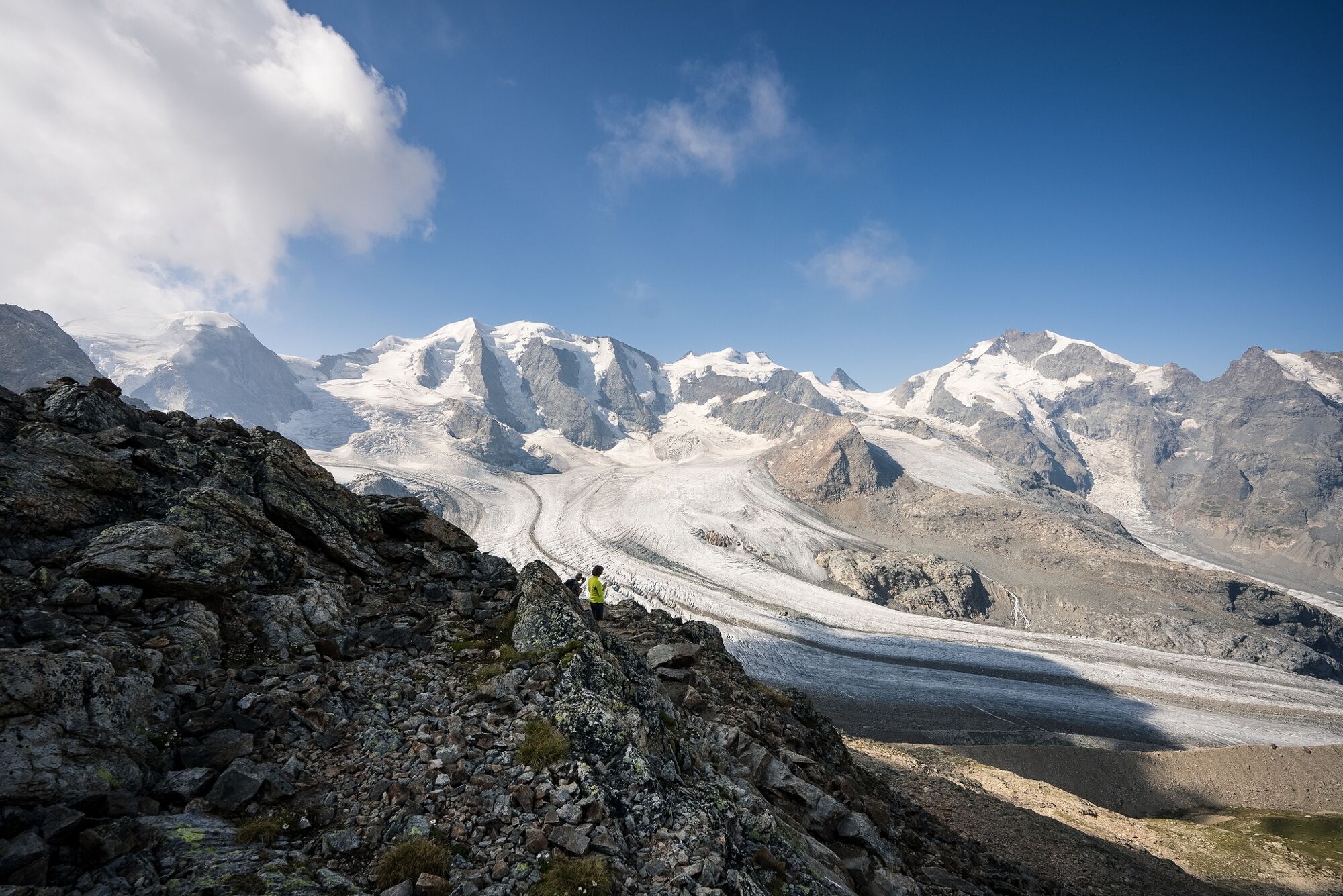
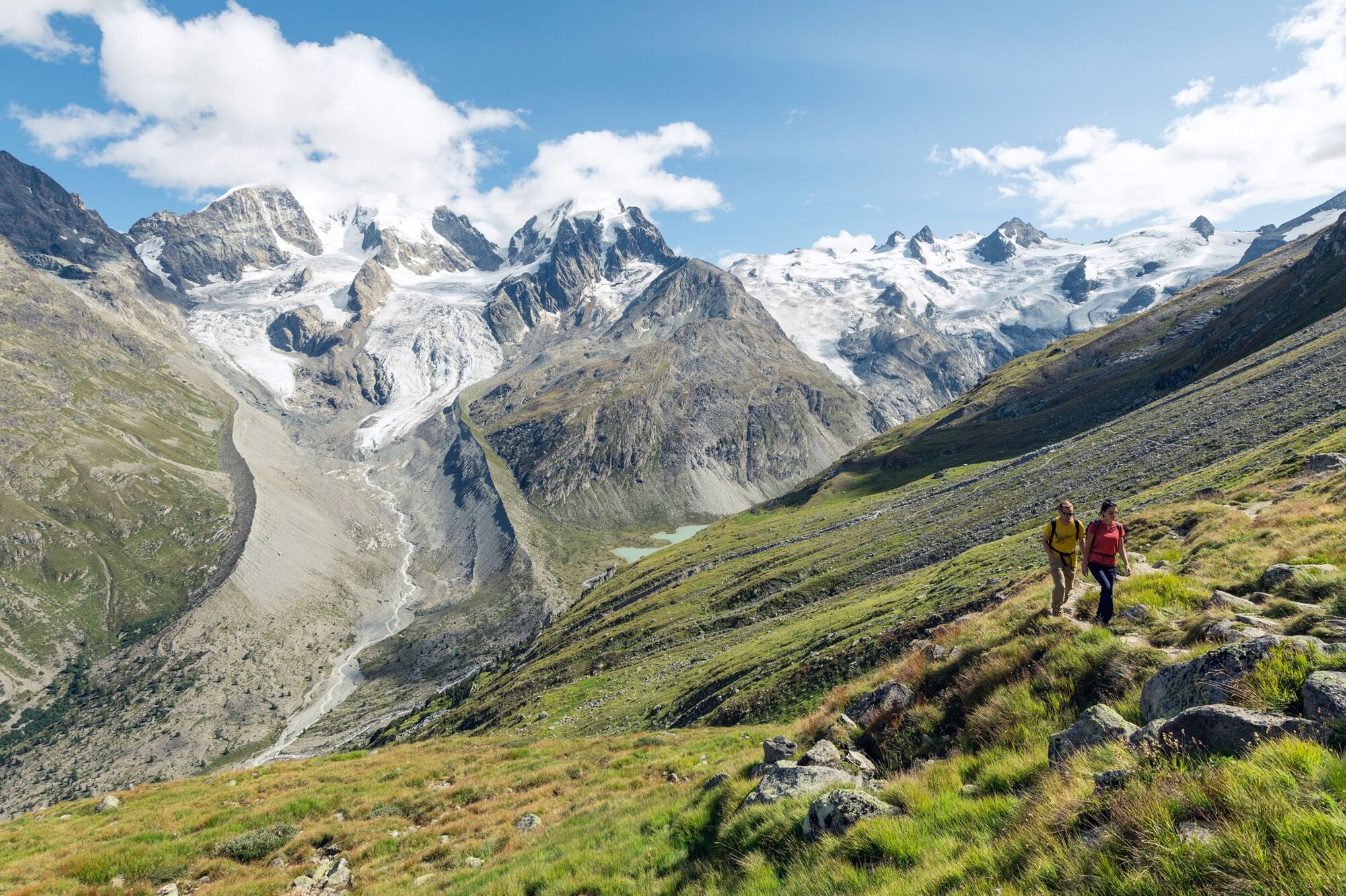
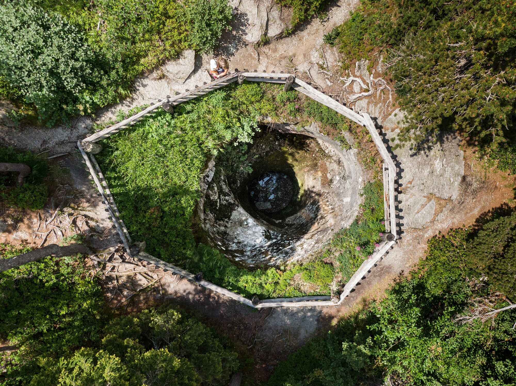
The tour begins in Poschiavo, at 1,021 metres above sea level, and leads along the UNESCO World Heritage line of the Rhaetian Railway up to the Bernina Pass at 2,328 metres, via the Cavaglia Glacier Garden with its glacial mills and Alp Grüm, giving the first view of the eastern flanks of the Bernina massif. The wide, flat path along the Lago Bianco gives runners the opportunity to take a breather and loosen up their muscles for the further 700 metres of altitude up to the summit station of the Diavolezza gondola with a breathtaking view of the Pers and Morteratsch glaciers.
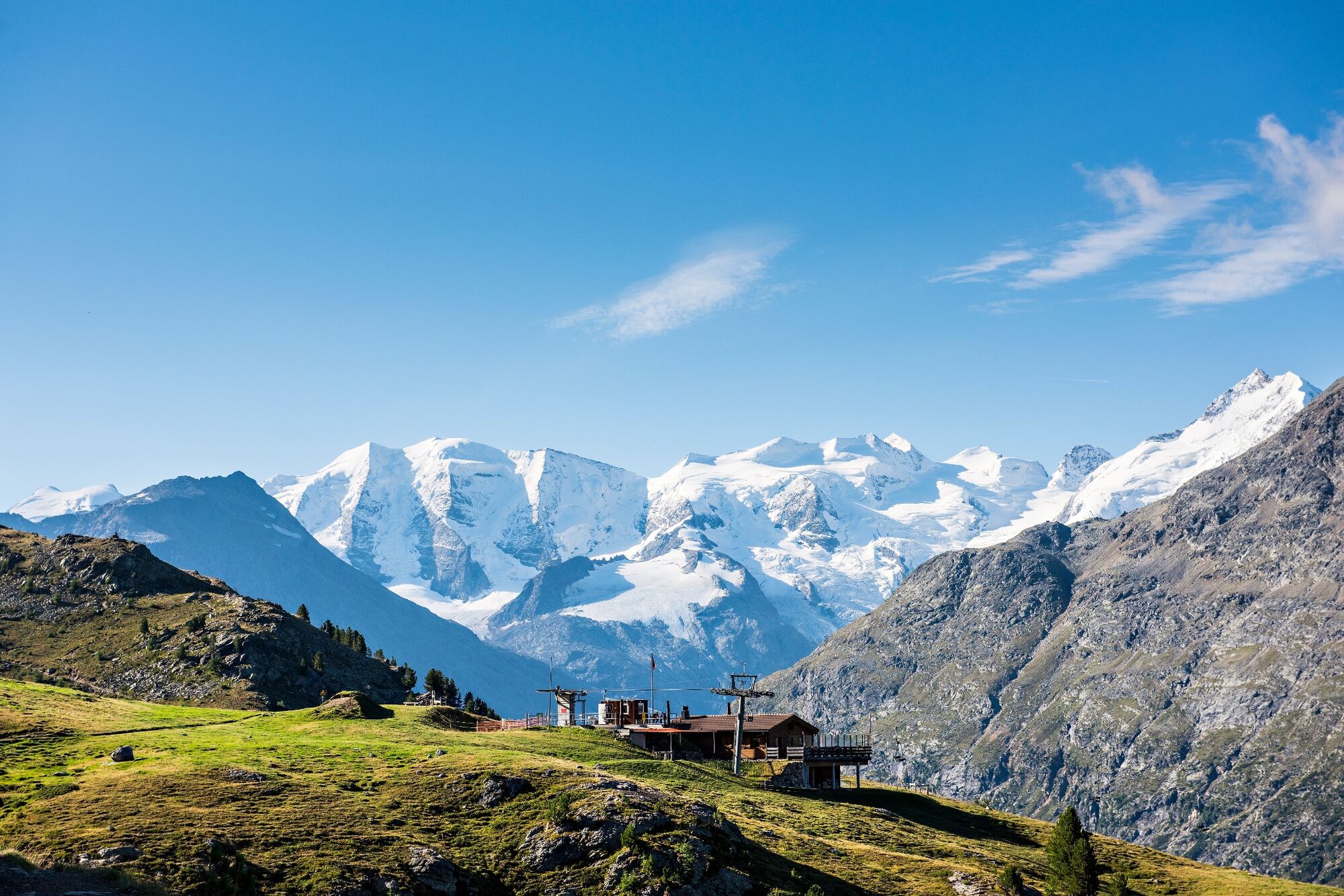
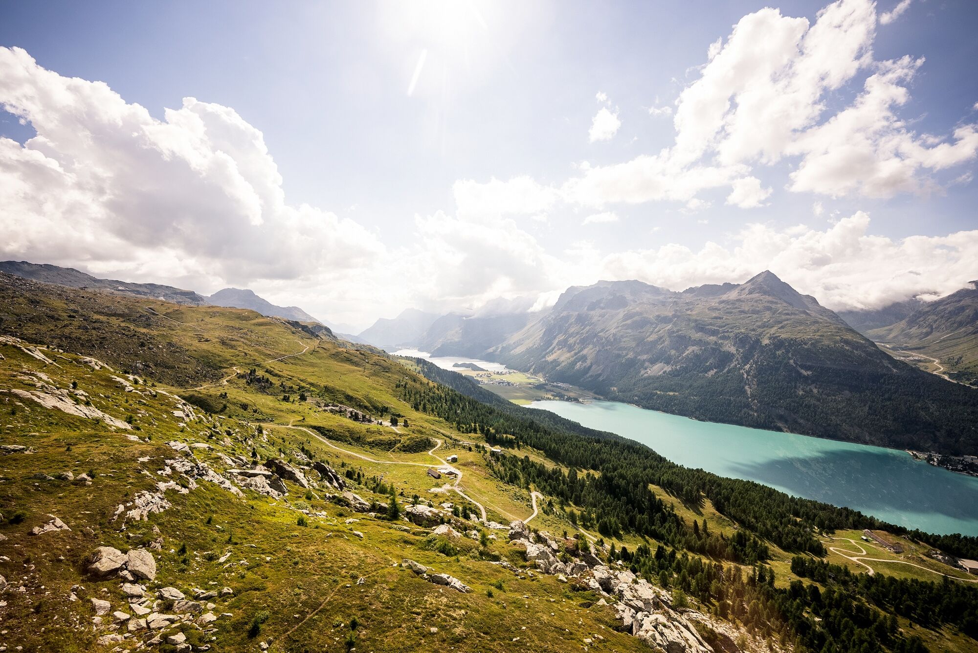
From the summit station of the Diavolezza gondola you take the gondola back to the valley station or walk, past the Lej da Diavolezza lake, down to the valley station. After crossing the main road, the steep ascent to the Fuorcla Pischa at 2,835 metres begins. On the descent to Pontresina, you can enjoy refreshments in the Chamanna Paradies hut or the Bergrestaurant Alp Languard. Once you have left the mountaineering village of Pontresina, on the same level as the train station you enter the pretty Val Roseg. In front of the Hotel Restaurant Val Roseg, the path turns right and climbs up to the Fuorcla Surlej, offering views of the Vadret da Roseg lake and the Bianco ridge of the Piz Bernina on the left. After the Fuorcla Surlej, the trail descends 200 vertical metres to the tiny Lej da la Fuorcla lake and traverses the mountain flank to Alp Prasüra and down to the culture village of Sils.
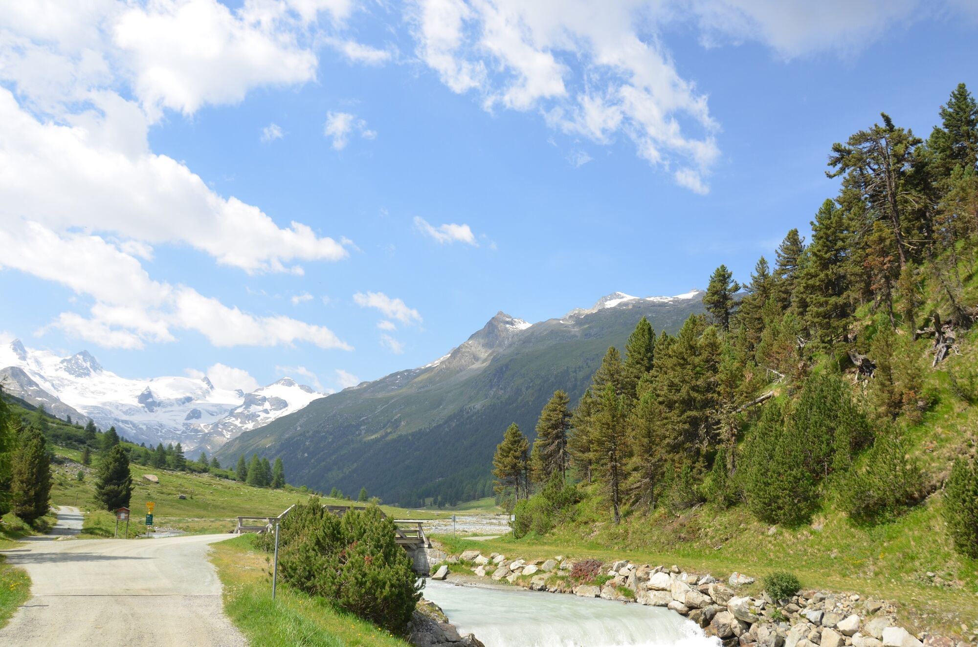
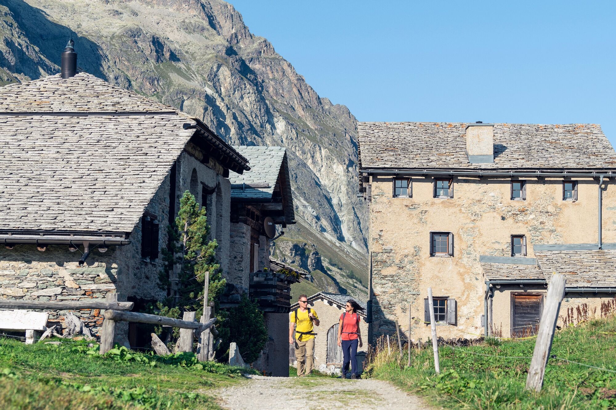
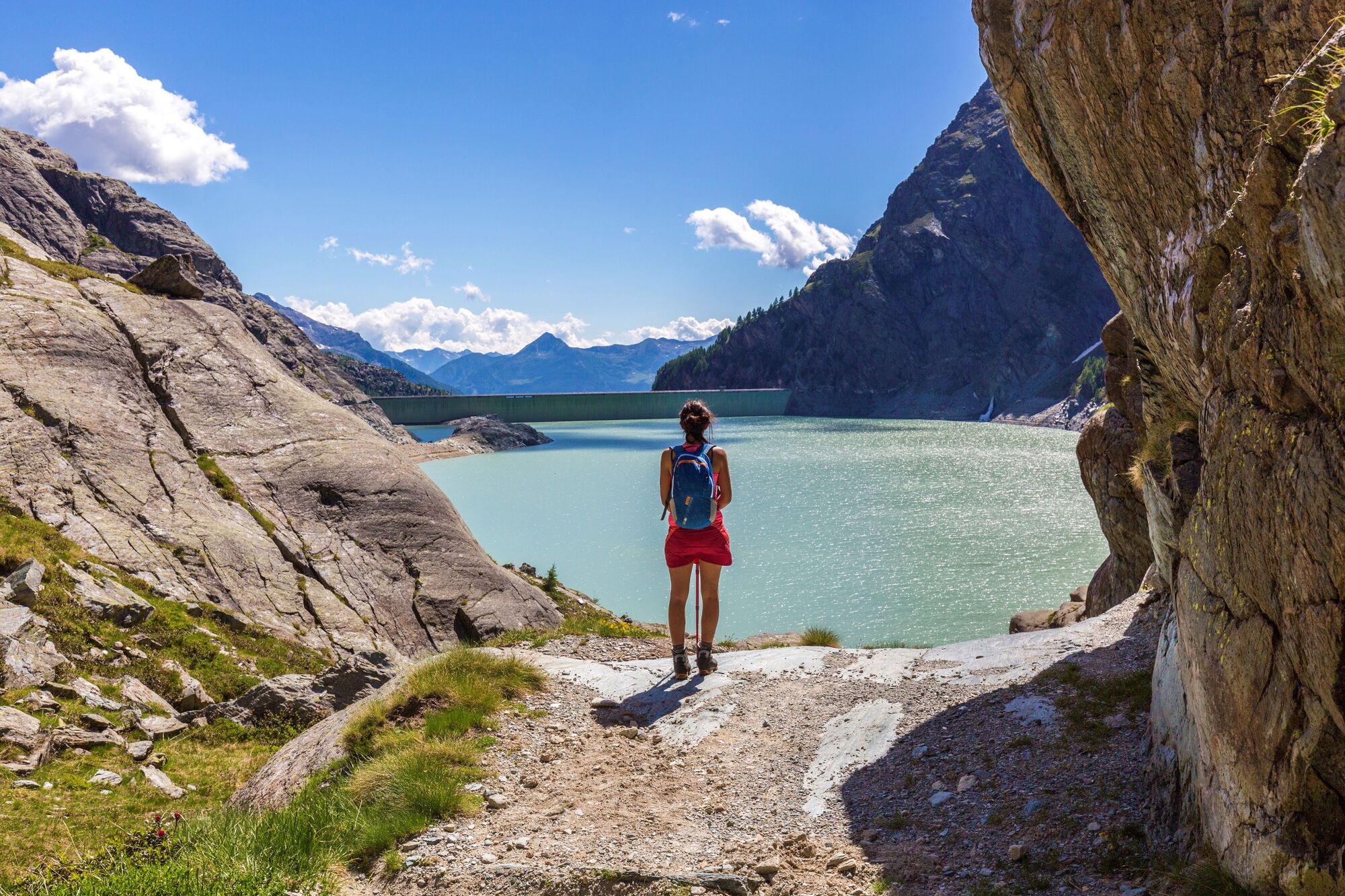
Next, the route leads past the church in Sils Baselgia to the left side of the valley along the Via Engiadina, past the Heidi village of Grevasalvas to Maloja. After crossing the Lägh da Cavloc in the direction of the Forno glacier, you reach the turn-off to the left in the direction of the Muretto Pass at 2,559 metres, leading along an ancient trail that once linked Switzerland and Italy. A wide path proceeds down to the Alpe dell’Oro above the Italian village of Chiareggio. After traversing the meadows of Palolungo, Paluetto abd Barchetto, you reach the Lago Palù at 1,947 metres above sea level. From there, the route climbs once again over the Bocchel de Torno and through extensive forests and over alpine meadows, past Campascio and Musella down to the dam of Lago Campomoro. Over the dam and up, past the lovely little lakes, you reach the Passo Canciano, which takes you back across the border into Switzerland. Here, the steep descent, past Selva, to Poschiavo begins.
More information
Engadin Tourismus AG
Via Maistra 1
CH-7500 St. Moritz
Phone: +41 81 830 00 01
E-mail: allegra@engadin.ch
Internet: www.engadin.chBooking
Eurotrek AG
Zürcherstrasse 42
CH-8103 Unterengstringen
Phone: +41 44 316 10 00
E-mail: eurotrek@eurotrek.ch
Internet: www.eurotrek.ch/en/hiking-bernina-tour-6-5Guided Tour
www.berninatrekking.com/bernina-weitwandern-7 - Directions
-
Poschiavo - Cavaglia - Alp Grüm - Ospizio Bernina - Daivolezza - Fuorcla Pischa - ALp Languard - Pontresina - Val Roseg - Fuorcla Surlej - Mittelstation Corvatsch - Sils - Grevasalvas - Blaunca - Maloja - Lägh Cavloc - Passo del Muretto - Chiareggio - Rifugio Longoni - Alpe Palù - Bocchel de Torno - Alpe Musella - Rifugio Bignami - Passo Confinale - Ursé - Val - Poschiavo
- Highest point
- 2,997 m
- Endpoint
-
Poschiavo
- Height profile
-
 © outdooractive.com
 - Equipment
-
Good, sturdy hiking boots, clothes suitable for the weather, sun and rain protection, enough food and drinking water, first aid kit, good map material.
- Safety instructions
-
In June there may still be snow at higher altitudes.
In the mountains, mobile phone reception cannot always be guaranteed. - Tips
-
Bring your passport with you, the tour goes over to Italy.
- Public transportation
-
With the RhB on the Unesco World Heritage Line to Poschiavo.


- Author
-
The tour 53 Bernina-Tour is used by outdooractive.com provided.


General info
-
Veltlin / Valtellina
851
-
Engadin St. Moritz
782
-
Diavolezza
278