- Brief description
-
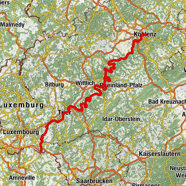
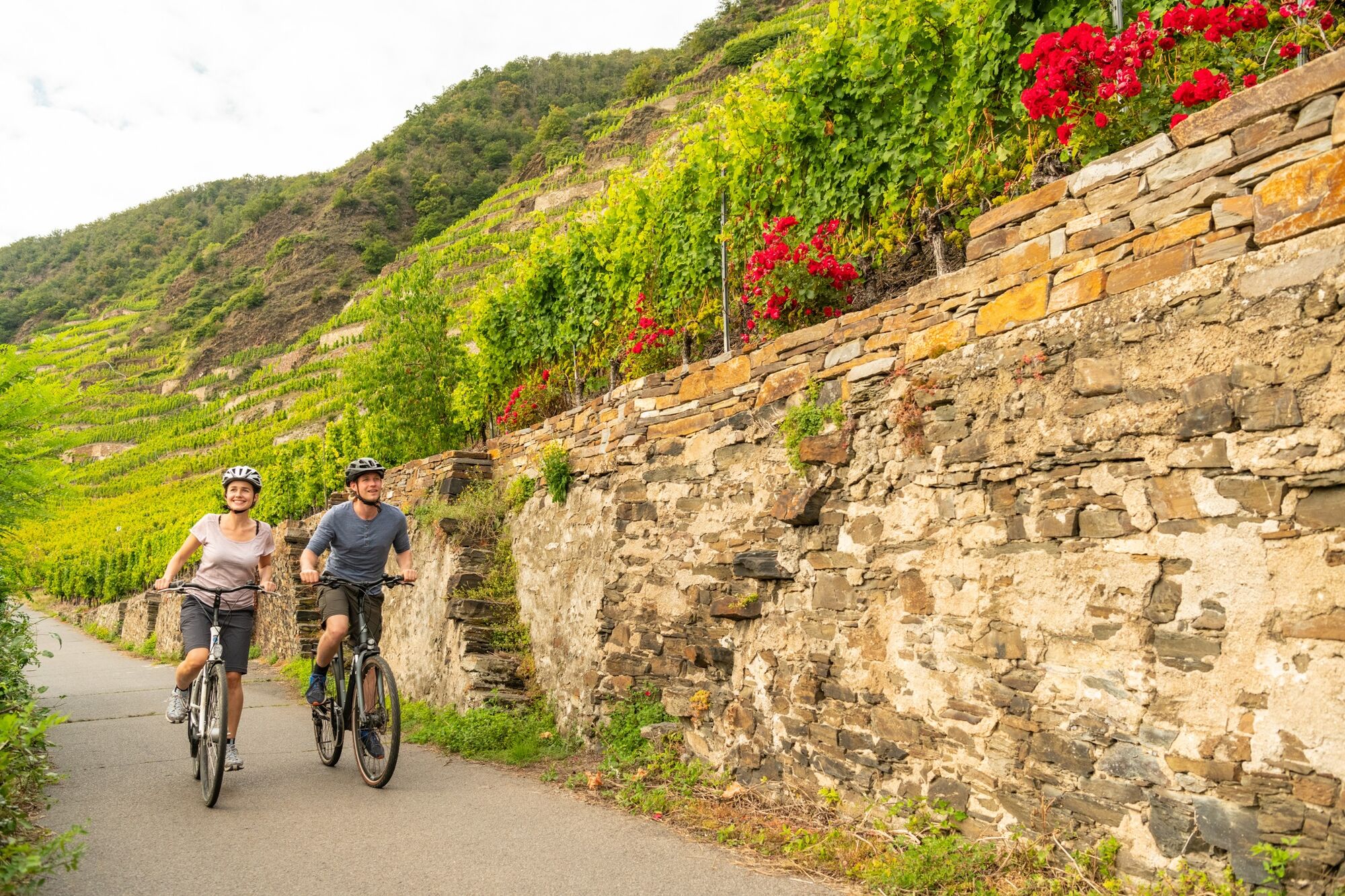
The Mosel Cycle Path leads through 248 kilometres of diverse landscape; rambling and secluded in parts, pretty spectacular in others.
- Difficulty
-
easy
- Rating
-
- Starting point
-
Perl
- Route
-
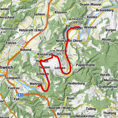
SchengenBesch3.2 kmBech-Kleinmacher6.5 kmRemich8.2 kmPalzem11.5 kmStadtbredimus11.8 kmHüttermühle15.4 kmWehr (Mosel)15.5 kmEhnen16.9 kmOberwormeldingen18.7 kmWincheringen-Wormeldange19.0 kmRehlingen21.1 kmAhn21.4 kmNittel24.7 kmMachtum25.3 kmWellen27.4 kmSt. Kunibert27.4 kmpehna's Restaurant27.6 kmWellen-Grevenmacher27.9 kmGrevenmacher28.7 kmTemmels30.6 kmSt. Peter30.7 kmMertert32.5 kmWasserbillig34.4 kmOberbillig34.5 kmOberbillig34.7 kmReza's Restaurant34.8 kmWasserbilligerbrück35.0 kmWasserliesch37.4 kmReinig37.9 kmKonz39.6 kmKarthaus42.0 kmLöllberg44.1 kmMatthias46.5 kmZurlauben49.3 kmTrier (137 m)49.5 kmPallien50.0 kmIn der Langwies unter Pallien50.6 kmDie Langwies51.6 kmPfalzel55.3 kmKlosterschenke55.5 kmEhrang60.8 kmSankt Georg65.1 kmSchweich66.7 kmKirsch67.7 kmLonguich (130 m)68.9 kmLongen70.2 kmLörsch71.1 kmMehring73.6 kmDetzem79.3 kmSt. Agritius79.6 kmEnsch80.6 kmThörnich81.3 kmZur Alten Fähre81.4 kmStraußwirtschaft K J Thul81.7 kmWein- & Sektmanufaktur Nikolaus Thul81.8 kmRestaurant "Alter Bahnhof"83.6 kmMoselhotel Ludwigs84.4 kmSt. Kunibert84.6 kmKöwerich84.6 kmLeiwen86.9 kmTrittenheim89.6 kmSankt Maria Himmelfahrt93.0 kmPeterskapelle93.2 kmNeumagen93.3 kmNeumagen-Dhron94.5 kmPiesporter Siedlung98.0 kmPiesport98.4 kmKatholische Allerheiligenkapelle99.1 kmMüstert99.2 kmMinheim102.5 kmGeierslay104.2 kmRestaurant St. Michael104.9 kmSankt Stephanus105.2 kmWintrich105.2 kmKesten107.4 kmFilzen108.8 kmBrauneberg109.8 kmSimultankirche St. Remigius109.8 kmWeingut Christian Steinmetz "Juffer Flair"109.8 kmStraußwirtschaft Weingut Harald Konrad Fehres109.8 kmMülheim an der Mosel111.8 kmAndel114.5 kmBernkastel-Kues117.3 kmSt.Michael117.3 kmGraach an der Mosel119.9 kmZeltingen-Rachtig124.6 kmDeutschherrenhof125.5 kmSaengerheim125.7 kmÜrziger Mühle127.2 kmÜrzig127.4 kmErden128.6 kmLösnich130.2 kmKindel130.8 kmKinheim131.0 kmKröv134.3 kmLandhaus am Ufer136.0 kmWolf136.1 kmHotel Weinhaus Gonzlay138.5 kmTraben-Trarbach140.5 kmEnkirch144.6 kmKövenig144.8 kmBurg147.9 kmReil149.6 kmPünderich152.7 kmSpielplatz Briedel154.8 kmBriedel155.0 kmBriedel155.3 kmKaimt159.6 kmSt. Jakobus der Ältere159.6 kmZell (Mosel)160.0 km1886160.6 kmMerl161.0 kmAnlegestelle Alf164.9 kmBullay165.0 kmFähranleger Alf165.0 kmAlf165.1 kmAnlegestelle Sankt Aldegund167.4 kmSankt Aldegund167.7 kmNeef169.0 kmBremm170.6 kmBremmer Calmont171.4 kmEller173.3 kmEdiger-Eller174.0 kmEdiger174.5 kmEdiger174.6 kmMeinradskapelle174.8 kmNehren176.8 kmSenhals178.6 kmMesenich180.0 kmBriedern183.4 kmPoltersdorf184.6 kmEllenz-Poltersdorf185.0 kmBeilstein185.3 kmFähre Beilstein185.5 kmEllenz186.2 kmSt. Sebastianus Kapelle186.4 kmBruttig-Fankel187.7 kmSankt Salvator190.3 kmErnst190.5 kmValwig191.6 kmEbernach193.1 kmSehl193.9 kmSankt Antonius-Kapelle194.0 kmPestkapelle St. Rochus194.7 kmCond195.5 kmCochem195.6 kmKlotten199.1 kmWeingut Josefshof204.2 kmPommern204.5 kmOlligs - Heiligenhäuschen205.1 kmTreis-Karden207.0 kmHotel-Restaurant Ostermann210.5 kmMüden (Mosel)210.6 kmMoselkern213.0 kmMoselkerner Fähre213.1 kmBurgen215.4 kmHatzenport218.1 kmBrodenbach219.4 kmLöf221.4 kmTraube222.3 kmAlken223.0 kmKattenes223.7 kmOberfell225.1 kmWeingut Würzlayhof227.2 kmLehmen227.8 kmGondorf228.9 kmNiederfell229.0 kmKobern-Gondorf229.8 kmKobern-Gondorf230.7 kmDieblich232.1 kmBelltal233.0 kmIm Breiten Weg235.1 kmAm Breiten Weg235.3 kmIm Leichen235.4 kmAufm Acker235.6 kmWinningen236.3 kmKatholische Kirche Winningen236.9 kmWinningen (Mosel)237.1 kmLay238.7 kmGrossheiligenhäuschen240.3 kmAlt-St. Servatius240.8 kmPizzeria La Palma240.9 kmGüls240.9 kmRestaurant Grebel241.1 kmKoblenz (73 m)246.8 kmAltstadt247.5 km
- Best season
-
JanFebMarAprMayJunJulAugSepOctNovDec
- Description
-
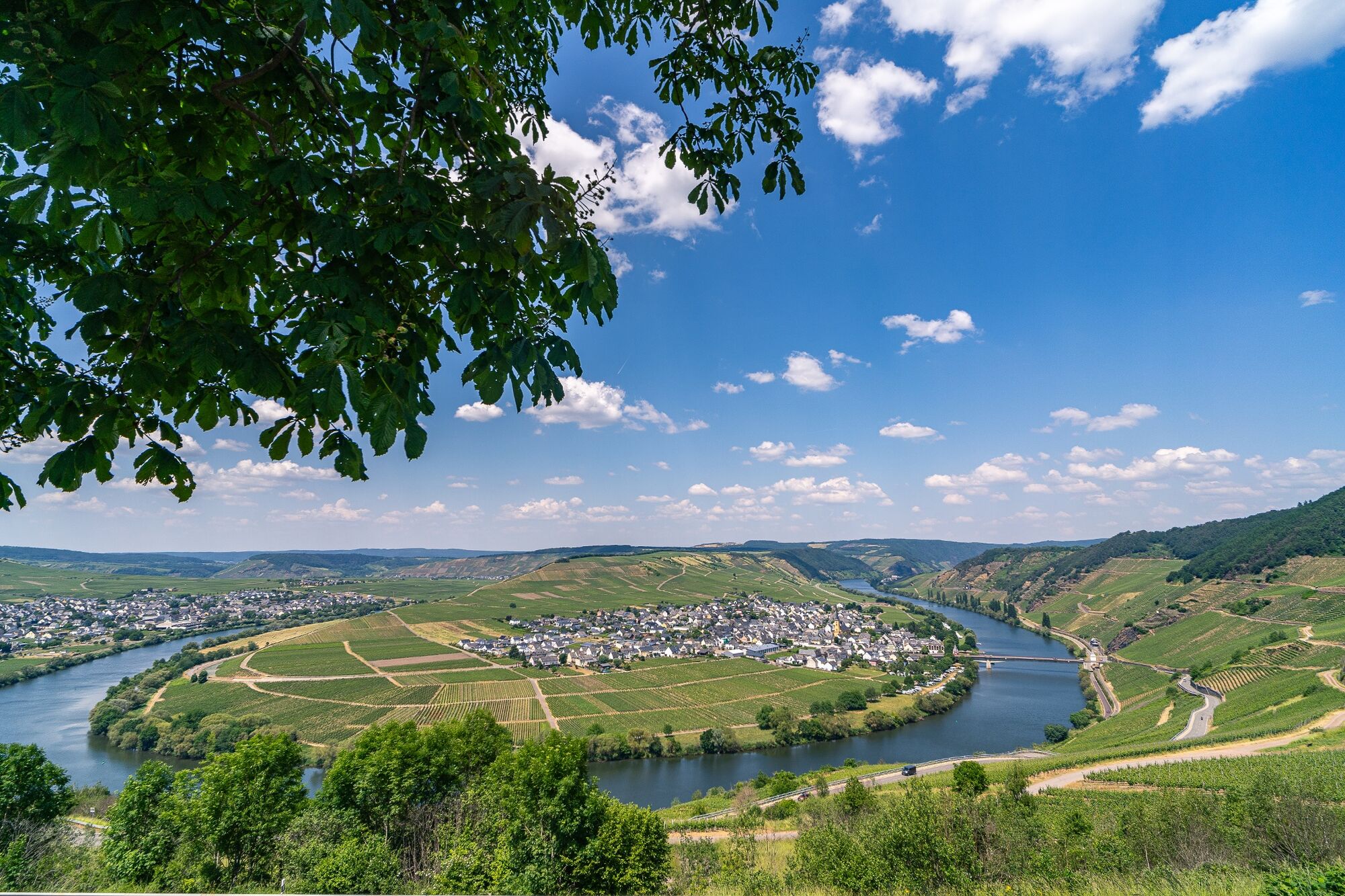
The Mosel Cycle Path is one of the most popular river cycle trails in Germany and accompanies the Moselle for 248 kilometres from the border triangle in Perl to the mouth of the Rhine in Koblenz. It leads past countless wineries and world-renowned vineyards, impressive rock formations and medieval wine villages as well as ancient sites and majestic-looking castles. No other German wine-growing region offers such a stunning natural contrast between breathtaking steep slopes and charming river valleys whilst also hosting an abundance of historic and cultural landmarks.
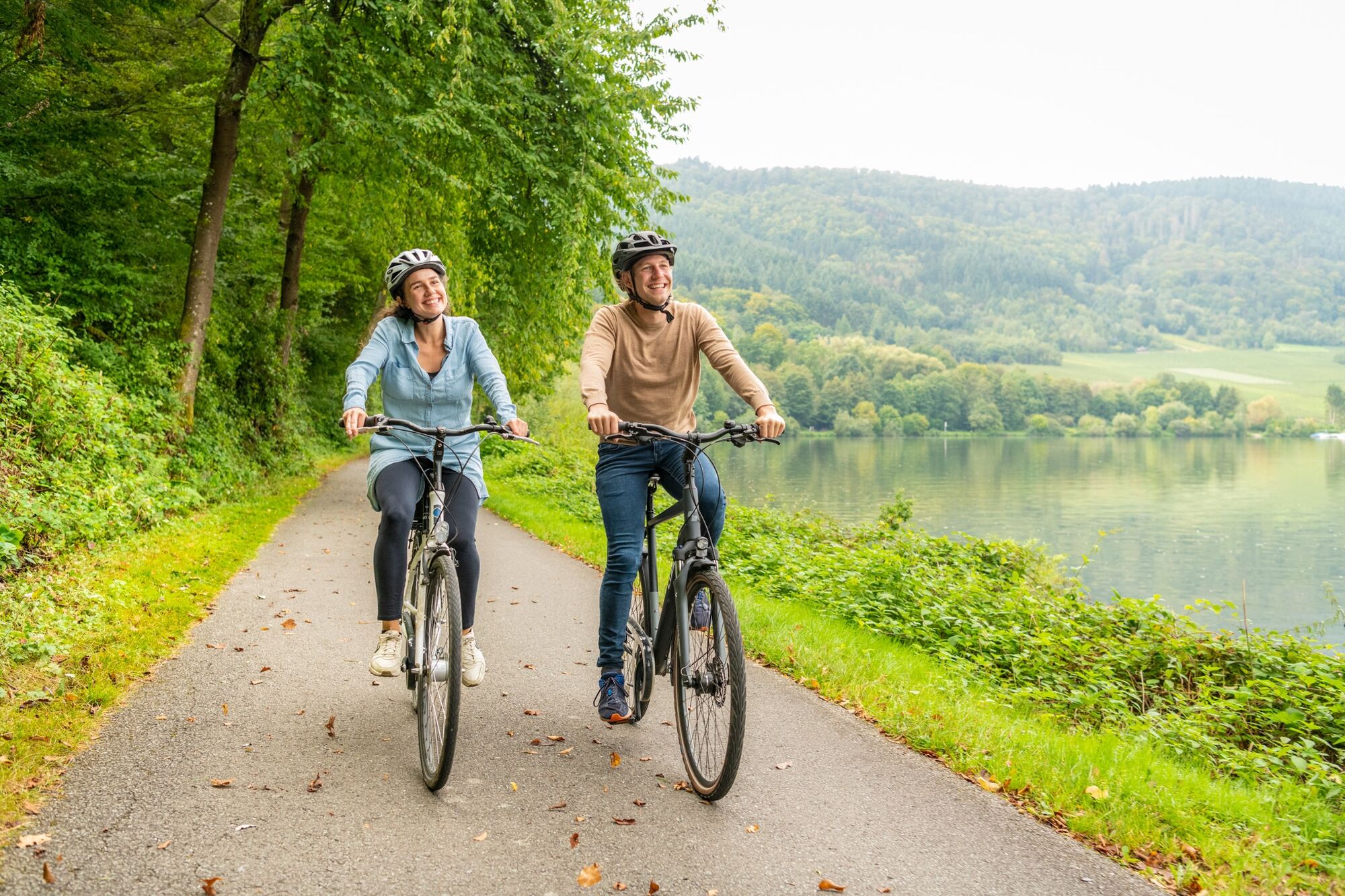
Pleasure and enjoyment take precedence over sporting ambition here. Europe's steepest vineyards can be found along the Moselle River. But taking the Mosel Cycle Path doesn’t involve having to master these. As most of the cycle route is away from road traffic, has asphalt surfacing and is relatively flat without gradients, even recreational cyclists can tackle it without difficulty.
And what could be better than rounding off an active tour through nature with some delicious refreshments? There are a multitude of excellent options directly on route for hungry and thirsty cyclists to stop off, enjoy good food and sample fine wines. Because exploring the Mosel Cycle Path always entails exploring the region’s top wines too!
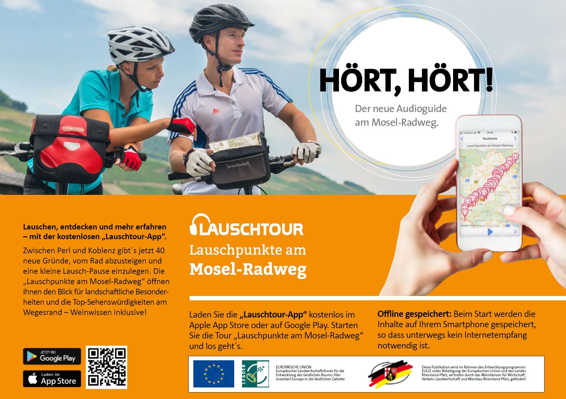
Tip: The new Mosel Cycle Path audio tour app
Get to know the Mosel region via a series of listening stop-off points. 40 listening stations between Perl and Koblenz encourage you to take a closer look and guide you to surprising discoveries along the way. The “Lauschtour App” can be downloaded free of charge from the Apple App Store or Google Play.
- Directions
-
Difficulty:
The Mosel Cycle Path is suitable for everyone, including families. Create a cycle tour that’s as easy and as long as you want it to be.
Terrain:
The route follows the Moselle through predominantly level countryside. It is suitable for children, cycle trailers and tandem bikes, though restrictions apply in some sections. Asphalt is the main surface, with some paved or gravel paths.
- Highest point
- 188 m
- Endpoint
-
Koblenz
- Height profile
-
 © outdooractive.com
 - Equipment
-
A smartphone to access the audioguide "Audiopoints along the Moselle Cycle Path": Get to know the Mosel region via a series of listening stop-off points. 40 listening stations between Perl and Koblenz encourage you to take a closer look and guide you to surprising discoveries along the way. The audio tour app can be downloaded free of charge from the Apple App Store or Google Play.
Remember to take your cycle tour book and your camera.
- Safety instructions
- Tips
-
Stop off at one of the many rustic wine taverns along the way and enjoy a chat with our wine makers.
- Additional information
-
Mosellandtouristik GmbH
Kordelweg 1
54470 Bernkastel-KuesTel. +49 (0)6531/97330
A review of your Outdooractive tour experience would be great. This gives us valuable feedback and helps others to plan their own tours. Thanks!
Suggestions, observations or something that isn't quite right? Get in touch via email at: radwege@lbm.rlp.de
- Directions
-
By train to Perl (the Mosel Cycle Path starts in the immediate vicinity of the train station).
Departure by train from Koblenz (the train station is approx. 2.5 km from the Mosel Cycle Path but is well signposted and easily accessible).
- Public transportation
-
Bike & Train
Regular Inter-City and regional train connections on the route Koblenz - Cochem - Bullay (connection to Traben-Trarbach via the Moselle Wine Express) - Wittlich - Trier. Trier Hbf station offers connections to locations in the Upper Moselle area as far as Perl, to Luxembourg and to locations on the right side of the Saar as far as Saarbrücken.
Bikes can be taken on local trains in the Rhineland Palatinate and in the Saarland free of charge, from 9 am Monday to Friday as well as at weekends and on public holidays within the limits of the available capacity. Taking your bike on long-distance trains requires paying a surcharge whereby a space reservation is required. For more information: www.bahn.de
Bike & Bus
So-called RadBusse, special bus lines with bike transport facilities, operate from April to the end of October.
Further information, timetables and reservation options can be found at www.radbusse.de
Bike & Boat
From mid-April to October, there are numerous passenger boats available on the Moselle each day, which lend themselves to round trips and extending your travel route by bike. Nearly every town has a pier for docking. The local notice boards of the relevant boat companies provide details of departure times. You can also choose from a total of seven ferries to take you and your bike to the other side of the river.
- Parking
-
Parking is available in Trier and Koblenz for those cycling the entire Mosel Cycle Path. Travel to the starting point follows via train. Anyone who has parked in Trier then returns there by train from Koblenz when the tour is over.
For further information and advice regarding suitable parking: Mosellandtouristik GmbH, telephone: +0049 (0)6531/97330; info@mosellandtouristik.de


- Author
-
The tour Mosel Cycle Path (in full): From Perl to Koblenz is used by outdooractive.com provided.