
- Brief description
-
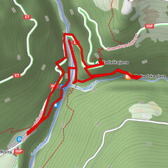
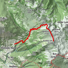
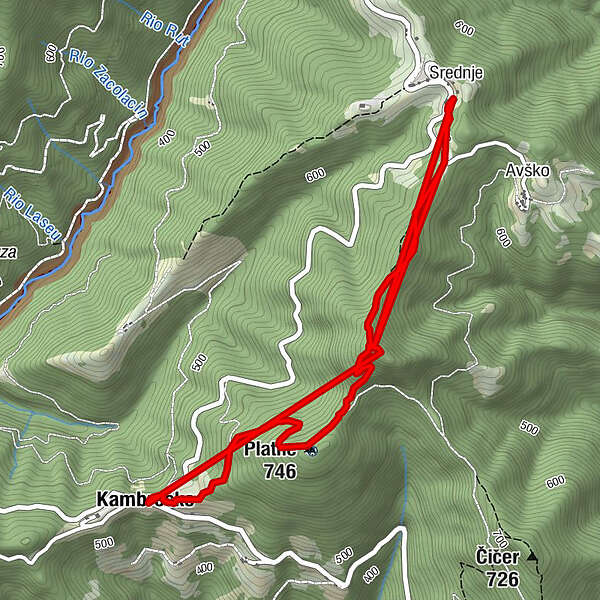
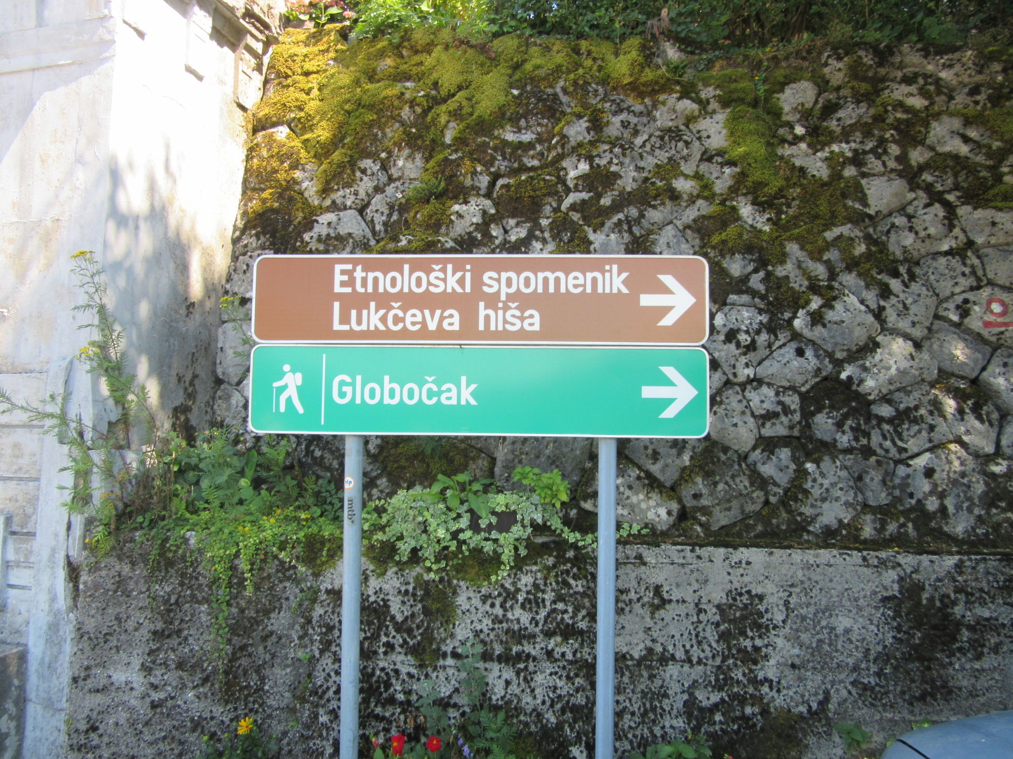
Circular undemanding hiking trail Kambreško - Globočak - Srednje - Kambreško.
- Difficulty
-
medium
- Rating
-
- Starting point
-
Kambreško, Srednje
- Route
-
Globočak (809 m)0.0 kmKambreško1.3 kmPlatne (746 m)2.5 kmGlobočak (809 m)3.2 kmSrednje6.1 km
- Best season
-
JanFebMarAprMayJunJulAugSepOctNovDec
- Description
-
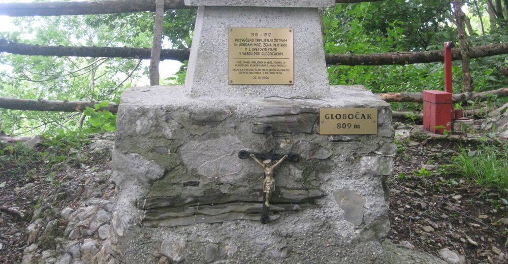
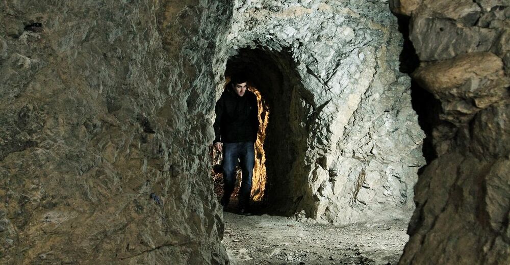
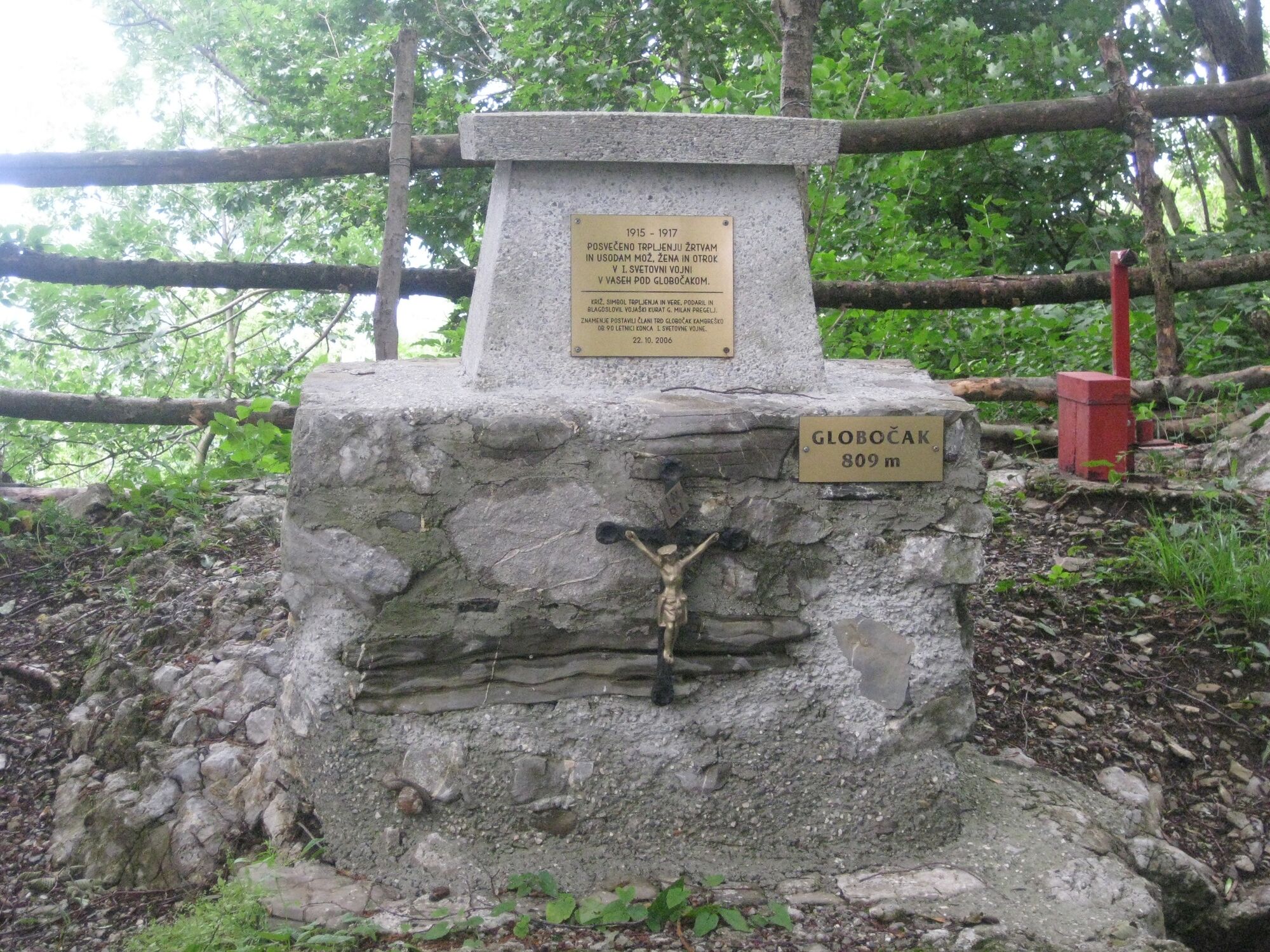
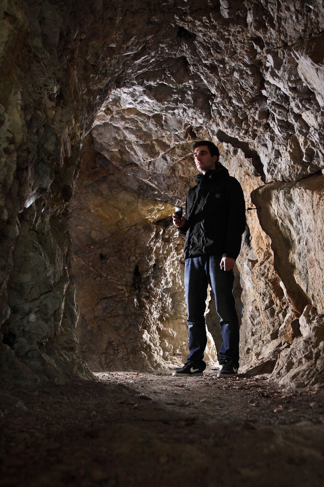
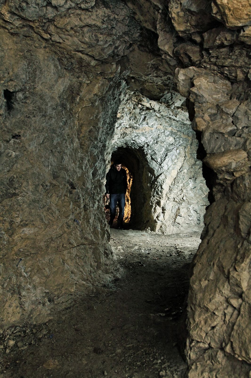
Mt. Globočak is an 809 m high hill on the Kanalski Kolovrat Ridge. During the battles of the Isonzo front this hill was one of the most important fortified Italian peaks on the Kanalski Kolovrat Ridge because it provided a good vantage point overlooking the Soča Valley and the Banjška planota Plateau. Nowadays the view from the top is blocked by trees.
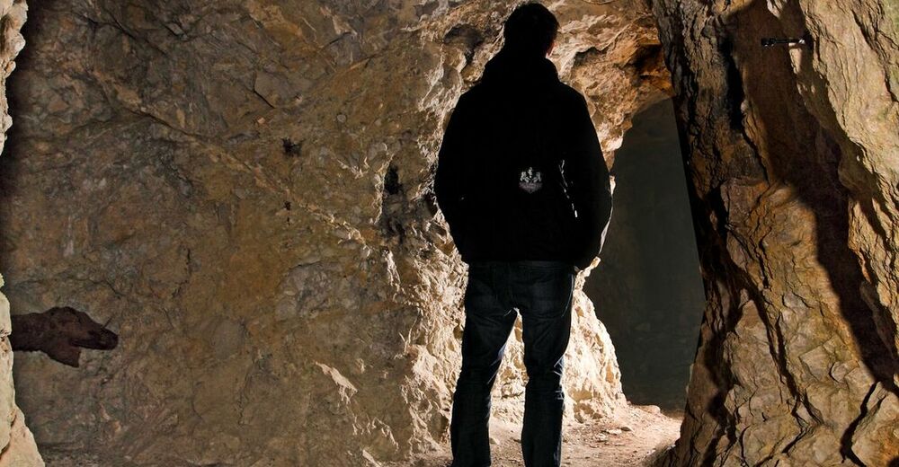
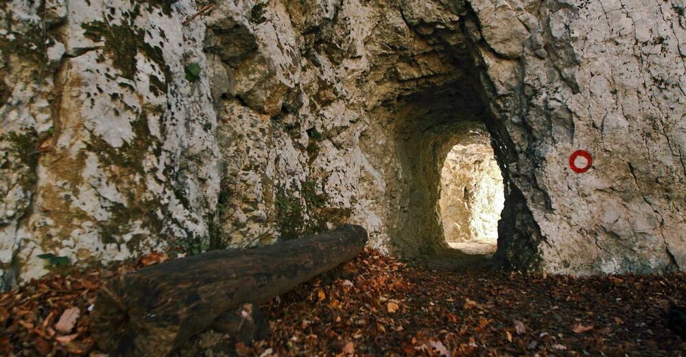
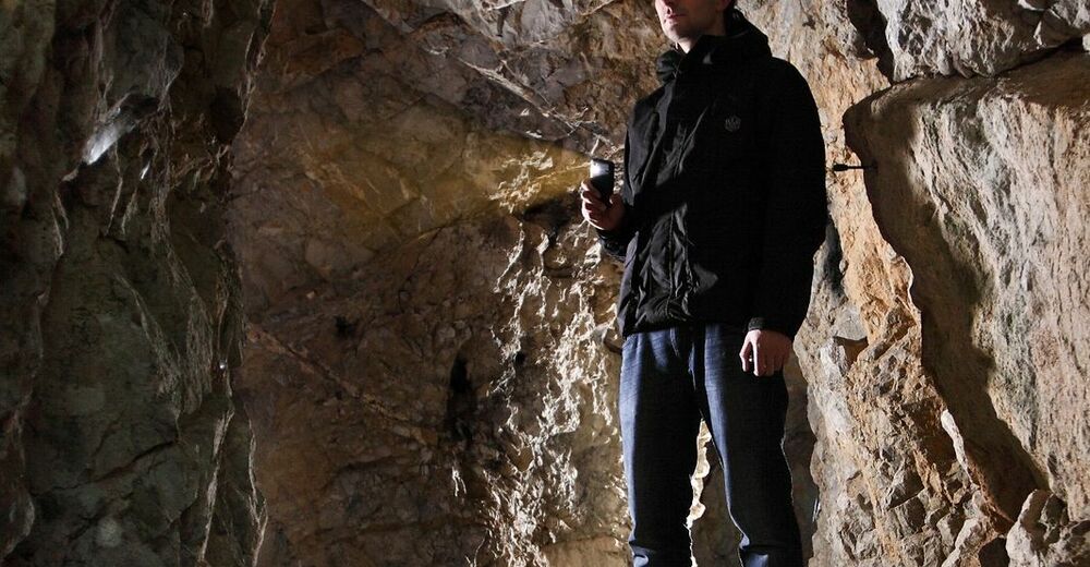
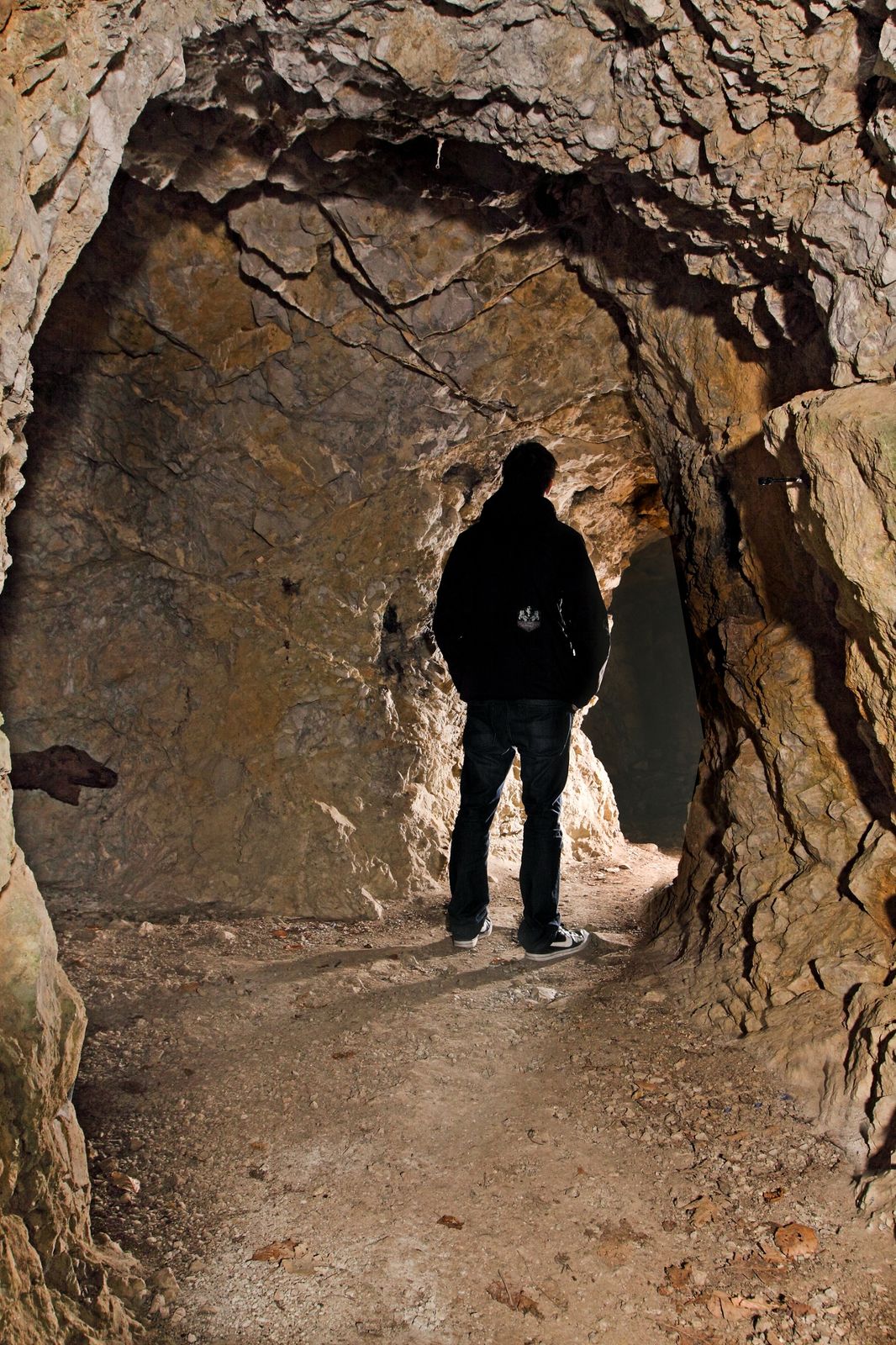
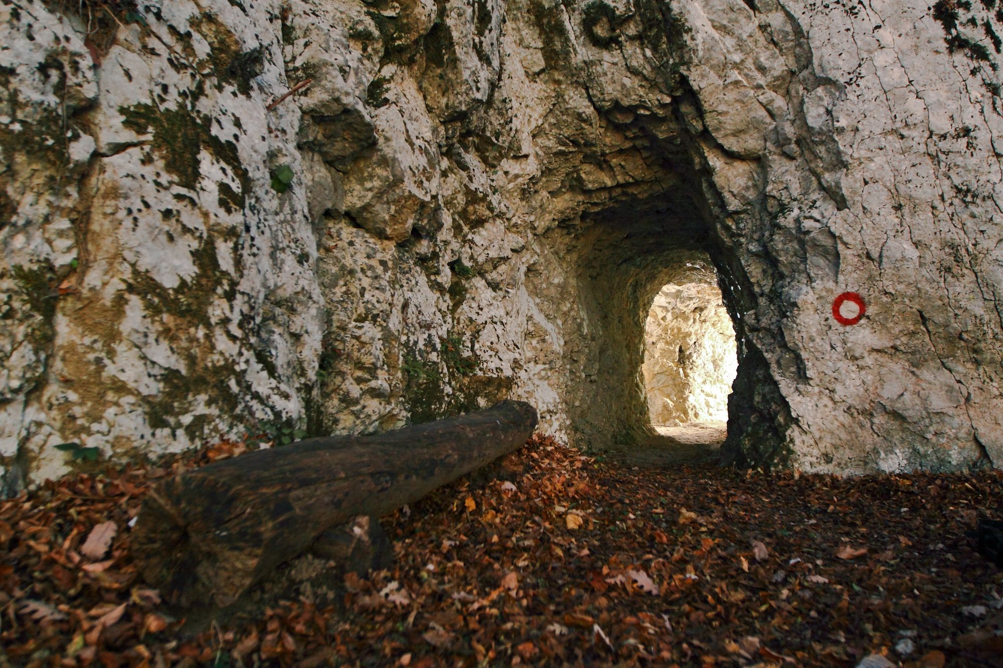
Along the trail and on the top of the hill you can visit the remnants of World War I: caverns, trenches, troughs and water reservoirs. On the top of the hill you can find a memorial and a box with a register book and a stamp.
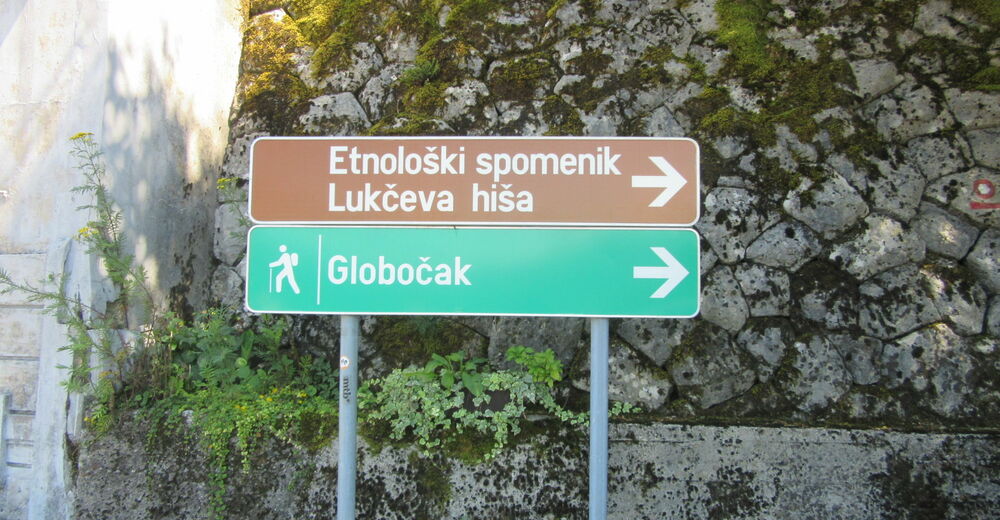
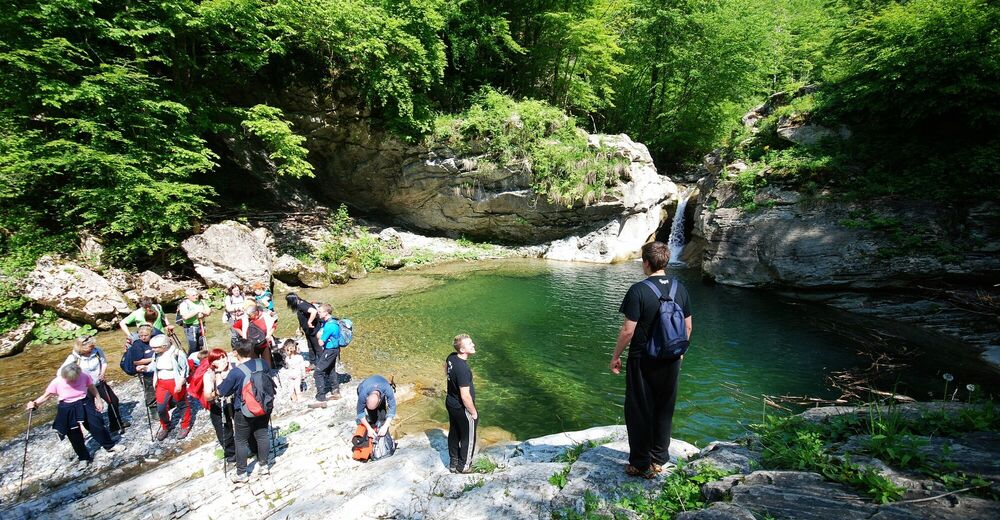
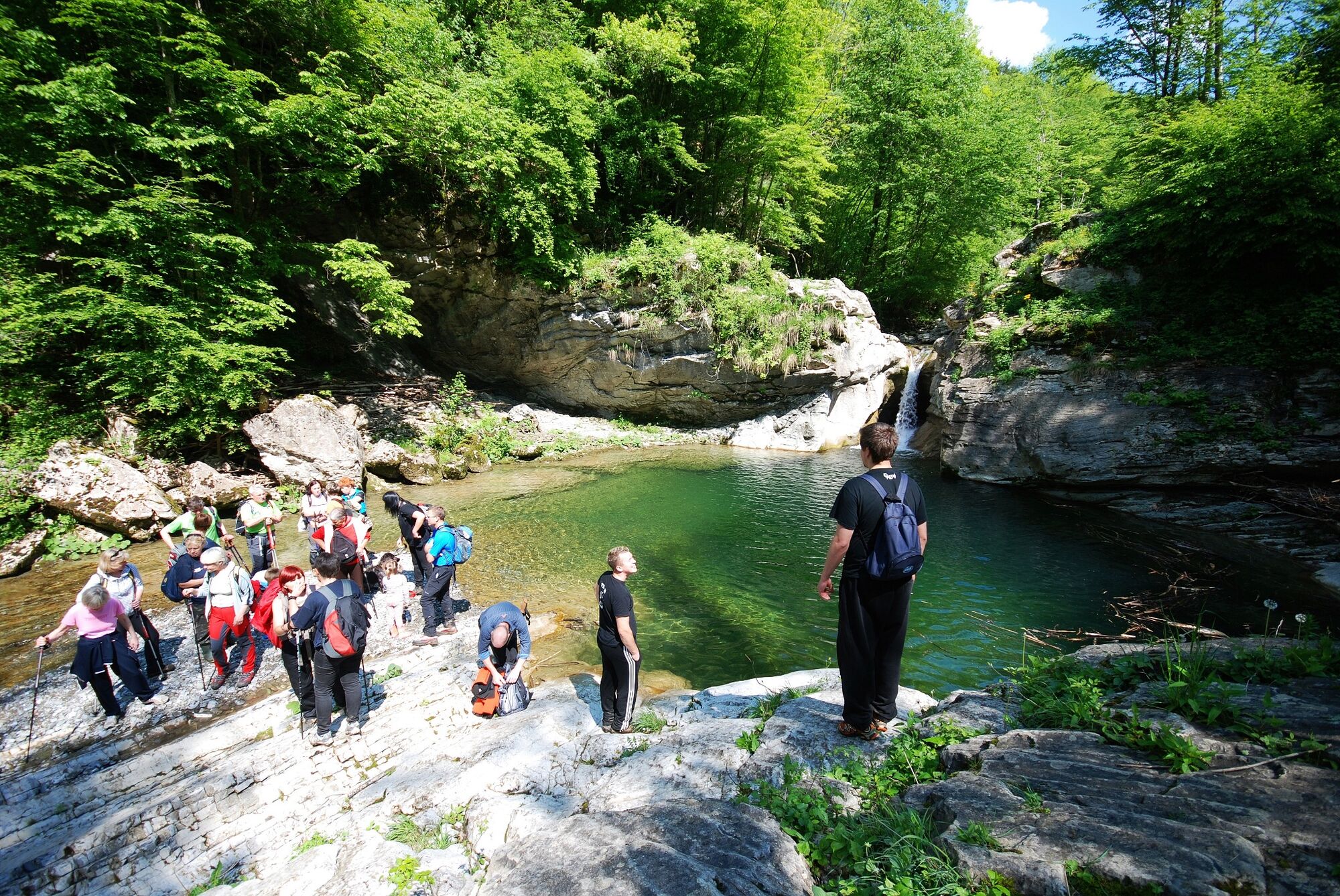
In the village of Kambreško you can visit the ethnological monument of local importance "Lukčeva hiša" House which houses an ethnological collection of photographs and artefacts from World War I, a tool collection and a preserved kitchen with a stone fireplace. Below Kambreško you can freshen up in the pools of the Idrija River. In the village of Srednje you can find a Church of the Holy Trinity from the 19th century, whilst along the road to the village of Ročinj you can admire the 29 m Savinka Waterfall with two smaller waterfalls (one above and one below).
- Directions
-
You can start the circular tour to Mt. Globočak in Kambreško or in Srednje.
A: Starting point Kambreško
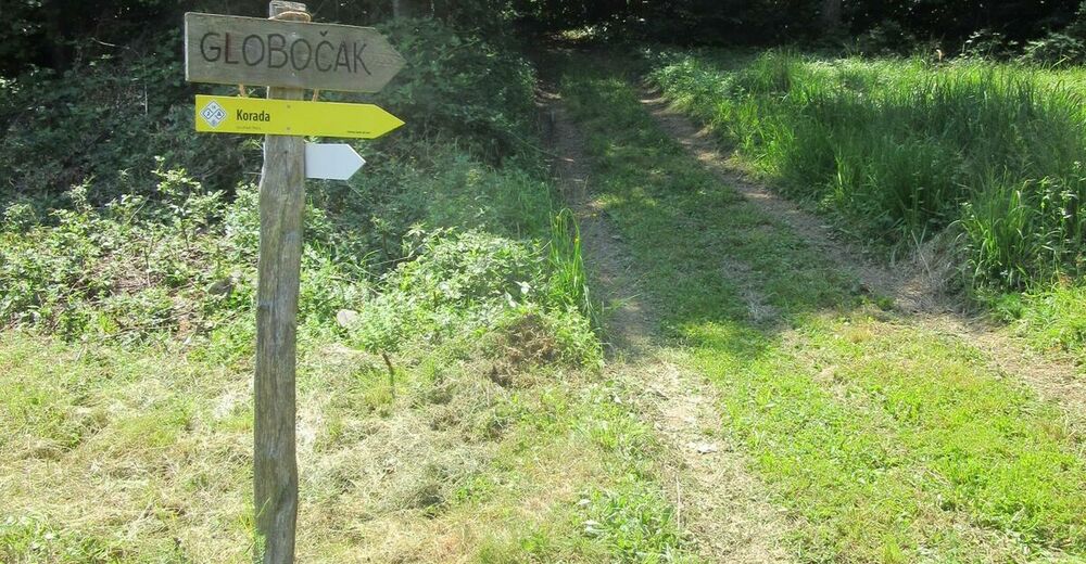
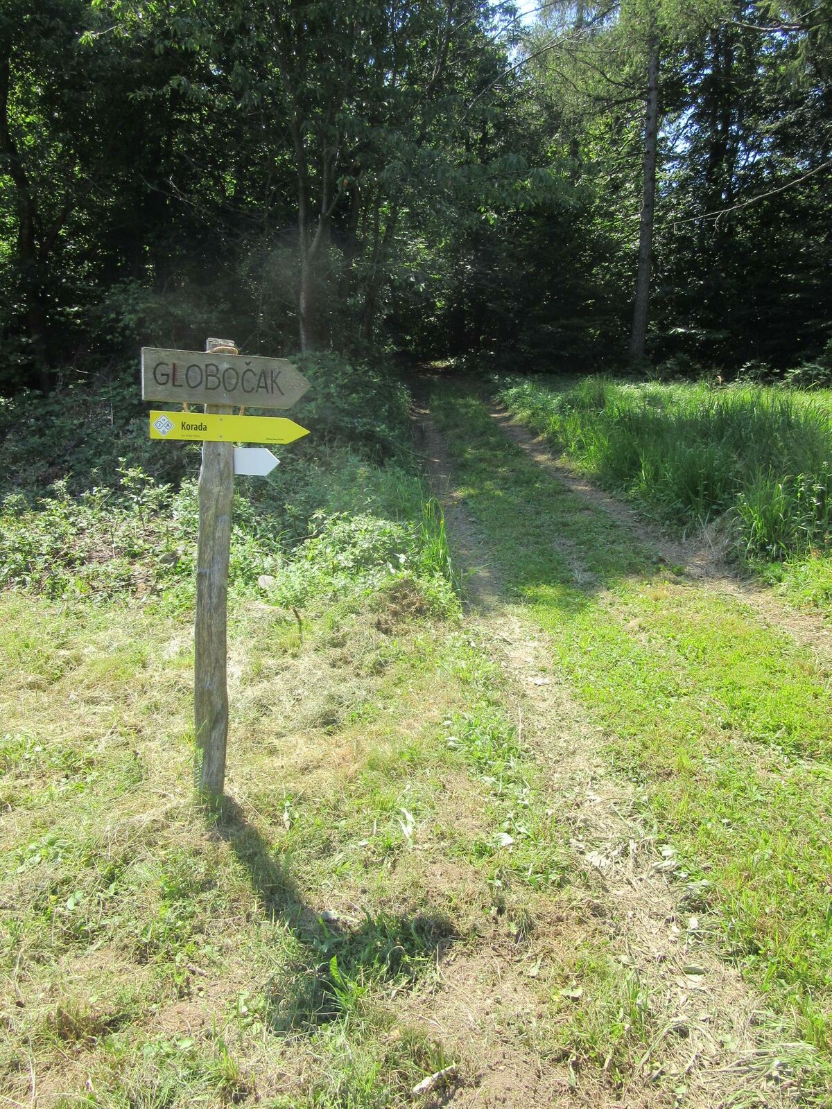
Start the tour in the village of Kambreško in the vicinity of the monument to the National Liberation War where the sign for Mt. Globočak will direct you onto a side road ascending through the village. This road ends above the village and you will have to continue along the grass-covered cart track until you reach the sign for Mt. Globočak from where you will have to follow the same signs all the way to the top. When you reach the top, descend towards the village of Srednje and continue to Kambreško.
B: Starting point Srednje
Start the tour at the beginning of the village of Srednje. Follow the signs for Mt. Globočak directing you onto an ascending narrow paved road. When you reach the bend, turn right onto a marked footpath, which will, after you overcome a gently ascending section, start ascending steeper and steeper through the forest. When you will arrive higher, the footpath will gradually descend and then start to gently ascend again to the main ridge of Mt. Globočak where the footpath joins the trail from Kambreško. From there continue to the left and you will soon reach the forest-covered top of the hill.
When you reach the top, descend towards the village of Kambreško and continue to Srednje.
- Highest point
- 796 m
- Endpoint
-
Mt. Globočak
- Height profile
-
 © outdooractive.com
 - Equipment
-
Season and weather appropriate hiking equipment (crampons during the winter months).
- Safety instructions
-
The trail is safe.
This is an easy hiking trail. Use of hiking trails is at your own risk!
- Tips
-
This trail is appropriate for families. It is mostly routed in the shade. It is also appropriate during the winter months. We recommend you to use a headlamp to visit the caverns.
- Additional information
-
- Visit to the remnants of World War I,
- Visit to the "Lukčeva hiša" House,
- Visit to the Savinka Waterfall,
- Summer refreshments in the Soča River or the pools of the Idrija River,
- Traditional hike to Mt. Globočak in memory of the victims of all wars – last Sunday of October,
- Visit to the medieval town of Kanal.
- Arrival
-
Drive from the city of Nova Gorica or the town of Tolmin to the village of Ročinj and follow the sign for the village of Kambreško.
If you start the tour in the village of Srednje you have to turn right at the intersection in Kambreško and continue to Srednje.
- Parking
-
Kambreško: in the vicinity of the memorial to the National Liberation War.
Srednje: at the cemetery (approx. 300 m out of the village).
- Author
-
The tour Hiking Trail to Mt. Globočak (809 m) is used by outdooractive.com provided.