
- Brief description
-
Pleasant easy family hiking trail beneath the summits of the Loška Koritnica Valley.
- Difficulty
-
easy
- Rating
-
- Starting point
-
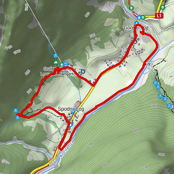
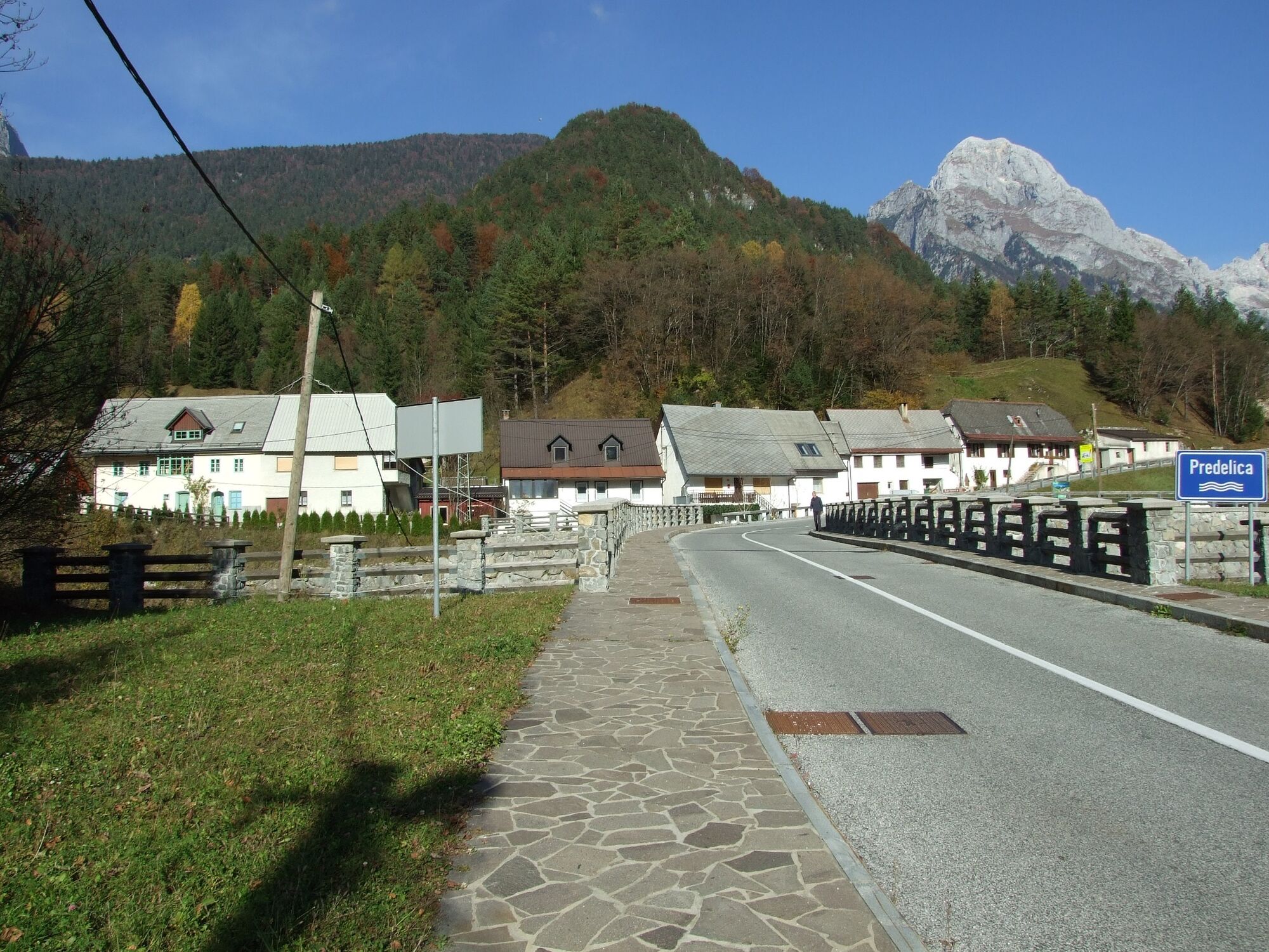
Parking lot in front of the new bridge in the upper part of the village of Log pod Mangrtom (beneath Hotel Alpine)
- Route
-
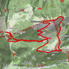
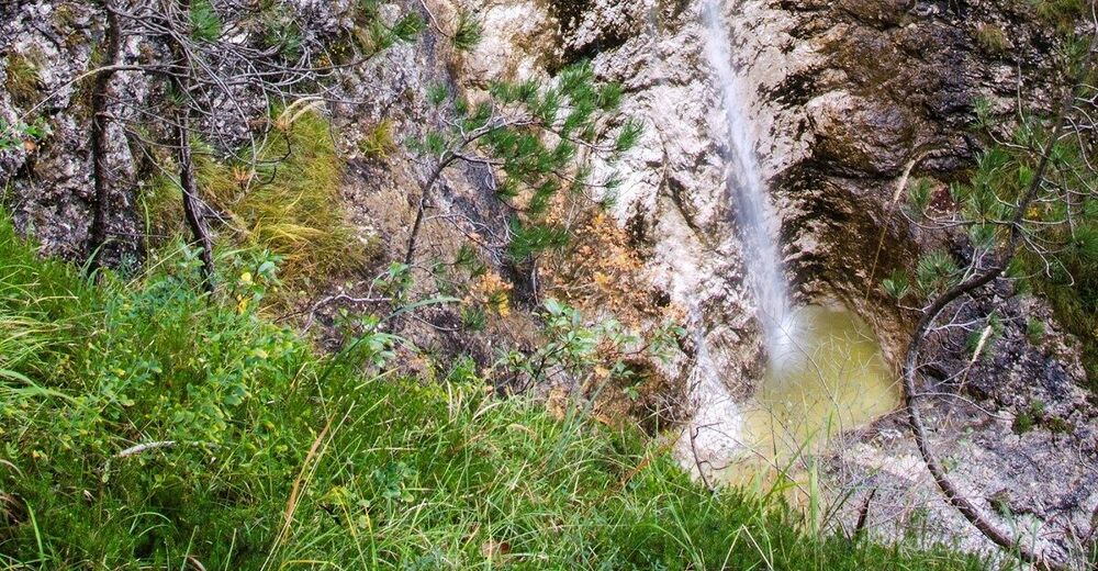
Gorenji Log0.0 kmSlap Spodnji limp0.4 kmSlap Dvojna latvica0.5 kmSpodnji Log1.5 kmGorejca2.0 kmSlap nad Štolnom2.5 kmGorenji Log3.5 kmBrettendorf3.5 km
- Best season
-
JanFebMarAprMayJunJulAugSepOctNovDec
- Description
-
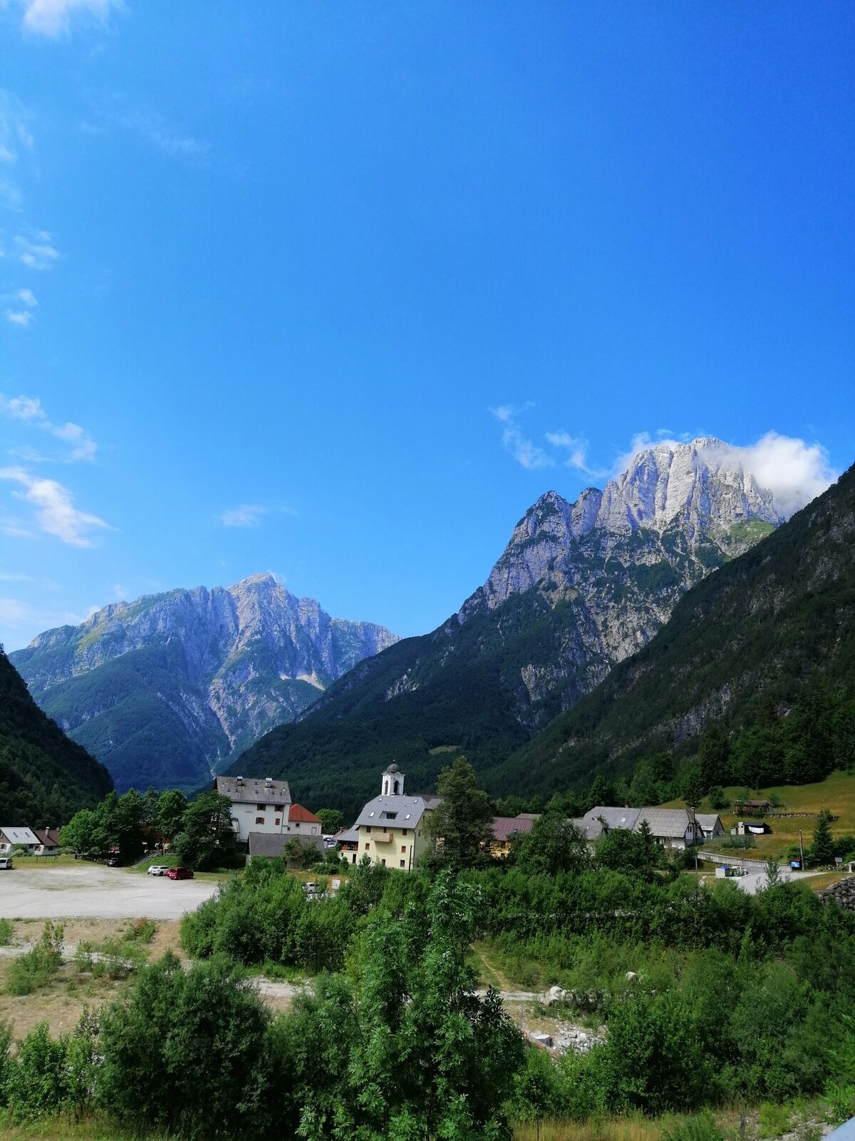
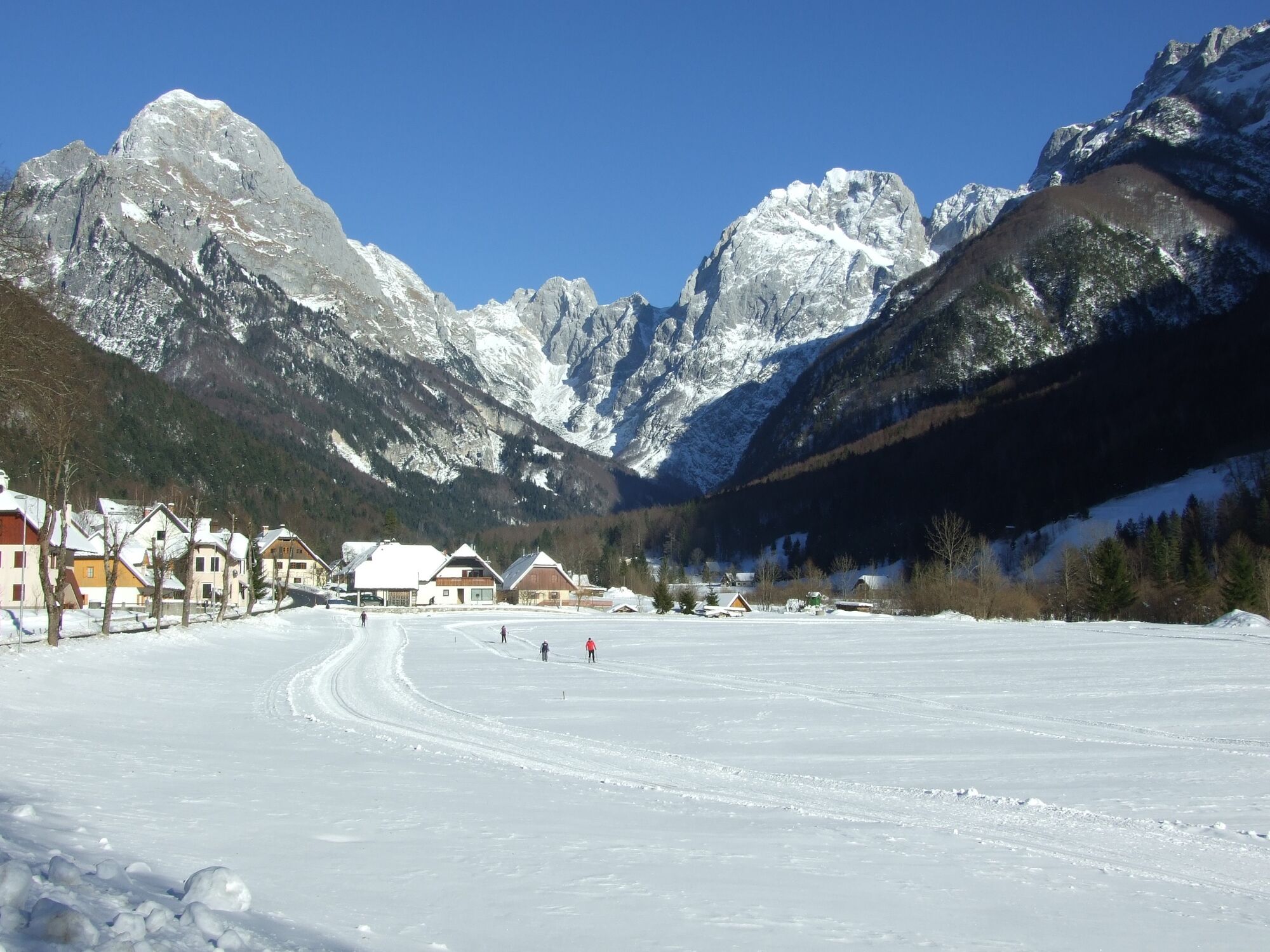
A trail with numerous splendid views of the surrounding mountains above the village of Log pod Mangrtom. The configuration of the terrain makes this trail appropriate for practically everyone, even persons with slight disabilities. You will be able to admire the typical Alpine house architecture, the non-typical architecture of the village church and enjoy in the specific colour of the Gorejca Stream, whilst city children will be able to see farm animals for the first time on the surrounding meadows and at the Černuta Farm.
- Directions
-
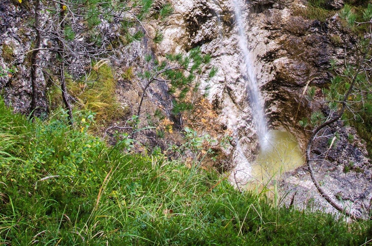
This easy circular hiking trail starts at the parking lot next to the new bridge, which was constructed after the catastrophic landslide in 2000. It is routed along the main road, passes the Church of St. Stephen, and leads through an idyllic upper part of the village of Log pod Mangartom towards the lower part of the village. Just behind the village cemetery, next to the mining cart – the monument to miners from Log pod Mangartom who earned their hard-earned money in the nearby Italian lead and zinc mine Rabelj – you will turn to the right onto a side road and continue for approximately 300 metres to the side exit from the mine called Štoln. Before reaching this point, you can turn from the trail next to the Černuta Farm and visit the World War I military cemetery. There is a small playground next to Štoln where cultural and sports events are often organized. From Štoln, you will continue through a cool forest and arrive to the Gorejca Stream which offeres refreshment during the summer in a small artificial pool. The trail then turns downhill through the forest, crosses the meadow and reaches the part of the village where you have to continue between the houses to reach the main road again. Here, turn downhill to the right, and when you reach the wastewater treatment plant on the left, descend to the gravel road routed along the Loška Koritnica River. From here, return back to the starting point and enjoy in splendid views of Mt. Mangart and Mt. Jalovec.
- Highest point
- 672 m
- Endpoint
-
Gorejca Stream
- Height profile
-
 © outdooractive.com
 - Equipment
-
Sports or trekking footwear, trekking poles.
- Safety instructions
-
Caution is advisable when walking along the main road because it is quite busy during the summer. A high degree of caution is also advised when crossing the main road next to the wastewater treatment plant.
- Tips
-
A recommended short trail for families. On hot days, you can refresh yourself in the Gorejca Stream.
- Additional information
-
Drinks and refreshments are available at the pizza restaurant of the Hotel Alpine and at the Mangart Guesthouse.
- Directions
-
You reach the village of Log pod Mangartom after a 10 km drive from Bovec along the national road No. 203 Bovec - Predel. The starting point is located in the upper part of the village. If you come from the other direction, descend from the former border crossing Predel and turn left to the parking lot next to the new bridge just after arriving to the village of Log pod Mangartom.
- Public transportation
-
During the summer months, there are three daily lines running between Bovec and Log pod Mangartom and a line from Ljubljana via Tarvisio (Trbiž (I)).
- Parking
-
There is a free parking lot available in front of the new bridge (from Bovec) in the upper part of Log pod Mangartom.
-

-
AuthorThe tour Gorejca family hiking trail is used by outdooractive.com provided.