
- Brief description
-
Mt Batognica is the closest neighbour to Mt. Krn. Covered with war remnants and caverns, it is a living reminder of the history.
- Difficulty
-
medium
- Rating
-
- Starting point
-
Parking lot in front of the Kuhinja Mountain pasture
- Route
-
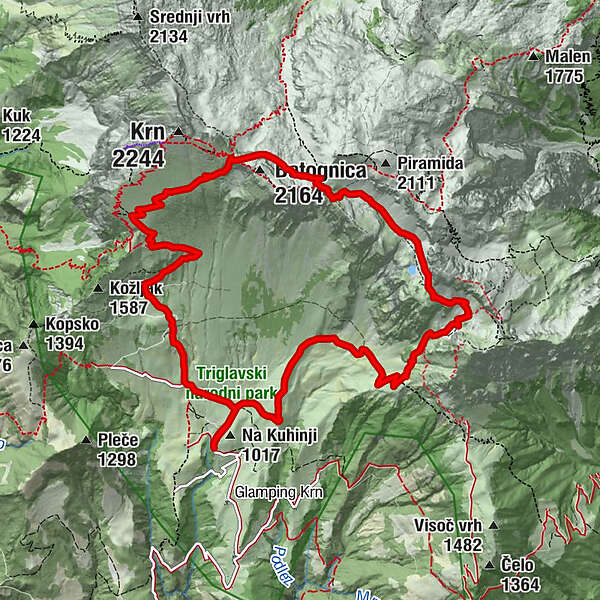
Planina Kuhinja0.2 kmKrnska škrbina (2,058 m)5.0 kmPlanina Leskovca10.8 kmPlanina Kuhinja12.8 km
- Best season
-
JanFebMarAprMayJunJulAugSepOctNovDec
- Description
-
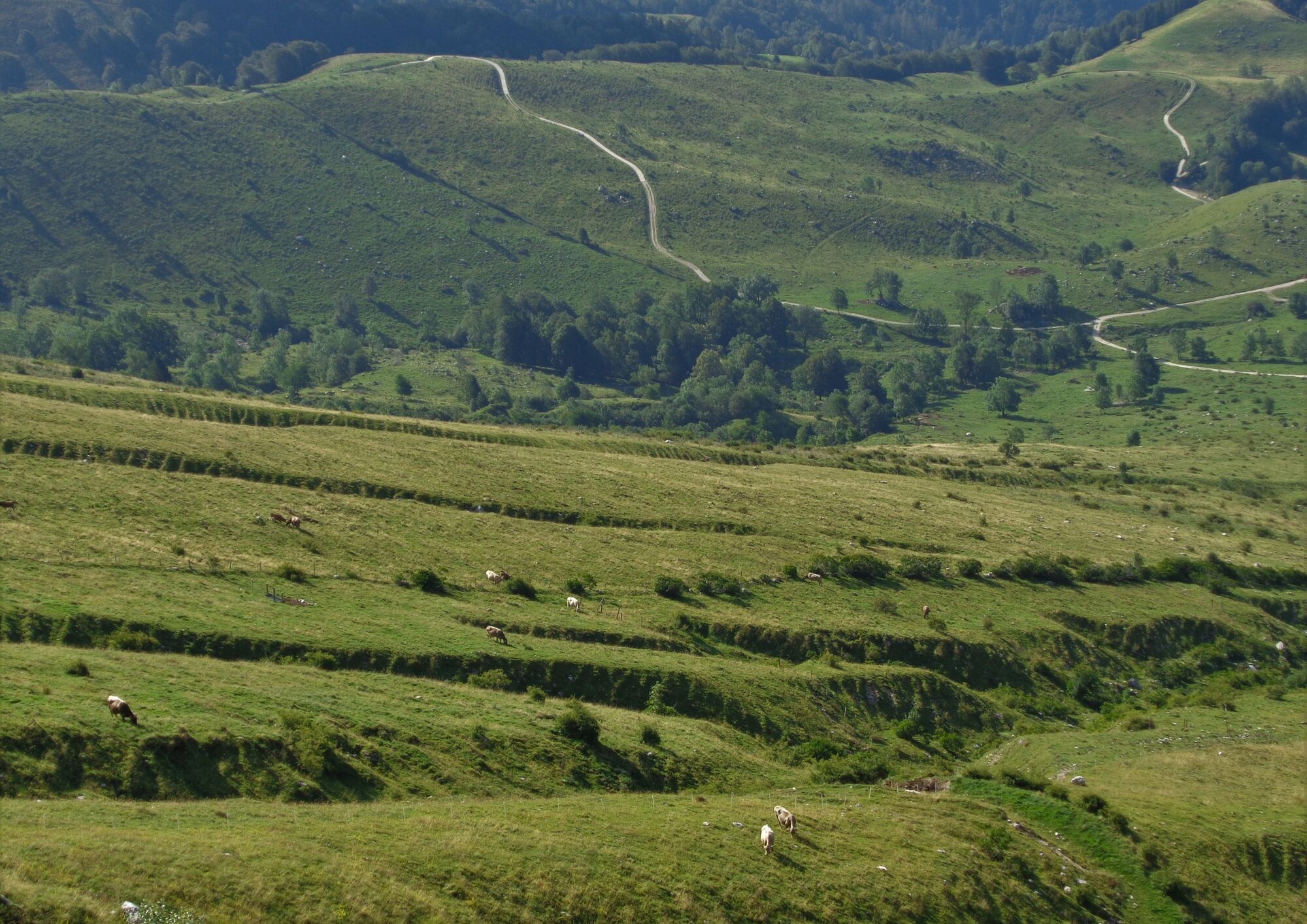
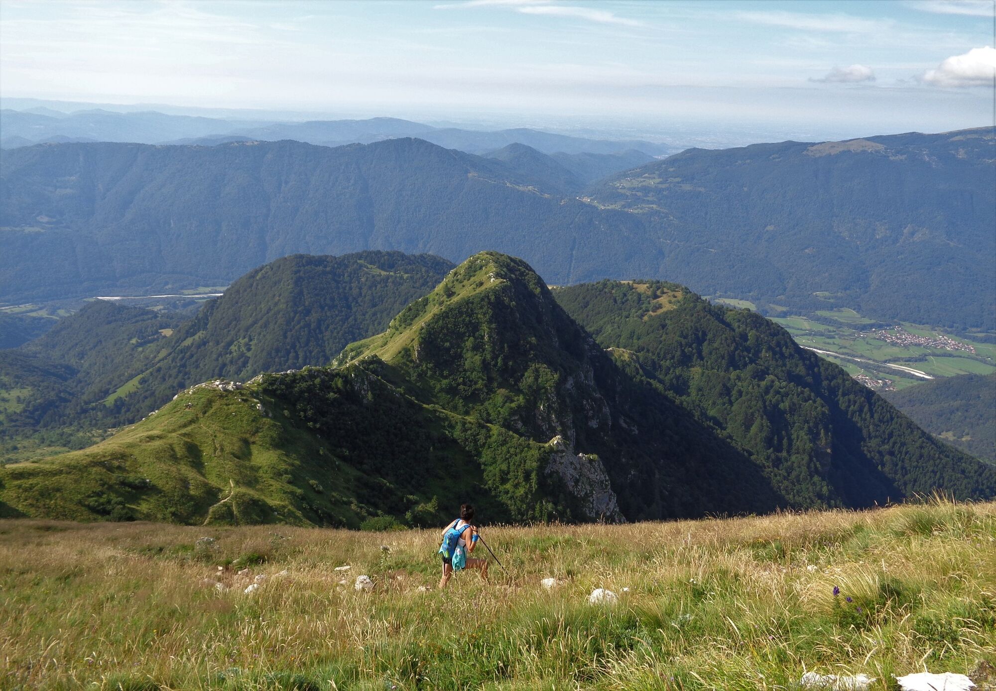
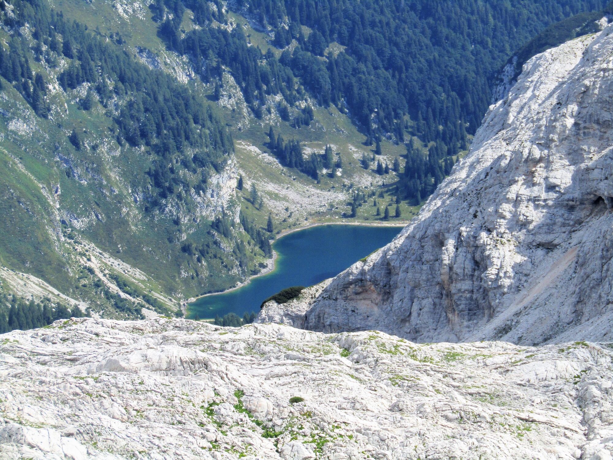
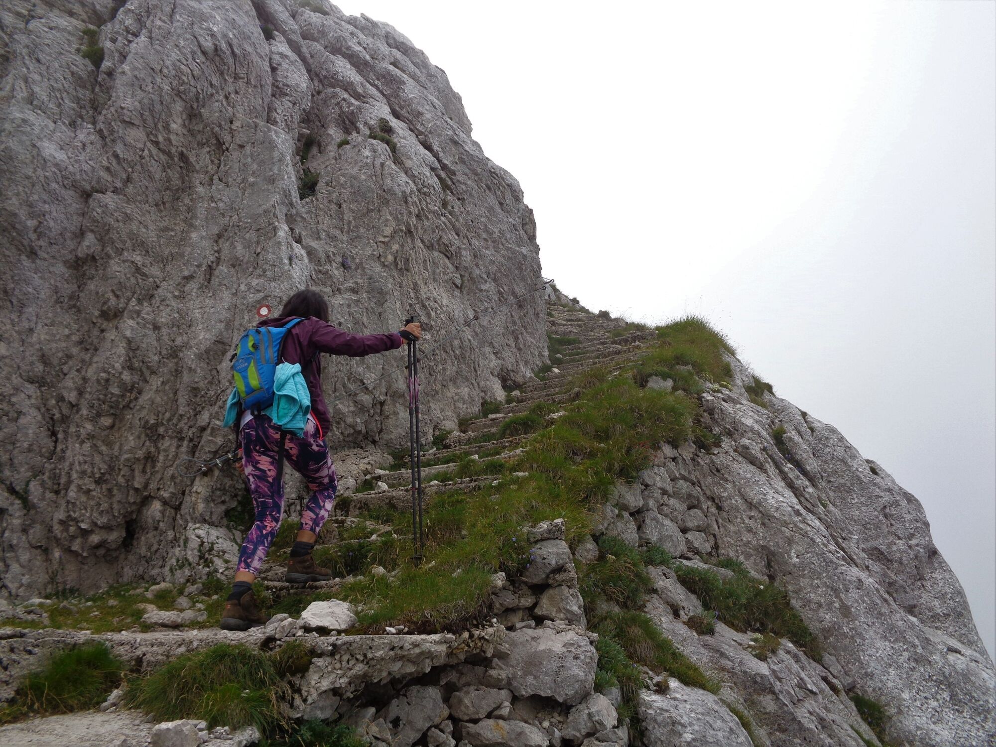
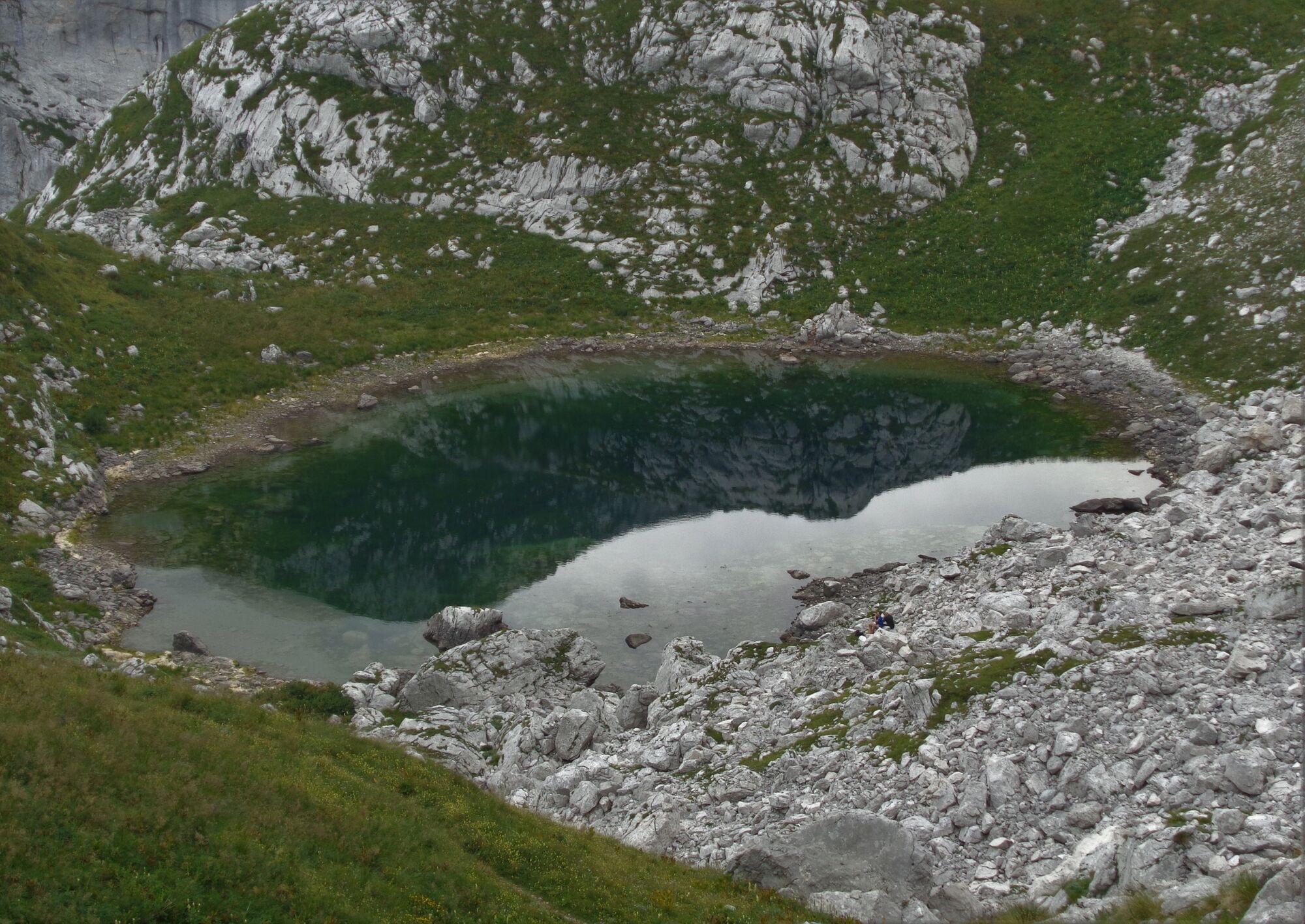
From the Kuhinja Mountain pasture, you have to follow a well-marked trail to Mt. Krn routed across the fragrant meadows and pastures where you can enjoy in music produced by the bells hung around the necks of the grazing cattle. When you arrive above Mt. Kožljak, at approximately 1700 m, a marked trail turns towards Mt. Batognica. The marking is painted on a small stone in the grass and is poorly visible. The trail crosses the slope of Mt. Krn and zigzags towards the notch of Mt. Krn where views open towards the north for the first time. Here, you will be able to notice an emerald eye – Lake Krn – a mountain chain above it and the distant mountain peaks far in the Austrian territory. From the notch, climb to the top of Mt. Batognica along the ridge, the well-preserved mountain steps and past the war remnants. The flat and wide top is tipping to the Prag Mountain pass. Above this mountain pass you will be able to notice the prominent Mt. Vrh nad Peski, the spacious scree beneath, and the Lužnica Valley with a lake at the end, giving the valley a quite particular visual attraction. On the mountain pass above the lake you will be greeted by the red rocks of Mt. Rdeči rob. From here, you only have to descend along the hairpin trail which passes the Leskovca and Kašina Mountain pastures and leads to the starting point.
- Directions
-
Ascend along the trail to Mt. Krn for approximately 120 minutes and turn right when the narrow grassy trail meets a mule trail. There is a Batog marking painted on a rock in the grass (see photo No. 4). Turn to the right when you arrive to the notch. From the top, you can descend into the Lužnica Valley along the marked ridge trail or directly towards the east. You will return to the starting point along a well-marked trail through the Lužnica Valley.
- Highest point
- 2,055 m
- Endpoint
-
Mt. Batognica (2164 m)
- Height profile
-
 © outdooractive.com
 - Equipment
-
Strong hiking footwear, trekking poles.
- Safety instructions
-
The trail is entirely safe, however, the most critical but unproblematic sections of the ascent to Mt. Batognica are secured with safety equipment (wire rope).
This is an easy hiking trail. Use of the hiking trails is at your own risk!
- Tips
-
From the top of Mt. Batognica to the Prag Mountain pass you can also descend along the ridge trail routed along the right slope of the mountain. You will come across numerous caverns along the trail.
- Additional information
-
If you have enough energy left, you can ascend from the Prag Mountain pass to Mt. Vrh nad Peski (approx. 1 h) and return back to the Prag Mountain pass.
- Directions
-
If you come from the town of Tolmin, turn right to the village of Kamno. In the centre of this village, turn left towards the town of Kobarid. After approximately 100 metres from the centre of the village you will come across a steep road turning uphill towards the village of Vrsno. After a nine-kilometre-long ascent along a narrow road you will arrive to the Kuhinja Mountain pasture.
If you come from the town of Kobarid, follow the road towards the village of Drežnica. After you cross the Napoleon’s bridge across the Soča River, turn to the right. Continue to the village of Ladra and turn left towards the village of Vrsno. The road from the town of Kobarid to the starting point is 12 kilometres long. The road from the village of Vrsno to the mountain pasture is very narrow.
- Public transportation
- Parking
-
Free parking lot in front of the Kuhinja Mountain pasture.


-

-
AuthorThe tour Mt. Batognica (2164 m), the closest neighbour of Mt. Krn is used by outdooractive.com provided.