


- Brief description
-
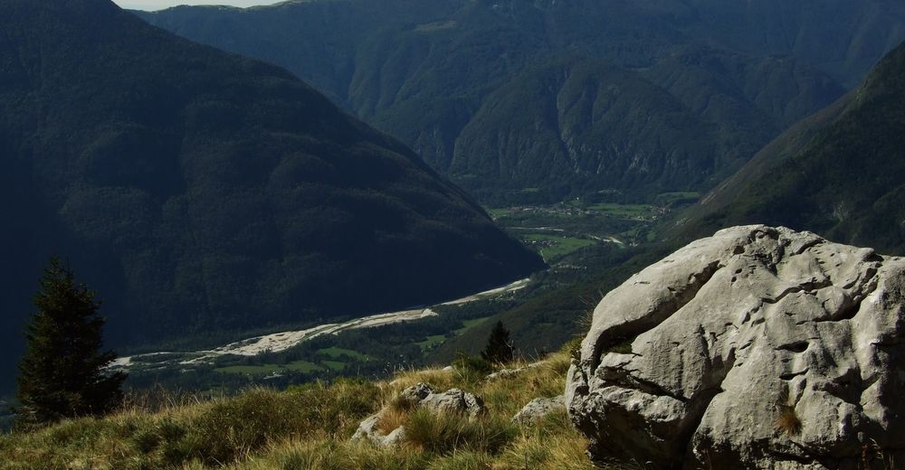
This popular hiking trail to the abandoned Goričica Mountain pasture above the town of Bovec will always impress you with the views and peaceful forests.
- Difficulty
-
medium
- Rating
-
- Starting point
-
Main square of Bovec
- Route
-
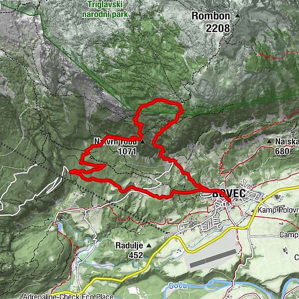
Flitsch0.0 kmCerkev svetega Urha0.1 kmKaninska Vas0.5 kmPlanina Goričica3.2 kmKaninska Vas10.4 kmCerkev svetega Urha10.7 kmFlitsch10.8 km
- Best season
-
JanFebMarAprMayJunJulAugSepOctNovDec
- Description
-
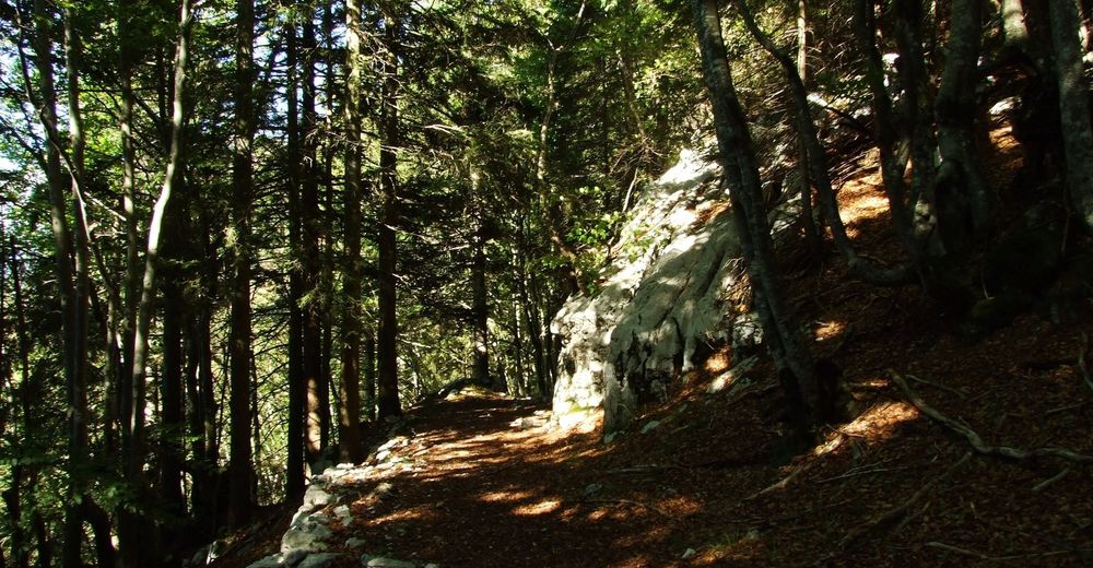
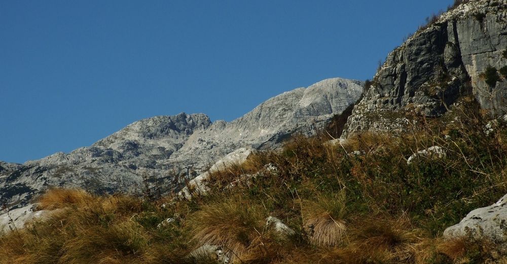
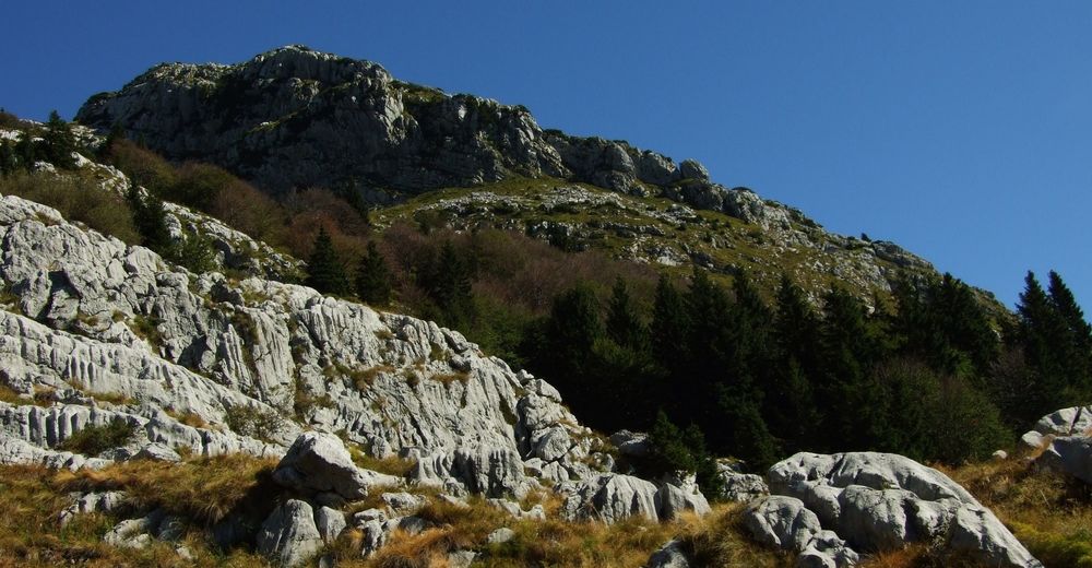
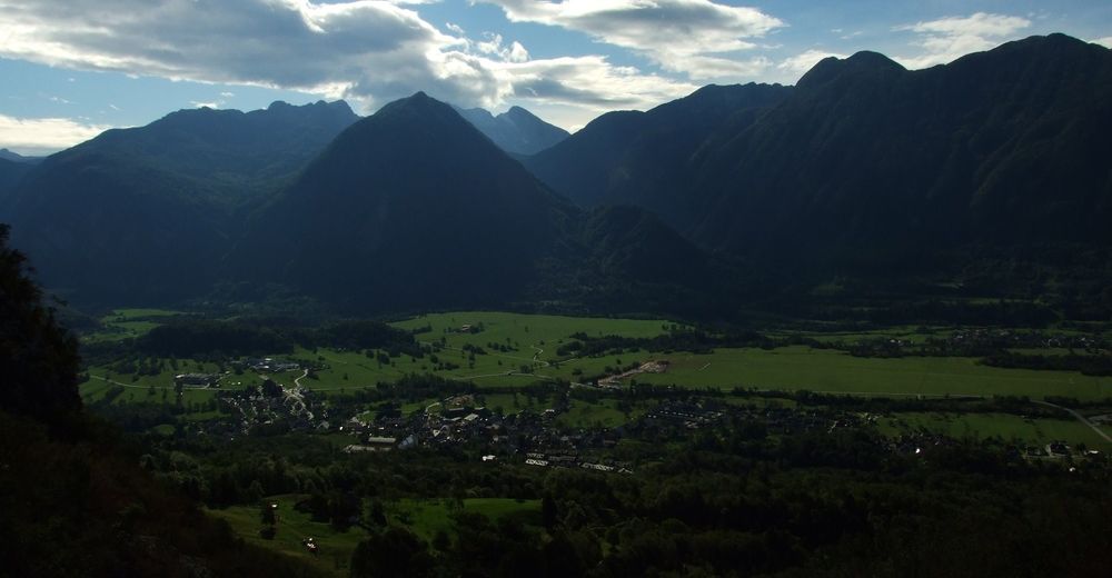
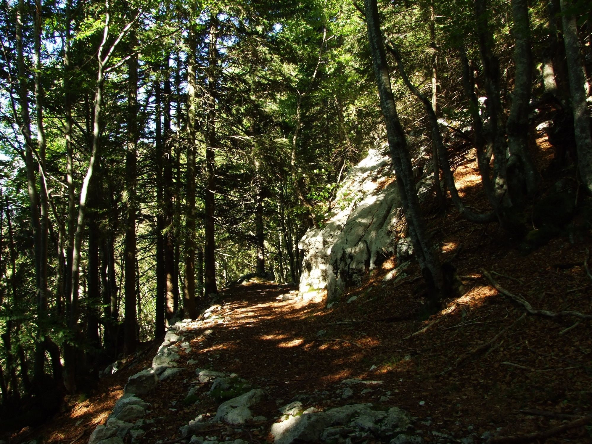
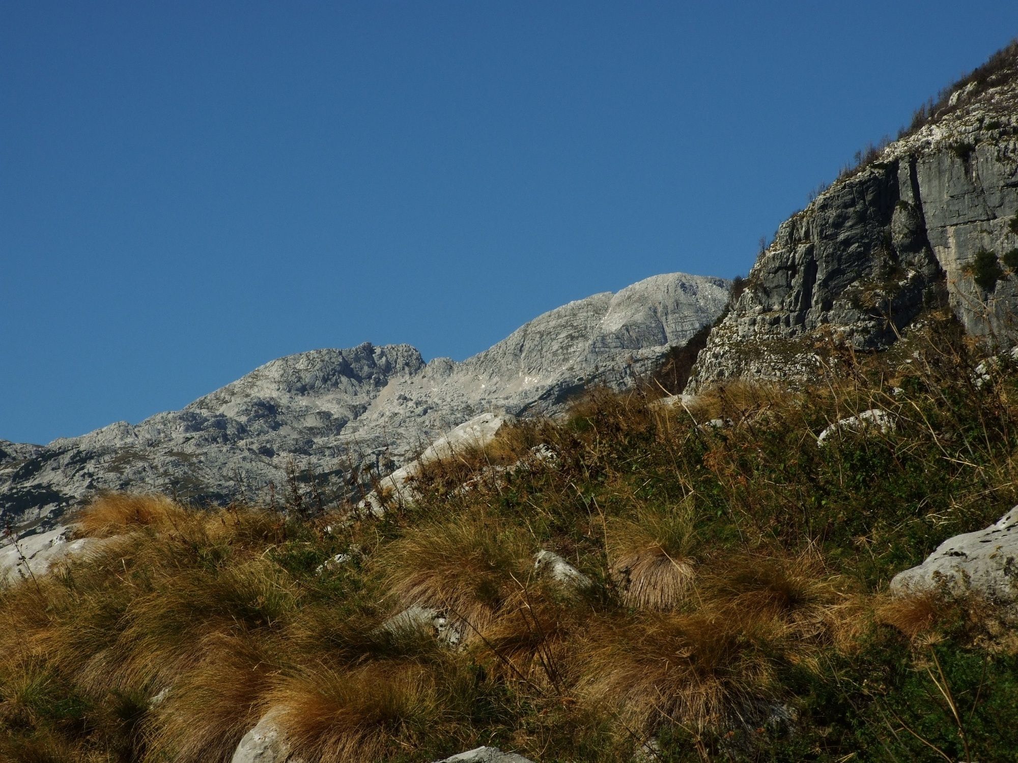
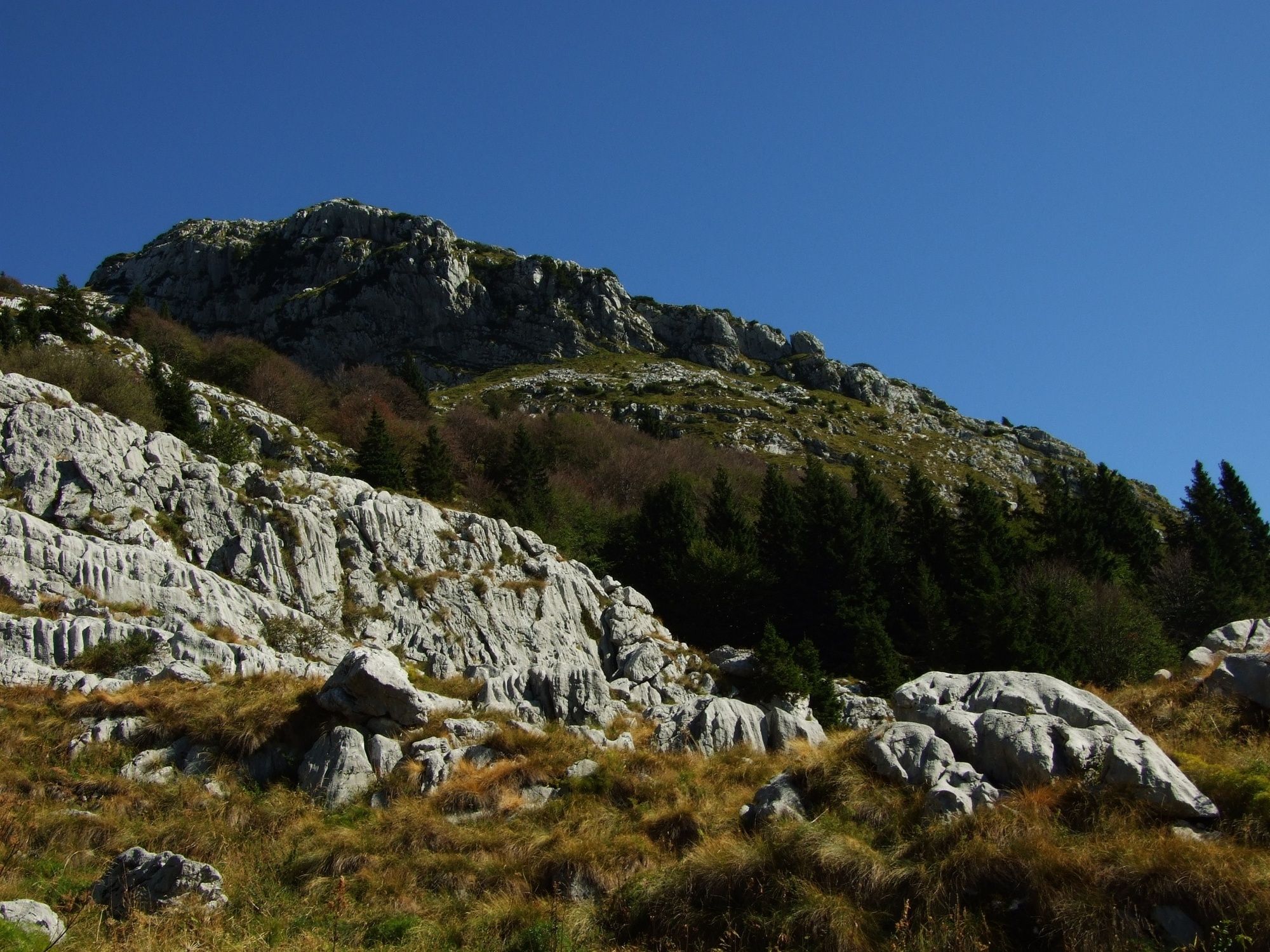
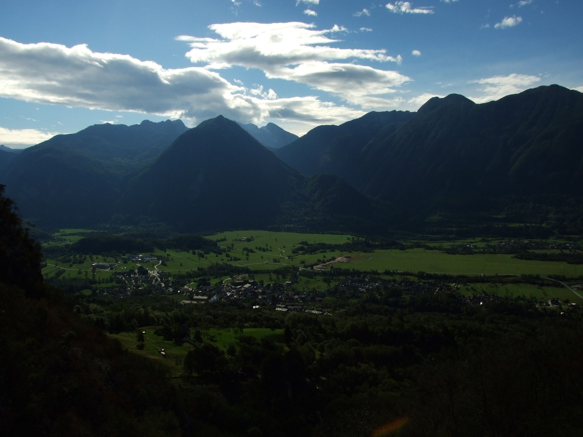
This undemanding hiking tour starts and ends in the centre of Bovec. It starts ascending at the very start and quickly gains altitude. At several sections it offers splendid views of Bovec and the Bovec Basin. The most difficult section of the ascent is already behind you when you reach the hunting lodge on the mountain pasture. From here, the trail mostly gradually descends into the valley, mainly along the former Italian military road – mule track.
- Directions
-
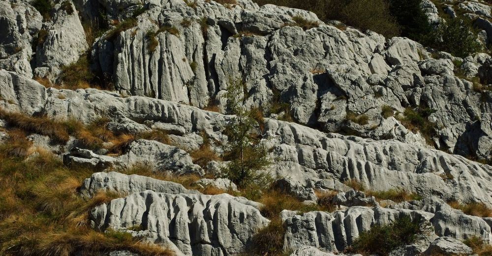
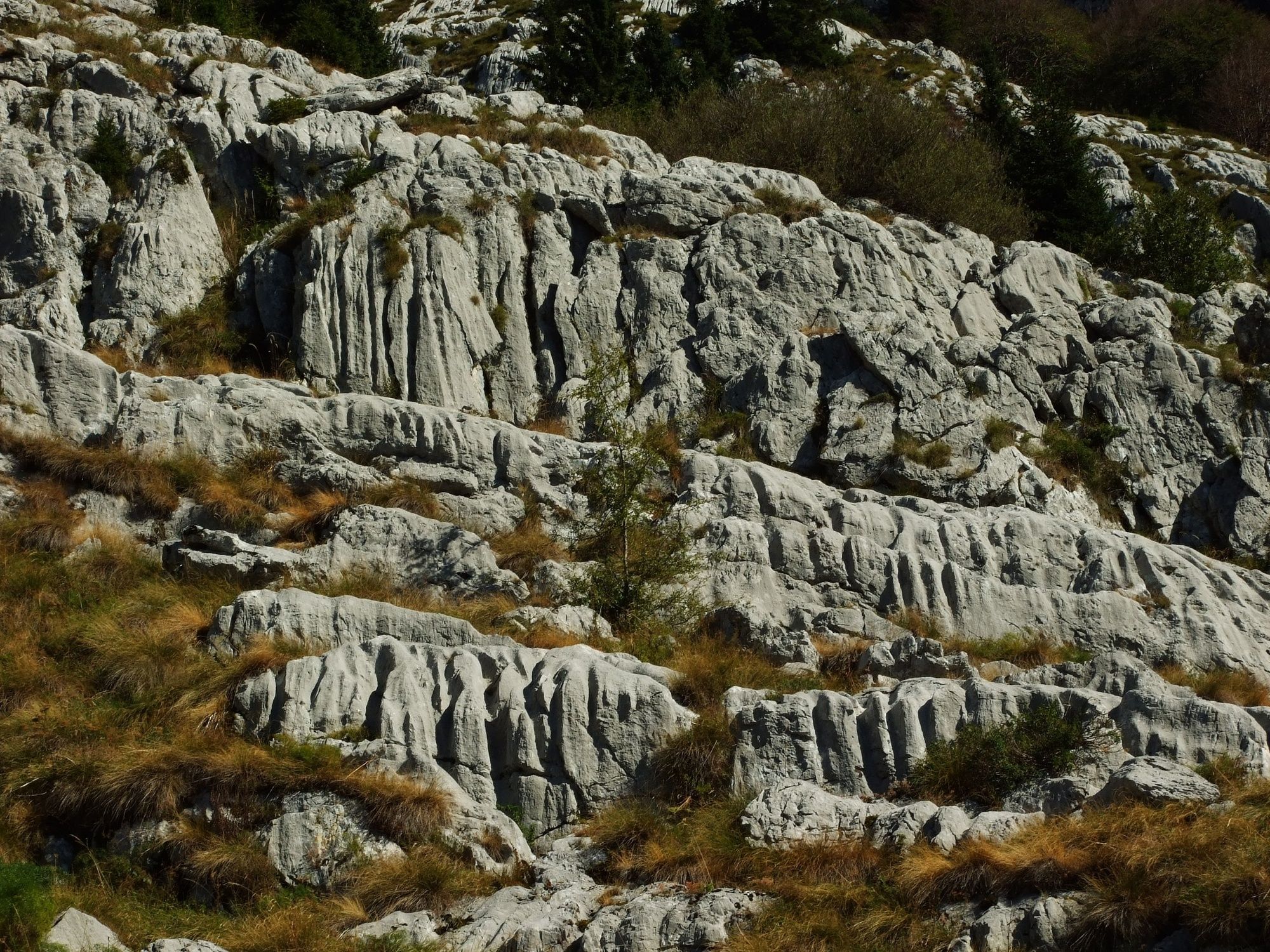
This trail starts (and also ends) in the centre of Bovec. In the centre of Bovec turn uphill to the left, pass the Church of St. Urh and just above the Kaninska vas reception point, turn to the hiking trail leading to Mt. Rombon. The trail is initially routed through the forest and continues to the last farms where the area opens up. Here, the trail winds between the boulders, however no section is exposed. Although the altitude here is still relatively low you can already admire the Bovec Basin below. When you overcome the rocky section of the trail you will turn uphill again through a nice beech forest which grows almost to the hunting lodge on the mountain pasture. The highest point of the tour is located a few metres above the hunting lodge, which is why we recommend you to take time for a longer rest and enjoyment on level areas in the vicinity of the hunting lodge. After you have rested, continue along a short gradually ascending slope west of the hunting lodge and enter a wonderful pine tree forest where you follow the former Italian military mule trail. This mule trail is initially almost level and later gradually descends. At the point called Na vrh robu the trail turns and starts descending diagonally along the area called Strmokres to a vast beech forest beneath the Planja paragliding take-off point. There are numerous forest skidding trails and roads. Find the marked Kanin mule trail which you follow to the main gravel road towards Station B of the Kanin cableway. From this junction on, follow the gravel road which joins the paved road towards the village of Plužna. Continue along this road to the centre of Bovec where this tour ends.
- Highest point
- 1,370 m
- Endpoint
-
Goričica Mountain pasture
- Height profile
-
 © outdooractive.com
 - Equipment
-
Hiking or trekking footwear, trekking poles, sun protection headgear, sufficient water supplies.
- Safety instructions
-
The initial rocky section of the trail requires special caution in case of wet weather. In winter conditions (snow) we advise you not to continue along the trail from the Goričica Mountain pasture towards the west because the trail (mule trail) is mostly routed along an avalanche area. In this case, we recommend you to return along the same trail you came from.
The trail is partially routed along an easy marked hiking trail. Use of the hiking trails is at your own risk!
- Tips
-
There are no water sources along the trail, which is why we recommended you to bring sufficient water suppplies, especially during the summer months.
- Additional information
-
Hunting lodge on the Goričica Mountain pasture is not staffed and is locked.
In case of stormy weather you should not seek refuge under the trees but you should seek shelter in World War I military caverns.
- Directions
-
Leave the national road No. 203 at one of the roundabouts in front of the town of Bovec and turn to the centre of the town.
- Public transportation
-
There are several daily bus lines connecting the town of Bovec with the town of Tolmin and the cities of Ljubljana and Nova Gorica. During the summer months there is also a bus line connecting the town of Bovec with the town of Kranjska Gora.
- Parking
-
There are free parking lots available next to the Bovec Airport, or north of the centre of Bovec next to the sports and recreation facility.


-

-
AuthorThe tour Circular hiking trail to the Goričica Mountain pasture is used by outdooractive.com provided.


General info
-
Region Villach - Faaker See - Ossiacher See
2064
-
Soča-Tal
392
-
Bovec
111


