
- Brief description
-
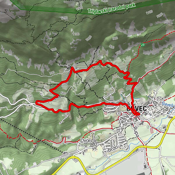
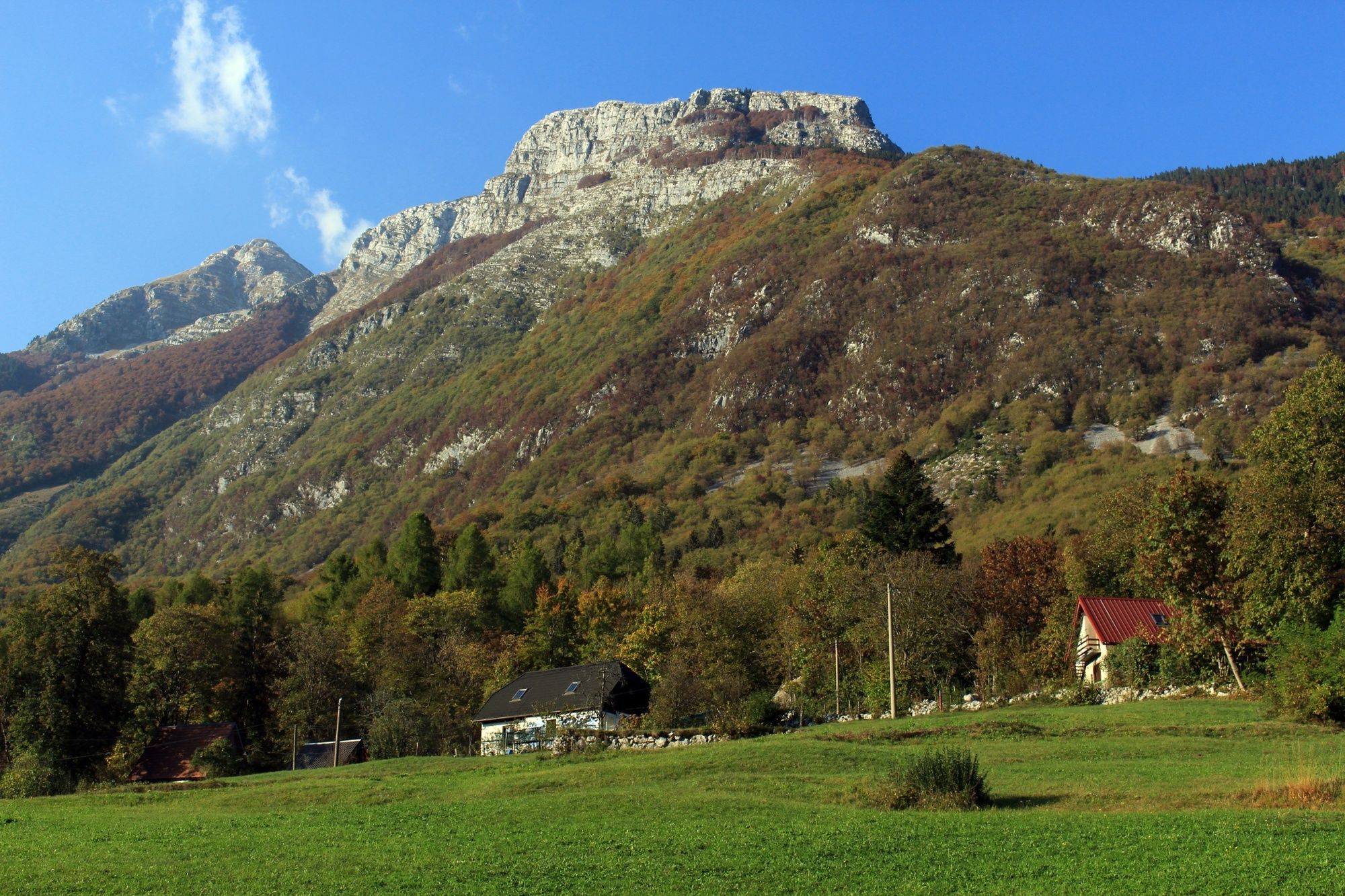
A short hour and a half 5 km loop through the upper farms of the Bovec basin, offering panoramic views of the Soča valley.
- Difficulty
-
easy
- Rating
-
- Starting point
-
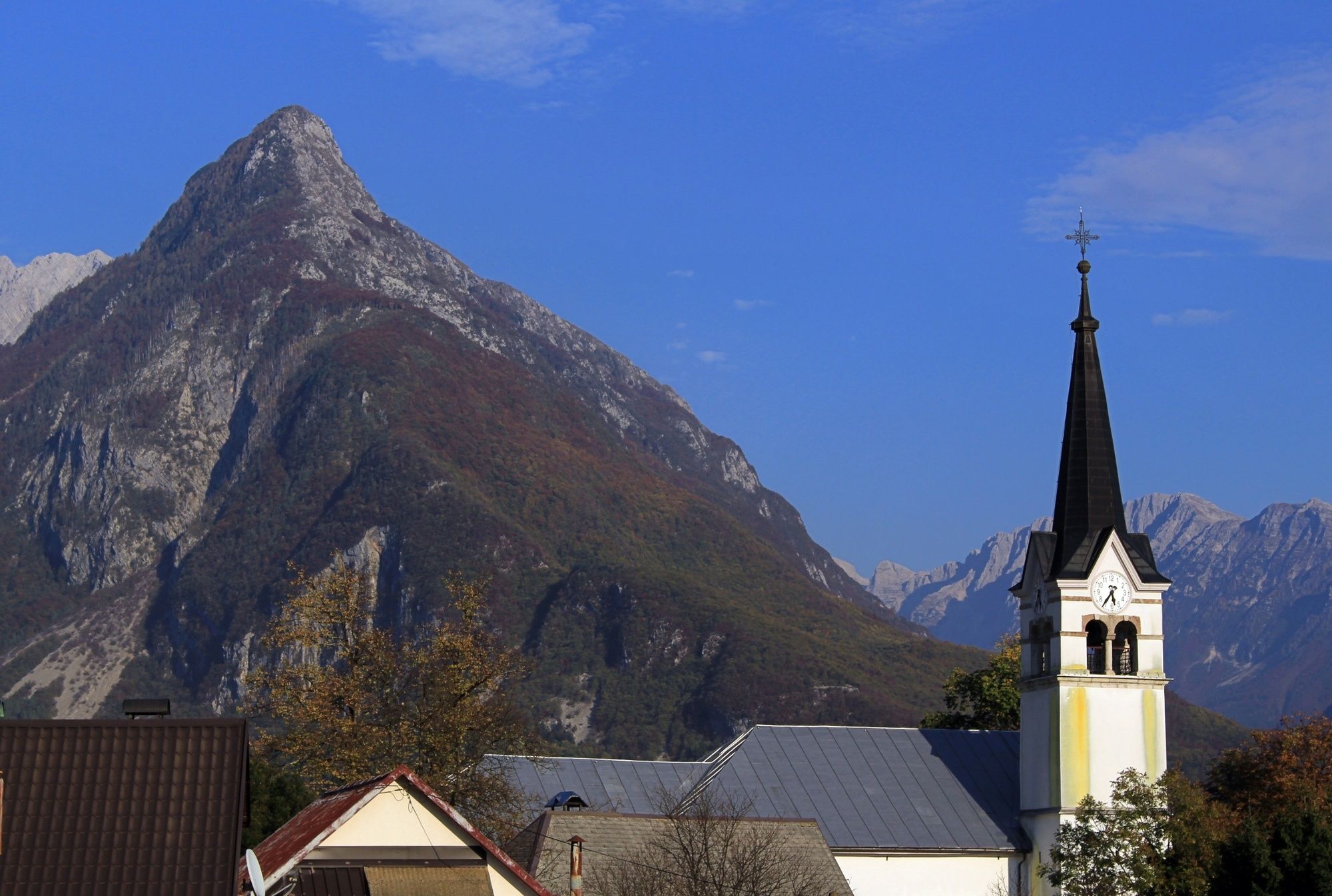
Bovec center
- Route
-
Flitsch0.1 kmCerkev svetega Urha0.2 kmKaninska Vas4.4 kmCerkev svetega Urha4.8 km
- Best season
-
JanFebMarAprMayJunJulAugSepOctNovDec
- Description
-
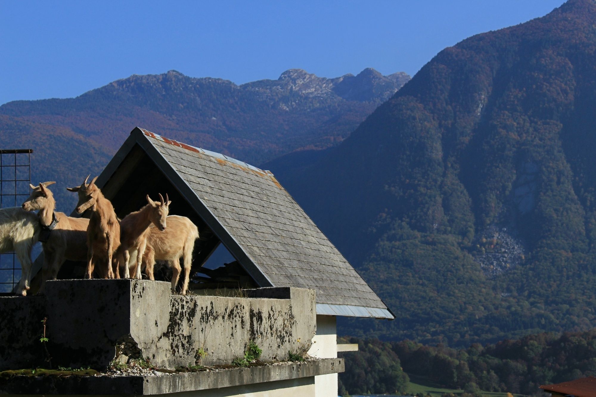
A short, easy hike through some of the most stunning properties that Bovec has to offer. A great trail to stretch the legs if you are short on time, offering a few viewpoints of the Soča valley and the town of Bovec. Expect to encounter sheep and goats on these farms, a source of the delicious dairy products that come out of the area.
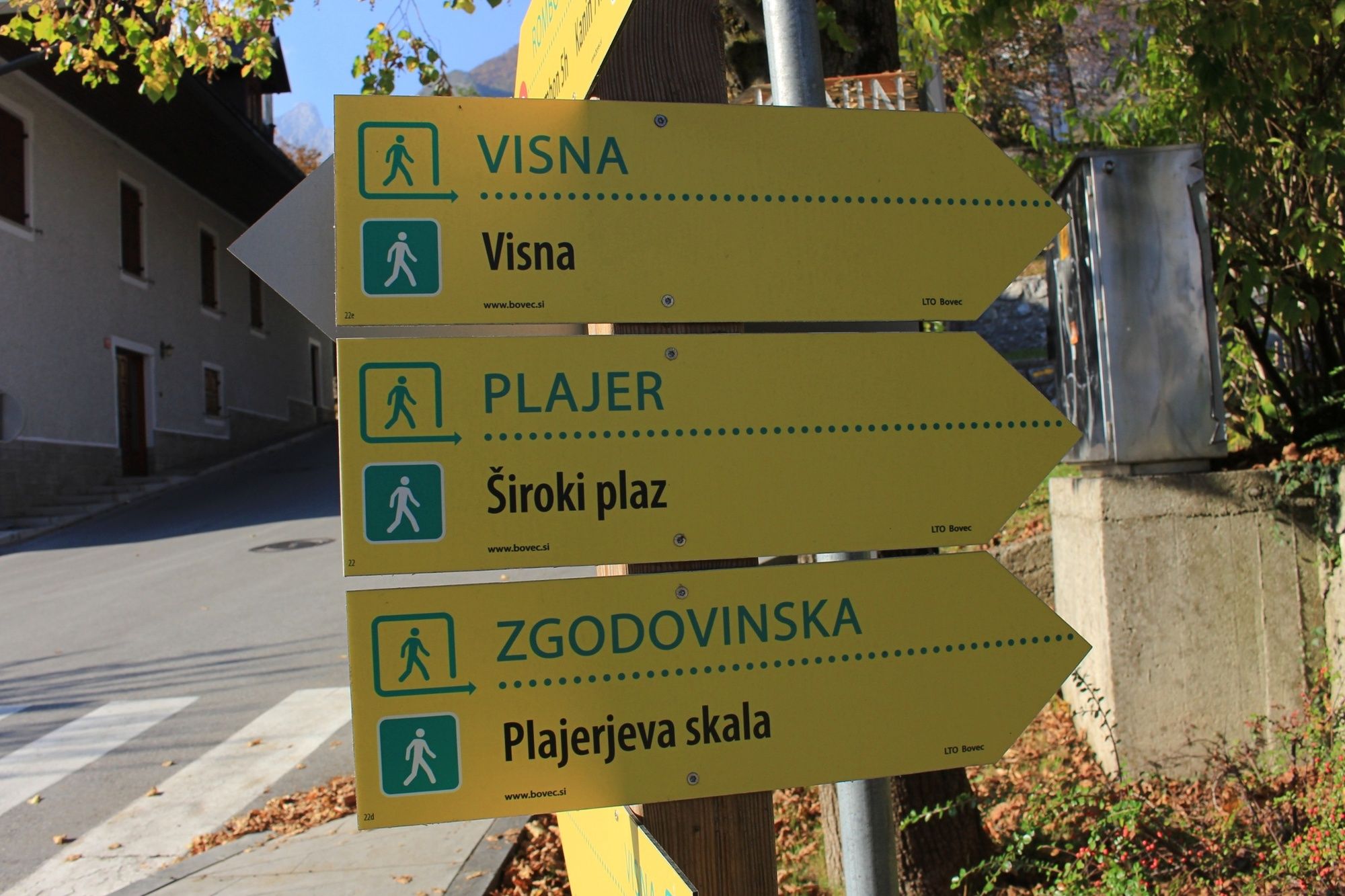
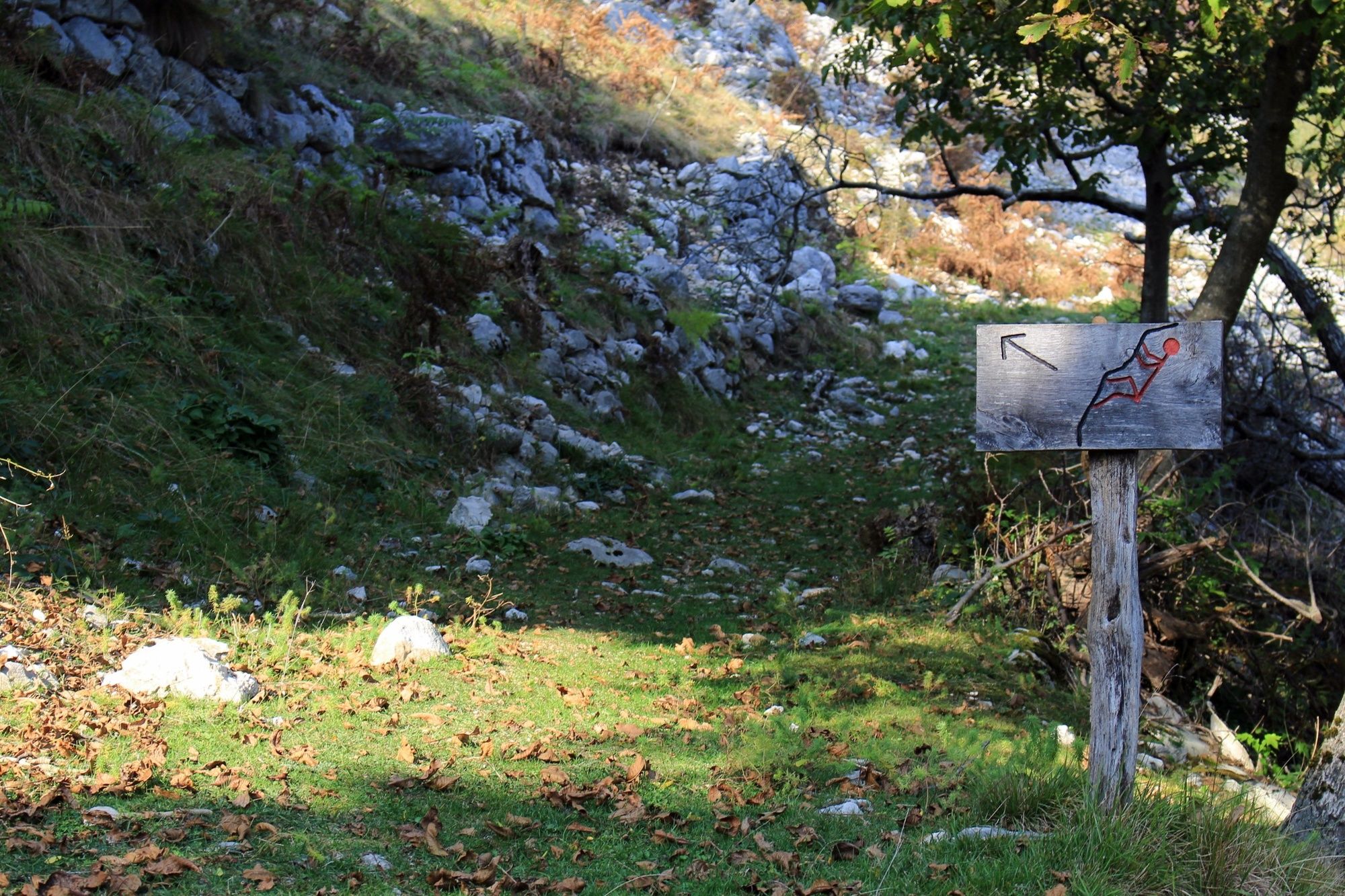
To start this track from the information center follow the road up to the church. Here you will see the first sign indicating the path for Visna. Follow this well marked path up the slopes of mt. Rombon eventually passing by the official trail head to the summit. From here follow the paved road leading back to the center of Bovec.
This 5 km trek takes about an hour and a half and is suitable for the whole family.
- Directions
-
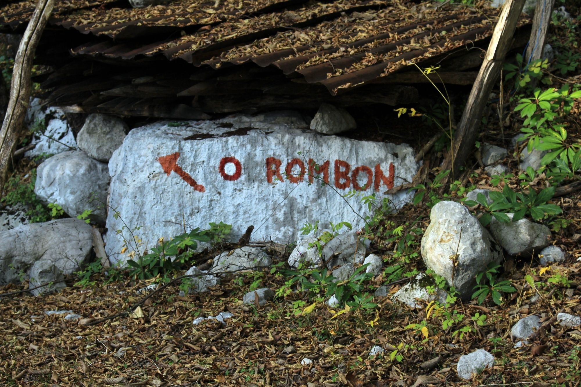
From the information center follow the road leading up the hill towards the church. At the base of the church take the road on the right and you will see the first yellow sign indicating the road for Visna. Following this road up you will pass through two gates (make sure to close them behind you). Shortly after the second gate turn left on the grassy road leading up the hill. Ascend the 3 switch backs, arriving at the third yellow sign, indicating a left turn. This is the point where Visna and Plajer trails diverge. Continue on a small dirt trail bordering private farm land. After crossing several properties on this trail you will arrive at the parking space for the Rombon trailhead. The rest of the Virje path descends on a paved road for about 30 minutes until you reach the center of Bovec.
- Highest point
- 682 m
- Endpoint
-
Bovec center
- Height profile
-
 © outdooractive.com
 - Equipment
-
This is a standard trail, requiring no special equipment. Bring gear according to the weather and the season.
- Safety instructions
-
The trail is easy and safe. Could be slippery after the rainfall.
- Tips
-
A great hike if you are short on time or if you want to gain some elevation to get a view of the beautiful Soča valley.
- Additional information
-
This track passes through several sections of private property. Please remember to always close the gate behind yourself and respect the private property.
There is a wall at the base of Rombon - Kegl with several established rock climbing routes. Refer to the pictures for the trail leading up to the wall.
- Directions
-
This is a round trip track starting and ending at the information building in the center of Bovec.
To get to Bovec you can come from the North or the South.
- From the North: Via Kranjska Gora through Vršič pass or through the Italian town of Tarvisio through Predil pass.
- From the South: Follow road number 102 from Tolmin to Kobarid, turning on 203 from Kobarid to Bovec.
- Public transportation
- Parking
-
During the summer months, parking can be difficult in Bovec. There are a few larger parking lots that generally have space available. Option number 1: directly across from the Mercator supermarket there is a large parking lot. Option number 2: there is a large parking lot near the school and the church.
- Author
-
The tour Visna trail is used by outdooractive.com provided.


General info
-
Region Villach - Faaker See - Ossiacher See
2064
-
Soča-Tal
392
-
Bovec
111