- Brief description
-
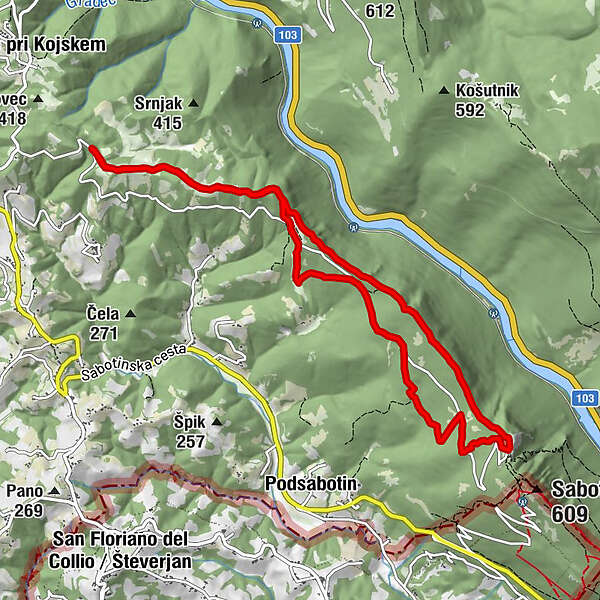
The 11.5-kilometer-long circular thematic route Briški krog miru leads past the remains of the First World War and wonderful views to the Sabotin open-air museum - Peace Park.
- Difficulty
-
medium
- Rating
-
- Starting point
-
Park Miru Sabotin
- Route
-
topovske kaverne galerije3.2 km
- Best season
-
JanFebMarAprMayJunJulAugSepOctNovDec
- Description
-
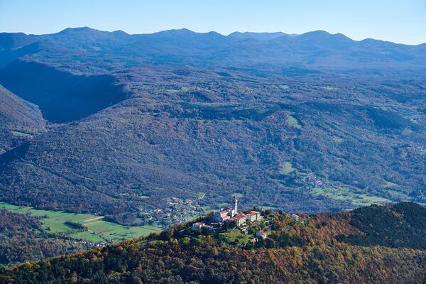
On Sabotin, almost every stone can tell an Austro-Hungarian and Italian story about the consolidation of battle positions. Today, the Peace Park is arranged here, but during the First World War it was overturned from all sides and riddled with trenches, ditches and caverns. Due to its strategic location above the river Soča, it was first an important Austro-Hungarian bridgehead on the right bank, and in the Sixth Battle of the Soča in August 1916, it was captured by the Italian army together with Gorica/Gorizia. The reward for the climb is a view that stretches from Sveta Gora, the Vipava Valley and Brda, the Karst and the Friuli Plain to the Julian Alps. In the premises of the former border guardhouse on Sabotin, there is an innovative multimedia center for visitors, which, with its museum, information point and many other remains, represents an important outpost on the Path of Peace from the Alps to the Adriatic. In the nearby snack bar, you can support yourself with jota and other delicacies.
- Highest point
- 548 m
- Endpoint
-
Park Miru Sabotin
- Height profile
-
 © outdooractive.com
 - Directions
-
Above Nova Gorica, towards Brda
- Public transportation
-
Bus or train (to Nova Gorica)
- Parking
-
Available
- Author
-
The tour Circle of Peace in Brda is used by outdooractive.com provided.


General info
-
Brda
115
-
Nova Gorica
26