- Brief description
-
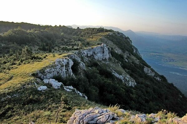
This trail will take you to some of the best views in Vipava Valley.
- Difficulty
-
easy
- Rating
-
- Starting point
-
Under the oak tree before the village of Ustje
- Route
-
Gemünd (101 m)0.1 kmDolling1.4 kmSv. Marjeta1.9 kmPlanina Inferiore2.6 kmLeitenberg2.8 kmOstri vrh (422 m)5.6 kmWeinstegen10.5 kmWerdischach12.5 kmLissiachi13.0 kmDeutschendorf bei Haidenschaft15.0 kmCerkev Sv. Justa17.2 kmGemünd (101 m)17.2 km
- Best season
-
JanFebMarAprMayJunJulAugSepOctNovDec
- Description
-
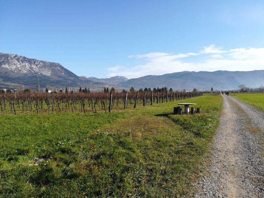
The hike traverses through sloping vineyards and the Valley’s picturesque villages where the famous priest, vintner, and author Matija Vertovec lived and worked, teaching others in the Vipava Valley how to make wine. He was the first person to write about wine-making, vineyards, and wine cellars in the Slovenian language, when he published his book Vinoreja (“The Art of Winegrowing”) on the subject in 1844.
- Directions
-
After leaving Ustje and traveling through Dolenje, Planina is the next destination, where Matija Vertovec worked, then through Šmarje, where he was born, and finally back through the villages of Vrtovče and Tevče to the starting point in Ustje. During the hike visitors will feast their eyes on a number of natural and cultural monuments, including a site with many fossils along the Vipava, the beauty of the Valley’s typical settlements, and the centre of the village of Šmarje, which is a protected piece of cultural heritage. There are many scenic overlooks, for instance at Ostri Vrh, where the whole Vipava Valley can be seen in all its splendor. The well-marked trail winds through vineyards and through old villages in the Valley. This hike takes around 5 hours, or can last even longer if you stop to try a glass of wine at one of the many wine cellars lining the path.
- Highest point
- 393 m
- Endpoint
-
Under the oak tree before the village of Ustje
- Height profile
-
 © outdooractive.com
 - Equipment
-
Hiking boots and hiking poles
- Safety instructions
-
No special safety issues


- Author
-
The tour In the Footsteps of Matija Vertovec is used by outdooractive.com provided.


General info
-
Vipava Tal
78
-
Štanjel
16