
- Brief description
-
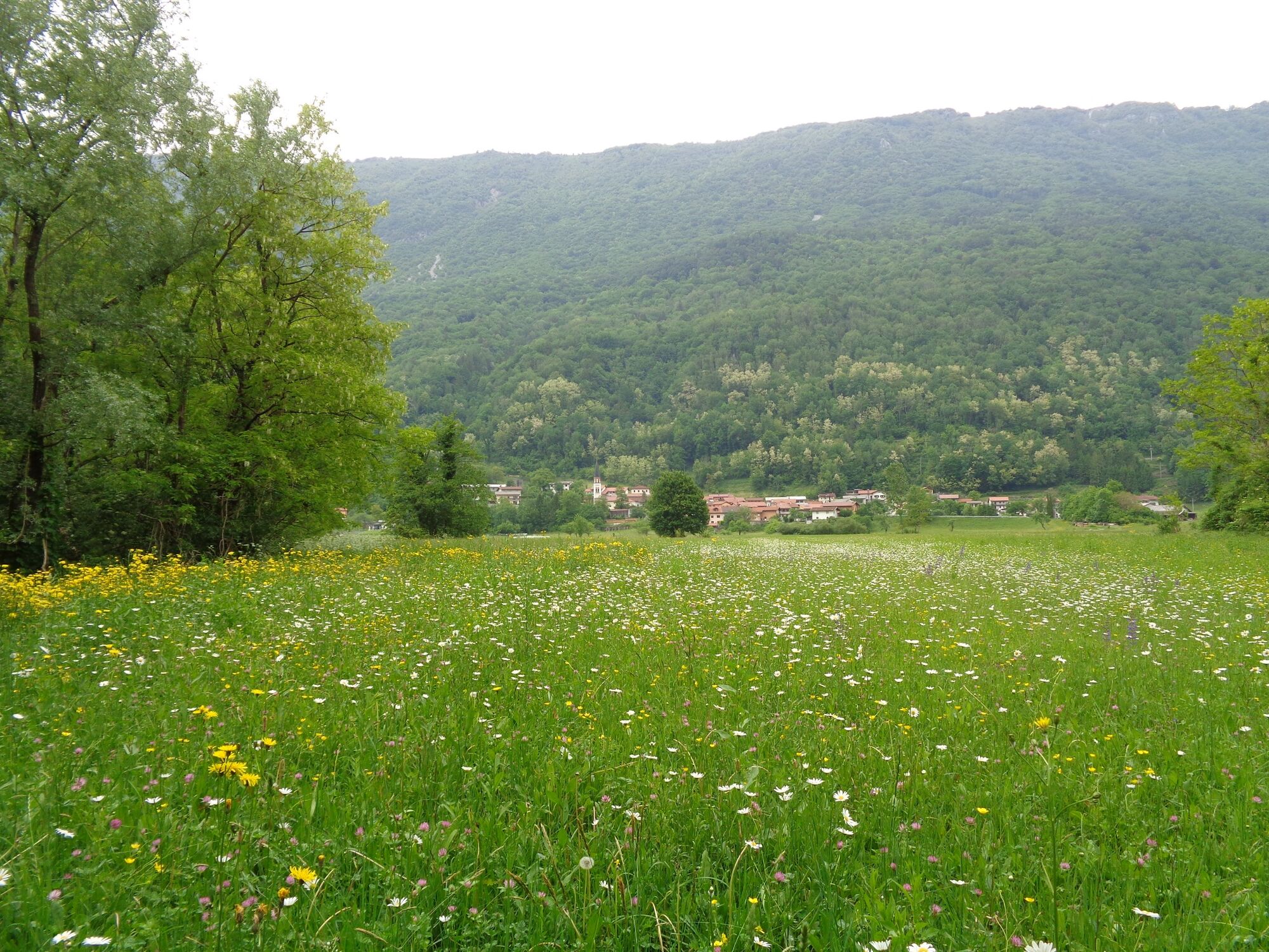
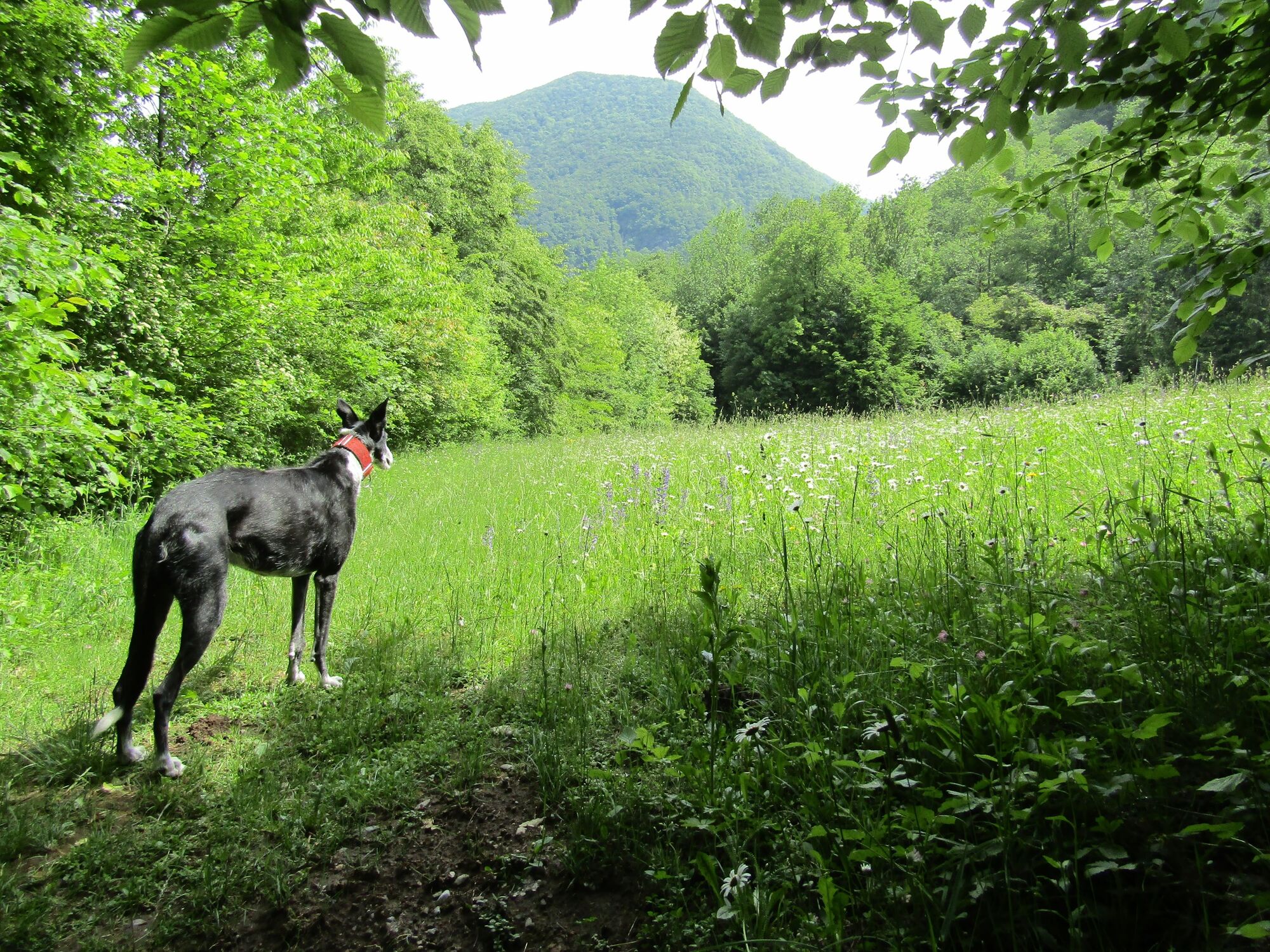
This hike along the Nadiža River and through the forest to the Church of St. Volar is a true balm for your soul. The majority of the tour is routed through the forest. On your return you can refresh yourself in the Nadiža River during the summer months.
- Difficulty
-
easy
- Rating
-
- Starting point
-
Parking lot at the end of Robič
- Route
-
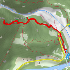
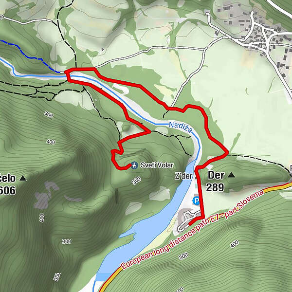
Artelsdorf0.6 kmSveti Volar2.3 km
- Best season
-
JanFebMarAprMayJunJulAugSepOctNovDec
- Description
-
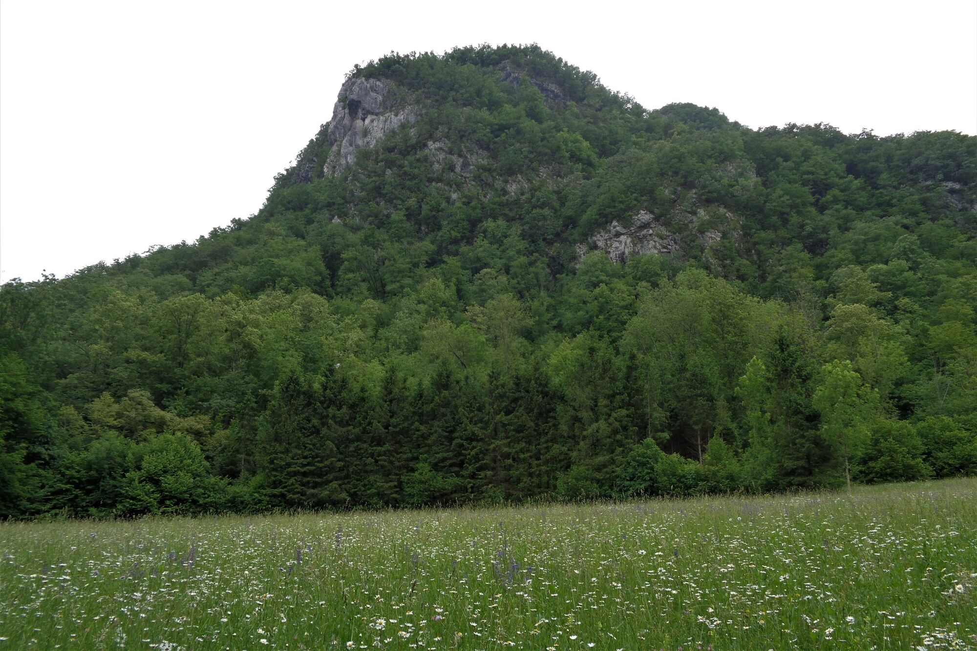
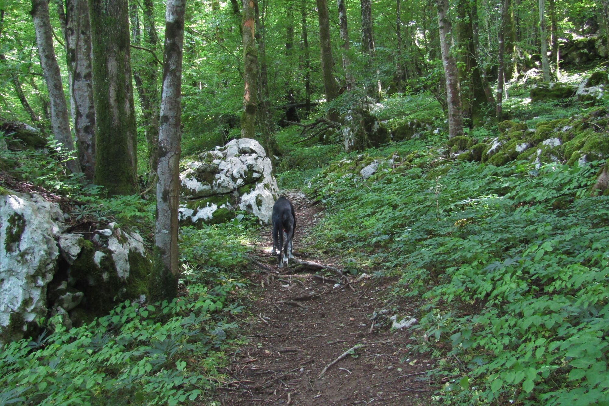
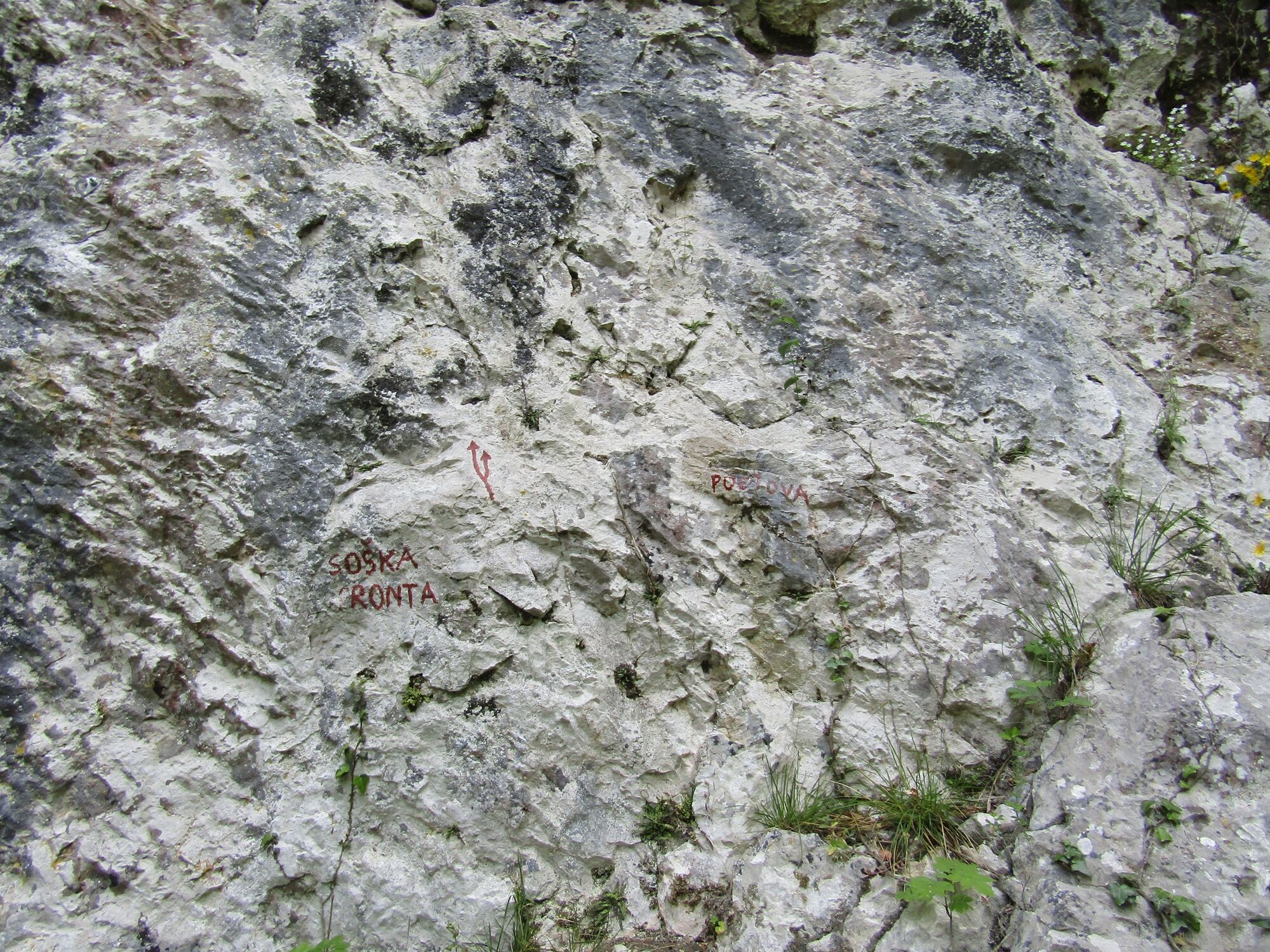
The trail along the Nadiža River runs along the cart track or a marked cycling trail until you reach the bridge. Because the majority of the trail runs through the forest and because it is routed along an undemanding terrain surrounded by a wonderful environment, this trail is ideal if you would like to escape from the summer heat. Its additional value is that it provides you with a chance to refresh yourself in the clear pools of the Nadiža River. After you cross the bridge, continue along the marked trail until you reach the climbing site. If you are lucky you have a chance to admire the incredible climbing skills of various climbers overcoming different climbing routes, since the prepared routes are not of the easiest difficulty levels. After a somewhat steeper section, which will force you to breathe a little bit heavier, you will already be able to notice a small water source, which is, according to the legend, good for your eyes. From here you will only have to overcome another bend or two in order to reach your destination. Archaeologists speculate that the rising where the Church of St. Volar stands was permanently settled already in the Bronze Age.
It is impossible to enjoy in any views of the valley from the church because they are blocked by the forest, however, the benches in the shade are more than welcome if you would like to make a stop and meditate.
Return along the same trail.
- Directions
-
At the parking lot, start following the only cart track leading past the restaurant, which is already visible from the parking lot. Walk past the chapel and, when you reach a small junction, start following the cycling trail leading to Kamp Nadiža and the village of Podbela. Cross the river across the footbridge and, when you reach the other side, start following the signs for the Church of St. Volar. Cross the clearing and hike along the well-worn trail past the climbing site until you reach the rising where the church is located. Return along the same trail.
- Highest point
- 309 m
- Endpoint
-
Church of St. Volar
- Height profile
-
 © outdooractive.com
 - Equipment
-
Hiking footwear and trekking poles for those who are used to walking with them.
- Safety instructions
-
The trail is completely safe.
- Tips
-
This tour is ideal for families with small children. When you return to the bridge across the Nadiža River you can freshen up in the river below.
- Additional information
-
If you would like to make a longer tour you can start in the town of Kobarid and follow the cycling trail past the villages of Sužid, Staro selo and Robič to the already mentioned destination. By doing so you prolong the tour for another 5 km in one direction.
- Directions
-
You can reach the starting point from Kobarid through the village of Robič (in the direction of Italy).
- Public transportation
- Parking
-
Payable parking lot in front of the Nadiža bathing area.


-

-
AuthorThe tour Church of St. Volar above the Nadiža River is used by outdooractive.com provided.


General info
-
Friaul Julisch Venetien
139
-
Goriška
387
-
Podbela
86