
- Brief description
-
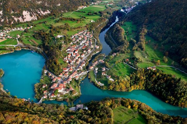
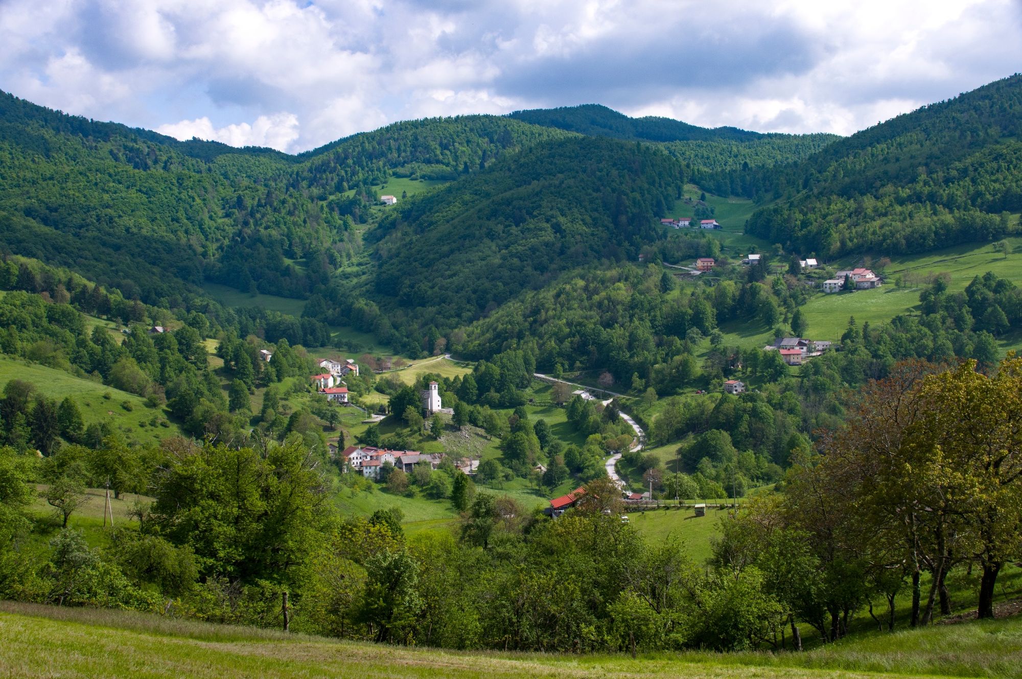
Above the confluence of the Soča and Idrijca rivers, the Banjšice Plateau rises to the south. At its most north-western part you can find a dry valley whose slopes are populated with small and large groups of houses that form the villages of KANALSKI and TOLMINSKI LOM, while across the ridge, above the dry Čepovan valley, you can find a small village of GRUDNICA. This is the area of Lom.
- Difficulty
-
easy
- Rating
-
- Route
-
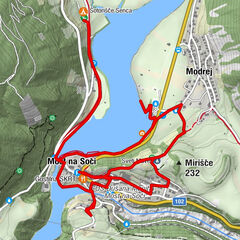
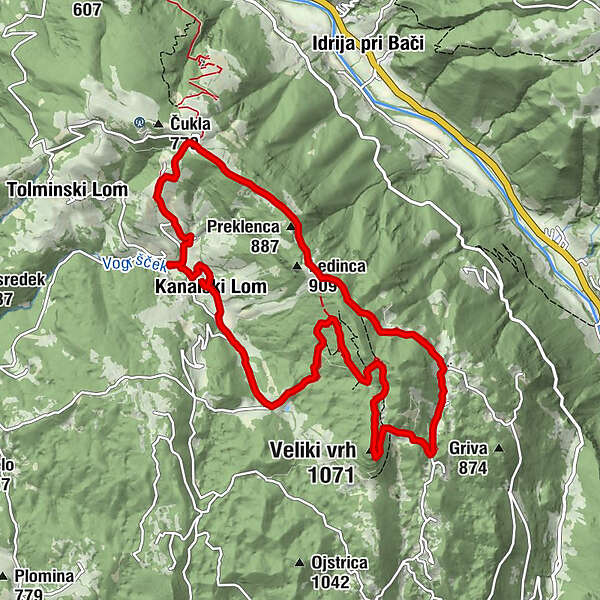
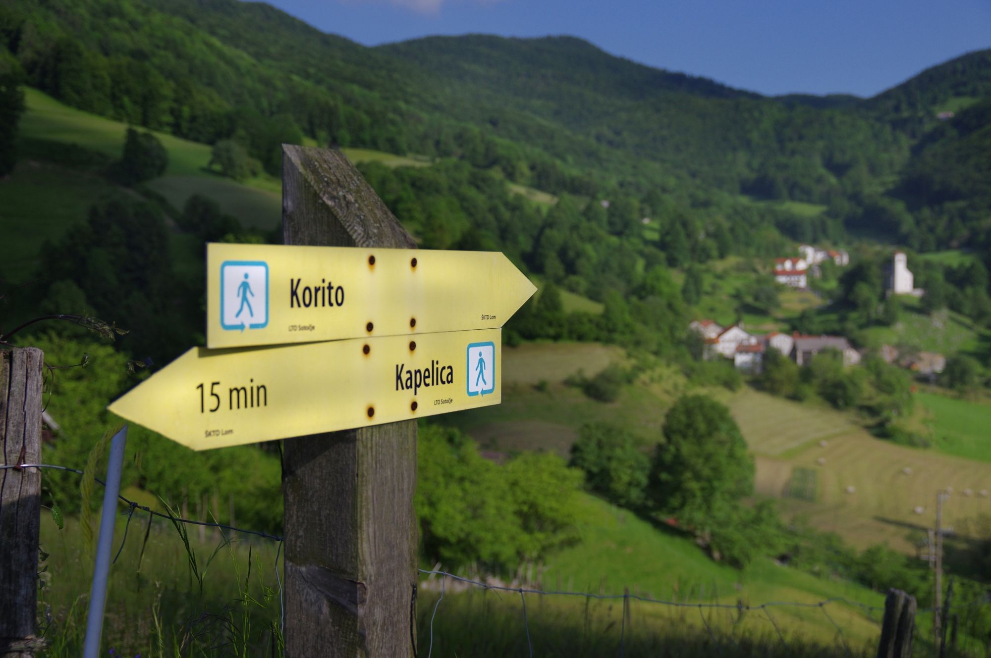
Cerkev sv. Primoža in Felicijana0.4 kmKanalski Lom0.5 kmBrezno v Špilah (950 m)3.2 kmVeliki vrh (1,071 m)4.7 kmGrudnica6.5 kmLedince8.2 kmŠirokolandija9.3 kmŠiroko9.8 kmKanalski Lom11.8 km
- Description
-
The circular hiking trail, LOM IS MY HOME, runs through these villages and across colourful meadows, grasslands, pastures, and through cool forests on their edges. Information boards, placed along the trail, bring us closer to the past and the present-day life in this area.
There are no permanent watercourses in this karst area, however, you can find many sinkholes, abysses and hollow caves. There are several sites where the locals dug stone plates, which were used for roofing purposes. Even today, you can still admire the village church and the oldest preserved house which are covered with such stone plates. In this hilly countryside, crops were cultivated on small fields, while livestock was pastured on higher ground and in the forests.
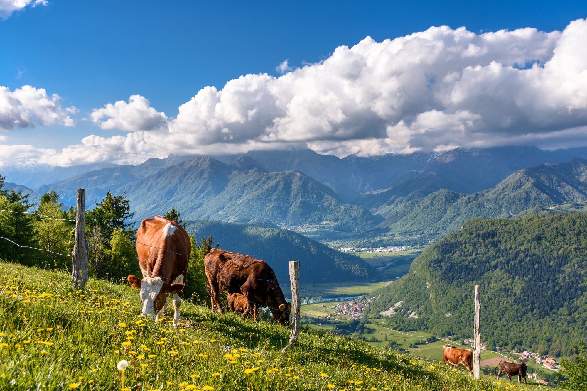
Picturesque vistas open up along the trail. The church of St. Primus and Felician welcomes visitors on a slope in the centre of Kanalski Lom. Above Kanalski Lom, you can admire the Kolovrat ridge in the south-west direction, and even the Italian Dolomites if the weather is clear enough. From the ridge that stretches from Široko to Mt. Veliki vrh, and further to the hills above Lokovec, the view extends from the ridge of Mt. Kolovrat, across Kanin and the Tolmin-Bohinj Mountain chain to Mt. Porezen and other Idrija-Cerkno hills; at the Široko viewpoint, it is possible to admire them from up close with the help of binoculars.
- Highest point
- 1,047 m
- Height profile
-
 © outdooractive.com
 - Tips
-
At the Široko Tourist Farm we enjoy the cuisin with typical local dishes, famous for their delicious štruklji. Along the path Lom je moj dom stands the Tratar cheese-making farm, where we can get quality home-made cheese, cottage cheese and other dairy products.
-

-
AuthorThe tour Lom is my home is used by outdooractive.com provided.


General info
-
Brda
114
-
Most na Soči
78