Čez most po modrost: a cultural-historical trail along Most na Soči


- Brief description
-
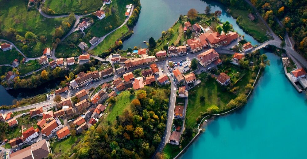
This cultural-historical trail takes you through the three millennia of Most na Soči.
- Difficulty
-
easy
- Rating
-
- Starting point
-
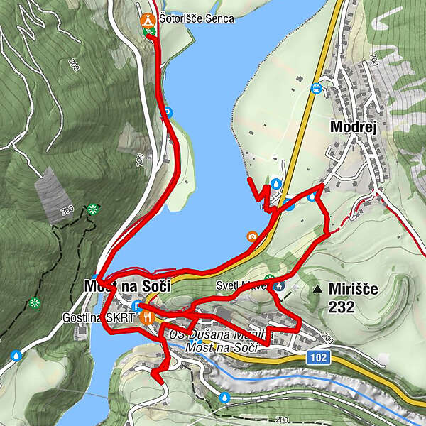
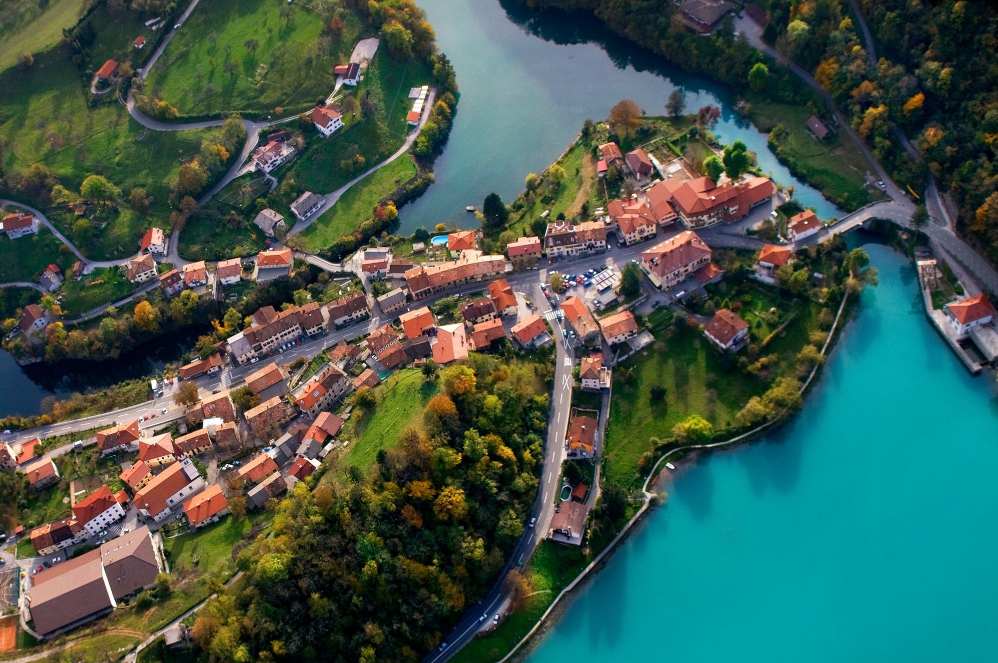
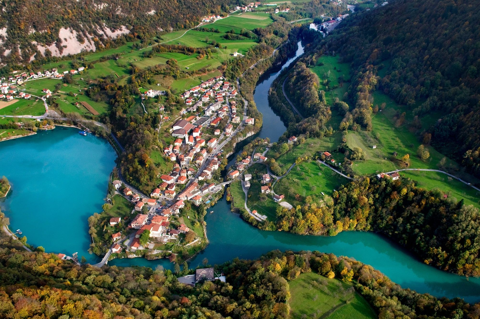
Centre of Most na Soči next to the gas station
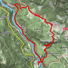
- Route
-
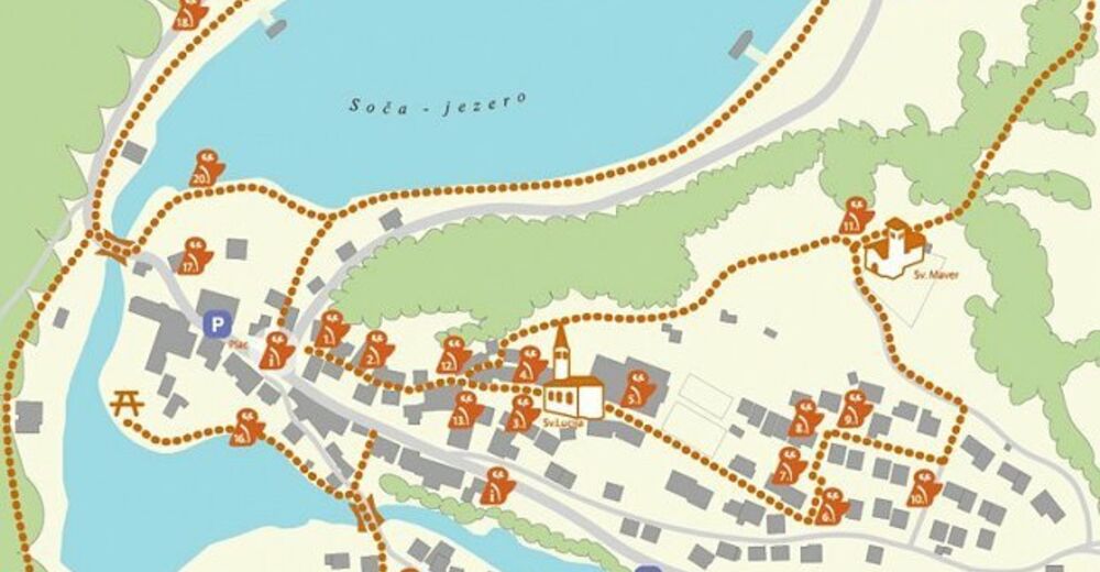
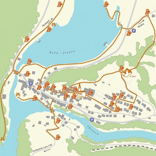
Restaurant SKRT0.0 kmSveta Lucija0.2 kmSanta Lucia1.2 kmKozmerice1.9 kmPizzerija Jezero2.1 kmModreuzza2.9 kmModrea5.2 kmSveti Maver5.7 km
- Best season
-
JanFebMarAprMayJunJulAugSepOctNovDec
- Description
-
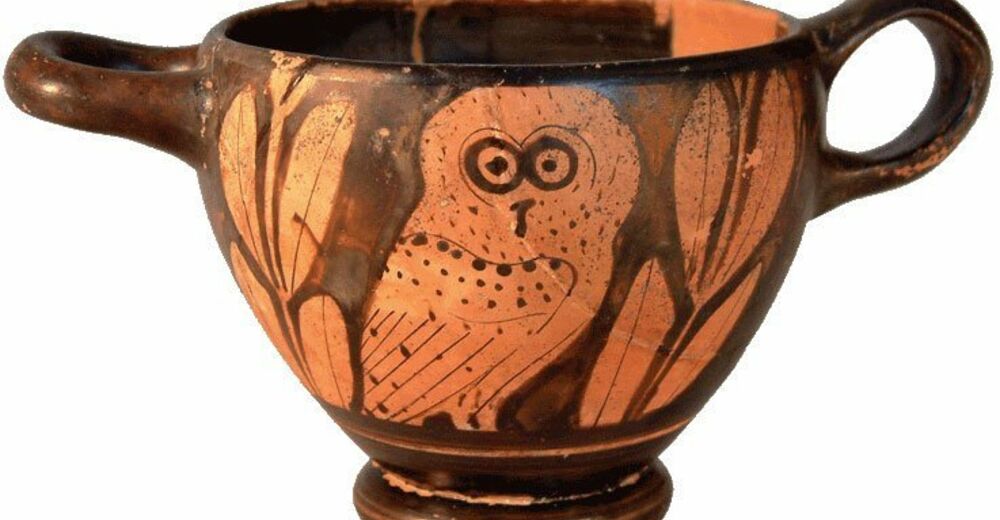
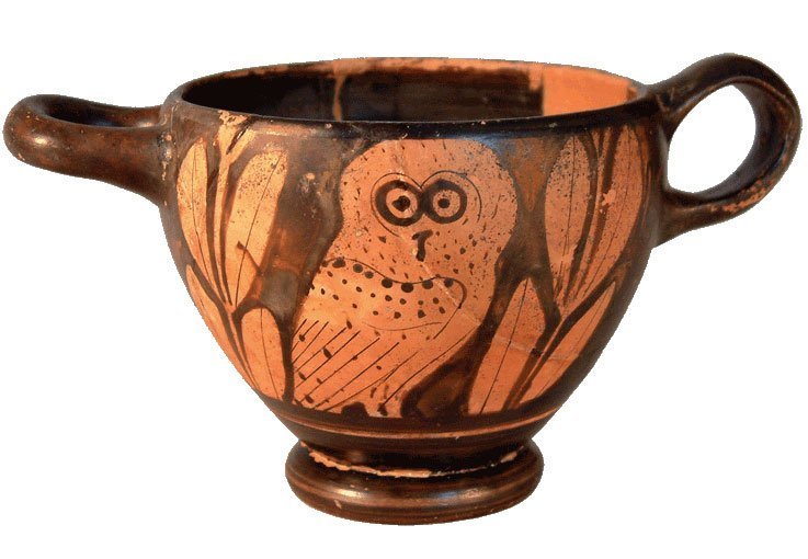
The trail is routed through the village and along the arranged spots equipped with information boards and niches containing replicas of the archaeological finds. At the first spot of the trail you can take a look at the replica of the Greek Skyphos bowl with a picture of an antique owl. This owl will accompany you along all of the 22 spots:
- Bronze Age Settlement,
- Church of St. Lucy,
- Early Iron Age Settlement,
- Roman House,
- Roman Cemetery,
- Iron Age cemetery,
- Pregelj (Lovrč) House,
- Bridge across Idrijca,
- Old-Slavic Settle grounds,
- From stone to lime,
- In the front’s hinterland,
- Archaeological Museum,
- Tolminsko mostišče Museum …
- Directions
-
From the centre of the village, climb up the stairs and the slope through the village to the Church of St. Lucy and continue past the Elementary school which also includes the Archaeological museum. At the next intersection, follow the sign pointing to the left towards the Church of St. Maurus with splendid views of the lake. Continue down the slope to the left and pass the Church of St. Lucy. When you reach the main road, cross it and continue across the bridge crossing the Idrijca River. The trail leads uphill to the spot No. 15.
Return along the same way, and after you cross the Idrijca River again, continue to the left along the trail to the confluence of the rivers Idrijca and Soča. Descend along the main road past the Lucija Hotel, cross the bridge across the Soča River, turn downhill to the right, and continue along the lake to spot No. 19.
Return along the same way, and after you cross the Soča River again, descend to the left along the stairs and continue along the lake promenade. After you visit spot No. 21, cross the main road in the direction of the village of Modrej. The trail leads uphill to the right along a concrete road and past the Church of St. Maurus from where you descend back to the starting point in the centre of Most na Soči.
- Highest point
- 204 m
- Endpoint
-
Most na Soči
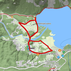
- Height profile
-
 © outdooractive.com
 - Equipment
-
Regular footwear.
- Safety instructions
-
Take special care on the sections where the trail crosses the main road.
- Tips
-
Besides the archaeological museum in the village of Most na Soči we also recommend you to visit the Tolmin Museum in the centre of the town of Tolmin.
- Additional information
-
Along the trail you can refresh yourself at the Skrt Inn, Jezero Pizzeria, Pension Šterk or Tami snack bar next to the lake.
- Public transportation
-
There is a bus line running from the town of Tolmin to the village of Most na Soči.
From Ljubljana/Bled/Bohinjska Bistrica you can take the train to the Most na Soči Railway station where you take the bus to the centre of the village.
- Parking
-
There is free parking available in the centre of the village next to the gas station (2-h limit).
At the entrance into the village (from Tolmin) you can find a free parking lot at the left side of the road (without time limit).
-

-
AuthorThe tour Čez most po modrost: a cultural-historical trail along Most na Soči is used by outdooractive.com provided.


General info
-
Goriška
388
-
Most na Soči
81