

- Brief description
-
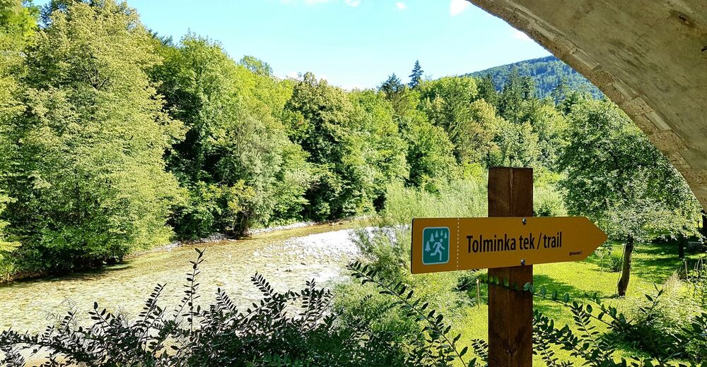
This trail run around the town of Tolmin and along the Tolminka and Soča Rivers connects the confluence of these rivers, the German ossuary and the Austrian cemetery, and is later routed beneath Mt. Kozlov rob and past the entrance point of the Tolmin Gorges.
- Difficulty
-
easy
- Rating
-
- Starting point
-
Confluence of the Soča and Tolminka rivers (centre of Tolmin (optional))
- Route
-
Sveti Urh1.5 kmLoče5.4 kmTolmein6.8 km
- Best season
-
JanFebMarAprMayJunJulAugSepOctNovDec
- Description
-
In order to determine the line of this trail run at various junctions, pay regard to yellow directional arrows. Along the trail you can also help yourself by following the yellow-white markings (on the ground or on buildings). We recommend you to start this trail run at the confluence of the Soča and Tolminka rivers (start is also possible in the centre of Tolmin), follow the Soča River upstream, pass the German ossuary and the civil cemetery, and run through the shopping area to the foothills of the rising with the remnants of the castle. This run is not routed to the top of this rising but crosses its slope above the settlement on the east side of the hill and joins the pavement leading to the village of Zatolmin. When you arrive to the village, start following the signs for the Polog Mountain pasture and the Memorial Church in Javorca. At the Church of St. Peter (TNP board), turn right to a military mule trail which will take you directly to the entrance point of the Tolmin Gorges (entrance ticket allows you to make a circular tour). When you arrive to the restaurant, find the gravel trail leading to the Austro-Hungarian cemetery at Loče from where the trail run shortly follows the paved road through the town until it reaches the bridge across the Tolminka River. Here, continue along the well-arranged hiking trail routed along the Tolminka River until you reach the wooden footbridge across the river in the vicinity of the confluence of the Soča and Tolminka rivers.
- Directions
-
This trail run starts at the confluence of the Soča and Tolminka rivers from where you follow the gravel road past the German ossuary and further past the civil cemetery. When you arrive to the junction, cross the national road and enter the shopping area from where you have to continue towards the paragliding landing point. Ascend to the foothills of Mt. Kozlov rob (Grad), cross its eastern slope and continue towards the village of Zatolmin. When you arrive to the Church of St. Peter above the village, turn right to a military mule trail and follow it downhill to the entrance point of the Tolmin Gorges from where you have to continue to the right and, after a couple of meters, to the left to a gravel road towards Loče. Run along the Tolminka River all the way to the bridge and start following the hiking trail along the Tolminka River which you have to follow to the confluence of the Soča and Tolminka rivers or your starting point.
- Highest point
- 259 m
- Endpoint
-
Around Tolmin
- Height profile
-
 © outdooractive.com
 - Equipment
-
Combined running shoes (asphalt, gravel, trail). You can also decide to visit the Tolmin Gorges, but you will have to buy an entrance ticket.
- Safety instructions
-
Pay special attention in the section where the line of the trail run crosses the national road and passes through the shopping area. You will cross the main road (low traffic) again between the village of Zatolmin and the Church of St. Peter above this village.
- Tips
-
We recommend you to start this trail run at the confluence of the Soča and Tolminka rivers (also possible in the centre of Tolmin) and continue upstream along the Soča River.
- Additional information
-
For more information visit www.soca-outdoor.com.

- Author
-
The tour Tolminka trail run is used by outdooractive.com provided.