
- Brief description
-
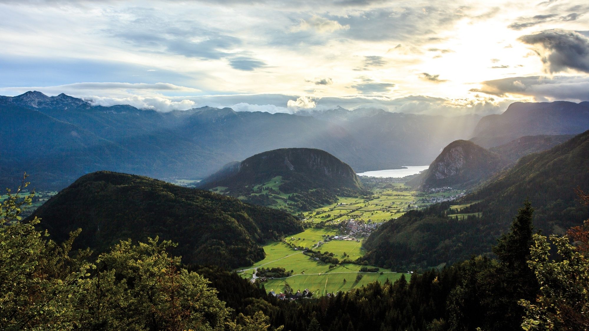
A short and easy walk takes you to Vodnikov razglednik View Point that offers wonderful views of the Lower and Upper Bohinj Valleys, the lake basin and the surrounding mountains.
- Difficulty
-
medium
- Rating
-
- Starting point
-
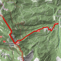
Bus stop in Jereka
- Route
-
Frauenberg0.5 km
- Best season
-
JanFebMarAprMayJunJulAugSepOctNovDec
- Description
-
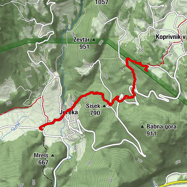
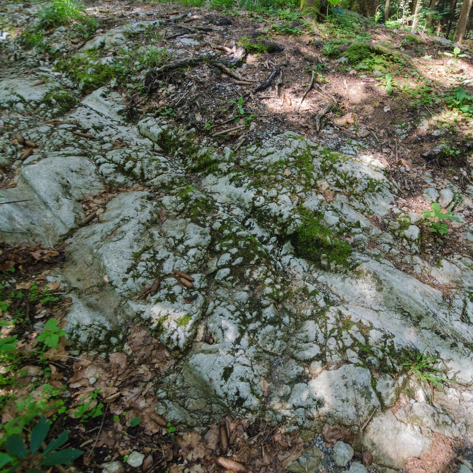
The trail from Jereka to the view point runs along a cart track that used to connect the villages of Koprivnik and Gorjuše with the valley. Paved stone road was built in the 18th century and was used to transport iron ore and charcoal from Pokljuka to Bohinj. The channels made in stone and carved by the wheels of carts are still visible today.
The view point on the edge of the Pokljuka plateau got its name after Valentin Vodnik, who spent three years working as a priest in Koprivnik. The locals also call the view point "Gospodovec".
The view of the U-shaped Upper Bohinj Valley between Rudnica and Studor hills shows the power of the glacier that left behind many traces in Bohinj. Lake Bohinj, the largest natural permanent lake in Slovenia, glows like a pearl in the west. Rest on a bench at the top and learn about the names of the surrounding mountain peaks from the info board. The village of Koprivnik emerged on a former pasture.
- Directions
-
Continue from the bus stop in Jereka along the main road towards Pokljuka. When you cross the bridge over Jerečica, you will see the first signposts for Vodnikov razglednik View Point which will direct you to the left on a path that ascends to the following houses where two asphalt roads are crossed. The trail continues along a former paved road from the 18th century and along a small stream. The path through the forest curves to the right and crosses the asphalt road a couple of times. At a higher altitude, when you reach the asphalt road again, you walk along the road to Vogar and Krniški Lom, where the signposts for Vodnikov razglednik View Point directs you to the right to a former paved path, where you can follow the signposts in intersections. When the path flattens and brings you to the edge of a forest, another path from Koprivnik comes from the left. Continue to the right and back to the forest. Hike along a steep path and on the path with a wooden fence to the panoramic peak of the hill where there is also a large cross. (Source: hribi.net)
- Highest point
- 983 m
- Endpoint
-
Vodnik's View Point
- Height profile
-
 © outdooractive.com
 - Equipment
-
Hiking shoes and clothes.
- Safety instructions
-
A part of the trail runs on the local road, so caution is necessary.
The last part of the trail to the view point can be icy in winter (danger of falling).
- Tips
-
Don't forget to take a camera with you. In autumn and winter, the view point offers a beautiful dreamy view of the sea of fog that is quite frequent at that time and the surrounding peaks bathe in the sun.
Prior to every hike, check the weather forecast and trail conditions.
Vodnik Days take place in Koprivnik in September every year.
You can finish your hike in Koprivnik and return to Jereka by bus.
- Additional information
-
Information:
Turizem Bohinj, Stara Fužina, tel.: +386 4 57 47 590
TIC Bohinj, Ribčev Laz, tel.: +386 4 574 60 10
TIC Bohinj, Bohinjska Bistrica, tel.: +386 4 574 76 00
TIC Bohinj, Stara Fužina, tel.: +386 4 572 33 26
TNP Bohinj Centre, Stara Fužina, tel.: +386 1 200 97 60
In summer you can ride a free Hop On Hop Off Pokljuka bus to Koprivnik.
Julian Alps:Bohinj Card offers free transport and other benefits.
Have a drink at the Pri Maretču bar.
Sights in close vicinity: Church of the Finding of the Holy Cross, windmill model in Koprivnik, Church of St Margaret in Jereka
The Church of the Finding of the Holy Cross was built at the end of the 18th century. The first priest in Koprivnik, Valentin Vodnik, held the first mass in the new church on 24 February 1793. Here, he met the owner of ironworks, Sigmund Zois, who became his mentor and inspired his interest in mountains and mineralogy.
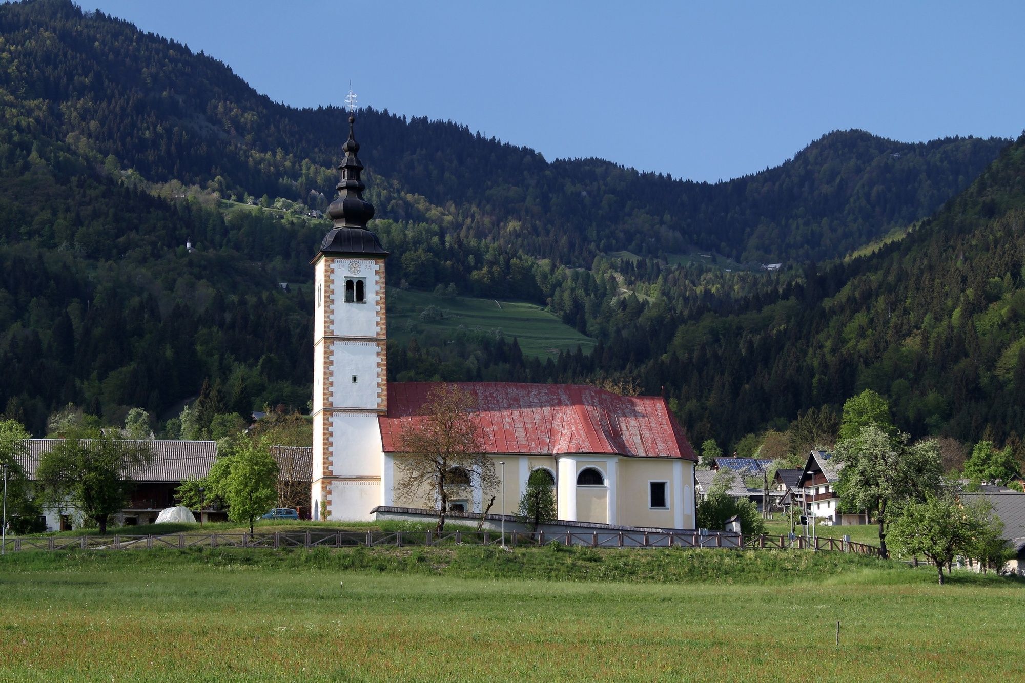
The Church of St Margaret in Jereka abounds in wooden and gold plated Baroque items from the 17th and 18th century which are typical of the Bohinj area. The bell tower of the Church of St Margaret is also an entry shed that is paved with river stones.
- Directions
-
You can drive by car to Jereka from Bled through Gorje or from Bohinjska Bistrica.
- Public transportation
-
You can travel by train or bus to Bohinj. From the Primorska side, you can also come by car train.
In summer you can ride by free Hop On Hop Off Pokljuka bus three times a day from Bohinjska Bistrica to Jereka and Koprivnik. On school days, you can use regular buses and also the SKI bus in winter.
More information is available on the website promet.bohinj.si.
- Parking
-
There is no official car park in Jereka. Public transport is recommended.


- Author
-
The tour From Jereka to Vodnikov razglednik Viewpoint is used by outdooractive.com provided.