- Brief description
-
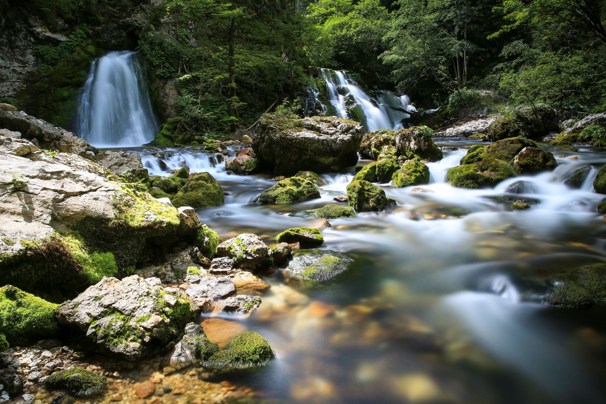
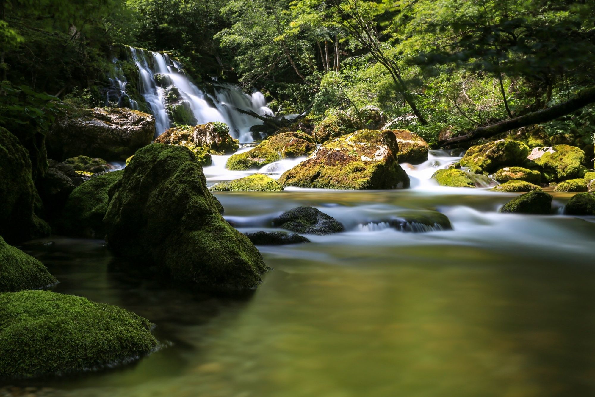
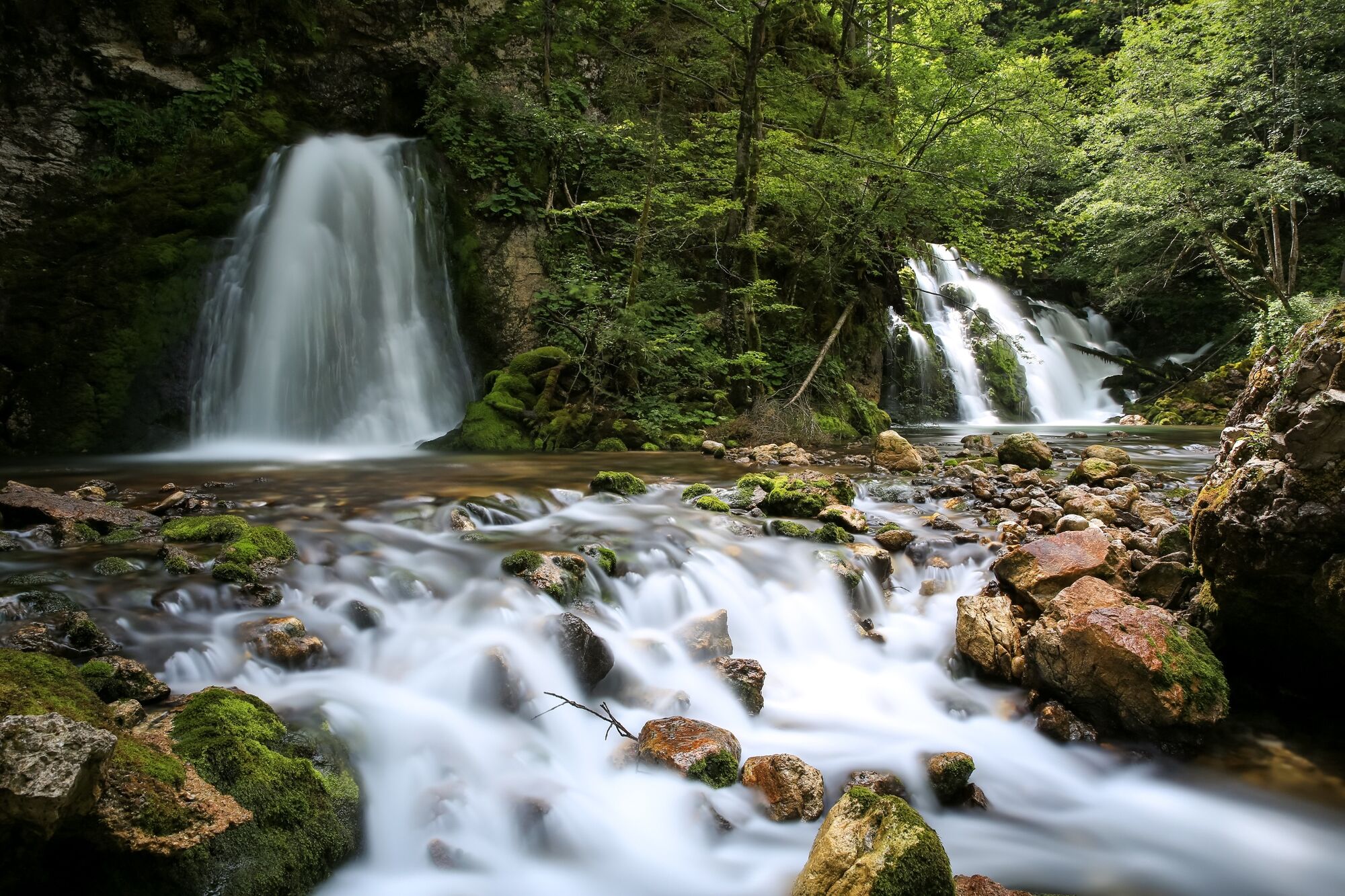
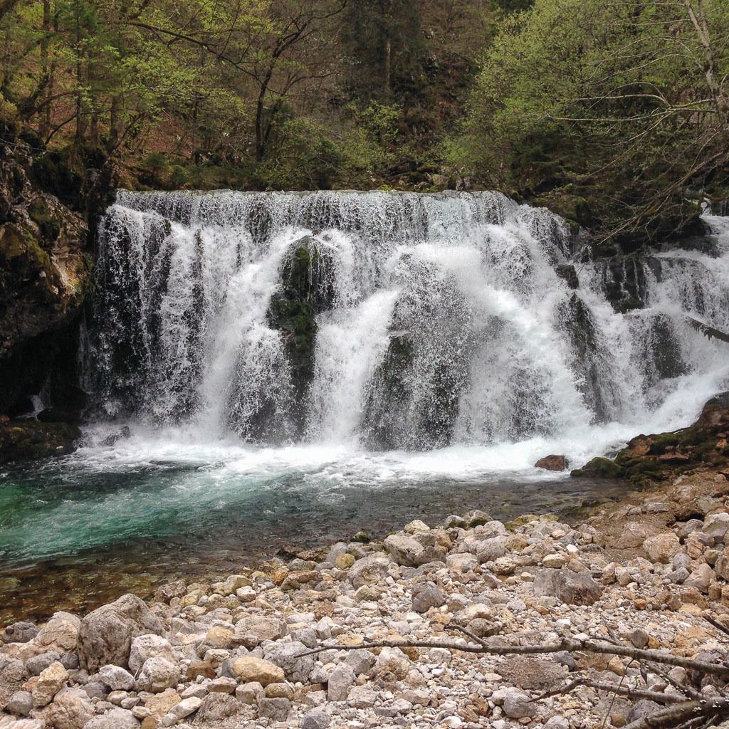
Bistrica with the Pod Luknjo spring is the strongest influx to the Sava Bohinjka River. The waterfall has quite a large volume after extensive rainfall.
- Difficulty
-
medium
- Rating
-
- Starting point
-
Bohinj TIC, Bohinjska Bistrica
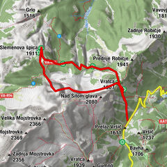
- Route
-
Wochein Feistritz0.2 kmWochein Feistritz8.2 km
- Best season
-
JanFebMarAprMayJunJulAugSepOctNovDec
- Description
-
The path from Pozabljeno to the spring along the right bank of Bistrica is perfect for all generations. It is hidden in the dense tops of birches and pines. In hot summer days, the cold coming from the clear stream is quite a pleasant breeze. Willow trees, alders, ferns and large coltsfoot leaves stretch along the path. Bistrica Brook used to drive mills and blacksmith hammers in the past. When the Bohinj tunnel was built, the water from the spring was artificially driven to the engines of the hydro power plant, which is now a fish hatchery. The brook running through Bohinjska Bistrica, springs below the South Bohinj Mountain Range. Currently, the crystal clear water also runs to the water pipeline for Bohinjska Bistrica.
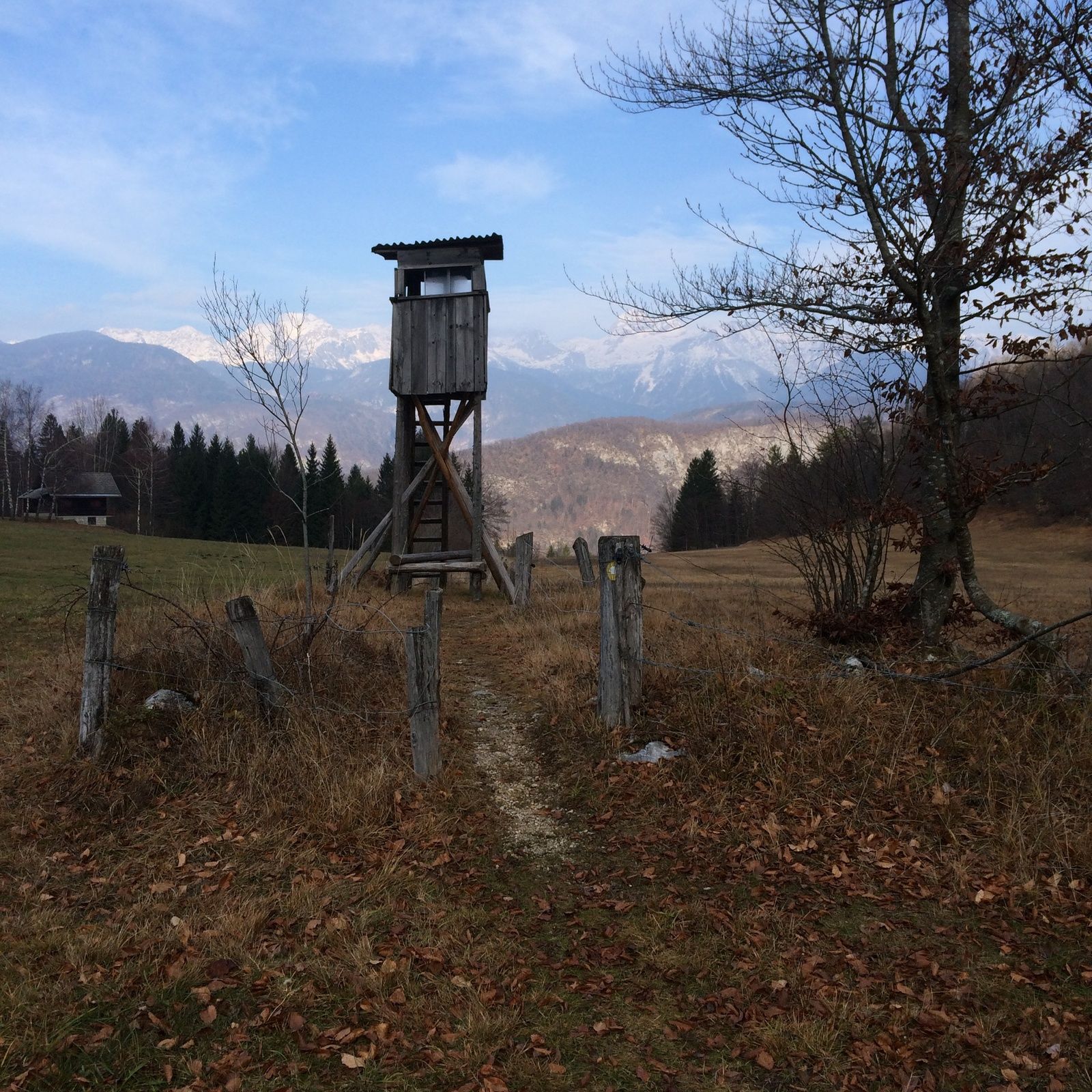
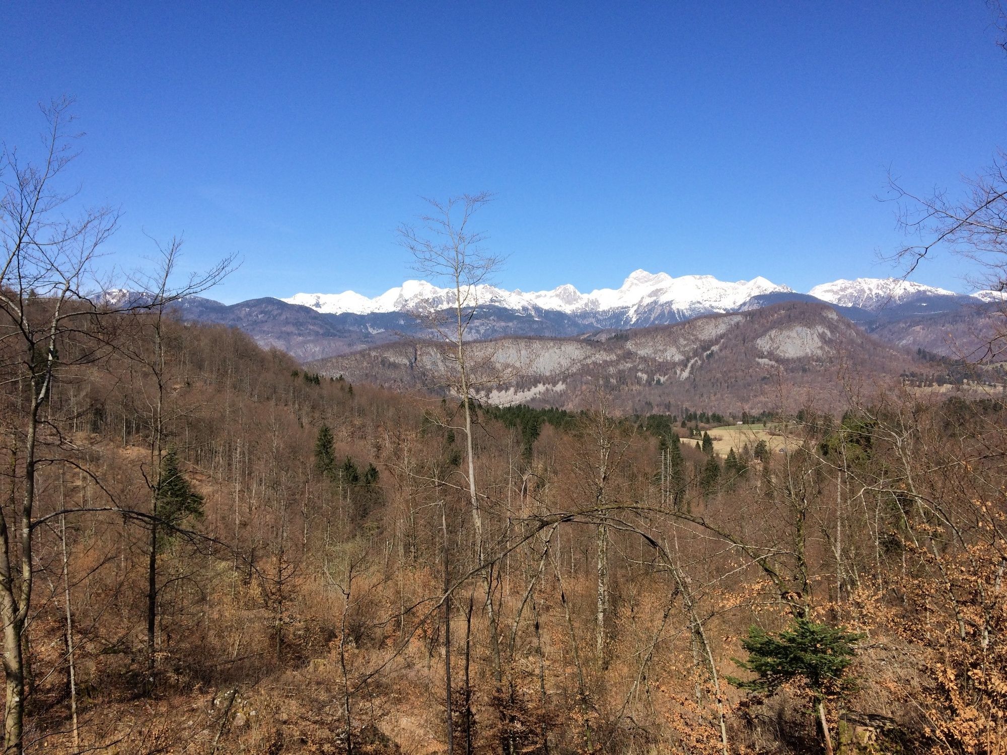
The ascent from the spring to the pass is very steep and inappropriate for small children or the elderly, thus, we recommend returning along the same way. Otherwise, you can also climb to the pass and return to the trailhead across the sunny Dobrava meadows that offer wonderful views of the surrounding mountains and blossoming meadows. In autumn, cattle graze on the meadows.
- Directions
-
Start the walk to the spring of Bistrica at TIC in Bohinjska Bistrica and continue past Tomaž Godec Museum. Walk to Zoisov grad mansion. This is now a restaurant and its former owner was baron Sigmund Zois, the owner of Bohinj ironworks. He was the patron of culture artistis and researchers who operated in the area of Bohinj. Continue past the Pozabljeno settlement. The path moderately ascends along a forest path and after half an hour you arrive to an unpaved road where the path forks. Continue to the right. Walk and follow the signposts where you can reach the first waterfall (Mala Bistrica), where the paht is crossed by a small brook. After heavy rainfall the path can be slippery and partially impassable. Right before the waterfall, the path turns right across the footbridge. After a five-minute walk (there are risks of falling), you arrive at the spring of Bistrica. You can continue ascending across a steep slope to come to the edge of a meadow. Descend past the hunters’ lookout to an unpaved road and return across Dobrava to Bohinjska Bistrica.
- Highest point
- 671 m
- Endpoint
-
Bohinj TIC, Bohinjska Bistrica
- Height profile
-
 © outdooractive.com
 - Equipment
-
We recommend hiking boots.
- Safety instructions
-
The trail can be icy in winter.
The ascent from the spring to the pass is very steep. The path from the footbridge over Bistrica to the spring is in some places very exposed and not suitable for younger children and the elderly.
- Tips
-
Prior to every hike, check the weather forecast and trail conditions.
The trail can be impassable after rainfall.
- Additional information
-
Information:
Turizem Bohinj, Stara Fužina, tel.: +386 4 57 47 590
TIC Bohinj, Ribčev Laz, tel.: +386 4 574 60 10
TIC Bohinj, Bohinjska Bistrica, tel.: +386 4 574 76 00
TIC Bohinj, Stara Fužina, tel.: +386 4 572 33 26
TNP Bohinj Centre, Stara Fužina, tel.: +386 1 200 97 60
The Julian Alps: Bohinj Card offers free transport and other benefits.
There are also many restaurants and inns available in Bohinjska Bistrica. Bohinj ECO Hotel, Tripič Restaurant, Danica Inn, Štrudl Inn and Sunrose 7 – Heritage Boutique Hotel all offer dishes with the Bohinjsko/From Bohinj certificate.
- Directions
-
You can drive by car to Bohinjska BIstrica from Bled, through Soteska or over Pokljuka. You can also access the village across Jelovica and Soriška planina.
- Public transportation
- Parking
-
You can part at P13 Boh. Bistrica – Danica car park (coordinates: 46.273515, 13.948998).

- Author
-
The tour Circular trail to Bistrica Spring is used by outdooractive.com provided.