
- Brief description
-
Forest and meadows, farms, and vacation houses stand along the trail, which also offers beautiful views of Jelovica and Karavanke.
- Difficulty
-
medium
- Rating
-
- Starting point
-
Heart of the village of Bohinjska Bela (488m).
- Route
-
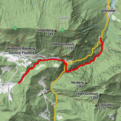
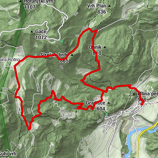
Bohinjska Bela1.2 kmStrešno brdo (865 m)5.8 kmBohinjska Bela8.1 km
- Best season
-
JanFebMarAprMayJunJulAugSepOctNovDec
- Description
-
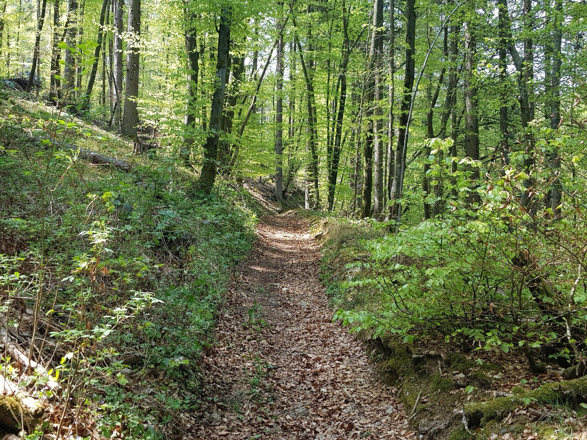
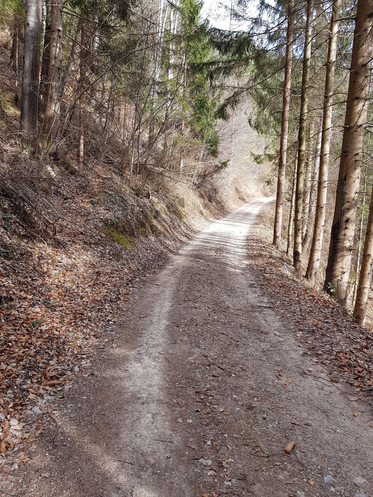
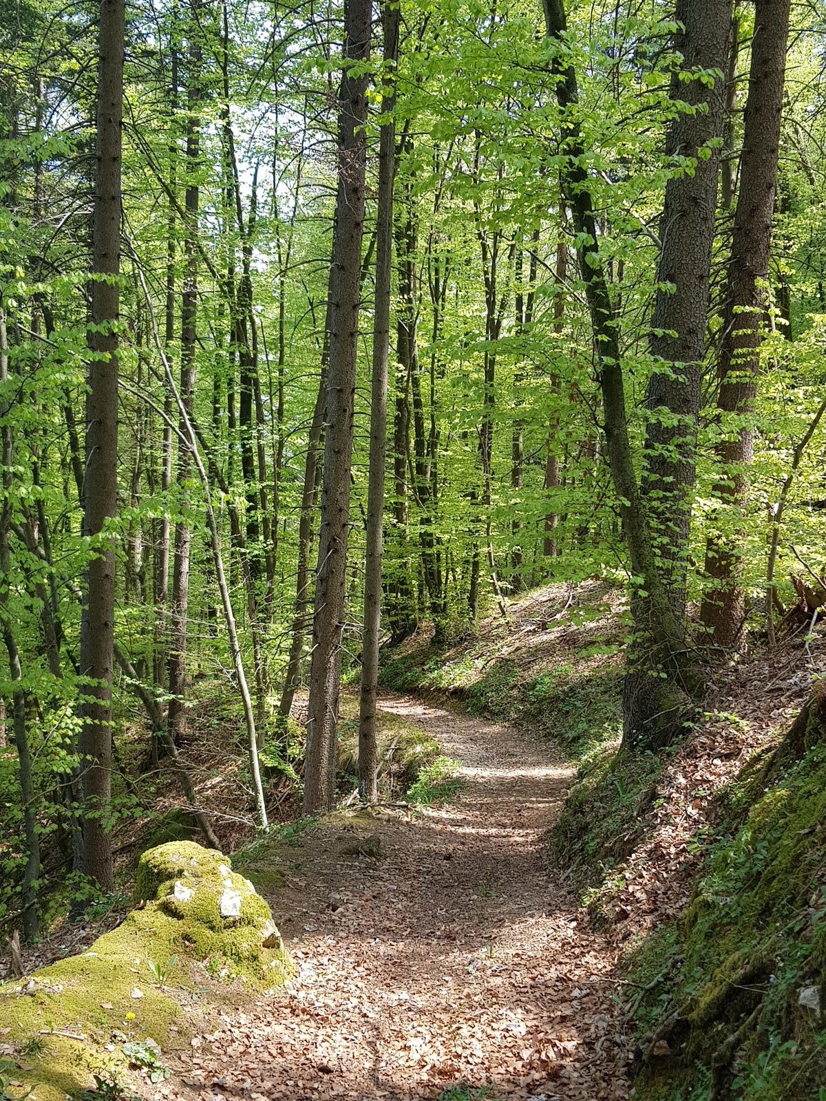
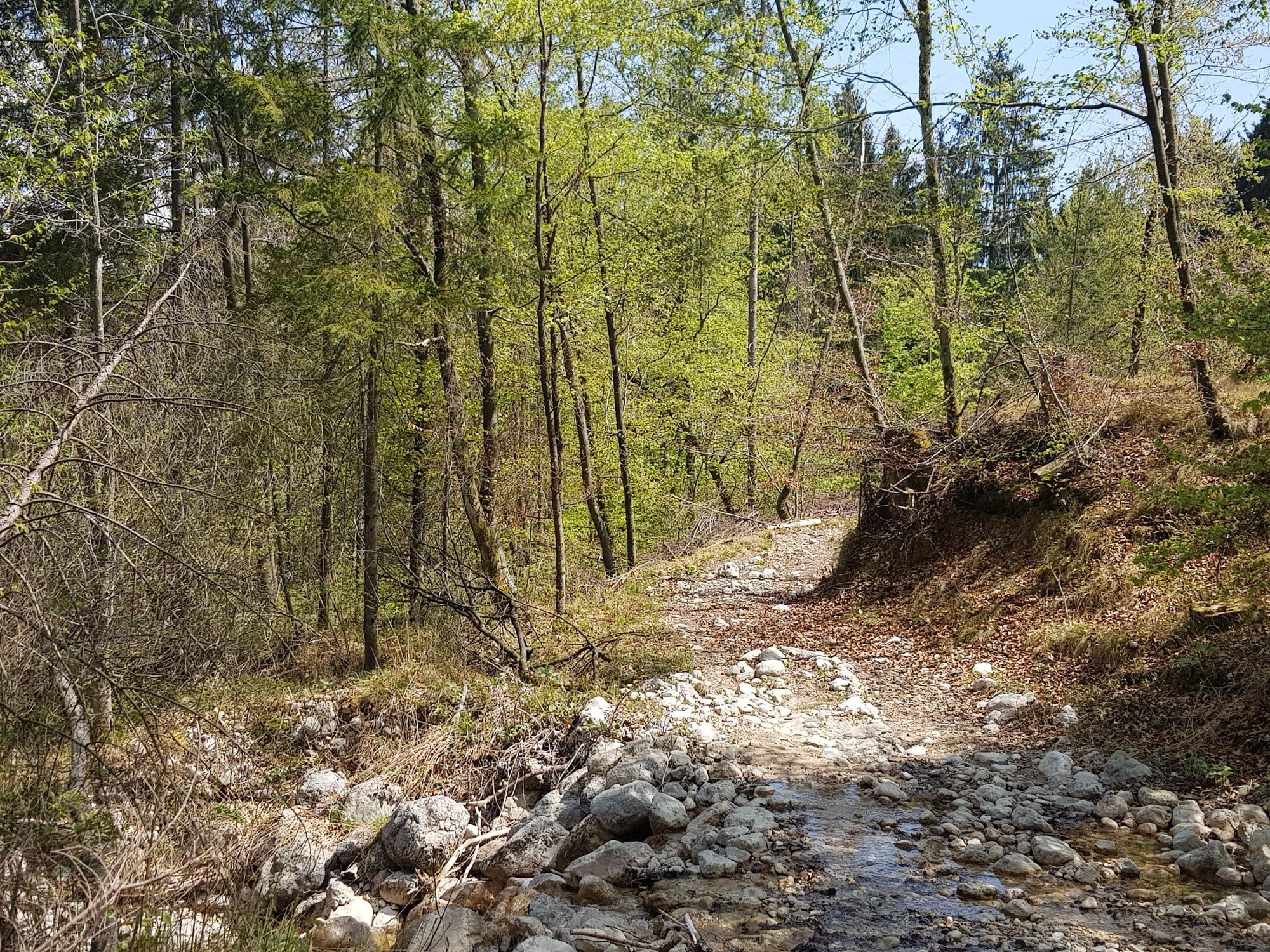
The trail to Rčitna and Kavca brings you to almost 1,000 metres, but the trail is quite flat, so it is not very difficult. First walk through the Slamniki village with its secluded farms. If you use the turning from the main path, which will take 5 minutes of your time, you can also enjoy the view from Iglica hill. Rčitno is a vast meadow plateau that is frequently visited by mountain cyclists and horse riders. When descending to Bled, turn to the secluded Kavca alpine meadow surrounded by pine forests that create a true oasis of peace. You can meet wild animals like roes and mouflons, as well as rich flora along the way.
- Directions
-
BOHINJSKA BELA – VILLAGE CENTRE – SLAMNIKI – RČITNO – KAVCA – VILLAGE CENTRE – BOHINJSKA BELA
Start in the village centre of Bohinjska Bela, cross the road and go past the village manger. Turn left at the wayside shrine and follow the Belca brook. Turn left under the railway underpass. The trail ascends slightly to Brezje settlement with only 4 houses. Make a turn to the Iglica Waterfall which is only 5 minutes away. Continue up the hill and continue on the stone road. Turn right at the next crossroads. Turn right at the crossroads and you will come to the first farm "Pri Blažu". There is a memorial plaque at the front of the house, because this was the site where, on 20 April 1941, Slovene people made a pact to fight the country’s occupier. Continue along the path above the house and stay on the main path. After a 100-metre change in altitude you reach the following two farms, from where you can enjoy beautiful views. After 100 metres turn right and right again, then continue to the Rčitno plateau. Continue along the forest on the left side, where you come to a cart path, where you continue across the highest point to the lower plateau. There, a board directs you to the forest road that soon starts descending towards the valley. After approximately 15 minutes, info boards direct you to the right, onto a new forest road. At the bird feeder, the path turns right again. Continue to Kavca. Cross a meadow and descend on the cart path to the forest, cross the Belca brook and reach the asphalt road where you started your hike. Return to the starting point.
- Highest point
- 970 m
- Endpoint
-
Heart of the village of Bohinjska Bela (488m).
- Height profile
-
 © outdooractive.com
 - Equipment
-
Light hiking shoes or sneakers are recommended.
The use of sun protection is recommended on sunny days.
In the warmer part of the year the use of tick repellent is recommended.
- Safety instructions
-
Due to its length and the almost 500-metre climb, the trail is demanding, and therefore not suitable for all.
There are no restaurants and shops along the circular trail, so we recommend you bring enough drinks and food with you.
In the first part, the trail is marked with typical Bled fingerposts, and subsequently with blazes and red way signs. - Tips
-
Don’t forget to take a camera with you. Hiking poles are also warmly recommended. Use the Bled – Hiking Trails or Bohinjska Bela – Hiking Trails maps.
- Additional information
-
TIC INFOCENTER Triglavska roža Bled
Ljubljanska cesta 27, SI – 4260 Bled
E-mail: info@visitbled.si , info.trb@tnp.gov.si
Tel: +386 (0)4 5780 205
Web address: http://www.bled.si ; http://www.tnp.si
TIC - Turistično Društvo Bled
Cesta svobode 10, SI – 4260 Bled
Tel: +386 (0)4 5741 122
Web address: http://www.td-bled.si/
Bohinjska Bela Tourist Association
Bohinjska Bela 37, SI - 4263 Bohinjska Bela
Web address: http://www.bohinjskabela.si/sl/drustva/turisticno-drustvo
- Directions
-
You can drive (4 km by car) or walk (1 hour from Bled town centre) to the starting point.
- Public transportation
-
You can take the bus or travel by train to Bohinjska Bela. There is a regular bus connection operating once an hour from Bled to Bohinjska Bela. The railway station is in the direct vicinity of the finishing point of this trip. For more on how to get to Bled, please visit our website:
http://www.bled.si/en/how-to-get-here
The hike both starts and ends in the heart of the village next to the bus stop in Bohinjska Bela.
- Parking

- Author
-
The tour Rčitno – Kavca (971 m) is used by outdooractive.com provided.


General info
-
Wörthersee - Rosental
1951
-
Bled
209