


- Brief description
-
This is an easy walking path and combines two different aspects of the trail. The first part follows the Roja brook, and the second part follows the stream of the Sava Bohinjka River across the meadows in unspoiled nature.
- Difficulty
-
easy
- Rating
-
- Starting point
-
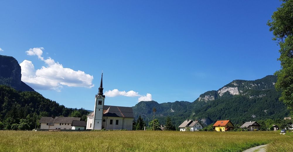
Heart of the village of Bohinjska Bela (488m).
- Route
-
Bohinjska Bela3.1 km
- Best season
-
JanFebMarAprMayJunJulAugSepOctNovDec
- Description
-
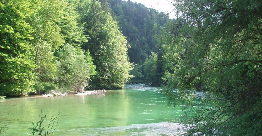
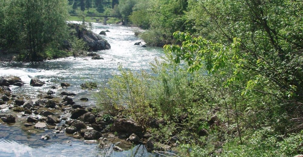
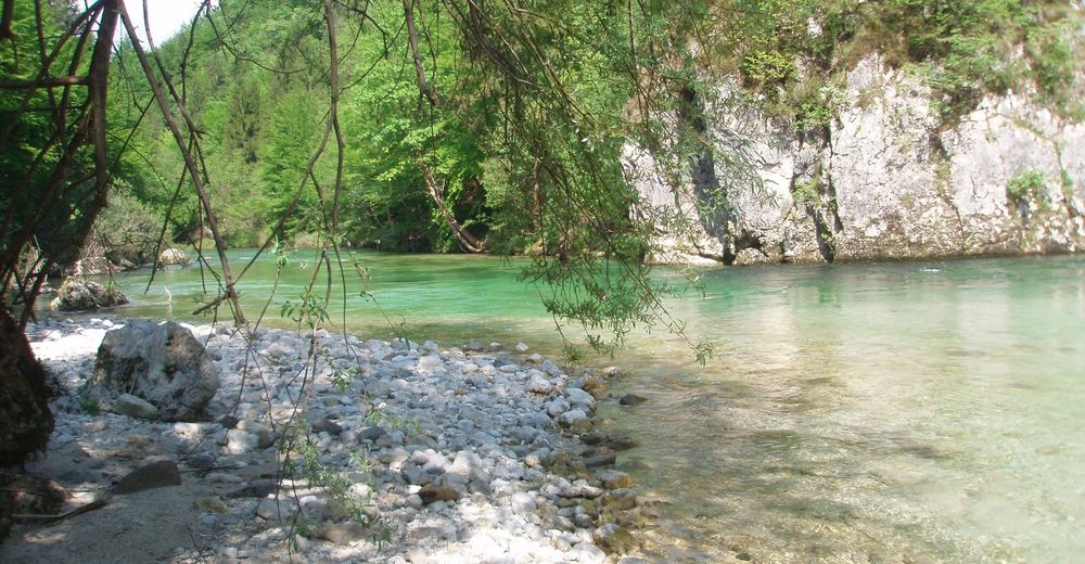
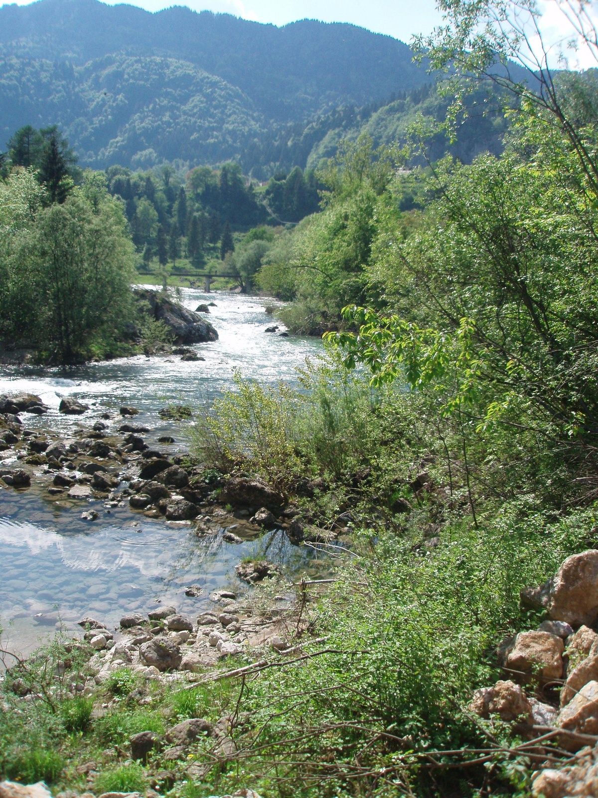
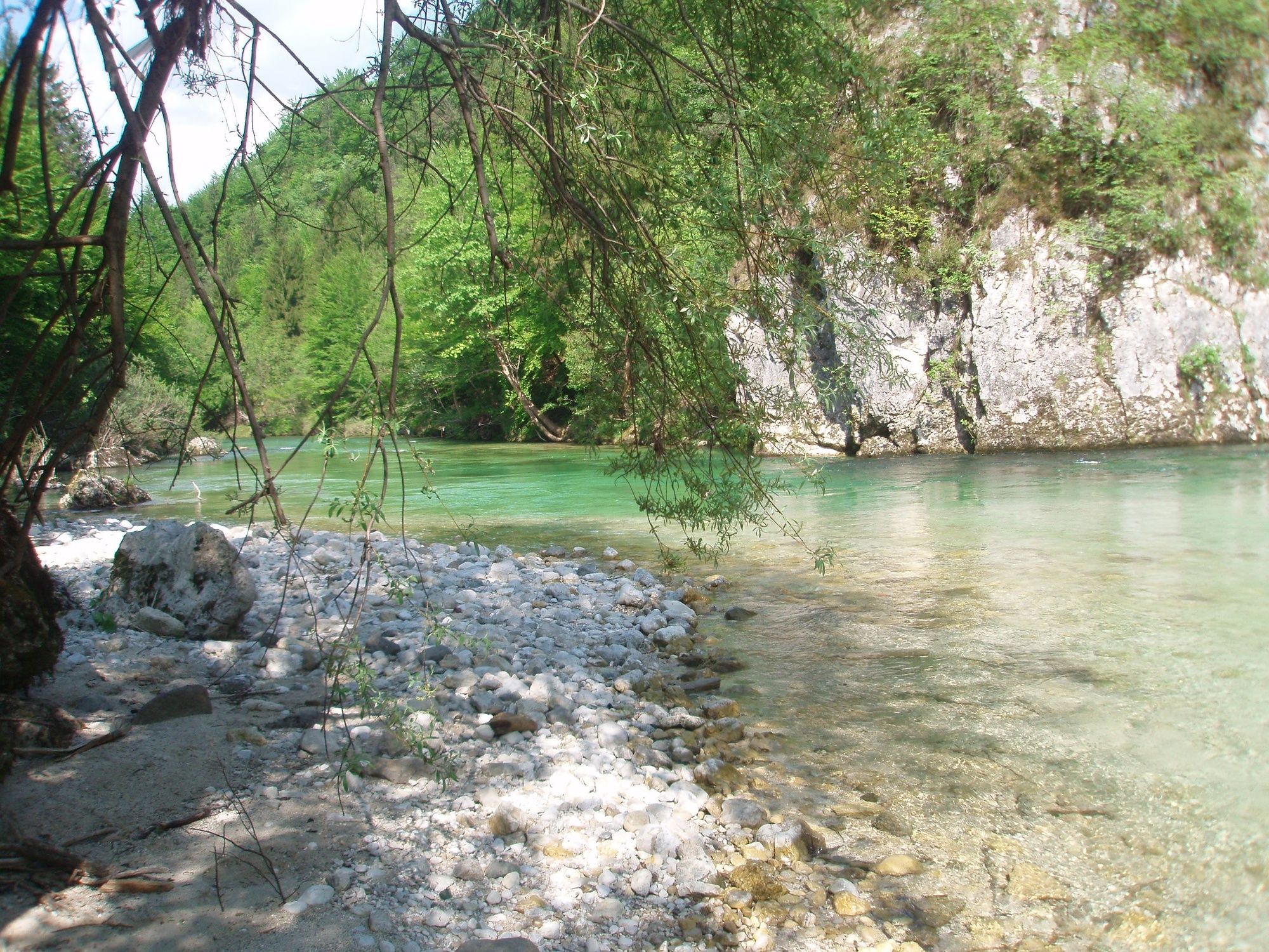
The Podroje along the Sava River trail is the oldest walking path. It runs almost entirely on a plain, except for one descent and one hill. Since this is an easy trail, it is perfect for families with small children. It is also suitable for walking in all seasons, except when there is a lot of snow. In the first part, the trail runs along the edge of the field past the wayside shrine dedicated to Mary of Lourdes in the rocky cave, and along the Roja brook that disappears underground and enters the ground in the other part. The second part runs across the meadows along the Sava Bohinjka River back to the village centre.
- Directions
-
BOHINJSKA BELA – VILLAGE CENTRE – PODROJE – GOLICE – VILLAGE CENTRE
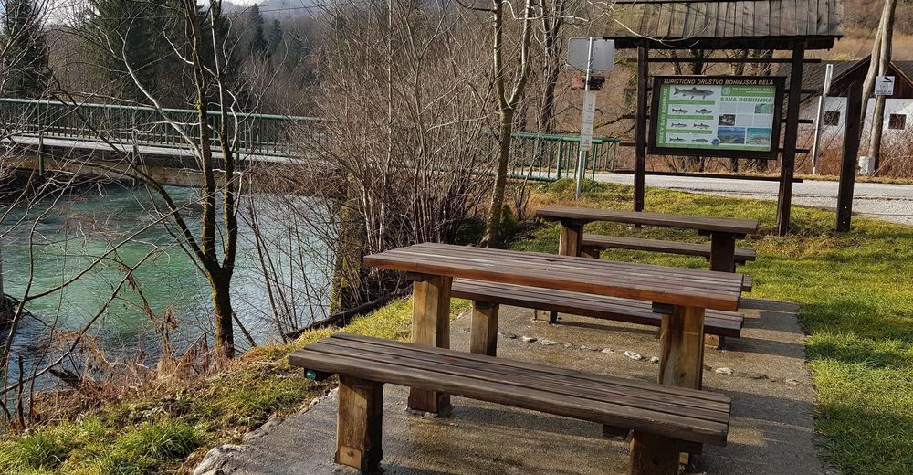
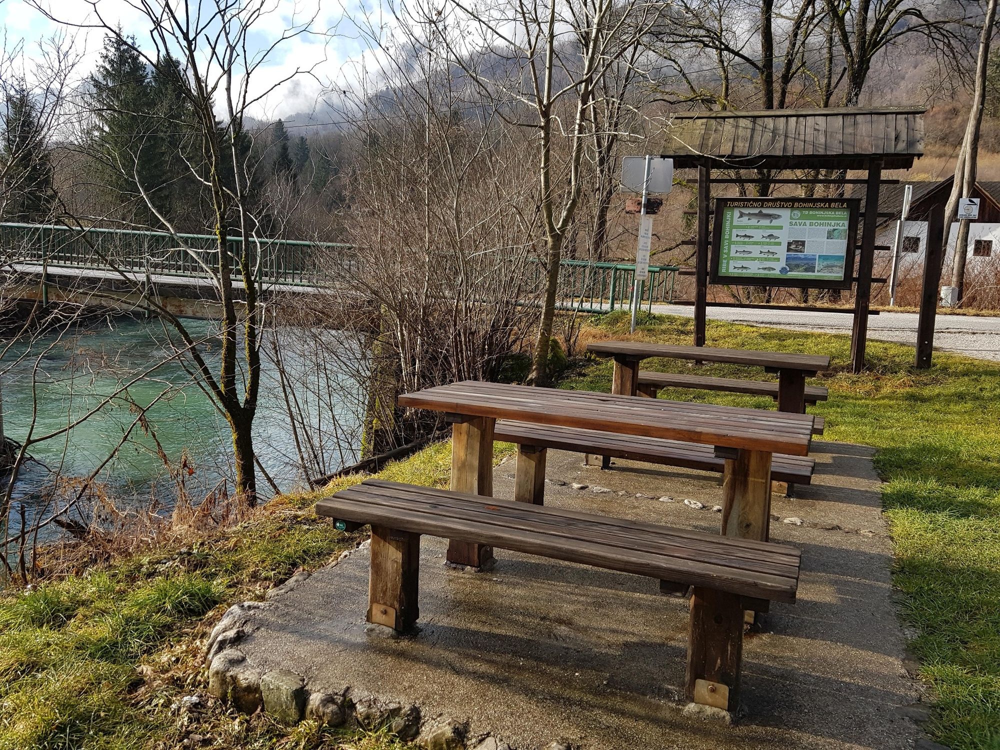
Start in the village centre, continue past the village manger, cross the Belca brook and turn right at the wayside shrine. Follow the brook to the main road through Bohinjska Bela, where you do not cross it, but after approximately 30 metres turn left from the pavement onto a stone road. On the 1 km long trail, you can enjoy the interesting landscape of meadows and hayracks. A hundred years ago, a mill was built below Osojnica hill, which used the water from the basin above the mill; the brook initially ran along the artificial "roji" stream to the underground water. The signpost directs you right across the Bled–Bohinj regional road to a new stone road that descends to the "Golice" plain along the Sava Bohinjka River. The Roja brook bursts out at the end of the hill. Follow the cart path to the right. At the crossroads, stay on the path that follows the Sava Bohinjka River. When the water level is high, you can observe numerous backwater parts and parts of the river that can rise for several metres when the riverbed is narrow. After crossing the Belca brook that flows in the Sava Bohinjka River, you can see the deepest river pool. Follow the inverted stream of the Sava Bohinjka River to the bridge. Read the board about the fish and the panoramic image of Bohinjska Bela at the resting place near the bridge. Continue right and you will reach the starting point after a short hill.
- Highest point
- 483 m
- Endpoint
-
Heart of the village of Bohinjska Bela (488m).
- Height profile
-
 © outdooractive.com
 - Equipment
-
Light hiking shoes or sneakers are recommended.
The use of sun protection is recommended on sunny days.
In the warmer part of the year the use of tick repellent is recommended.
- Safety instructions
-
The trail is easy and suitable for all types of hikers.
Despite the stone forest paths, the trail is suitable for baby strollers.
This is a safe trail, except for one Bled–Bohinj road crossing, where you need to be very careful. - Tips
-
Don’t forget to take a camera with you. Use the Bled – Hiking Trails or Bohinjska Bela – Hiking Trails maps.
- Additional information
-
TIC INFOCENTER Triglavska roža Bled
Ljubljanska cesta 27, SI – 4260 Bled
E-mail: info@visitbled.si , info.trb@tnp.gov.si
Tel: +386 (0)4 5780 205
Web address: http://www.bled.si ; http://www.tnp.si
TIC - Turistično Društvo Bled
Cesta svobode 10, SI – 4260 Bled
Tel: +386 (0)4 5741 122
Web address: http://www.td-bled.si/
Bohinjska Bela Tourist Association
Bohinjska Bela 37, SI - 4263 Bohinjska Bela
Web address: http://www.bohinjskabela.si/sl/drustva/turisticno-drustvo
- Directions
-
You can drive (4 km by car) or walk (1 hour from Bled town centre) to the starting point.
- Public transportation
-
You can take the bus or travel by train to Bohinjska Bela. There is a regular bus connection operating once an hour from Bled to Bohinjska Bela. The railway station is in the direct vicinity of the finishing point of this trip. For more on how to get to Bled, please visit our website:
http://www.bled.si/en/how-to-get-here
The hike both starts and ends in the heart of the village next to the bus stop in Bohinjska Bela.
- Parking


- Author
-
The tour Podroje – along the Sava River is used by outdooractive.com provided.


General info
-
Wörthersee - Rosental
1957
-
Gorenjska
141
-
Bled
211


