


- Brief description
-
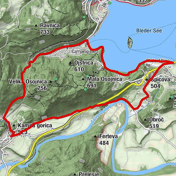
The path around Osojnica hill is the shortest path from Bohinjska Bela to the lake and bathing area. The path runs through the forest, and along the lake shore and the Sava Bohinjka River as well as across the fields.
- Difficulty
-
medium
- Rating
-
- Starting point
-
Heart of the village of Bohinjska Bela (488m).
- Route
-
Restavracija Zaka Camping Bled2.4 kmŠpicova (504 m)4.5 km
- Best season
-
JanFebMarAprMayJunJulAugSepOctNovDec
- Description
-
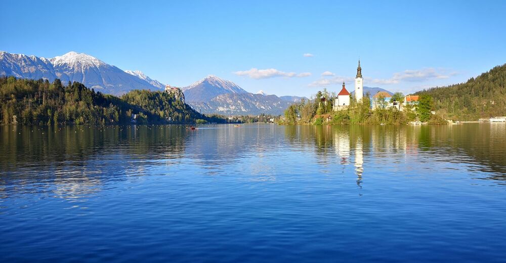
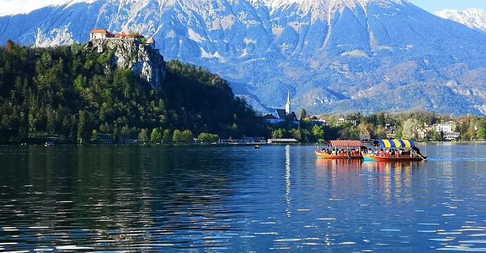
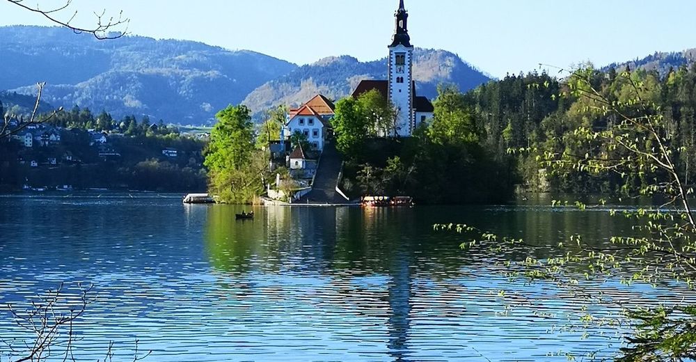
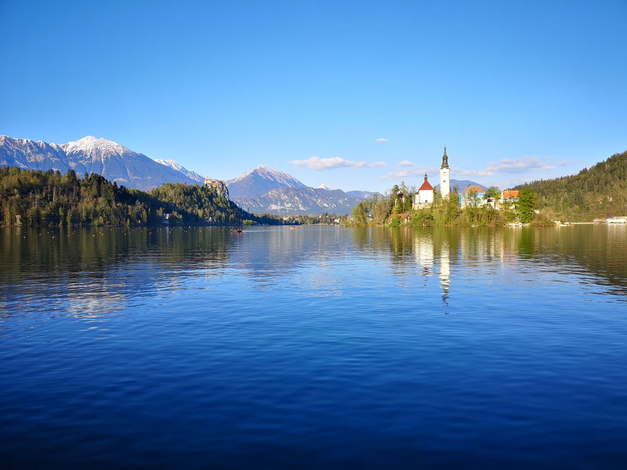
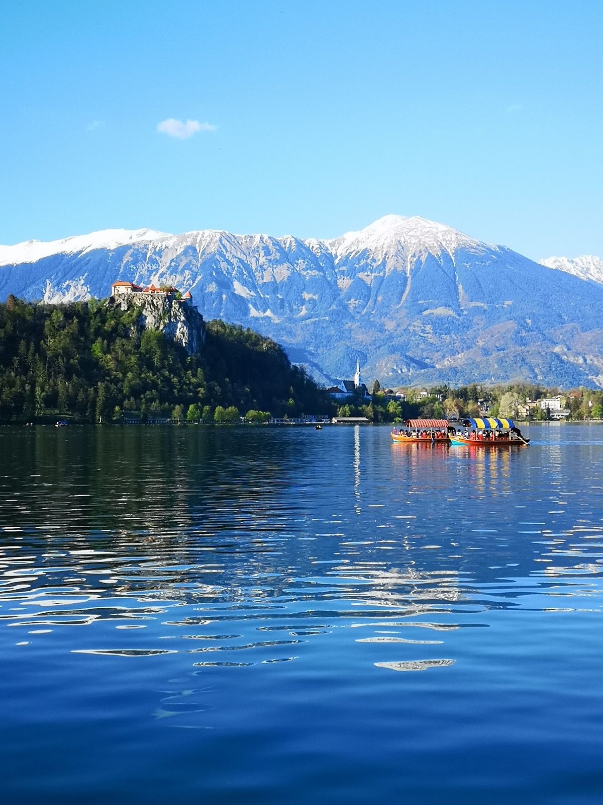
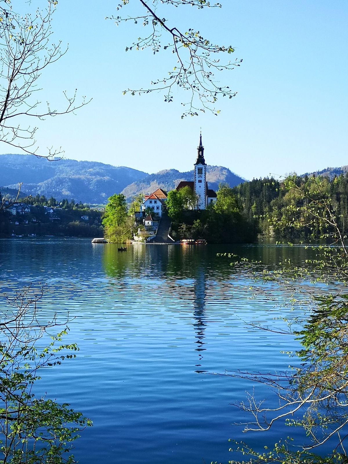
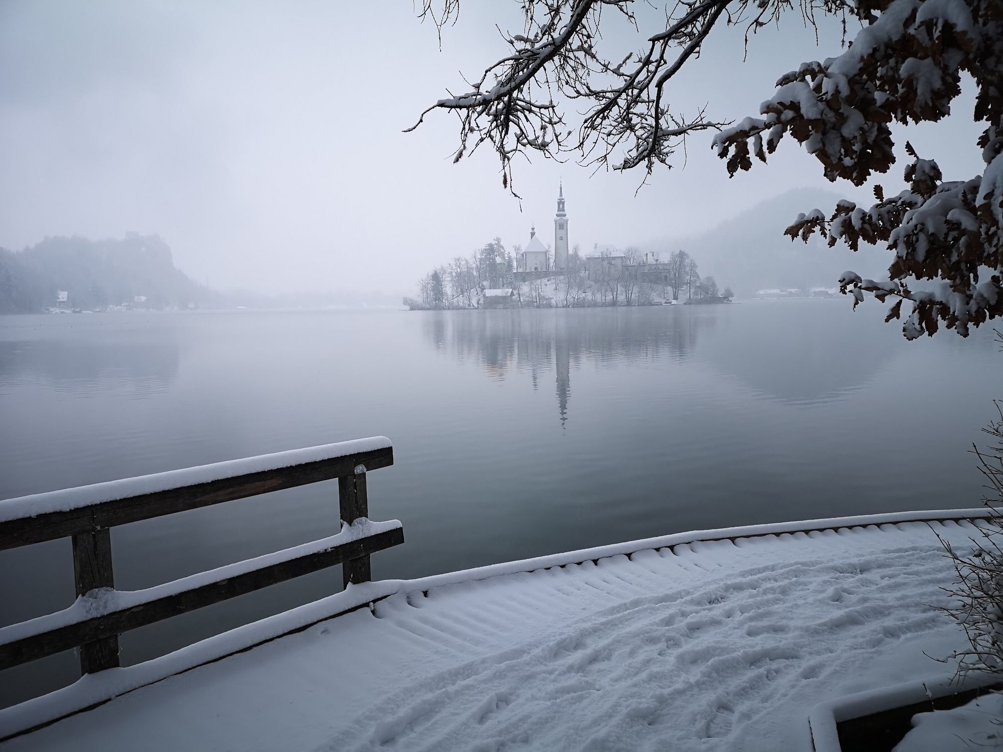
The trail around Osojnica hill (756 m) is quite interesting because after a 35-minute walk you reach the lake and its bathing area (without searching for parking places). You can enjoy in the diverse landscape along the way: from the panoramic path to the Megre pass, the lonely valley of Velika Zaka, the view of the lake and the island. The path along the shore offers the most beautiful views; if you continue along the Sava Bohinjka River, you can enjoy the peace and the unique natural landscape.
*WARNING: During the construction works of the pedestrian pavement in Mlino, a complete closure is in force on the part of the circular route around Lake Bled, on the section between the Mlino harbour and the Villa Beli dvor by the tunnel. More >
- Directions
-
BOHINJSKA BELA – VILLAGE CENTRE – MEGRE – LAKE BLED – VILLAGE CENTRE – BOHINJSKA BELA
Start in the village centre of Bohinjska Bela, cross the road and go past the village manger. Turn left at the wayside shrine and follow the Belca brook. After passing through the railway underpass, turn right onto the stone road that ascends slightly to the Megre pass (603 m). Continue straight on down the hill and you will reach Lake Bled after 35 minutes. Turn right along the walking path along the lake to reach the boat mooring (pletna) in Mlino; turn right and continue on the pavement to Vila Bled. Cross the road and walk down towards the Sava Bohinjka River through the part of Bled, called Zazer. Initially, walk on the asphalt road, then continue on the stone road. At the crossroads at the bottom turn right and after a small hill you will reach the main road; cross it and continue to the village along the path on the plain.
- Highest point
- 591 m
- Endpoint
-
Heart of the village of Bohinjska Bela (488m).
- Height profile
-
 © outdooractive.com
 - Equipment
-
Light hiking shoes or sneakers are recommended. The use of sun protection is recommended on sunny days. In the warmer part of the year the use of tick repellent is recommended
- Safety instructions
-
The trail is easy and suitable for all types of hikers. Because the forest paths are well regulated, the trail is also suitable for baby strollers. There are restaurants and shops along the circular trail, but we recommend you bring enough drinks with you. The trail is marked with fingerposts. - Tips
-
Don’t forget to take a camera with you.
Use the Bled – Hiking Trails or Bohinjska Bela – Hiking Trails maps. - Additional information
-
TIC INFOCENTER Triglavska roža Bled
Ljubljanska cesta 27, SI – 4260 Bled
E-mail: info@visitbled.si , info.trb@tnp.gov.si
Tel: +386 (0)4 5780 205
Web address: http://www.bled.si ; http://www.tnp.si
TIC - Turistično Društvo Bled
Cesta svobode 10, SI – 4260 Bled
Tel: +386 (0)4 5741 122
Web address: http://www.td-bled.si/
Bohinjska Bela Tourist Association
Bohinjska Bela 37, SI - 4263 Bohinjska Bela
Web address: http://www.bohinjskabela.si/sl/drustva/turisticno-drustvo
- Directions
-
You can drive (4 km by car) or walk (1 hour from Bled town centre) to the starting point.
- Public transportation
-
You can take the bus or travel by train to Bohinjska Bela. There is a regular bus connection operating once an hour from Bled to Bohinjska Bela. The railway station is in the direct vicinity of the finishing point of this trip. For more on how to get to Bled, please visit our website:
http://www.bled.si/en/how-to-get-here
The hike both starts and ends in the heart of the village next to the bus stop in Bohinjska Bela.
- Parking
- Author
-
The tour Around Osojnica is used by outdooractive.com provided.


General info
-
Wörthersee - Rosental
1949
-
Gorenjska
141
-
Bled
209


