- Brief description
-
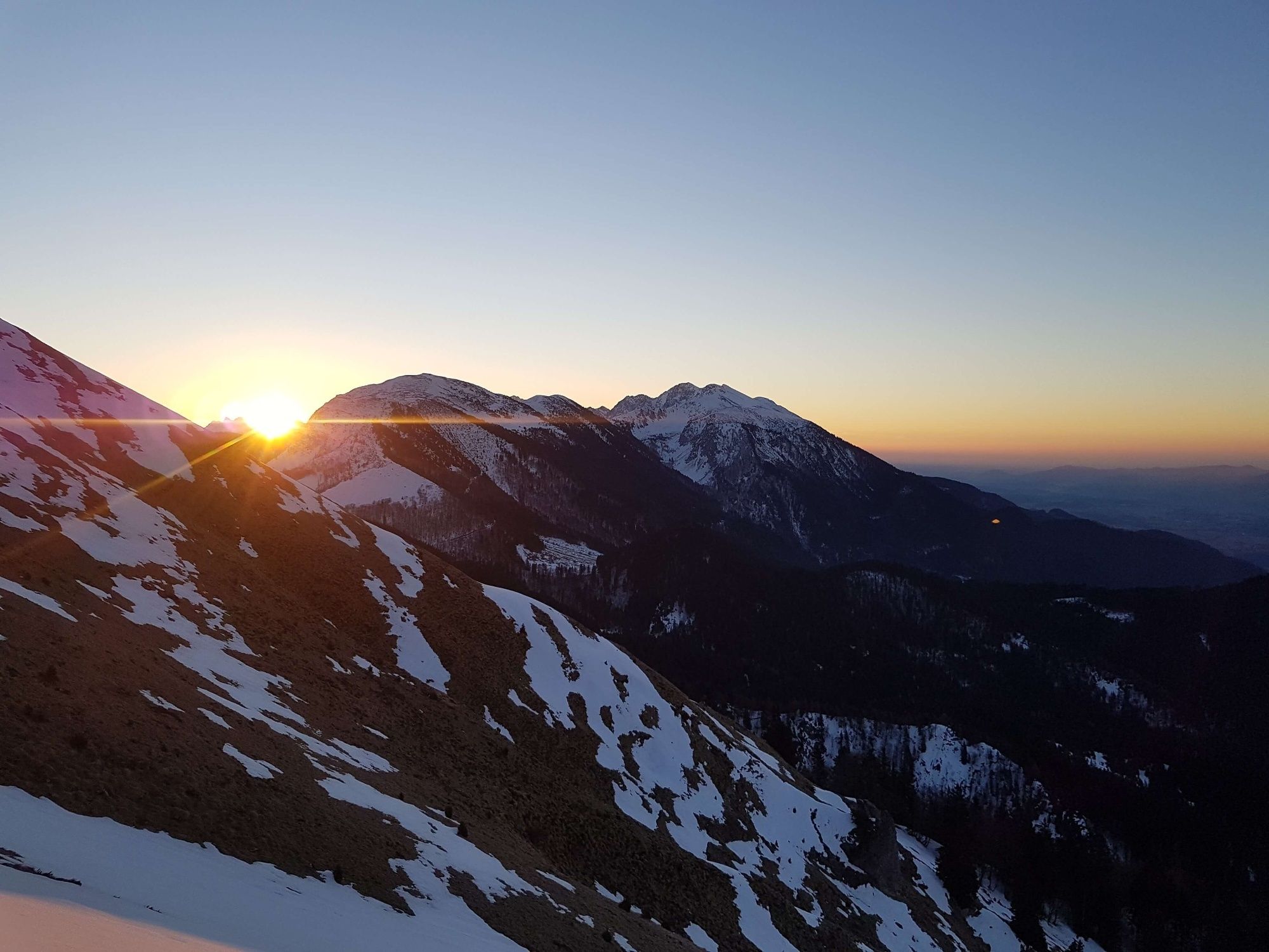
This stage has some truly spectacular views. Gorenjska lies on one side and Kärnten in Austria on the other. The route follows the southern slopes, which are not very steep.
- Difficulty
-
difficult
- Rating
-
- Starting point
-
Hut on Golica
- Route
-
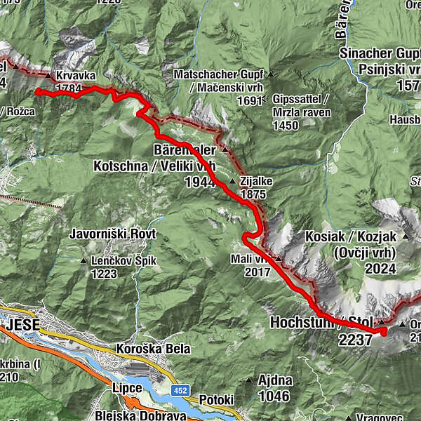
Kahlkogelhütte0.0 kmMaria-Elend-Sattel (1,439 m)1.7 kmSedlo Kočna / Kotschnasattel (1,469 m)3.0 kmBelska planina (Svečica)5.3 kmPlanina Seča (1,698 m)7.6 kmWeinaschsattel (1,971 m)11.4 kmPotoški Stol (2,017 m)11.7 kmKleiner Hochstuhl (2,187 m)13.5 kmPrešernova koča na Stolu13.8 km
- Best season
-
JanFebMarAprMayJunJulAugSepOctNovDec
- Description
-
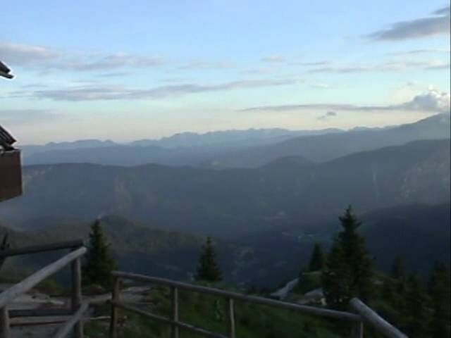
This is one of the most beautifull stages of the trail. Starting at the Golica hut the path leads up and down the ridge, but all the way keeping close to it, exposing views on both sides, Slovenia and Austria. The trail ends on the highest mountain in the Karawanks region...mt. Stol. The hut on Stol, the Prešeren hut and the end of the stage, is actually located about 30 min bellow the peak, but it is well worth the additional effort to reach the top.
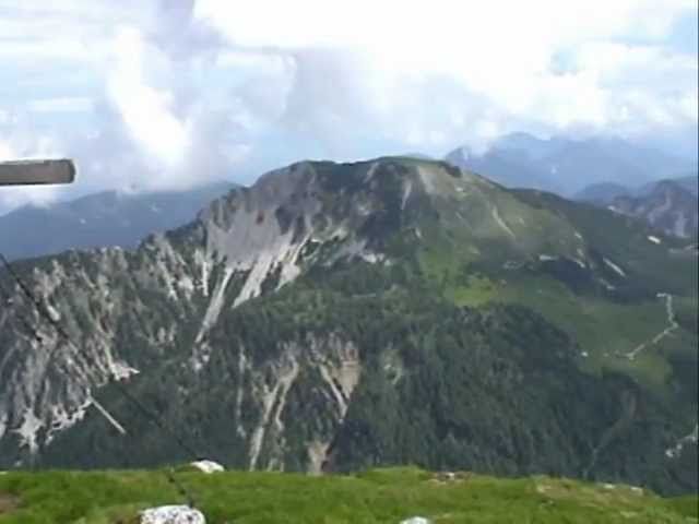
This stage boasts two significant and important mountains of the Karawanks, Golica and Stol. Golica with its views and endless daffodills covered pastures, found the way into the famous song Golica by Avsenik band. It is also very very popular day hike for many locals. Stol, on the other hand, is much more demanding to visit. Steeper and rougher from every angle it is a true king of the Karawanks. In winter, it offers a few difficult mountain skiing lines as well.
- Directions
-
Walk down the hill from Koča na Golici (1,582 m) past the hunting lodge to the junction with the path leading to Planina pod Golico. The route leads eastwards along the southern slopes, across small glades and through woods to the edge of Golica, where the slopes face east. Descend the wooded and gently sloping eastern slopes of Golica to the Suha pass (1,438 m). 30 min.
At the Suha pass, a road branches off to the right and leads through the valley towards Planina pod Golico, traversing an area known as Savske jame. Our route leads towards Ptičji vrh.(1,550 m) Walk up the grassy edge of the western slopes and through a beech wood, then turn towards the eastern slope. The Kočna pass (1,469 m) is accessible from here. 30 min. The Kočna pass connects Struška and Ptičji vrh and offers a good view of the Dravska dolina valley to the north. The northern side of the pass is a sheer cliff.
Take the route across the southern slopes of Struška and climb up the steep and bare terrain. The path gradually levels out and leads to the southern slopes, where a gradual ascent begins again. Climb over the wooden fence and continue on a short but steep climb that ends at an Alpine dwelling on Belska planina. Struška is a stubby mountain located between Kočna and the Seča or Medvedjak pass, whose tallest peak is Veliki vrh (1,944 m). The route continues upwards along the slopes of Struška through woods and meadows. A short descent leads to the Seča pass, also known as Medvedjak (1,698 m). The pass marks the border between Stol and Golica. Crossing Struška requires 1h 45 min. One path runs north to the Stouhutte hut. Take the other route down a steep hill to a large basin called Rida where it meets the path from the hamlet of Javorniški Rovt.
The route continues southwards and begins climbing towards Kamnitnik (1,858 m), a peak overlooking the Hrašenska planina pasture, and continue to the spectacular ridge of Belščica. This is the beginning of one of the most panoramic routes in Slovenia. The route leads to the Vajnež pass (1,972 m), above which towers Vajnežev vrh (2,104 m), the highest peak of the Belščica. 1h 30 min. Follow the ridge running below the peak of Potoški Stol (2,014 m) and continue along a partly grassy and partly rocky path along the state border. This leads to the junction with road from Valvazorjev dom. A steep, 20-minute climb leads to Prešernova koča na Stolu (2,174 m), which lies below Mali Stol peak. The stage takes 5h 30 min.
- Highest point
- 2,156 m
- Endpoint
-
Prešern hut on Stol
- Height profile
-
 © outdooractive.com
 - Equipment
-
Windshell and a sunscreen will come in handy.
- Safety instructions
-
The ridge is exposed, so keep an eye on the weather and do not forget a sunscreen. Mind the weather as well, especially look out for storms.
- Tips
-
It can be windy and sunny on the ridge, so have a hat and a windshell with you. Daffodilles are blooming in May and June.
- Additional information
-
Make reservations in the huts in advance, since they are popular hiking destinations.
- Directions
-
From Planina pod Golico (to Hut on Golica) or from Završnica Valley to reach Stol.
- Public transportation
-
You can reach Planina pod Golico with a local bus from Jesenice, from the village you have about 2h ascend to the Golica hut.
- Parking
-
There is free parking available in Planina pod Golico or Završnica Valley.
- Author
-
The tour Via Alpina Slovenia: Purple Trail: Stage 4 (Golica- Stol) is used by outdooractive.com provided.