
- Brief description
-
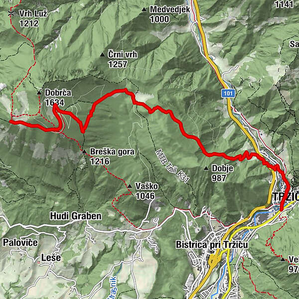
Geologically, this is part of Slovenia’s third massif, the Kamnik-Savinja Alps. The stage crosses several pastures then descends through the valley to Tržič.
- Difficulty
-
medium
- Rating
-
- Starting point
-
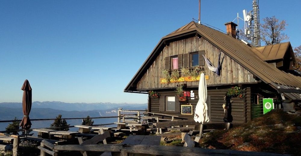
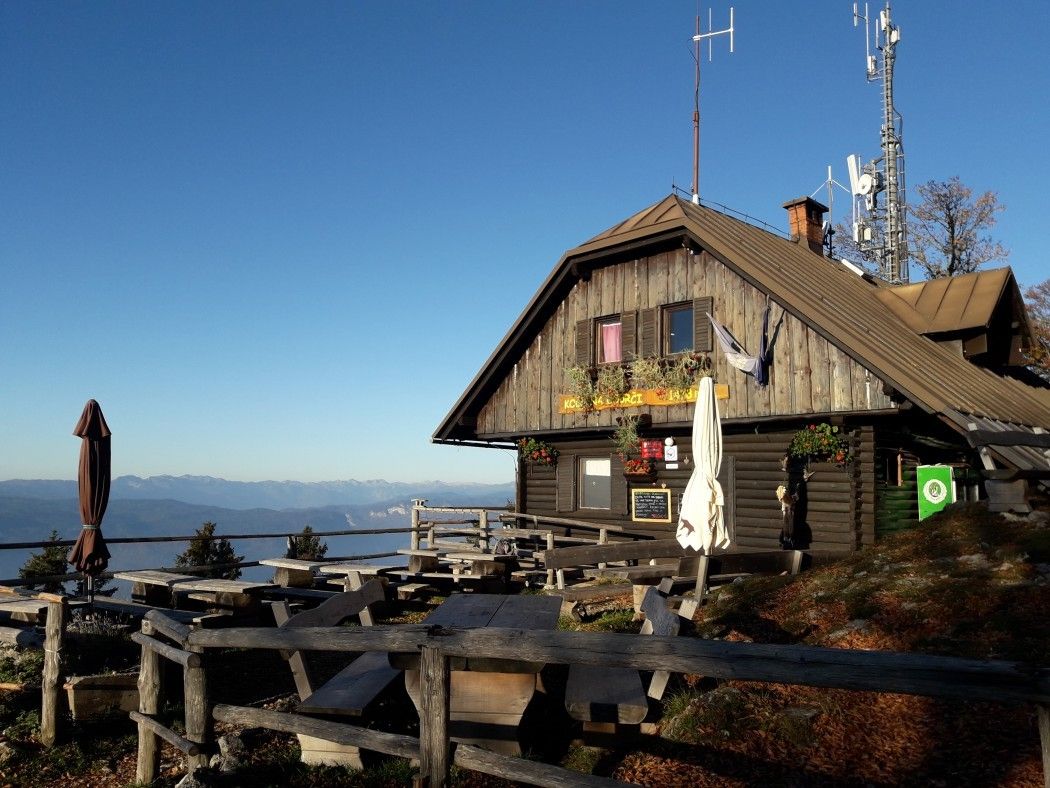
The hut on Dobrča
- Route
-
Pizzerija Pod gradom7.7 kmCerkev Svetega Andreja7.9 kmNeumarktl8.0 kmRestavracija Raj8.1 km
- Best season
-
JanFebMarAprMayJunJulAugSepOctNovDec
- Description
-
The trail is basiclly a slow descend towards Tržič, through many pastures and plains. Views give way to forests and pastures. This stage is fairly easy.
Tržič is an old city, that has grown along the important road connection. The old town centre of Tržič has been protected as a cultural and historical monument since 1985. The buildings with their medieval floor plan, with a workshop, storehouse, and connecting hallway on the ground floor, have preserved their classicist design in a row of facades since the 1811 fire.
There are a lot of things to see arund Tržič (like Dovžan Gorge, museums, etc.), but not a lot of places to stay, so make reservations in advance. The other option is to continue with the climb to hut at Kriška Gora (quite steep and will take about 2h).
- Directions
-
Climb down from Koča na Dobrči (1,487) and cross to the other side of the Podgorska meadow, where you will find a forest. Walk along the pleasant forest path and after 15 minutes you will come to a crossroads where one path branches off towards Dobrča peak. The path to the right, which runs through a valley to the hamlet of Brezje, is the Slovene balcony trail (No. »1«). Continue walking straight ahead for another 15 minutes until you reach Lešanska planina meadow, where there is a well-kept shepherd's hut. There is a view of the next two stages of the Via Alpina from the front side of the hut. To the east is the rocky peak of Stegovnik (1,692), and to the right the two-thousander Storžič (2,132). In the foreground is the ridge of Kriška gora (1,715) and the long ridge to the left is Košuta. 30 minutes from the hut. Climb down the steep slope from the hut, cross the meadow and enter the forest, then climb over the wooden fence. There will be several forest paths to cross along the way, so pay attention to the signs.
The path gives way to an improved dirt track. Turn right here. There is another crossroads about 200 m ahead, where you will make a sharp left turn. Continue walking down the gently sloping forest path and you will find a spring with drinking water to your left. After another 100 m, turn left off the road and follow the track to Bistriška planina (1,080). 45 minutes. Turn right and cross to the opposite side of the meadow and follow the forest road along the left side of the meadow. Enter the forest and climb up to a small clearing on the pass. On the pass, turn left onto a path leading into the forest. Cross the peak and begin the descent. At a crossroads, a balcony trail branches off to the right into the forest. Continue for another 50 m straight ahead until you reach a road which runs past a house on a small clearing. When the road turns right, follow the path in front of you into the forest.
The path begins a steep descent and leads you past the western slope towards the valley. Climb down the meadow on the other side of the forest to reach a farm. Follow the macadam road past the stable and climb down to the main road for Ljubelj. Follow the road running parallel to the main road. It leads to a bridge across a road from which you can see the tunnel to the right. Climb down to Tržič from here.
The macadam is replaced by a tarmac road, which leads to a junction. Turn left here and go through an estate of apartment blocks. Cross the pedestrian crossing and walk along the pavement on the right and cross the Tržiška Bistrica stream. The road then turns right through the old part of Tržič and joins another road running through Tržič. Continue walking past the church to the road junction. On the other side of the road are stone stairs which are part of the next stage. The hike from Bistriška planina takes 1h 15 min, the entire stage takes 2h 30 min.
- Highest point
- 1,486 m
- Endpoint
-
City Centre of Tržič
- Height profile
-
 © outdooractive.com
 - Equipment
-
Normal hiking equipment.
- Safety instructions
-
No special safety issues on the trail.
- Tips
-
Take a stroll in Tržič. It is a charming tiny old city that will steal your heart. Check for places to stay in advance.
- Additional information
-
Check for the events in Tržiž (especially Šuštarska nedelja- first sunday in September)
- Arrival
-
By bus or car to Tržič from the highway Ljubljana-Jesenice.
- Public transportation
-
There is good, regular bus connection to Tržič.
- Parking
-
Payable parking available in Tržič.
- Author
-
The tour Via Alpina Slovenia: Purple Trail: Stage 7 (Dobrča- Tržič) is used by outdooractive.com provided.


-
Wörthersee - Rosental
1944
-
Gorenjska
140
-
Tržič
162