
- Brief description
-
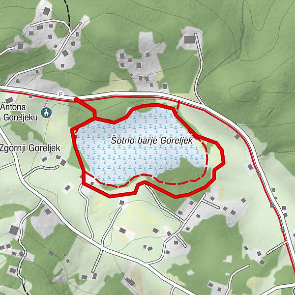
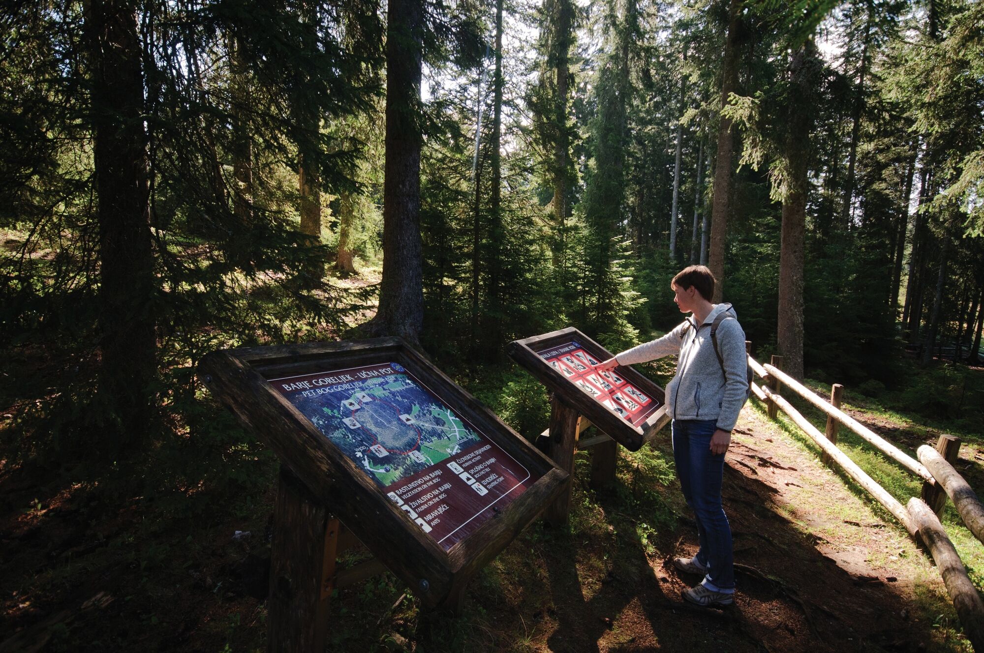
An easy hike across the Pokljuka around the peat bog that is one of the southernmost bogs in Europe. The info board provides information about the flora and fauna of this sensitive habitat area.
- Difficulty
-
easy
- Rating
-
- Starting point
-
Sport Hotel
- Route
-
Zgornji Goreljek0.2 km
- Best season
-
JanFebMarAprMayJunJulAugSepOctNovDec
- Description
-
A walk in the embrace of the Pokljuka forests is really relaxing for your mind and body. The vast pine forests provide shelter to many flora and fauna species, as well as clean air and peace for hikers. The study trail at the Goreljek Peat Bog is interesting for learning about the facts and importance of peat bogs that belong among the most precious natural areas in Europe. The trail is intended for random visitors, individual visitors, students and tourists.
Peat bogs are areas where water accumulates and they contain a layer of peat a few decimetres or metres thick that is overgrown by peat moss. Peat bogs started emerging after the last ice age. When the glacier disappeared, it left behind small lakes. Over thousands of years, they became filled up with various organic remains of water plants that inhabited the lake. Acidic water enabled only some flowers to grow and develop. Peat mosses were most frequent and they still prevail on the peat bog surface. Peat mosses are constantly growing on top and carbonising in the lower part. The surface therefore rises, so the peat bogs can also be called high peat bogs.
- Directions
-
From Sport Hotel in Goreljek walk to the road and turn right. After a few hundred metres, the direction signs at the crossroads take you left to the info board that marks the start of the trail along the Goreljek Peat Bog. The first info boards are located before the peat bog. Turn left and walk around the peat bog in a clockwise direction. There are many wooden platforms along the trail that enable you to walk on dry terrain. Return to the starting point along the same road.
- Highest point
- 1,266 m
- Endpoint
-
Sport Hotel
- Height profile
-
 © outdooractive.com
 - Equipment
-
Hiking shoes and clothes.
- Safety instructions
-
A part of the trail runs on the local motor road.
- Tips
-
Prior to every hike, check the weather forecast and trail conditions.
Don't forget to take a camera with you.
You can admire diverse flora and fauna along the way.
- Additional information
-
Information:
Turizem Bohinj, Stara Fužina, tel.: +386 4 57 47 590
TIC Bohinj, Ribčev Laz, tel.: +386 4 574 60 10
TIC Bohinj, Bohinjska Bistrica, tel.: +386 4 574 76 00
TIC Bohinj, Stara Fužina, tel.: +386 4 572 33 26
TNP Bohinj Centre, Stara Fužina, tel.: +386 1 200 97 60
Freshen up at Sport Hotel and Jelka Hotel that also offer dishes that have the Bohinjsko/From Bohinj certificate.
During the International Wild Flower Festival (end of May, start of June) you can join a guided hike (with a botanist) along the Goreljek Peat Bog.
Julian Alps Card: Bohinj enables you to explore and travel for free.
Peat bogs are very rare in Slovenia. In their original form, they can only be found on Jelovica, Pohorje and Pokljuka. In lowland areas, they were mostly destroyed due to drainage to acquire agricultural land or peat for heating. Due to extraordinary sensitivity, peat bogs are protected according to the European legislation, and are included in the NATURA 2000 area.
- Directions
-
You can drive by car to Goreljek from Bled through Gorje or from Bohinjska Bistrica.
- Public transportation
-
You can travel by train or bus to Bohinj. From the Primorska side, you can also come by car train.
In summer you can ride by free Hop On Hop Off Pokljuka bus three times a day from Bohinjska Bistrica to Goreljek. In winter, you can use SKI bus.
More information is available on the website promet.bohinj.si
- Parking
-
A private car park at Sport Hotel in Goreljek (coordinates: 46.338129, 13.961187).


- Author
-
The tour Goreljek Peat Bog Educational Trail is used by outdooractive.com provided.