


- Brief description
-
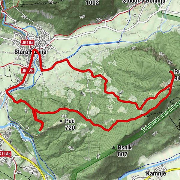
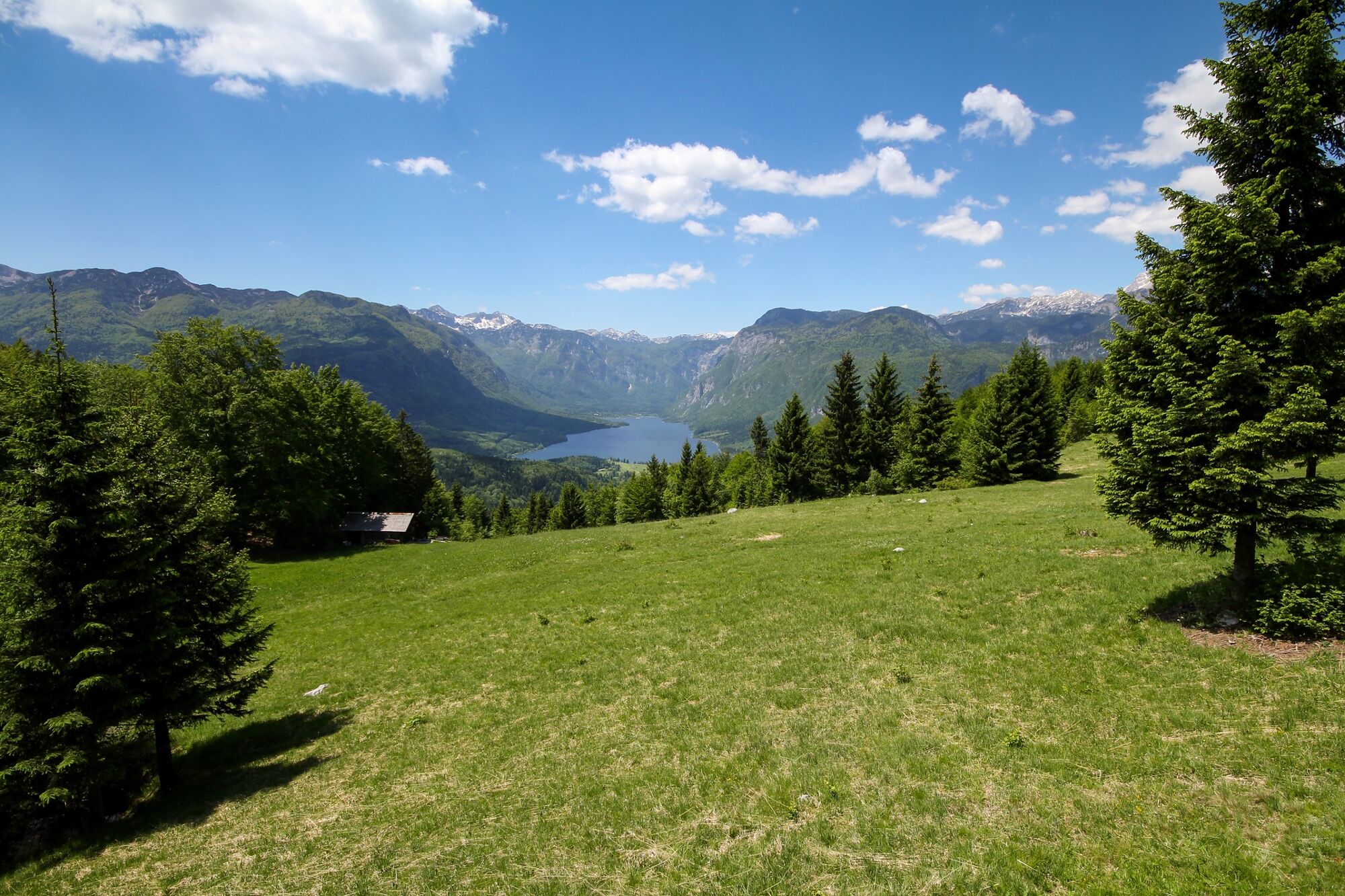
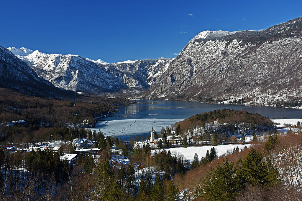
Many points along the circular trail to the top of Rudnica offer views of almost all corners of Bohinj and the surrounding mountains. Rudnica separates Bohinj in the Lower and Upper Bohinj Valleys.
- Difficulty
-
medium
- Rating
-
- Starting point
-
TIC Bohinj, Stara Fužina
- Route
-
AlthammerRudnica (946 m)4.8 kmGostilna Mihovc7.9 kmAlthammer8.1 km
- Best season
-
JanFebMarAprMayJunJulAugSepOctNovDec
- Description
-
Rudnica got its name after ore that was mined there in the past (Ruda - ore). The ore was transported to the valley by cableway from the edge of the clearing where the trail runs. It was used to manufacture iron and aluminium. Excavations made by miners on the hill can still be seen along the trail. Most bauxite was excavated during WWI.
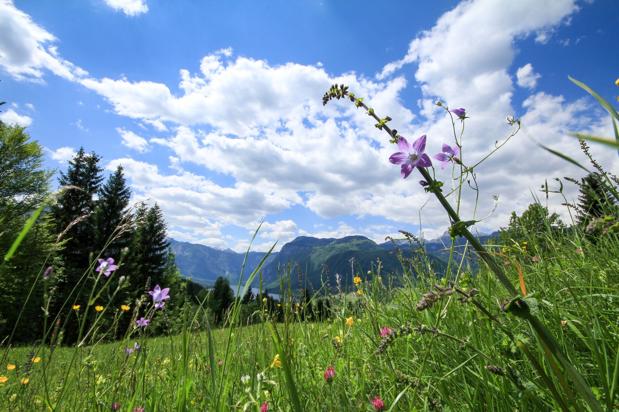
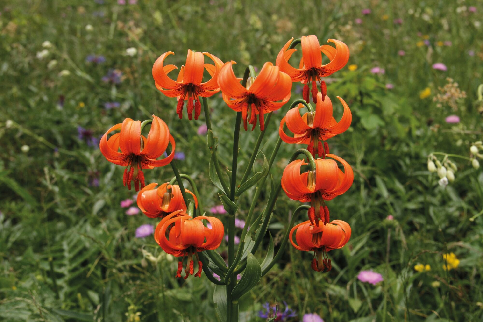
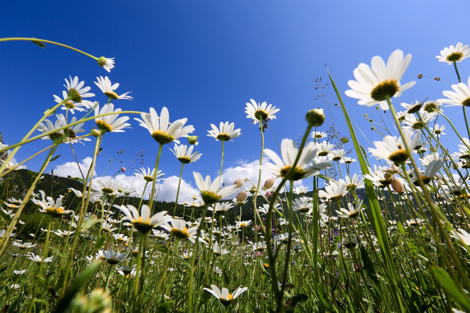
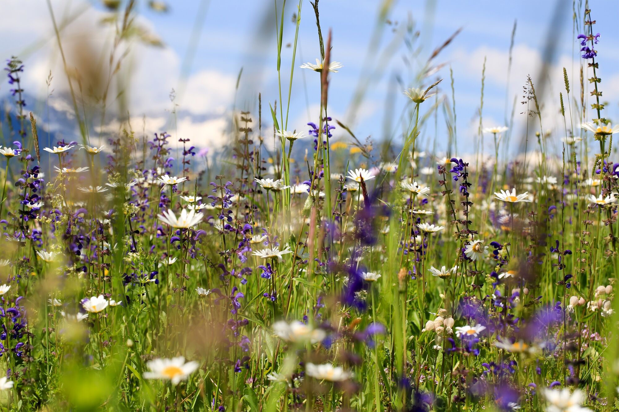
Rudnica is famous for rich flora. The Bohinj iris, the symbol of the International Wild Flower Festival that takes place every spring in Bohinj, is especially interesting.
The top of Rudnica is a beautiful spot for a bird's-eye view.
- Directions
-
Start at TIC in Stara Fužina, go along the main road to Ribčev Laz. Turn left over the Mostnica at the end of the village and then continue left uphill and continue through the forest. Soon you will come to a resting spot with a bench and a view of the lake. There is a crossroad nearby that orients you to Peč on the right side and left to Rudnica. The tenminute walk to Peč is recommended because it offers a beautiful view.
Return along the same trail to the crossroads, i.e. in the direction of Rudnica. Walk over the meadow and descend to the stone road from the left side. Follow this trail to the right and after a few metres turn left onto a stone and steep path. Please be cautious about the signs, because the trail is not very visible in some parts. Soon you will come to a meadow, from where you can descend to Brod. Continue straight ahead on the forest ridge of Široka polica. There are numerous basins, which are the remains of iron ore, along the trail. A view of the Lower Bohinj Valley and the largest village, Bohinjska Bistrica, opens up from the edge. After a short descent you come to a meadow that offers a beautiful view of Lake Bohinj. After a short ascent you reach the top that rewards you with a view of the Upper Bohinj Valley.
Return to the meadow the same way and turn right for Stara Fužina. The trail continues along a narrow path across a meadow and then comes to a steep stone road down through the forest and partially across some meadows. A beautiful view of Studor hill and the lake opens up multiple times. When you come to the asphalt cycling route along the Ribnica brook, continue down the stream to get to the confluence with the Mostnica. Turn right over the bridge and continue towards the centre of Stara Fužina. Walk along Mostnica and keep left. When you come to the bridge, turn left and you arrive at the starting point.
- Highest point
- 939 m
- Endpoint
-
Rudnica
- Height profile
-
 © outdooractive.com
 - Equipment
-
Please wear proper shoes and clothes and bring enough drinks, because there are no water springs or bars along the way.
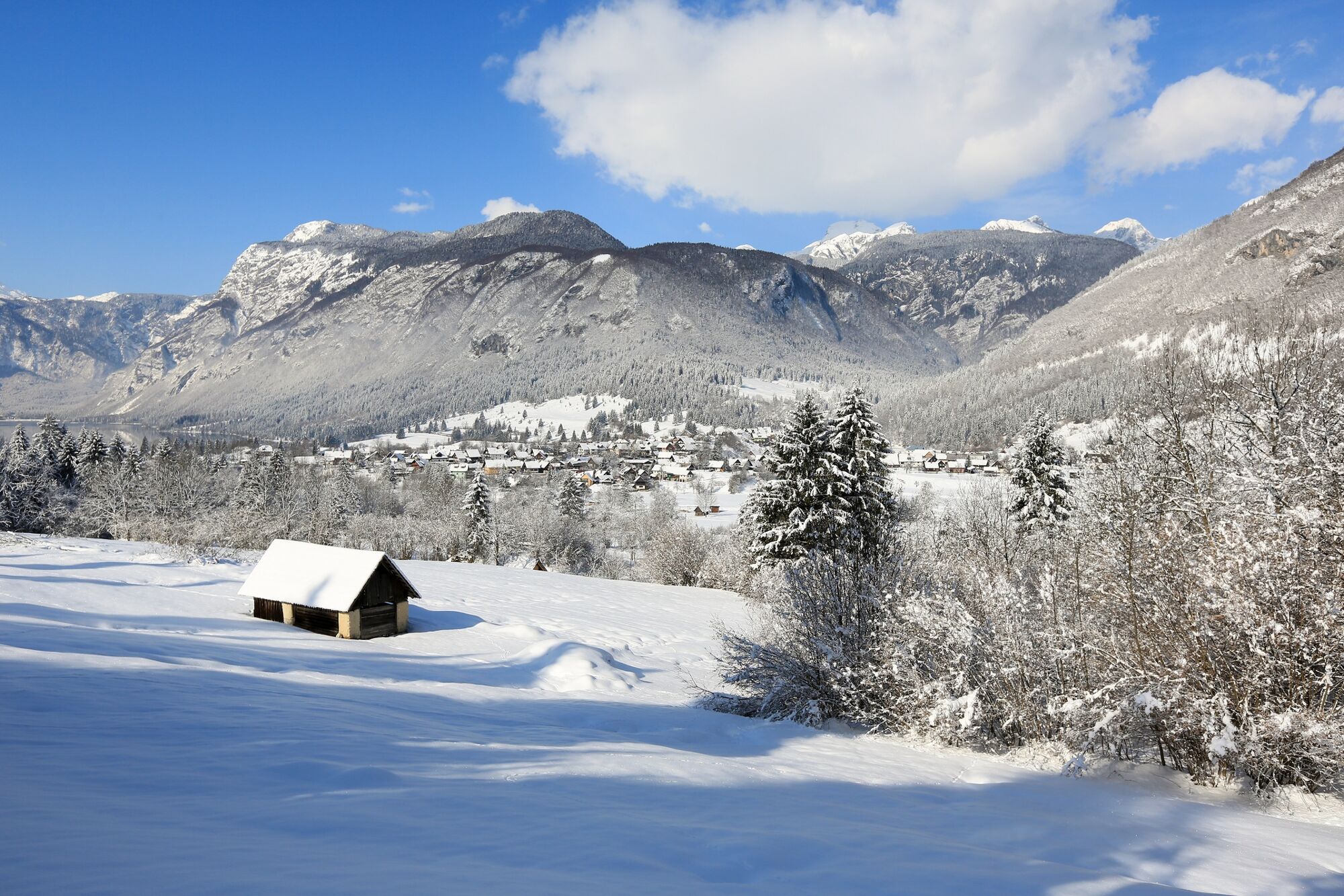
Winter:
Small crampons are recommended for winter conditions.
- Safety instructions
-
There can be fallen trees in some parts of the trail due damage caused by strong winds.
Winter:
At the very top, where it is steep, be careful because it can be icy and slippery in the winter months.
- Tips
-
Don't forget to take a camera with you.
Prior to every hike, check the weather forecast and trail conditions.
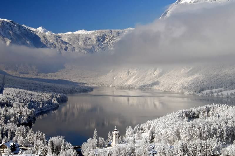
If you don't have the time to walk to the top of Rudnica, you can also hike to Peč that offers a beautiful view of Lake Bohinj and the mountains rising above it.
- Additional information
-
Information:
Turizem Bohinj, Stara Fužina, tel.: +386 4 57 47 590
TIC Bohinj, Ribčev Laz, tel.: +386 4 574 60 10
TIC Bohinj, Bohinjska Bistrica, tel.: +386 4 574 76 00
TIC Bohinj, Stara Fužina, tel.: +386 4 572 33 26
TNP Bohinj Centre, Stara Fužina, tel.: +386 1 200 97 60
Julian Alps Card: Bohinj offers free transport and other benefits.
During the International Wild Flower Festival (end of May, start of June) you can join a guided hike (with a botanist) to Rudnica, where you can get detailed information about the flora of this area.
https://www.bohinj.si/alpskocvetje/
In Stara Fužina, visit the Alpine Dairy Farming Museum and theTriglav National Park Centre. The Alpine Dairy Farming Museum is located in an abandoned village cheese dairy. It is also the place of the first cheese dairy with two large built cheese-making kettles and a press to form cheese loaves. You can also visit a wooden alpine herdsman's cottage which originates from the Zajamniki pasture. The TNP Bohinj Centre displays the magnificent "Lake" exhibition and also sells products with the Bohinjsko/From Bohinj certificate.
Stop at Triglav Restaurant, Mihovec Inn or Ančka Bar. There are two shops in the village.
- Directions
-
Drive by car to Stara Fužina from Bled, through Soteska or over Pokljuka. You can also access the village across Jelovica and Soriška planina.
- Public transportation
-
You can travel by train or bus to Bohinj. From the Primorska side, you can also come by car train.
Regular buses drive from Stara Fužina to Bohinjska Bistrica whole year round, in summer time you can come to Ukanc, the Savica Waterfall or Rudno polje (on the Pokljuka) by Hop-On-Hop-Off bus. The bus stop is located at the starting point.
More information is available on the website promet.bohinj.si
- Parking
-
The car park at the starting point Stara Fužina 11 has a limited parking time (2 hours), therefore, use it only to visit the Peč view point (coordinates: 46.287753, 13.894128).
A larger car park is located above Stara Fužina – Stara Fužina 8 (coordinates: 46.290434, 13.886832).
In summer, you can park your car at the car park between Ribčev Laz and Stara Fužina – Stara Fužina 7 (coordinates: 46.281193, 13.887203).


- Author
-
The tour Peč and Rudnica from Stara Fužina is used by outdooractive.com provided.


General info
-
Bohinj
118


