


- Brief description
-
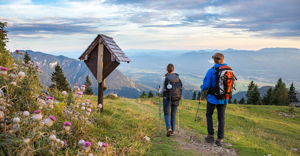
This curcular route in the Karawanke mountain range will reward a hiker with pristine nature and beautiful views towards the Julian Alps.
- Difficulty
-
difficult
- Rating
-
- Starting point
-
Draga Valley near Begunje
- Route
-
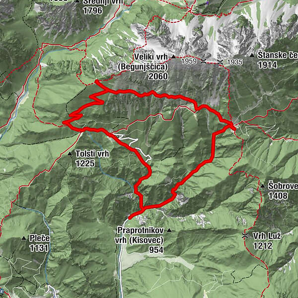
Luknja Waterfall1.0 kmPreval-Alm2.9 kmPlanina Preval (Prevala)2.9 kmRoža4.4 kmRoblekov dom6.0 kmTomčeva koča8.5 kmPoljška planina8.6 kmPlanina Planinca (1,136 m)9.2 km
- Best season
-
JanFebMarAprMayJunJulAugSepOctNovDec
- Description
-
This circular trail begins in the Draga valley from where it leads to the Preval mountain pasture and onwards traversing panoramic slopes past the source of the Roža spring all the way to the Roblekov dom mountain hut. From there, it descends back to the valley via the Poljška planina and Planinca planina mountain pastures and ends back at the start in the Draga valley.
The route can be prolonged with a hike up to the summit of Mt. Begunščica. It can be reached via the steep path from the Preval mountain pasture or via the somewhat easier route from the Roblekov dom mountain hut. Refreshments are available at all the mountain pasture huts.
- Directions
-
After finding an appropriate parking space, continue on the gravel forest road that leads up the valley alongside the Begunjščica stream. When road makes first left turn, cross the stream and continue straight ahead on a pebbly path following a lively mountain stream (signs for "Planina Prevala"). Ignore small paths branching off to the right-hand side and continue on the most beaten trail ascending further alongside the main stream. Soon you will find yourself in a wide-open scree slope with a view of a small waterfall to you left-hand side. The trail continues into a narrow rocky cravass, where you scale the sloping rock with the help of some inserted iron pitons and cables. Reaching the stream again, it's worth making a few steps downstream to see the top of the upper waterfall. The path continues through spectacular narrow ravine of Luknja Gorge, with overhanging rocks towering on both sides. You occasional have to cross the river stream, until the path reaches a forest road with a nice resting place "Počivalo" (benches, table and a Christian shrine). After a short descend on a forest road, the trail continues straight ahead onto a steep slope (signs : Prevala).
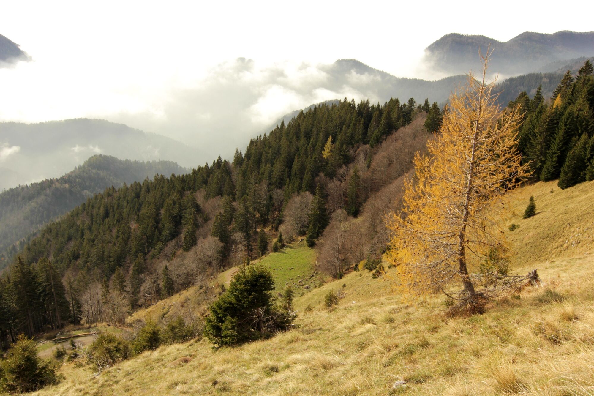
The (occasionally very steep) trail zig-zags up the forest until reaching the wide open meadows of Prevala pastures. Herdsmen's hut at Prevala pastures is well worth a stop, not only for the fabulous views of Begunjščica, Mt. Triglav and Košuta range, but also for a taste of delicious »štuklji« (cottage cheese rolled dumplings).
From the hut, descend down to the wooden crucifix at the junction of the roads. Choose the one ascending gradually to the left hand side (signed : Roblekov dom, čez Rožo). Gravel track leads you between forests and alpine meadows and occasional scree slopes. Where the gravel road reaches the highest point (and starts descending to the valley), continue walking straight ahead on a narrow trail entering the mountain forest. The single trail ascend steeply, as the forest becomes less and less dense. Soon you will come across a small spring named Roža (the flower). Locals from Begunje believe that the water from Roža spring has healing powers, therefore make sure you have a sip before you continue the walk.
The trail now traverses the wide open pastures of Mt. Begunjščica from east to west, as the views strech further and further across Gorenjska region. The terrain is very steep, the path occasionally very narrow - therefore be attentive crossing the wide open gullies. You might be surprised to see a stone vaulted entrance to an underground hall, this is a remnant of one of three former manganese mine existing on the mountain in the 19th and early 20th century (information panel). Follow the path further towards a small forest, where you will soon encounter a much more beaten trail ascending from the valley. Turn right and follow the trail leading uphill. After only few minutes you will be on open ground again, gazing at Lake Bled, the Julian Alps and nearby Mt. Stol of the Karavanke mountains.
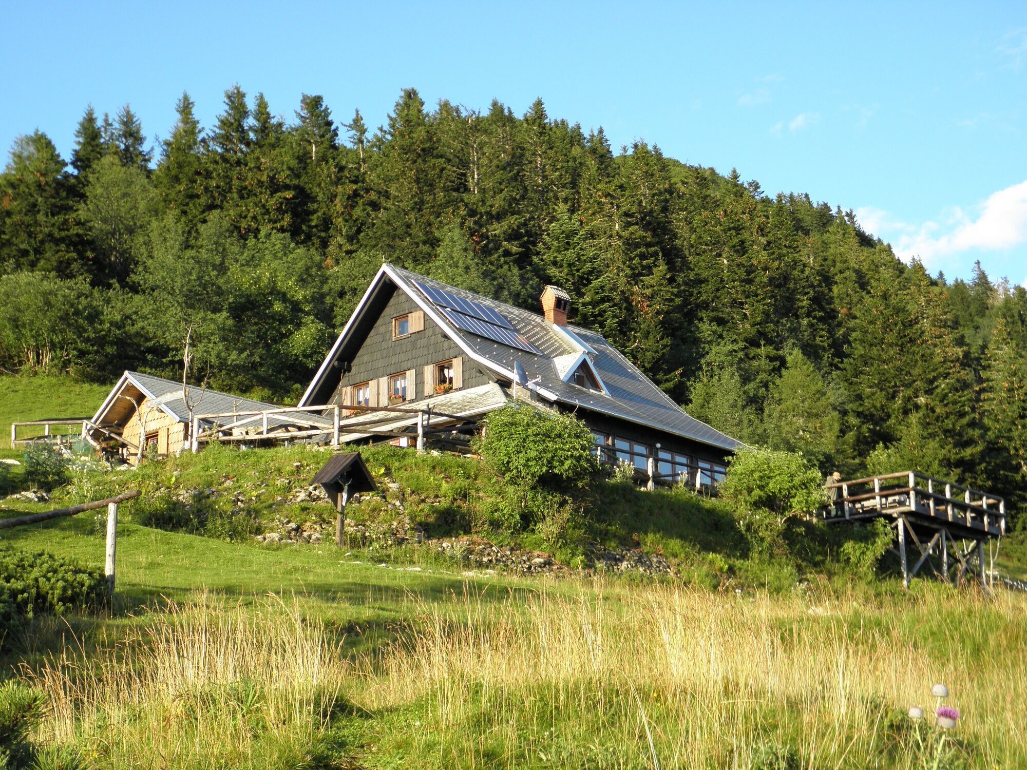
Right amidst the meadow stands the famous Roblek mountain lodge, scene of the immenly popular slovenian folk song Večer na Robleku. Next to excellent food and generous wievs, Roblek hut also witnessed the turbulent history of 20th centrury (presented on the information panel and photograps inside the house).
After a rest by the Roblek hut you can decide to ascent the peak of Mt. Begunjščica (1 hour), or follow the Shepherds trail down to the valley. Retrace your steps down to the junction in the forest, than continue descending straight ahead (signs: Draga, Poljška planina). The steep wide road descend through mountain forest in noumerous switch backs and shortcuts. Try to stay on the principal path (protection of natural environment), however: if you do end up on a shortcut, you can be quite certain it will eventually bring you back on the main trail. After about 45 minutes of descend you will reach Poljška planina alpine pastures, where you can refresh with a cold drink or a bowl of warm soup.
Reaching Poljška planina, turn left and continue walking on a wide gravel road. The road will soon bring you to the second alpine pasture named Planina Planinca.
At this point you can decide to continue the descend on the road, of follow the Shephers trail on the official shortcuts (recommended). The trail leads you across the pastures and enters the forest close to the the first left turn on the gravel road. The well beaten trail continues straight trough the forest, occasionally crossing the gravel road. Eventually the trail joins with the road and enters a narrow gully. Though the walk follows the gravel road, this section is very scenic due to the company of a lively mountain stream and surrounding rocky crags. There road gradually levels and reaches the Draga Inn at the start of the circular walk.
- Highest point
- 1,638 m
- Endpoint
-
Begunje na Gorenjskem
- Height profile
-
 © outdooractive.com
 - Equipment
-
Sturdy boots are warmly welcome, especially on the traverse from Prevala alpine pastures to Roblekov dom alpine lodge. Begunje Shepherd's trail is a proper alpine hike, therefore a back-pack with rain jacket, water flask etc. is recomended.
- Safety instructions
-
In the section from Prevala alpine pastures to Roblekov dom mountain the Shepherd's trail traverses steep grassy mountains slopes (former hay meadows). In wet, extra coution is needed. After long winters, certain sections of the path can be damaged due to snow avalanches or landslides.
In Luknja Gorge (10- 15 minutes after the start of the walk) a short metal ladder has to be scaled in order to ascent the ravine (easy).
- Tips
-
Accommodation is possible on Roblekov dom Mountain Hut or in Draga Inn at the begining of the tour.
- Additional information
-
Don't miss the fresh home made "štruklji" (cottage cheese dumplings) in the Hut at Prevala Pasture There is a perfect soundtrack to Begunje Shepherds trail: The legendary song "Večer na Robleku", recorded by Avsenik brothers Ensemble in 1957, gave Roblek mountain hut an iconic status amidst Slovenians and wider: Večer na Robleku
- Directions
-
Exit Ljubljana - Jesenice Highway (E61) on Lesce-Bled exit and drive towards Begunje na Gorenjskem. Stay on the main road through the village (direction Tržič). Turn left towards Kamen Castle on the of the village. Drive past Kamen Castle and leave your car on one of the parkings after you reach Draga Inn.
- Public transportation
-
If using public transport, the bus will leave you in Begunje na Gorenjskem. From there you can start the hike via Lambergh's Trail or on the main roud through Draga Valley.
- Parking
-
There are smaller parkings in Draga Valley. Parking free.

- Author
-
The tour Begunje Shepherd's Trail is used by outdooractive.com provided.