
- Brief description
-
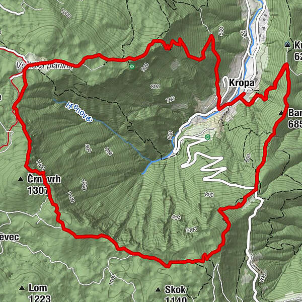
This hiking trail leads around the peaks that rise above Kropa, where there are magnificent views from the Zidana skala viewpoint, and onwards to the Vodiška planina on Jelovica.
- Difficulty
-
medium
- Rating
-
- Route
-
KropaThe Parish Church of Our Lady of Kropa0.3 kmBarigla (685 m)1.3 kmZidana skala5.7 kmČrni vrh (1,307 m)5.8 kmŽupnijska cerkev sv. Lenarta9.8 kmKropa10.2 kmThe Parish Church of Our Lady of Kropa10.6 km
- Best season
-
JanFebMarAprMayJunJulAugSepOctNovDec
- Description
-
The first part of the route leads along a pleasant cart track through the deciduous forest until you reach the road that leads from Kropa up to Jamnik. Cross the main road and continue in the direction of the Vodiška planina. Enroute pause to enjoy the view of the prominent ridge with the church at Jamnik, then continue upwards.
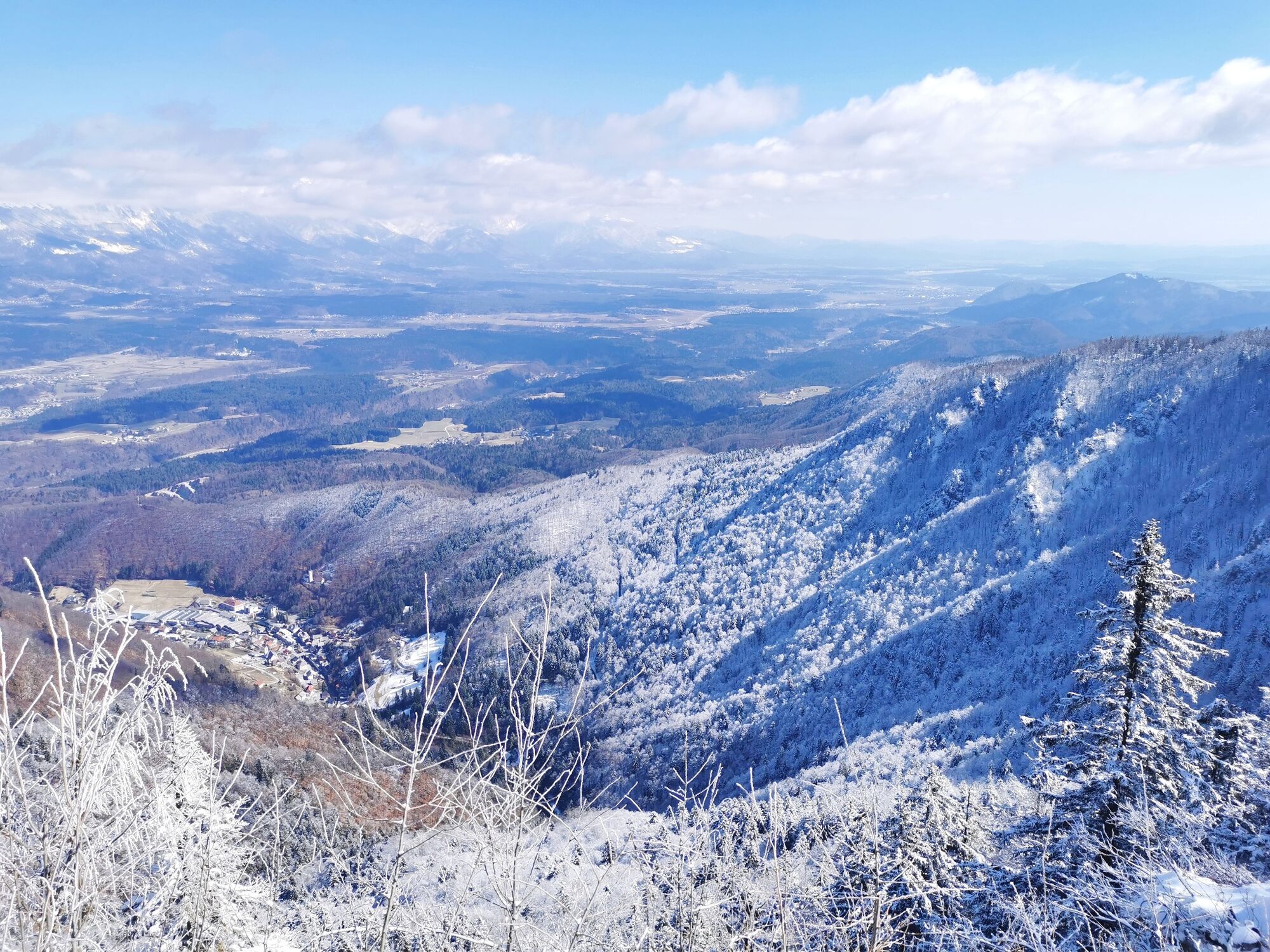
In the upper part of the ascent, the path from Jamnik joins from the left. After walking for around two hours from Kropa, the Zidana skala viewpoint provides beautiful views of Kropa deep below in the valley, and the Ljubljana Basin and the Kamnik-Savinja Alps in the distance. Continue just a few metres upwards before the path begins to descend towards the Vodiška planina mountain pasture.
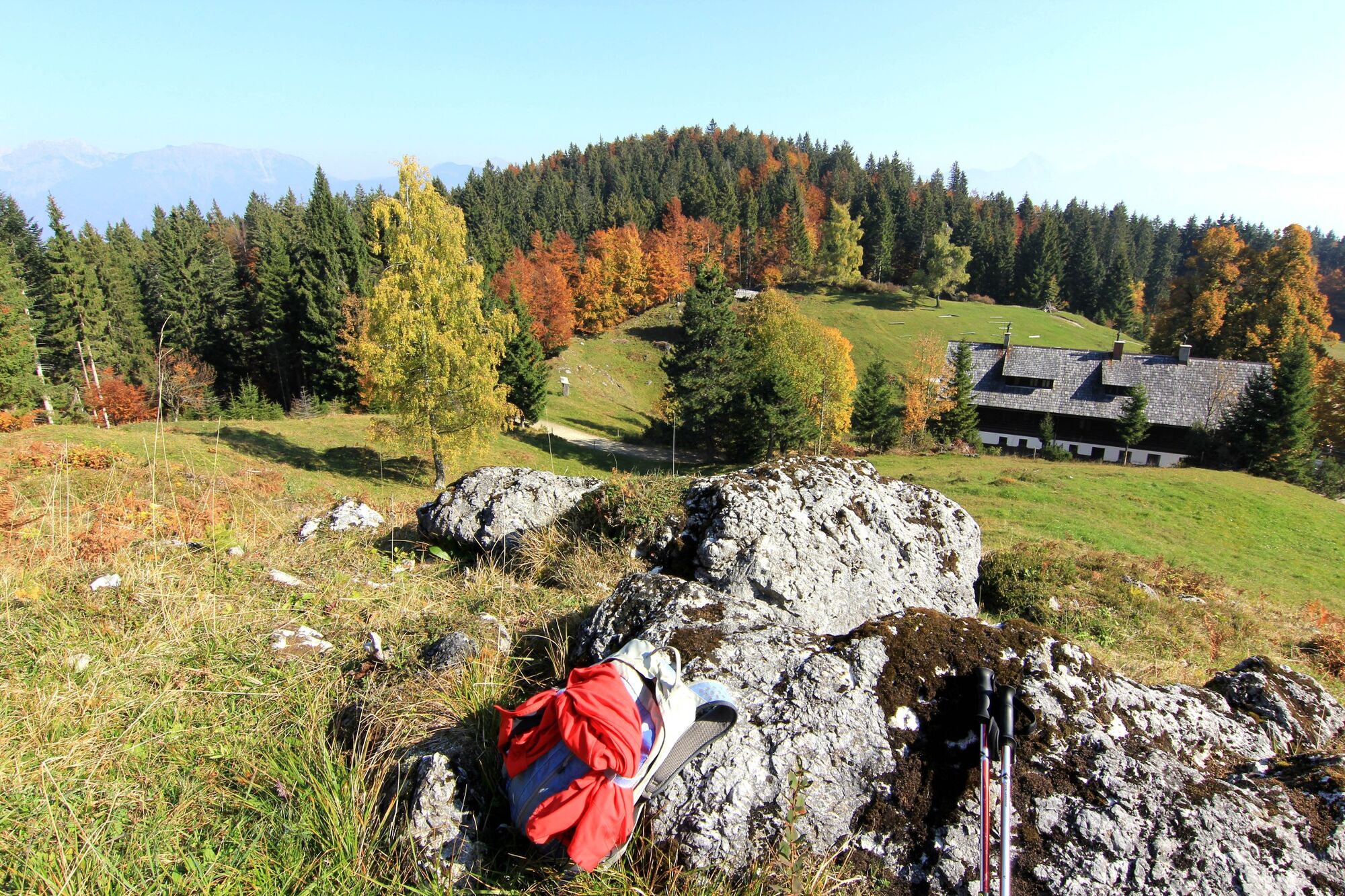
Take a break for refreshments at the mountain hut, then continue across the pasture in the direction of Kamna Gorica and Kropa, following the signs to the right for Kropa. There are two paths leading to Kropa from here, both of which lead to Kropa past St. Lenart's church.
- Directions
-
From Kropa, first follow the signposts for Jamnik, which lead to the left from the car park/children's playground up along a cart track and past the Church of the Mother of God. The path gradually leads upwards before reaching a junction, where you continue to the right in the direction of Jamnik. Walk along the pleasant cart track that ascends gently. After two kilometres, when the track leads slightly to the left, you should continue along the forest path upwards and will soon reach the main Kropa – Jamnik road. Here the path to Jamnik turns left and runs along the edge of the main road, but you should instead cross the main road and follow the markers and signposts for the Vodiška planina mountain pasture (in places marked as Vodice).
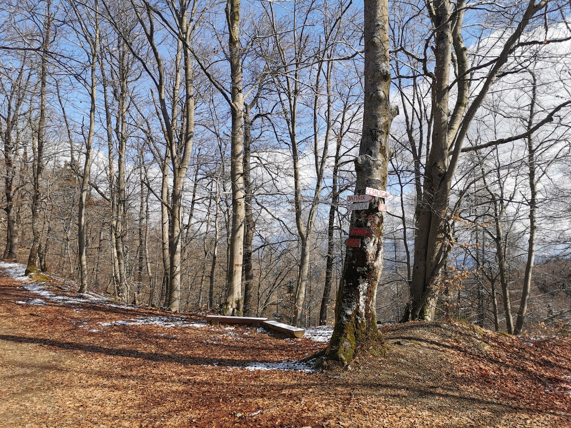
The path ascends with hairpin bends further through the forest. On reaching a junction join the path that leads to the Vodiška planina mountain pasture from the direction of Jamnik. From here, continue straight ahead and keep to the right at all intersections. At several places the path approaches the edge of the Kropa mountains. The Zidana skala viewpoint, where there is a bench, offers the most beautiful views and is the ideal place to take a breather.
From the Zidana skala viewpoint continue upwards for a few more minutes to reach the highest point of the path before gradually descending towards the Vodiška planina mountain pasture, which you will reach after cca. 7 kilometres from the start of the hike.
From the Vodiška planina mountain pasture and the Partizanski dom mountain hut, which is open year round for refreshments, continue past the linden tree and then along the left edge of the pasture towards Kamna Gorica. At the end of the pasture, turn right onto a forest path that leads to Kropa. Slightly lower you will reach another crossroads, from where two paths lead to Kropa. Choose either of the paths, both of which lead down to Kropa and St. Lenart's church.
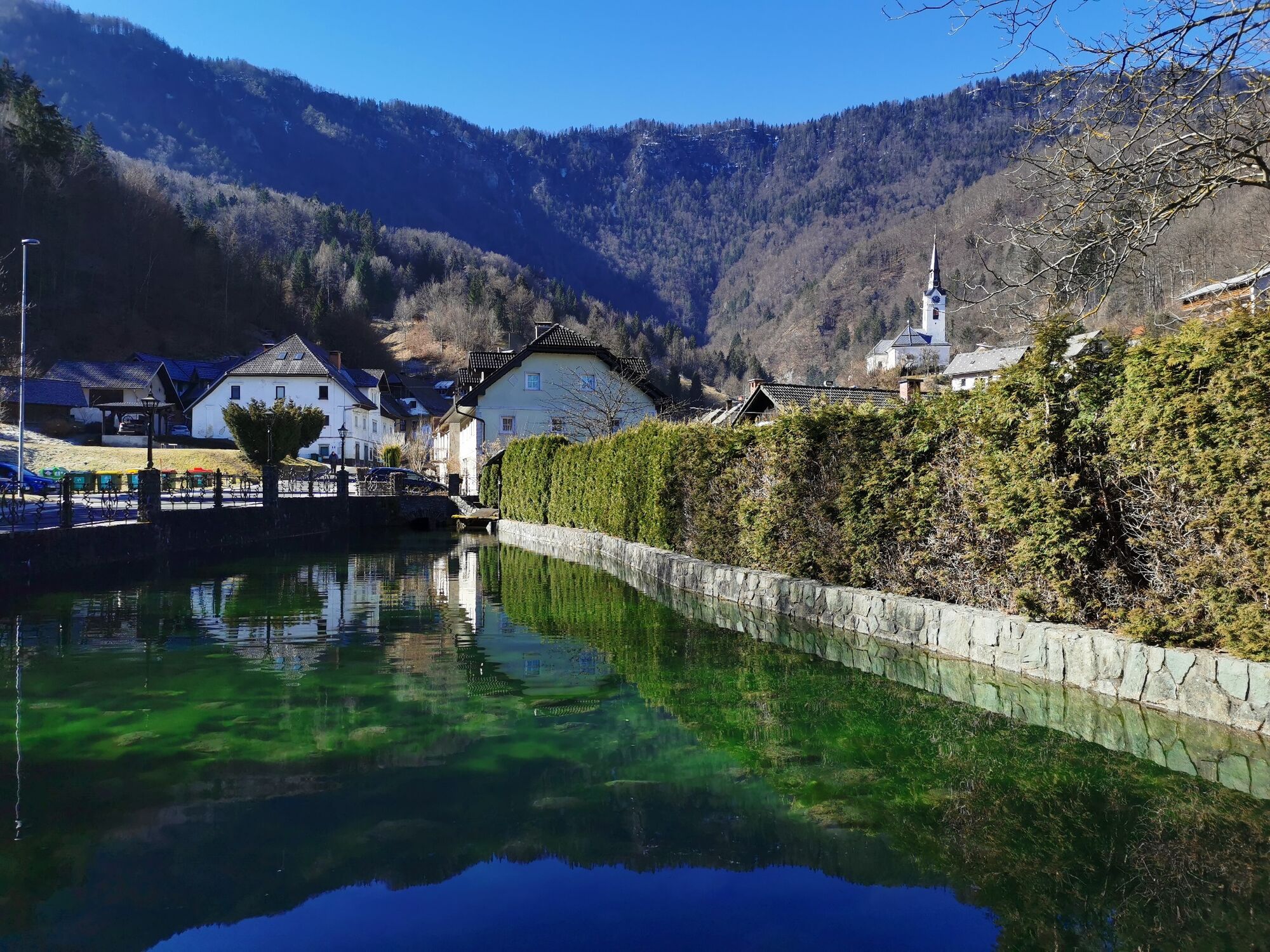
At the church look for the road that leads down to the right of the church. The road joins the main Kropa - Jamnik road near the Vigenjc Vice foundry. Turn left and walk past the picturesque ironworkers' houses to reach the main square. From the square, cross the stone bridge over the Kroparica stream, walk past the Iron Forging Museum and return to the car park.
- Highest point
- 1,278 m
- Height profile
-
 © outdooractive.com
 - Additional information
-
After your hike, it's worth spending some time exploring Kropa's historic market square.
- Directions
-
From the direction of Ljubljana, leave the A1 motorway at the exit for Podbrezje and continue in the direction of Kropa. When you arrive in Kropa you can park in the small car park on the left-hand side of the road opposite the pond.
- Public transportation
-
You can start this circular tour at the bus station in Kropa. Regular buses run between Kropa and Radovljica during the week, however, at weekends the connections are less regular.
- Parking
-
You can leave xour acr at the small parking on the left side of the road just before the old part of Kropa.

- Author
-
The tour Kropa - Zidana skala - Vodiška planina - Kropa is used by outdooractive.com provided.


General info
-
Klopeiner See - Südkärnten
1163
-
Gorenjska
140
-
Radovljica
166