Juliana SkiTour 1a -Kotovo sedlo (2300 m), žlahtna klasika v veličastnem ambientu


- Brief description
-
Kotovo sedlo is the saddle beneath Jalovec, one of the most stunning peaks of the Julian Alps, which adorns the symbol of the Mountaineering Association of Slovenia with its image.
- Difficulty
-
medium
- Rating
-
- Starting point
-
Parking is at the end of the paved road on the edge of the Nordic Center Planica (960 m)
- Route
-
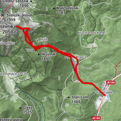
Chapel Marija Pomagaj - Tamar3.5 kmPlaninski dom Tamar3.6 kmPlaninski dom Tamar13.3 kmChapel Marija Pomagaj - Tamar13.5 km
- Best season
-
AugSepOctNovDecJanFebMarAprMayJunJul
- Description
-
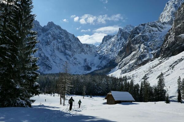
Kotovo sedlo is the lowest point on the ridge that connects Jalovec and Mangart, two of the mighty 2,000-meter-high Slovenian peaks. It also borders two dramatic alpine valleys - Loška Koritnica on the Primorska side and Tamar on the Gorenjska side. Kotovo sedlo is a watershed - forming rivers that flow into the Adriatic Sea on the Primorska side, and into the much more distant Black Sea on the Gorenjska side.
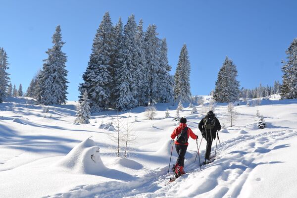
Kotovo sedlo is a ski touring classic that will not let down even the most spoiled mountain visitor in the winter. This ski tour is distinguished by all the qualities that a winter classic offers: an exceptional ambience, a decent elevation gain, and excellent skiing.
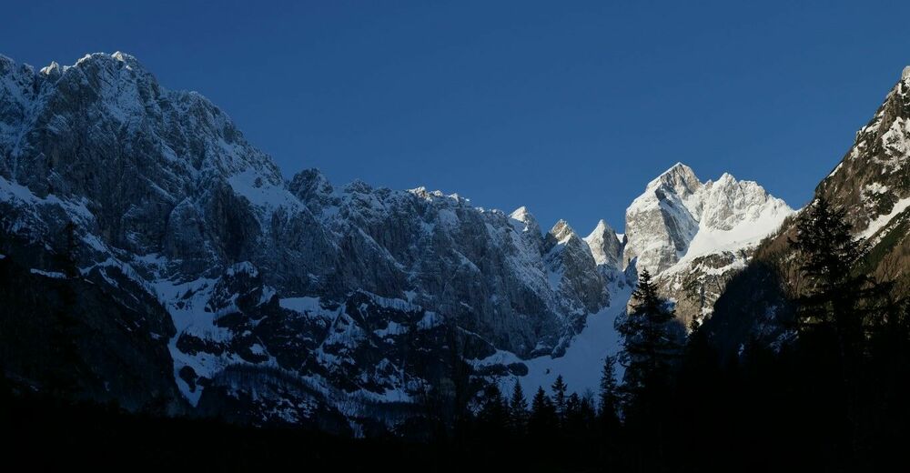
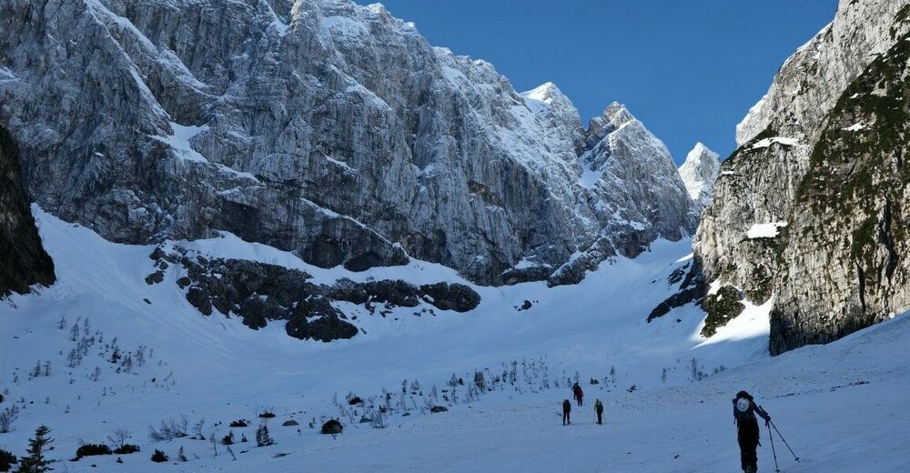
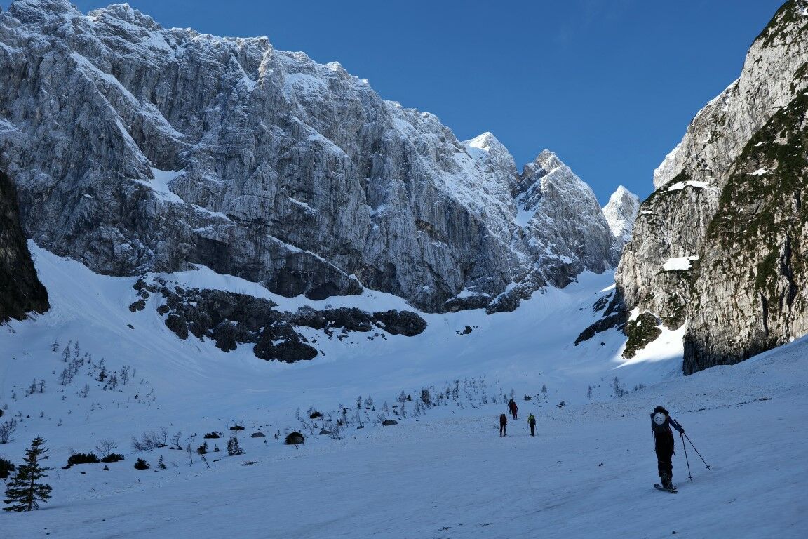
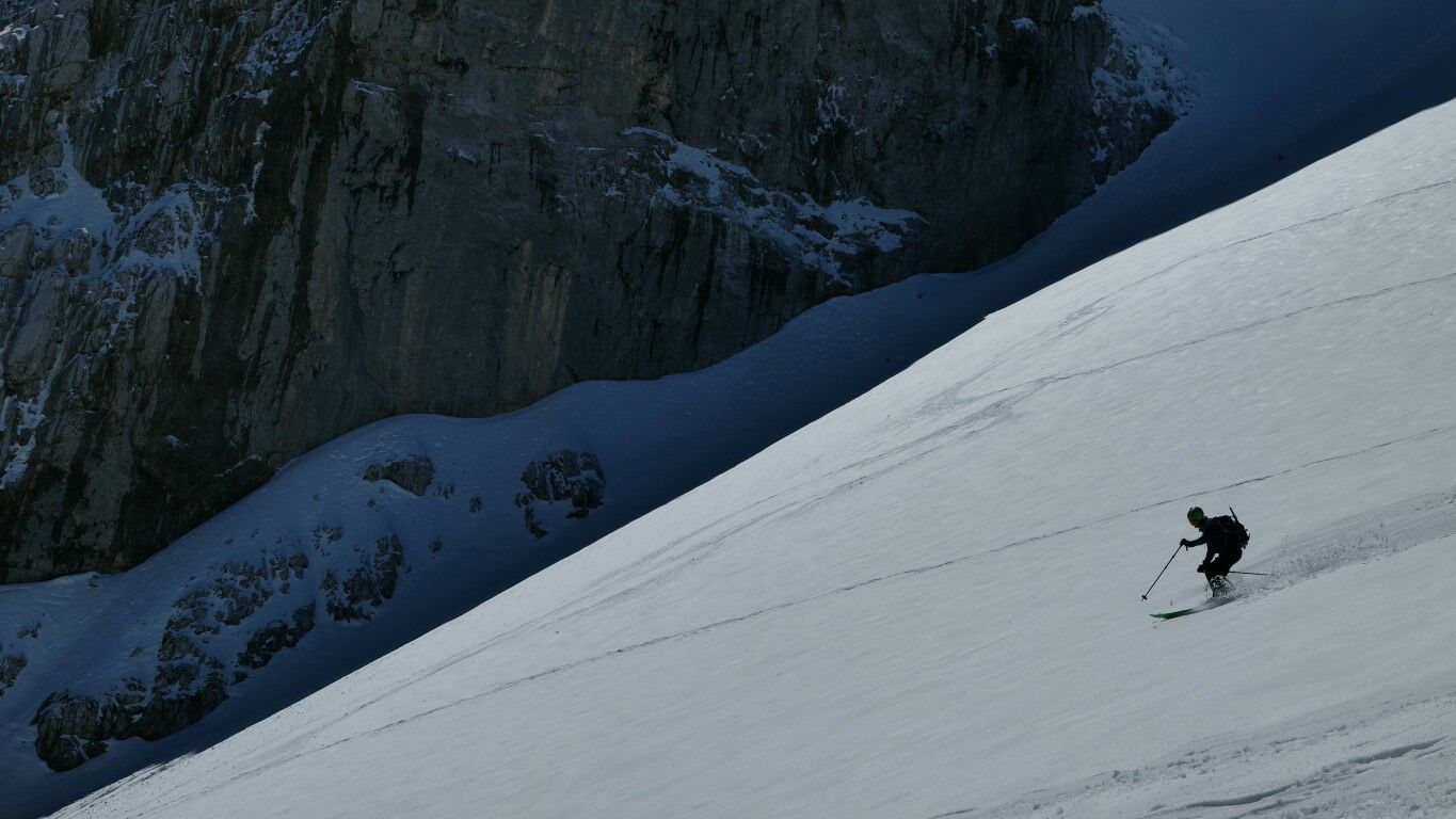
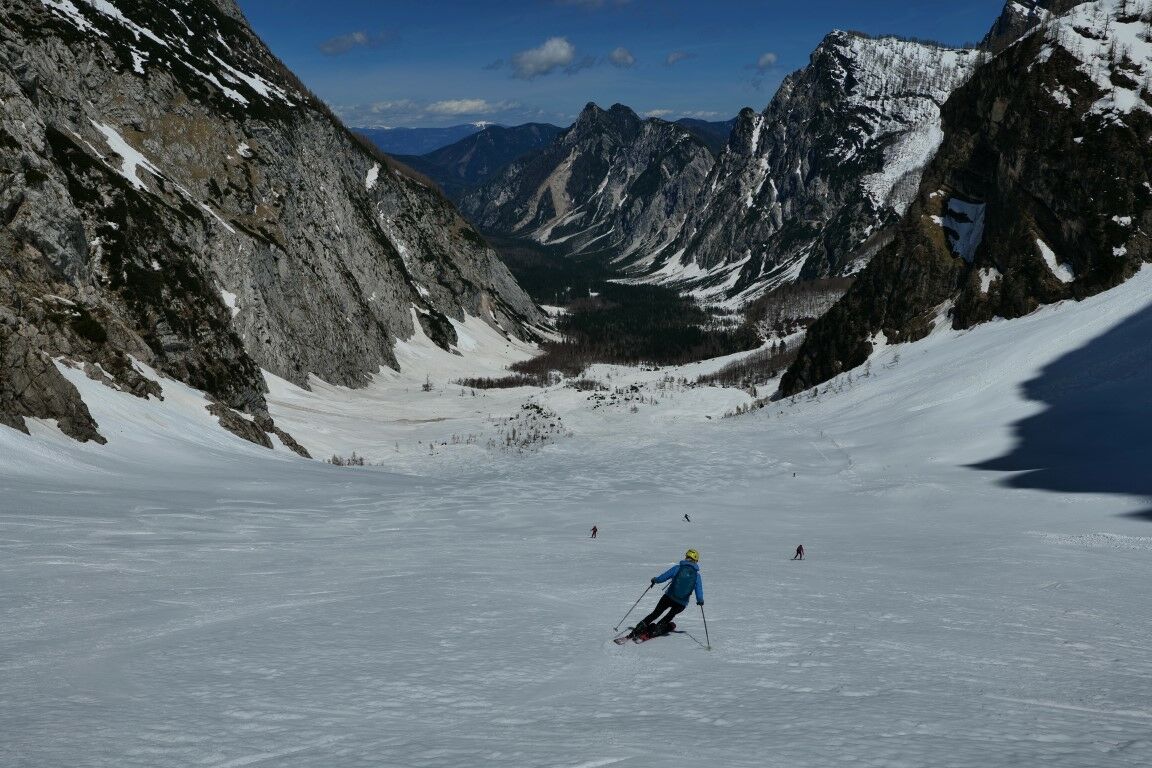
The starting point of the ascent is in the world-famous Nordic Ski Center Planica. From the ski center the path follows the Tamar Valley past the mountain hut and further on below the dramatic, nearly vertical, walls of Travnik and Šit. The path follows the ever-narrowing valley. Below the summit of Jalovec, the path gradually turns onto the wide slopes of the eastern side and continues to the extreme point on the ridge, which can still be reached on skis. The descent follows in the same direction as the ascent. The descent is smooth, except in the gully below Šit where you must take time to choose the best line through the variable terrain.
- Directions
-
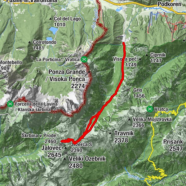
From the parking lot in Planica (960 m) follow the gravel road (3.4 km) to Planinski dom in Tamar. During the winter, when the snow is in the valley, there is a cross-country trail on this road and you can start on skis. From March onwards, when the snow melts, you have to walk with your skis strapped to your backpack.
Immediately after the mountain hut, follow the signs of the summer trail. If the markings are not visible, look for the direction through the beech forest towards the right edge of the valley. After twenty minutes you arrive on the snowfields above the forest border.
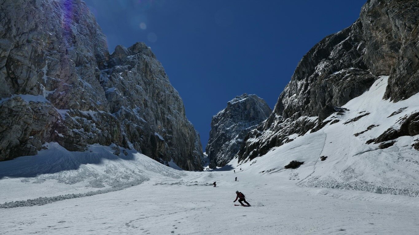
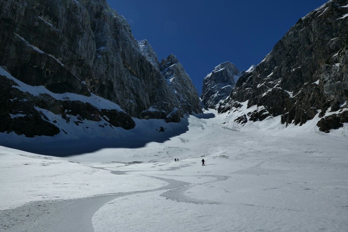
Continue along the narrow valley below the walls of Šit where the slope of the ascent increases and the width of the passage narrows. This part is often icy, ski crampons and regular crampons are essential equipment that should at least be in the backpack.
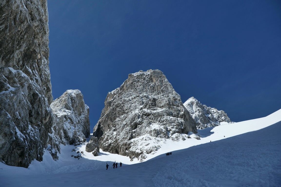
Ascend through the ravine below the top of Jalovec where the slope’s incline gradually levels. In good conditions it is possible to continue straight up through Jalovčev ozebnik (a picturesque couloir below Jalovec). Otherwise the regular trail turns right, ascending up below the walls to a huge, unmistakable boulder.
The tired ones can finish the ascent at the boulder. But the less tired can continue along the open plains to the right, upwards to the indistinct ridge’s shoulder (2300 m), just below the beginning of the rocky walls. These 200 additional meters of altitude from the boulder onwards are definitely worth the effort, as they open up a view over the precipice’s ridges of Šit, Travnik and Mojstrovka to the central Julian Alps on one side and Mangart on the other.
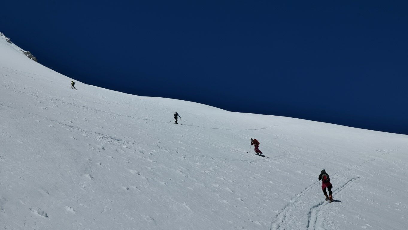
Ski in the direction of the ascent. On the upper section, the slopes are wide enough to freely pick the line of your choice, while the choices become more restricted as the narrow ravine is approached below Šit. This ravine should be approached with caution as it is often susceptible to hard pack and ice.
Ski down all the way to the mountain hut. If there is snow in the valley, you can continue on skis, otherwise return to the parking lot on foot.
If in spring there is no more snow on the gravel road to the mountain hut - Koča v Tamarju , it can be accessed by a mountain bike.
- Highest point
- 2,304 m
- Endpoint
-
Ridge’s shoulder above Kotovo sedlo (2300 m) - Koča v Tamarju (1106 m) - Planica (960 m).
- Exposition
- Height profile
-
 © outdooractive.com
 - Equipment
-
Avalanche trio (avalanche beacon, avalanche probe, shovel), touring skis, bindings, ski boots, skins, ski crampons; ice axe, crampons.
- Safety instructions
-
Regular, high-altitude caution is required. The ravine below Šite is often with hard snow or ice, so all the mandatory equipment for winter ascents should be in your backpack. The ending point on the ridge is exposed.
- Tips
-
Skiing from Kotovo sedlo is a popular spring destination. In stable winter conditions it is also possible to ski it in February or March.
- Additional information
-
Kotovo sedlo is an orientationally simple and a technically moderate tour. However, it is one of the longer ones and requires adequate physical fitness. If you seek a shorter tour, it is possible to skip the last 200 m of altitude and end the tour at the unmissable boulder below the peak.
- Directions
-
From Kranjska Gora or from the direction of the Italian border crossing, continue to the town of Rateče where the road to Planica branches off at the roundabout.
- Public transportation
-
There is no public transport.
- Parking
-
Park in front of a stream bed at the end of the paved road on the upper edge of the Planica Nordic Center.


-

-
AuthorThe tour Juliana SkiTour 1a -Kotovo sedlo (2300 m), žlahtna klasika v veličastnem ambientu is used by outdooractive.com provided.