
- Brief description
-
A cycling tour that takes you from Bled to Bohinj across the famous Pokljuka plateau.
- Difficulty
-
medium
- Rating
-
- Starting point
-
Infocenter Triglavska roža Bled.
- Route
-
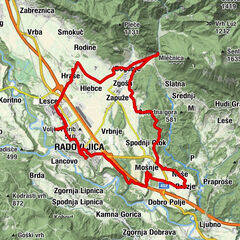
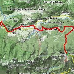
Bled0.4 kmUnter Göriach3.9 kmPoljšica pri Gorjah4.7 kmSv. Jurij4.9 kmZgornje Gorje5.0 kmGrabče5.4 kmKrnica6.1 kmGostilna Zatrnik Pr' Jagru9.7 kmZatrnik10.1 kmGorjuše22.5 kmKoprivnik v Bohinju25.6 kmFrauenberg31.1 kmKerschdorf32.5 kmMitterdorf34.6 kmStudorf35.2 kmAlthammer37.4 kmFischgereuth38.5 kmLaški Rovt40.0 kmFeld40.6 kmSteinfeld41.4 kmSawitz41.8 kmFürten42.2 kmWochein Feistritz44.9 kmHotel, restavracija, picerija Tripič***45.1 kmWochein Feistritz45.4 km
- Best season
-
JanFebMarAprMayJunJulAugSepOctNovDec
- Description
-
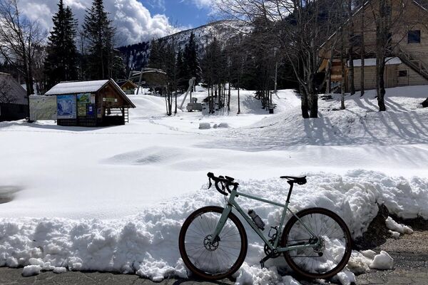
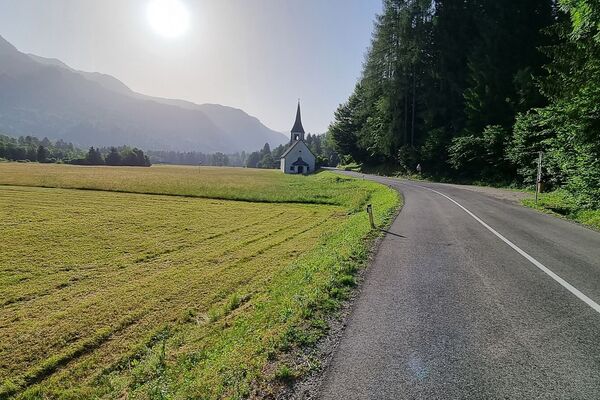
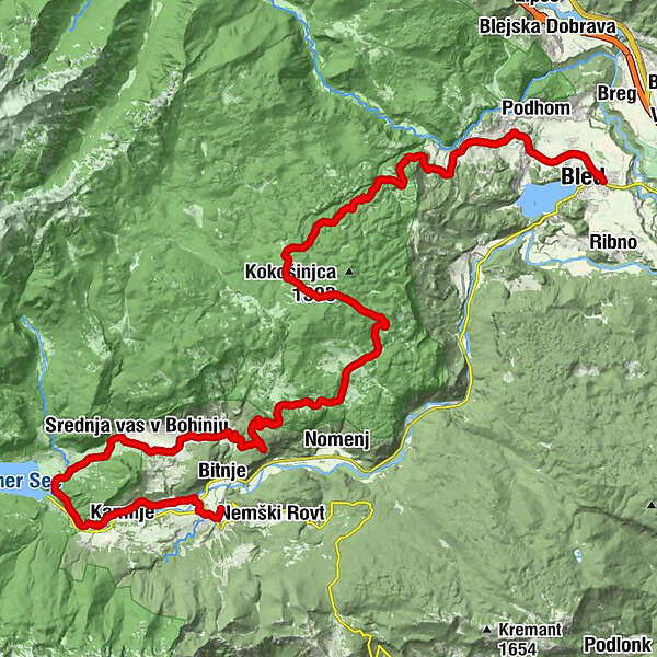
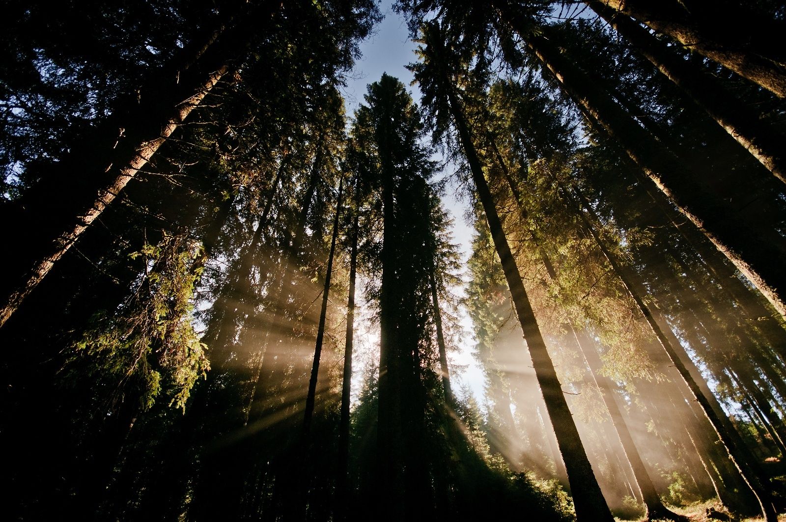
This is a long and relatively strenuous but exceptionally beautiful tour that offers views of the Julian Alps, the mighty forests of Pokljuka and the beautiful Bohinj Valley. The tour starts in Bled and continues towards Spodnje and Zgornje Gorje, where you start your ascent to the Pokljuka plateau. After a long and demanding ascent, cycle through the beautiful forests of Pokljuka and Triglav National Park. Descend through Gorjuše and Koprivnik to the Upper Bohinj Valley, and continue along the Bohinj Cycling Route to Lake Bohinj. The tour continues along the Lower Bohinj Valley to Bohinjska Bistrica, where you stop and take the train back to Bled.
- Directions
-
BLED - SPODNJE GORJE - ZGORNJE GORJE - ZATRNIK - POKLJUKA - GORJUŠE - KOPRIVNIK - JEREKA - BOHINJSKA ČEŠNJICA - STARA FUŽINA - RIBČEV LAZ - BOHINJSKA BISTRICA
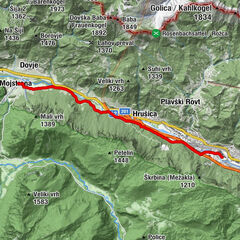
The tour starts in front of the Triglavska roža Bled Info Centre and continues along the road on the right side of Mercator shop. At the end of the street, turn left and cross Seliška cesta, where you reach the cycling route. Turn right and ride along the cycling route to Rečica. Continue along the main road towards the Pokljuka Plateau through Spodnje and Zgornje Gorje. Follow the signs for Pokljuka to reach Zgornje Gorje. From Krnica continue in the direction of Pokljuka and start your ascent after a couple hundred metres (12%). After approximately 3 km, you will come to Zatrnik (ski centre in the past) and continue a steep ascent (18%). Soon the slope flattens and you continue to the top where the road is completely flat.
Continue to the crossroad and turn left towards Bohinj. After a few kilometres you have to once again start a slight ascent and then you start a long descent to Gorjuše. Continue straight on along the main road towards Lake Bohinj and past Koprivnik (on the right side). Continue straight on towards Lake Bohinj and be cautious in many sharp turns. When you stop descending, you reach the village of Jereka. Drive through the village and come to the main road of the Upper Bohinj Valley and turn right towards Lake Bohinj.
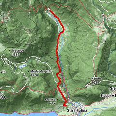
At the end of the village of Češnjica, turn left off the main road to the cycling route in the direction of Senožeta Ski Centre. Cycle along the route past the ski slopes (on the left side) and follow the signs for the cycling route through Studor, continue to Stara Fužina. If you want to see Lake Bohinj, leave the cycling route in Stara Fužina and continue towards Ribčev Laz. Continue along the cycling route through Savica and Brod towards Bohinjska Bistrica.
When you come to the edge of Bohinjska Bistrica, you reach a forest, where you have to turn sharp right and after a couple hundred metres you reach the wooden footbridge over the Sava Bohinjka River. Cross the river and at Danica Campsite and football field (on the ride) cycle to the main road. Turn left in the village and continue to the roundabout, take the second exit. Continue past the Tripič Hotel (on the right). Turn left after hundred metres towards the railway station. Cross the Belca brook and immediately after the bridge turn left and continue straight on until you reach the railway station in Bohinjska Bistrica (on the right side). Return to Bled by train.
- Highest point
- 1,255 m
- Endpoint
-
Infocenter Triglavska roža Bled.
- Height profile
-
 © outdooractive.com
 - Equipment
-
Bike and helmet
- Safety instructions
-
The tour is suitable for mountain, trekking and road bicycles.
Consider traffic signalisation. - Tips
-
We recommend the return from Bohinjska Bistrica to Bled by train. Timetables: www.slo-zeleznice.si/sl/potniki
- Additional information
-
TIC INFOCENTER Triglavska roža Bled
Ljubljanska cesta 27, SI – 4260 Bled
E-maili: info@visitbled.si, info.trb@tnp.gov.si
Tel: +386 (0)4 5780 205
Web address: http://www.bled.s i; http://www.tnp.si
TIC - Turistično Društvo Bled
Cesta svobode 10, SI – 4260 Bled
Tel: +386 (0)4 5741 122
Web address: http://www.td-bled.si
Triglav National Park Centre in Bohinj
Stara Fužina 37-38, SI - 4265 Bohinjsko jezero
E-mail: info.bohinjka@tnp.gov.si
Tel: +386 (0)45 780 245
- Directions
-
You can get to the starting point in Bled by car from Lesce (Ljubljana-Karavanke motorway exit) or from other regional roads from Bohinj or Jesenice.
- Public transportation
- Parking
- Author
-
The tour Visit Bohinj is used by outdooractive.com provided.