- Brief description
-
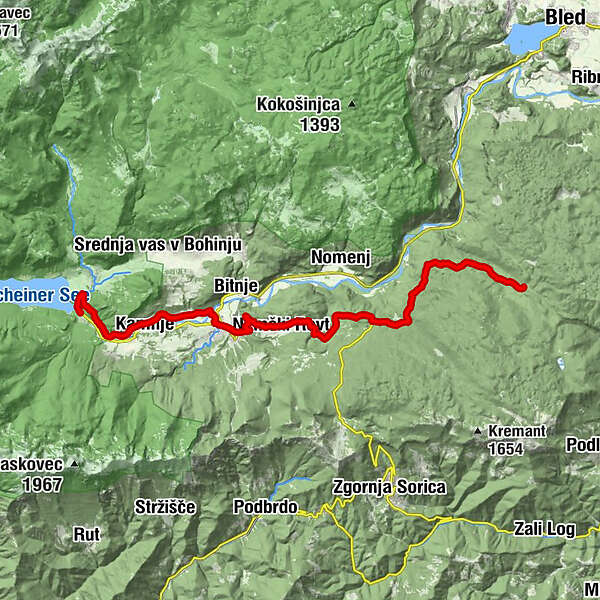
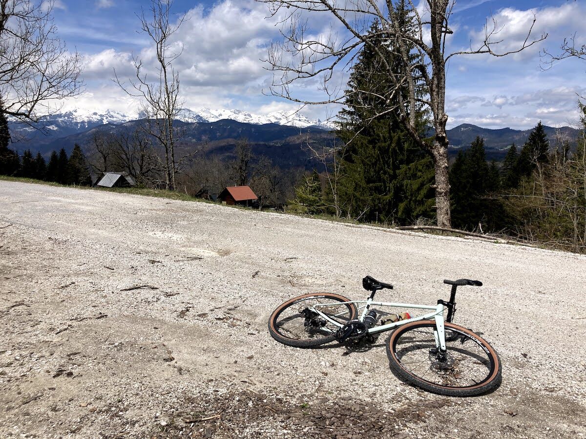
A cycling tour that takes you from Lake Bohinj all the way to the forestry hut on the Jelovica plateau.
- Difficulty
-
medium
- Rating
-
- Starting point
-
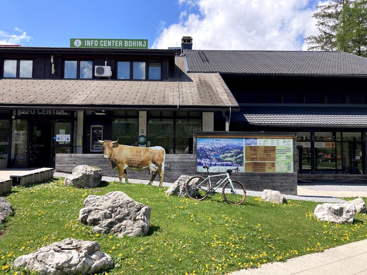
Info center Ribčev laz
- Route
-
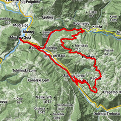
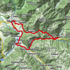
Fischgereuth0.0 kmHudičev Most0.1 kmChurch of St. John the Baptist0.1 kmLaški Rovt2.7 kmFeld3.3 kmSteinfeld4.1 kmSawitz4.5 kmFürten4.9 kmWochein Feistritz7.6 kmHotel, restavracija, picerija Tripič***7.8 kmNemški Rovt10.6 kmPenzion Resje10.9 kmRovtarica23.1 km
- Best season
-
JanFebMarAprMayJunJulAugSepOctNovDec
- Description
-
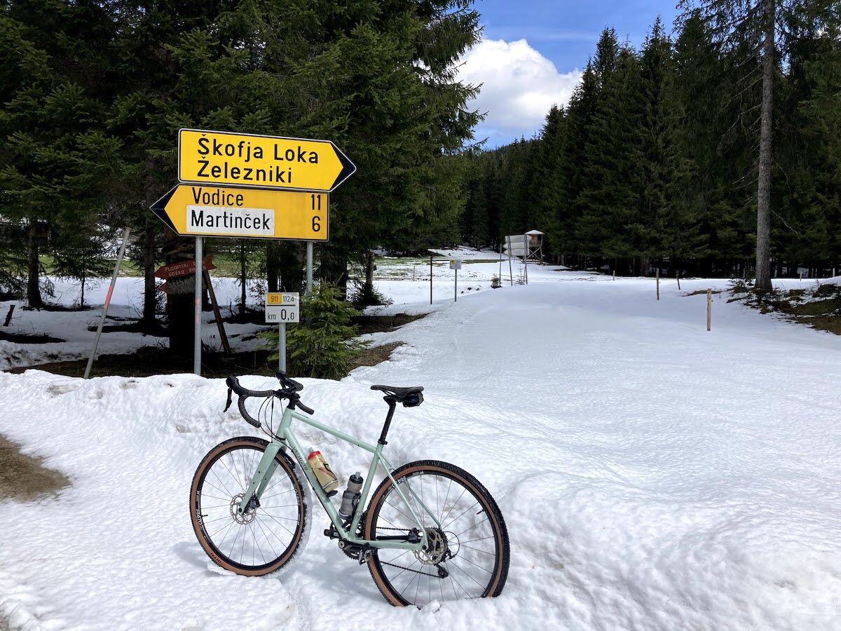
Cycling in the Jelovica area is a wonderful experience where you will feel the majesty of the Slovenian forests. The Rovtarica hut is located at one of the most important forest road junctions on the plateau and provides a starting point for continuing your trip in the direction of Bled, Radovljica and Dražgoše.
- Directions
-
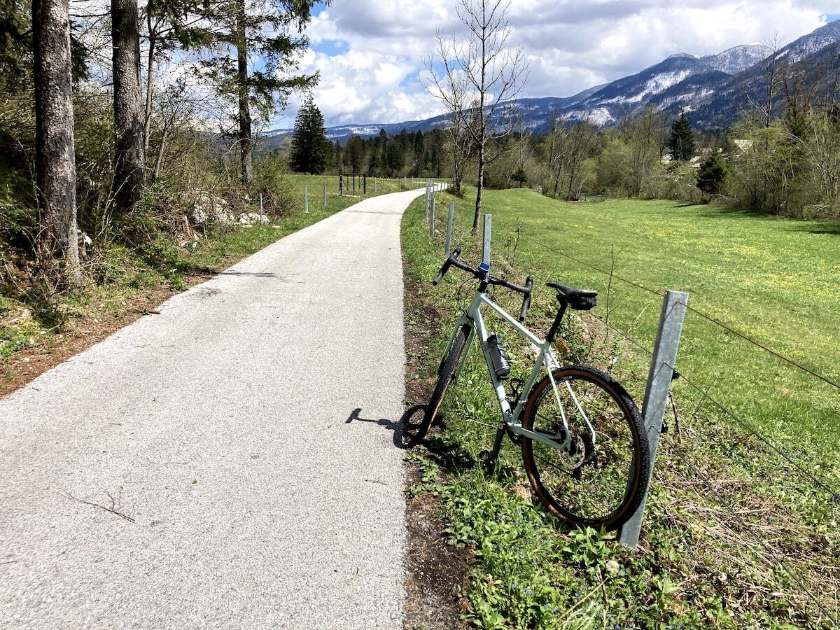
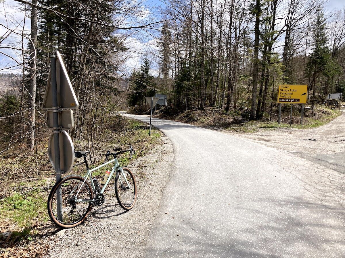
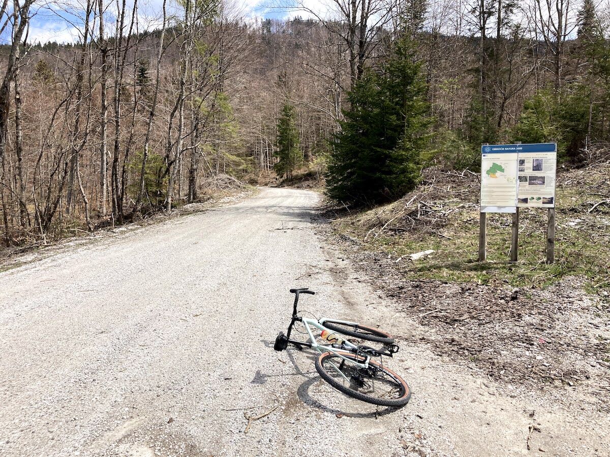
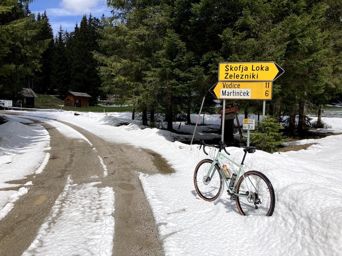
The tour starts in the village of Ribčev Laz in front of the Bohinj Info Centre. From the parking lot in front of the info centre, turn left towards Lake Bohinj. When you reach the bridge, turn right and cross it. You will leave the famous Church of St. John the Baptist. Continue along the road to the village of Stara Fužina and at the first crossroad turn right over the bridge. After crossing, keep right and join the signposted cycling route, which you follow all the way to the village of Bohinjska Bistrica. After about 5 kilometres of cycling, you will reach a small forest where the path branches off to the right. The blue markings of the Slovenian Mountain Biking Trail can also help you. Turn right and after a few dozen metres cross a wooden bridge at Camp Danica. Follow the cycle path past the campsite, the football pitch and the car park to the junction with the main road, where you turn left and join it. Continue straight ahead until you reach a roundabout, where you take the second exit (direction Soriška planina). Continue straight on past the Health Clinic and Hotel Tripič, then turn left at Cecconi Park (on the left). Continue straight on past the park (on the left) and the Sunrose 7 Hotel (on the right) and cross the Belca stream. After crossing the bridge, turn right and go under the railway tracks and follow the road past the Lip factory (on our left). When you get to the crossroad turn left (there is an electrical transformer on the opposite site) and after a few metres turn right (direction Tolmin / Soriška planina). After a few hundred metres the road starts to climb. Stay on the main road and after a few kilometres pass the village of Nemški Rovt (on your right) and continue your ascent. After about 4 kilometres, you reach a crossroad and turn right (there is no signpost, marked direction Tolmin, Škofja Loka, Železniki, Podbrdo, Soriška planina). After a few hundred metres on Bitenjska planina, the asphalt is replaced by macadam and we have about 3 kilometres of gentle ascent to the crossroad where we see the Rovtarica forestry hut ahead of us.
- Highest point
- 1,095 m
- Endpoint
-
Forest hut Rovtarica
- Height profile
-
 © outdooractive.com
 - Equipment
-
Technically flawless bike (gravel bike, mountain bike, trekking bike or e-bike)
Helmet, gloves, sunglasses
Food and beverages in a backpack
Spare tire, pump, multi tool, first aid kit
Personal identity document, health insurance card - Safety instructions
-
The trail runs partly on a cycling route path from Bohinjska Bistrica onwards along the national road, so caution will be needed. From Bitenjska planina onwards, the path is unpaved, so the possibility of slipping increases slightly. Forestry machinery can be found on the forest road, so caution is advised when cycling. Be especially careful when returning towards Bohinjska Bistrica, in case you are returning to the starting point along the same route.
IMPORTANT: The Jelovica Plateau is criss-crossed with forest roads, skidding trails, crossroad and spurs and is difficult to navigate. For easier orientation, we recommend using the GPS track on your phone or navigation device and a map with the routes plotted on it.
- Author
-
The tour BOHINJ I3: TIC Ribčev Laz - Rovtarica is used by outdooractive.com provided.