


- Brief description
-
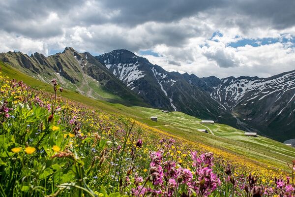
The varied route leads from the Scex Rouge mountain station over the glacier via Quille du Diable and Sanetschsee to Gsteig.
- Difficulty
-
difficult
- Rating
-
- Starting point
-
Col du Pillon, Station of the cable car Scex Rouge
- Route
-
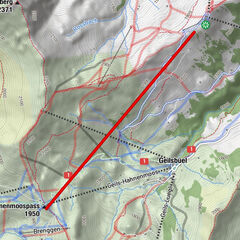
BottaRefuge L'Espace2.6 kmAuberge du Barrage du Sanetsch13.5 kmBären19.4 kmGsteig b. Gstaad (1,184 m)19.4 kmSanetsch19.5 km
- Best season
-
JanFebMarAprMayJunJulAugSepOctNovDec
- Description
-
From Col du Pillon (1545 m) you take the cable car Glacier 3000 to the top station Scex Rouge (2940 m). From there you enjoy a beautiful view over the fascinating alpine panorama and the glacier Tsanfleuron which you cross. Follow the well market trail across the glacier that will take you in a south-easterly direction to the Tour St. Martin (2908 m), situated at the edge of the glacier. Take the descending path at the end of the furthest skilift, there are no crevices on the glacier in this aerea. There is an indicatin near the lift station that directs you towards the Cabane de Prarochet (2555 m). At the spring of the Saane you take the right hand side trail to the Barrgae du Sanetsch (restaurant 2062 m). For the descent to Gsteig (1184 m) you can also take the cable car.
Important: Please check in advance if the hike is open and the condition of the trail.
- Directions
-
Col du Pillon - Glacier 3000 - Cab. de Prarochet - Col du Sanetsch - Barrage de Sanetsch - Gsteig
- Highest point
- 2,922 m
- Endpoint
-
Gsteig
- Height profile
-
 © outdooractive.com
 - Equipment
-
Good footwear, snacks to savor during a break - why not a Fondue-Backpack?
- Safety instructions
-
Inform yourself about the condition of the hiking trail before you start the hike!
- Tips
-
Get a round-trip ticket for this tour. More informations on www.gstaad.ch.
- Additional information
-
Notes
Operating times Sanetsch: 8.30 am - 17.00 pm Please take note of the operating dates for lifts and cable cars.See also
Gstaad Saanenland Tourismus
Haus des Gastes
Promenade 41
3780 Gstaad
Tel: +41 (0)33 748 81 81
E-Mail:
www.gstaad.chInformation, application groups: Talstation Sanetsch, 3785 Gsteig, Tel. +41 58 477 85 75
- Directions
-
The Destination Gstaad is located in the south-west of Switzerland right on the border to the French-speaking part of the country. The Destination is easily accessed by rail or car from the regions around Lake Thun and Lake Geneva and the Gruyere region Direct connections to the European high-speed rail network and all international airports in Switzerland guarantee a time-saving and pleasant journey.
- Public transportation
-
Col-du-Pillon, Glacier 3000
- Parking
-
Parkplatz Glacier 3000 (Col du Pillon)


-

-
AuthorThe tour Glacier 3000 (Scex Rouge) - Sanetsch - Gsteig is used by outdooractive.com provided.


General info
-
Thyon les Collons
1426
-
Coteaux du Soleil
604
-
Gsteig bei Gstaad
170