


- Brief description
-
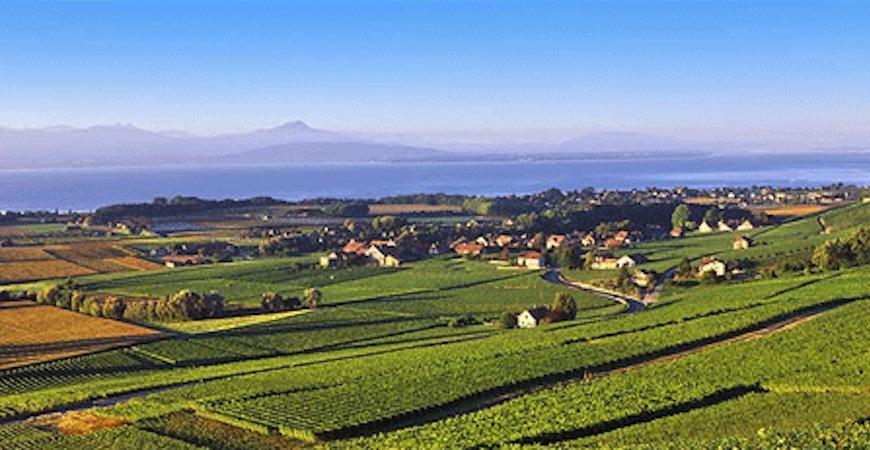
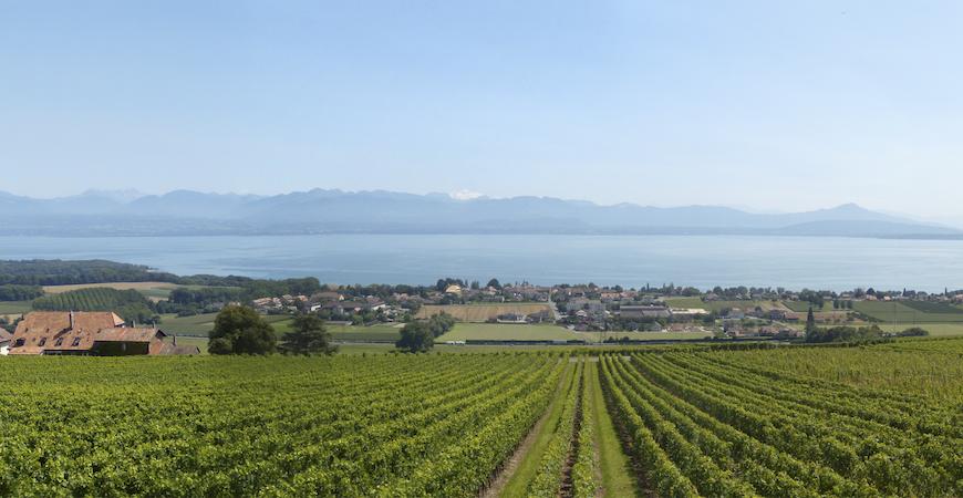
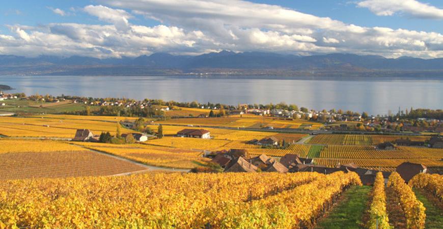
On the edge of Lake Geneva, between Geneva and Lausanne, the rolling hills of La Cote invite you to wander quietly in the vineyards. Discover the charms of the area between Aubonne and Rolle. Enjoy this amazingly scenic trail from which you will be able to see the Mont Blanc on a clear day. In each village you will find spots to taste the local Chasselas and Gamay wines.
- Difficulty
-
easy
- Rating
-
- Starting point
-
Aubonne bus station
- Route
-
Aubonne0.2 kmDomaine de Riencourt3.9 kmAuberge Communale4.1 kmBougy-Villars (548 m)4.2 kmRolle (376 m)7.0 kmRolle (402 m)7.3 km
- Best season
-
JanFebMarAprMayJunJulAugSepOctNovDec
- Description
-
On the edge of Lake Geneva, between Geneva and Lausanne, the rolling hills of La Cote invite you to wander quietly in the vineyards. Discover the charms of the area between Aubonne and Rolle. Enjoy this amazingly scenic trail from which you will be able to see the Mont Blanc on a clear day. In each village you will find spots to taste the local Chasselas and Gamay wines.
- Directions
-
Aubonne bus station – take the rue du Chêne - walk into the village of Aubonne – turn left on Grande Rue – climb to the Porte du Bourg de Four and turn left on rue Chaffard – cross the main road and continue on to route de Bougy for 200 meters – turn left on to Sous Bougy – walk 300 meters and turn right on chemin des Curzilles (1.3 kilometer) – climb 20 meters and turn left onto chemin des Ballenches – continue straight (option: turn left and walk down the route de Bougy to Fechy-Dessus to visit the church and the ampelographic garden and return to where you left) - continue up to Bougy - cross the village - as you exit turn left and follow the road down 50 meters then turn right into the vineyards continue straight ahead to Les Plantaz when you have no choice but go down to route de l’Etraz – follow this road - prior to the village of Mont sur Rolle turn right and take the route du lac to cross the motorway – continue and after the train line turn right on a small path to the train station.
- Highest point
- 548 m
- Endpoint
-
Rolle train station
- Height profile
-
 © outdooractive.com
 - Equipment
-
Comfortable walking shoes
- Public transportation
-
Go to Allamand train station and take the bus to Aubonne
- Author
-
The tour Swiss fine wine trail - La Côte is used by outdooractive.com provided.
GPS Downloads


General info
Refreshment stop
A lot of view
Other tours in the regions
-
Yverdon-les-Bains / Nord Vaudois
328
-
Morges Region
187
-
Perroy
26