
© Pilgerwege Schweiz - Robi Müller
© Pilgerwege Schweiz - Robi Müller
© Pilgerwege Schweiz - Robi Müller
© Pilgerwege Schweiz - Robi Müller
© Pilgerwege Schweiz - Robi Müller
© Pilgerwege Schweiz - Robi Müller
© Pilgerwege Schweiz - Robi Müller
© Pilgerwege Schweiz - Robi Müller
© Pilgerwege Schweiz - Robi Müller

© Outdooractive – 3D Videos
- Brief description
-
Die «Via Francigena» ist einer der 3 christlichen Pilgerwege des Mittelalters, dessen Hauptachse von Canterbury in England nach Rom führt. Diese Dokumentation umfasst vorerst den Abschnitt von Pontarlier nach Rom.
- Difficulty
-
medium
- Rating
-
- Starting point
-
Aigle, Market-Place
- Route
-
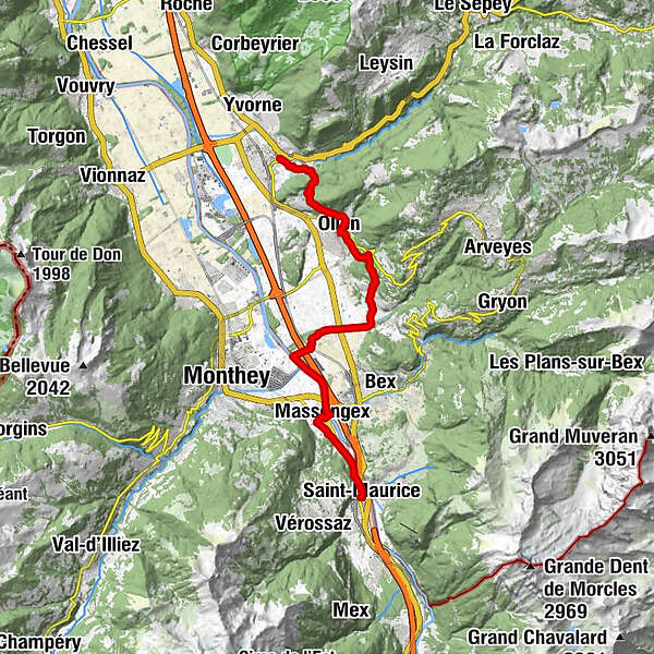
Aigle (415 m)Le Cloître0.4 kmOlun (478 m)4.3 kmHôtel de Ville4.3 kmLa Fin du Buit6.5 kmAbbaye de Salaz7.6 kméglise St-Jean-Baptiste14.0 kmMassongex (408 m)14.1 kmMassongex (399 m)14.3 kmBasilique Saint Maurice17.3 kmSaint-Maurice (414 m)17.3 km
- Best season
-
JanFebMarAprMayJunJulAugSepOctNovDec
- Description
-
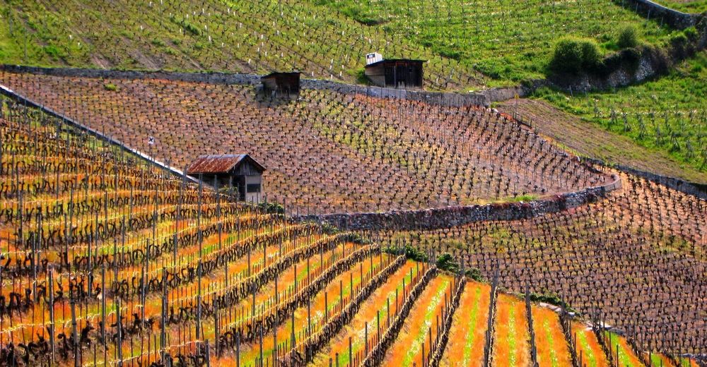
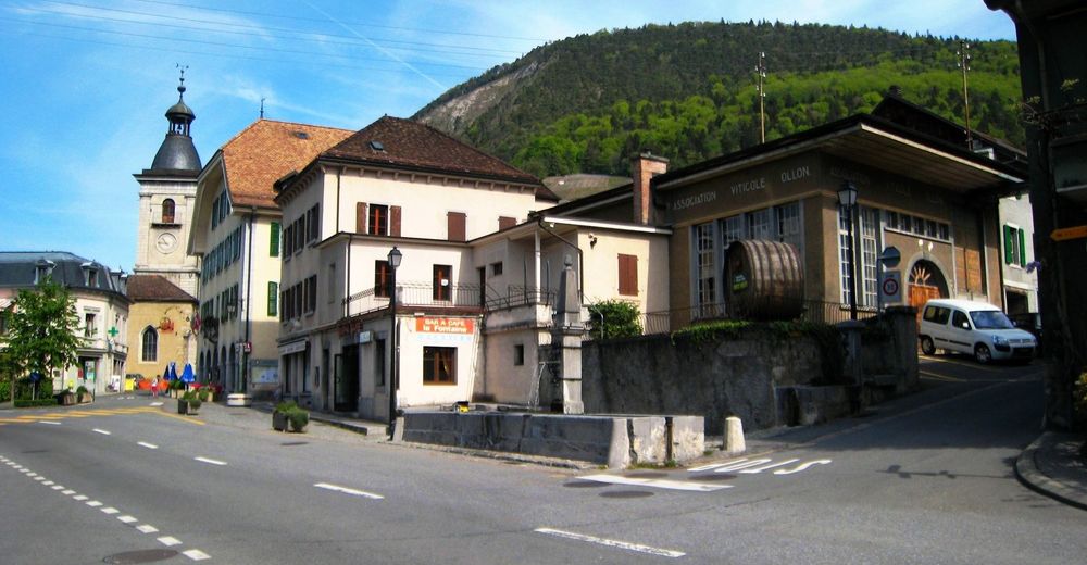
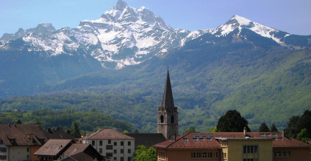
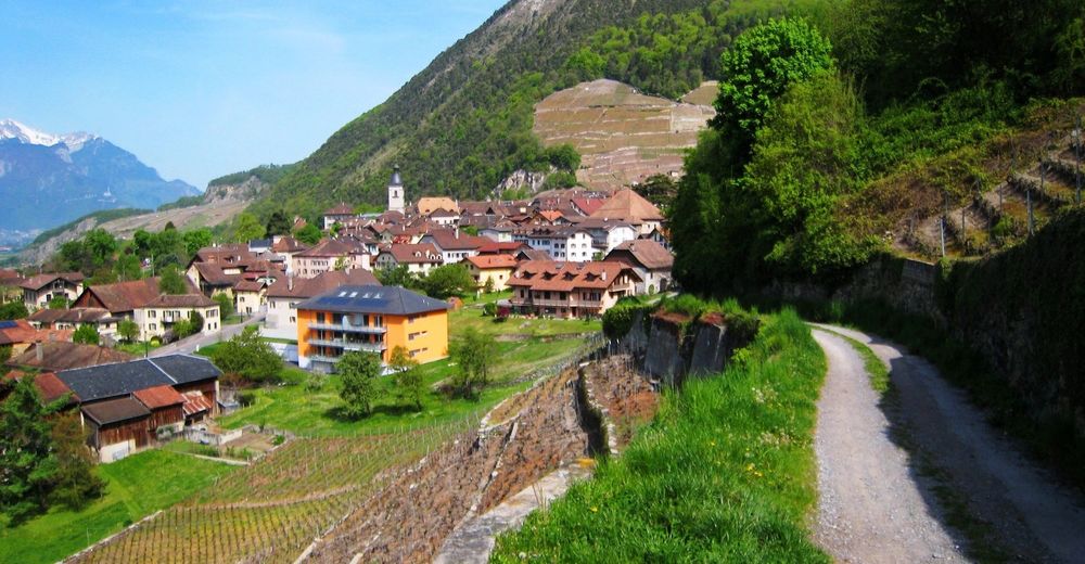
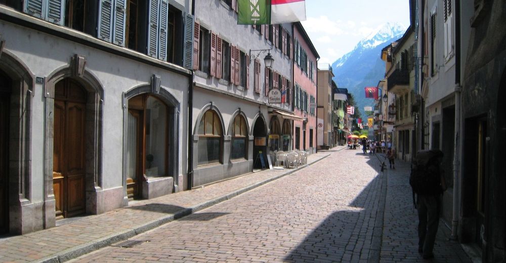
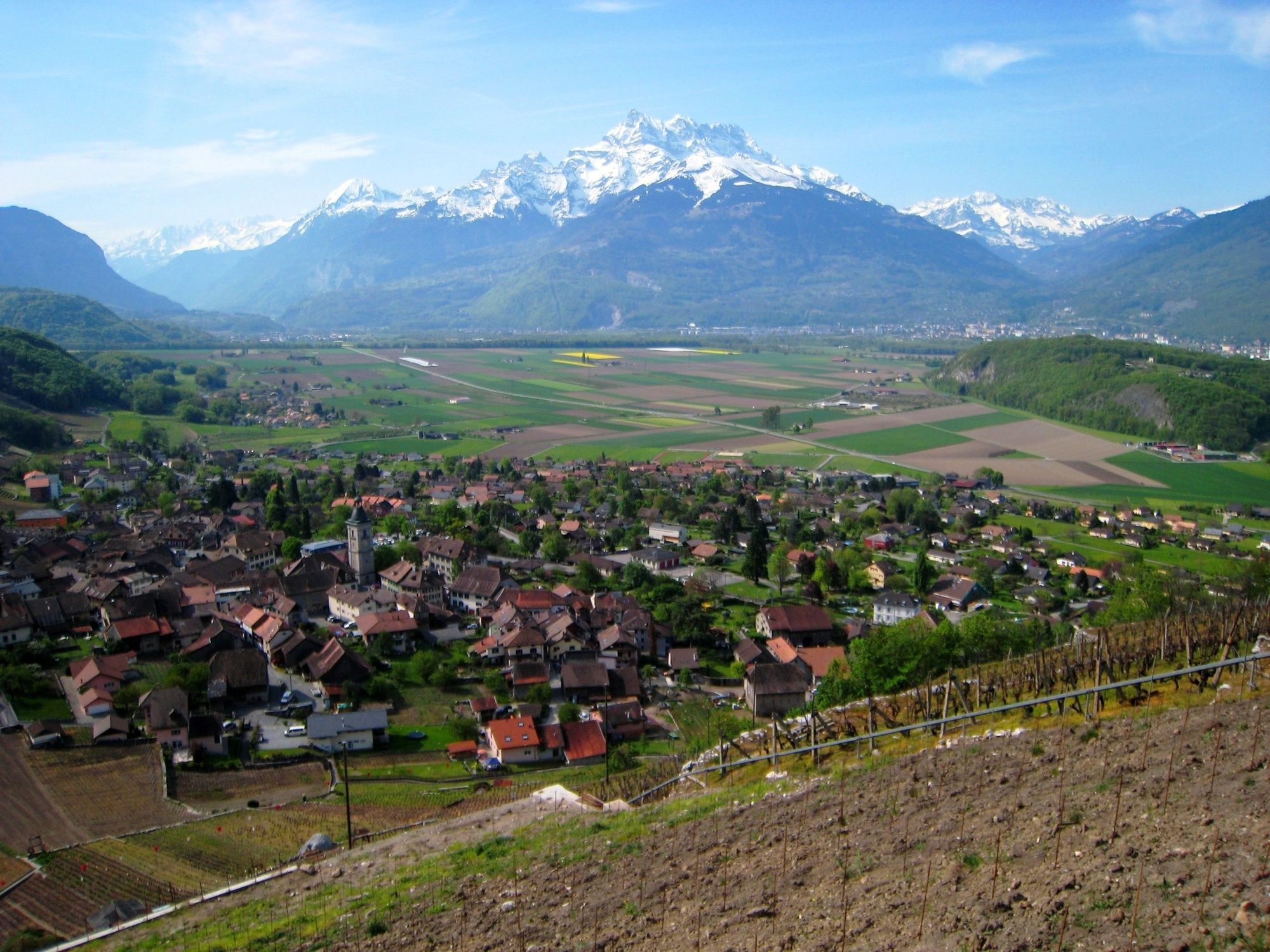
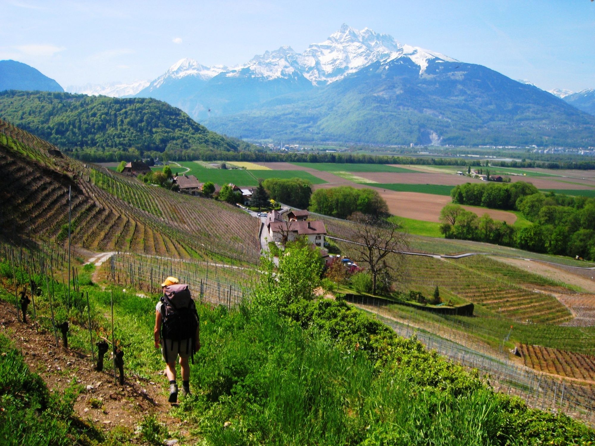
This section takes us from Aigle in canton Vaud to St. Maurice in canton Wallis. Once we leave Aigle direction south-east starting from the Market-Place through the vineyards, we soon will reach the Aigle Castle of the 13th century. Today, it serves as a museum for vintage and vines. Along the mountainside, we get to Ollon, through vineyards first, then in the shadow of a forest.
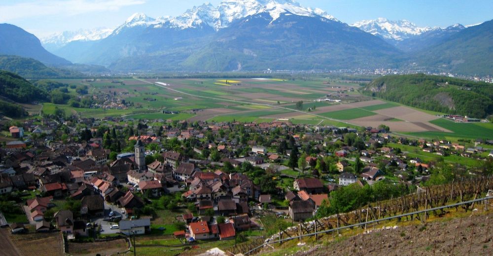
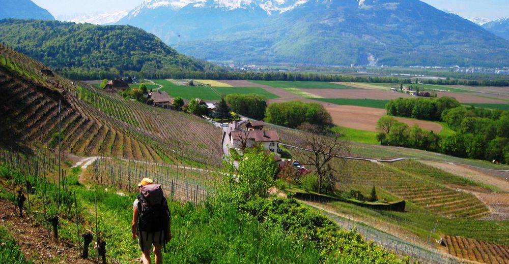
Behind Ollon, we hike across another height, before we cross a road at the entrance of the village Antagnes, and then reach the «La Gryonne» creek below the village. We follow this creek on the left bank, cross the railway and the highway, and reach the River Rhône a first time close to «Iles d´Amont», and then we follow the Rhône against its flow.The settlemen across the river, with major chemical plants, in canton Wallis already, is named Monthey.
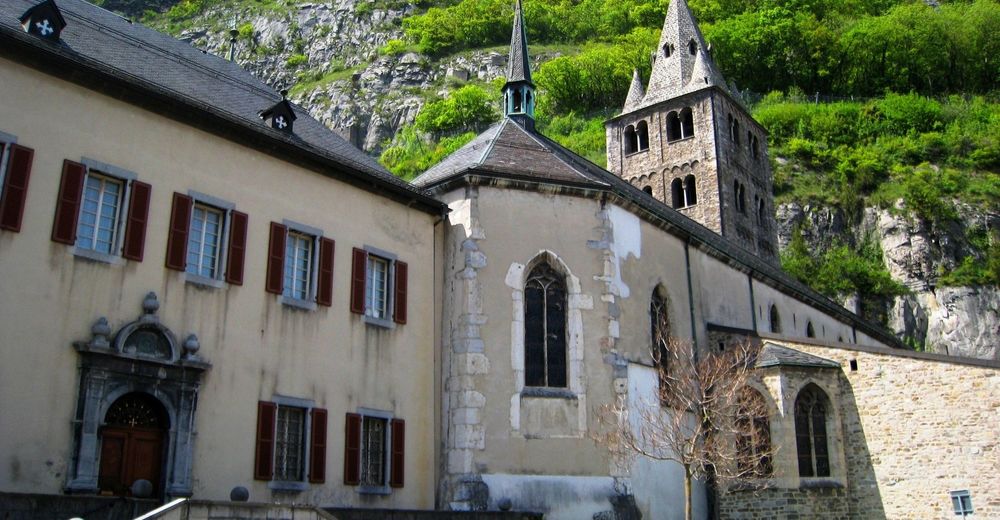
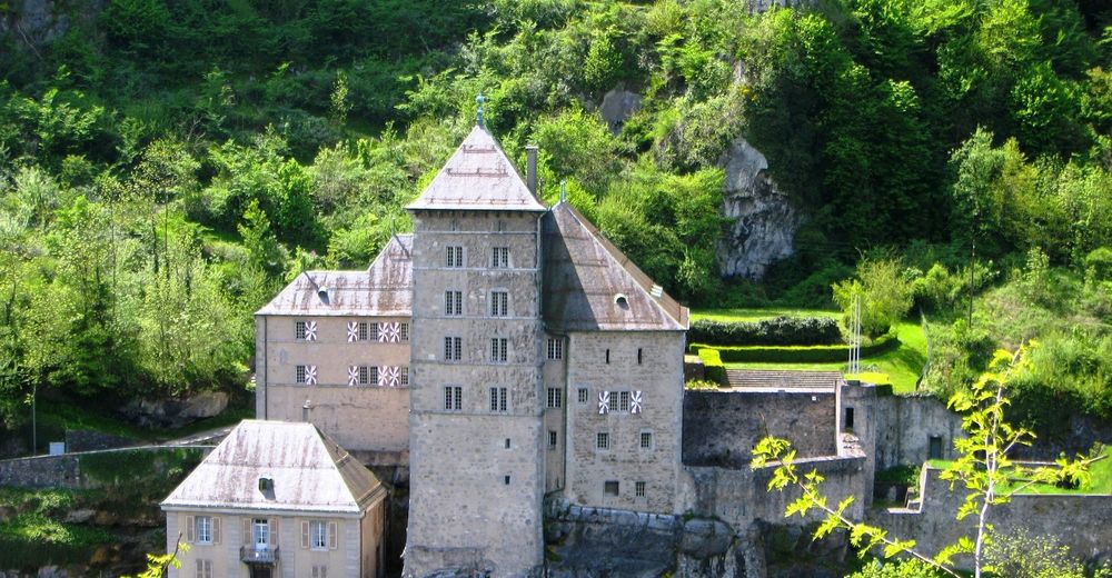
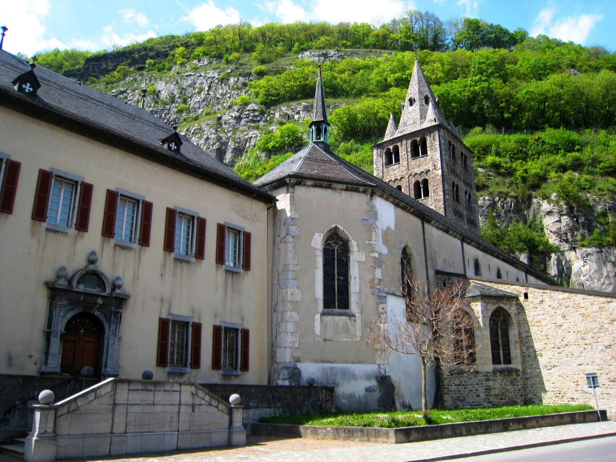
We cross the river Rhône close to Massongex and enter the canton Wallis. At the entrance of St. Maurice, where the road and the river squeeze through a rocky bottleneck, we pass by a castle dating back to 16th/18th century, which serves as a museum for military history since 1815. St. Maurice with it´s Abbey already in the middle ages was an important place for pilgrims on their way to Rome - we should feel comfortable here as well.
Note(s)
The «Via Francigena» is one of the 3 main christian pilgrimage trails of the Middle Ages, the main axis leading from Canterbury to Rome. This documentation currently covers the stretch from Pontarlier close to the F/CH border across Lausanne to Rome. - Highest point
- 642 m
- Endpoint
-
Saint Maurice bei der Abtei
- Height profile
-
 © outdooractive.com


- Author
-
The tour Via Francigena: Aigle - St-Maurice is used by outdooractive.com provided.
GPS Downloads


General info
Refreshment stop
Cultural/Historical
A lot of view
Other tours in the regions
-
Alpes Vaudoises
993
-
Villars - Gryon - Les Diablerets - Bex
542
-
Bex
160


