


- Brief description
-
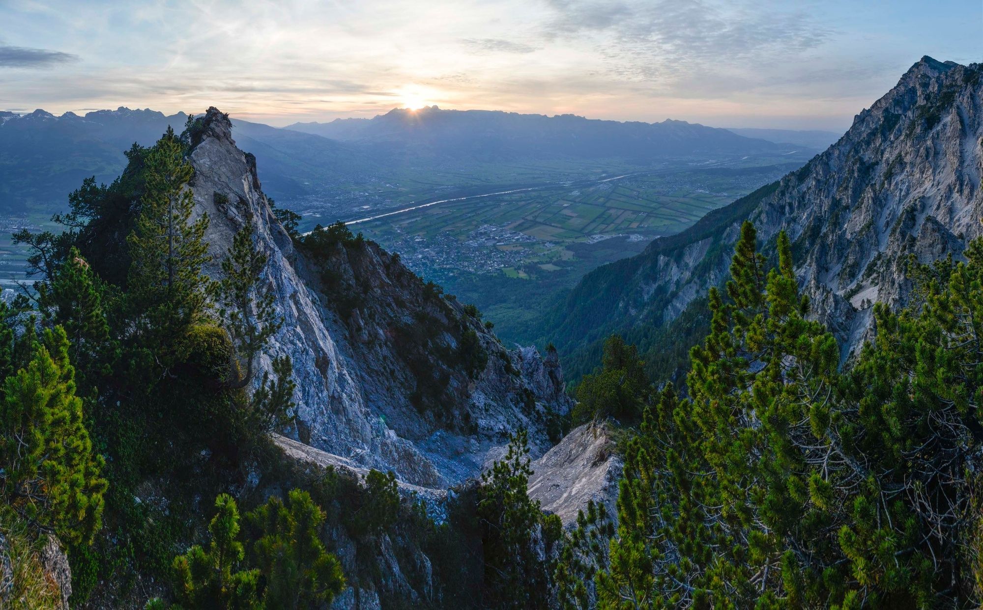
The Alpspitz soars above Bargälla with its promising views. The Fürstensteig, leading through its west flank, is the most famous trail of the Rätikon- a first class hike full of contrasts and and surprises.
- Difficulty
-
medium
- Rating
-
- Route
-
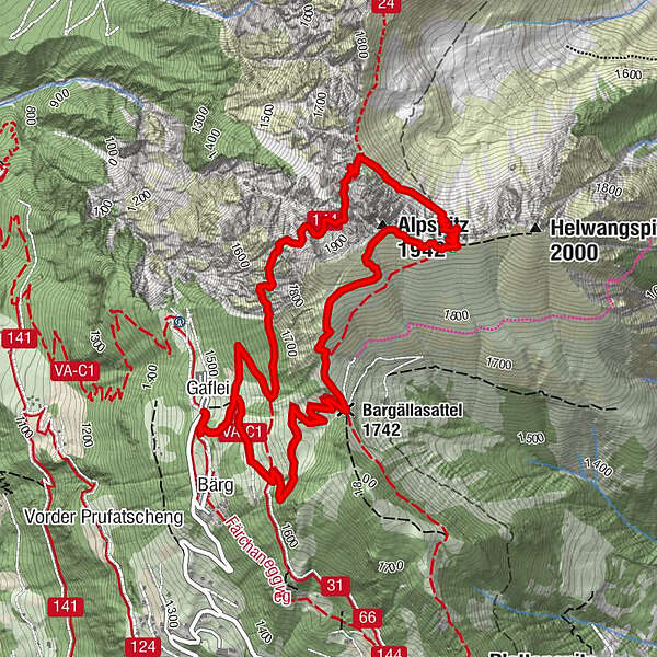
GafleiBargällasattel (1,742 m)1.8 kmAlpspitz (1,942 m)2.8 km
- Best season
-
JanFebMarAprMayJunJulAugSepOctNovDec
- Description
-
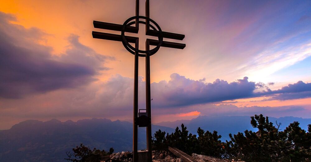
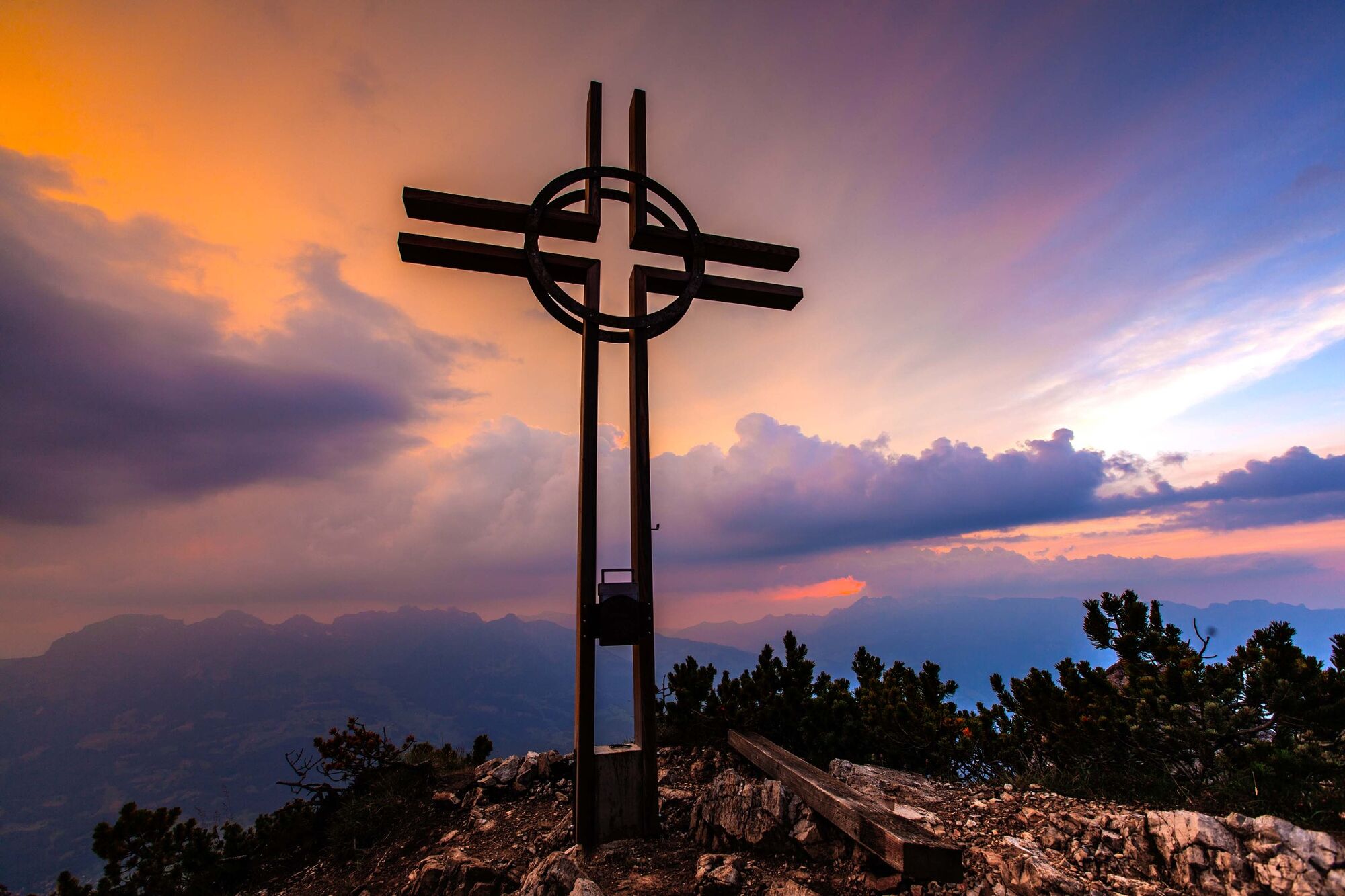
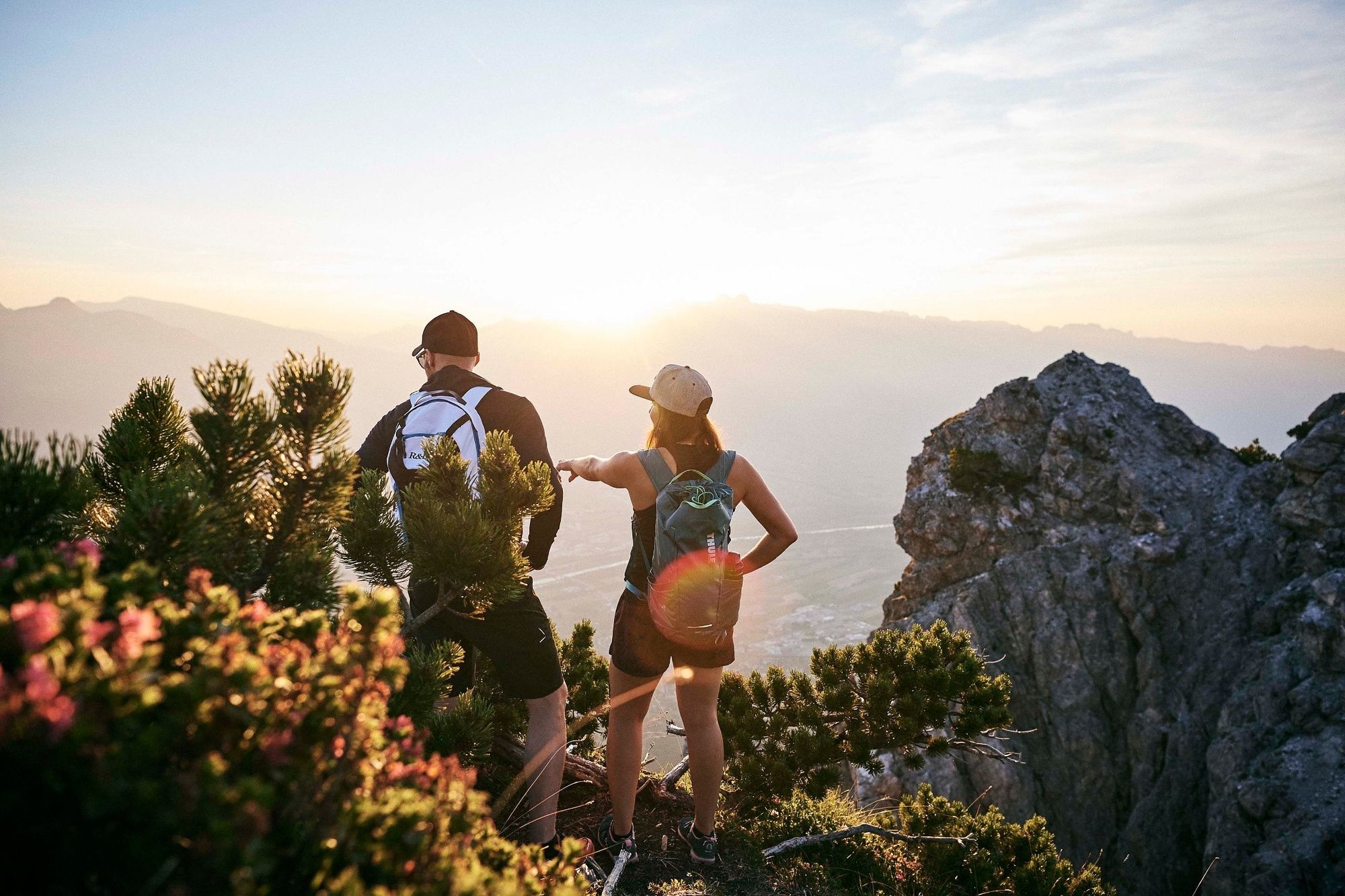
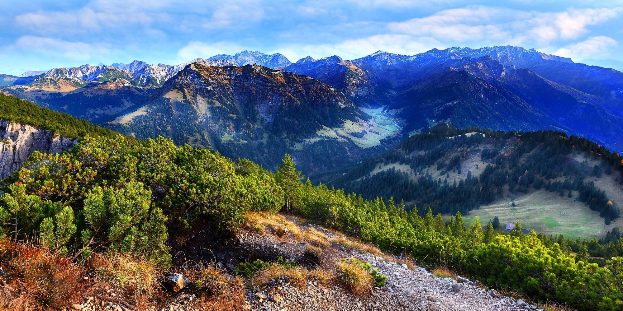
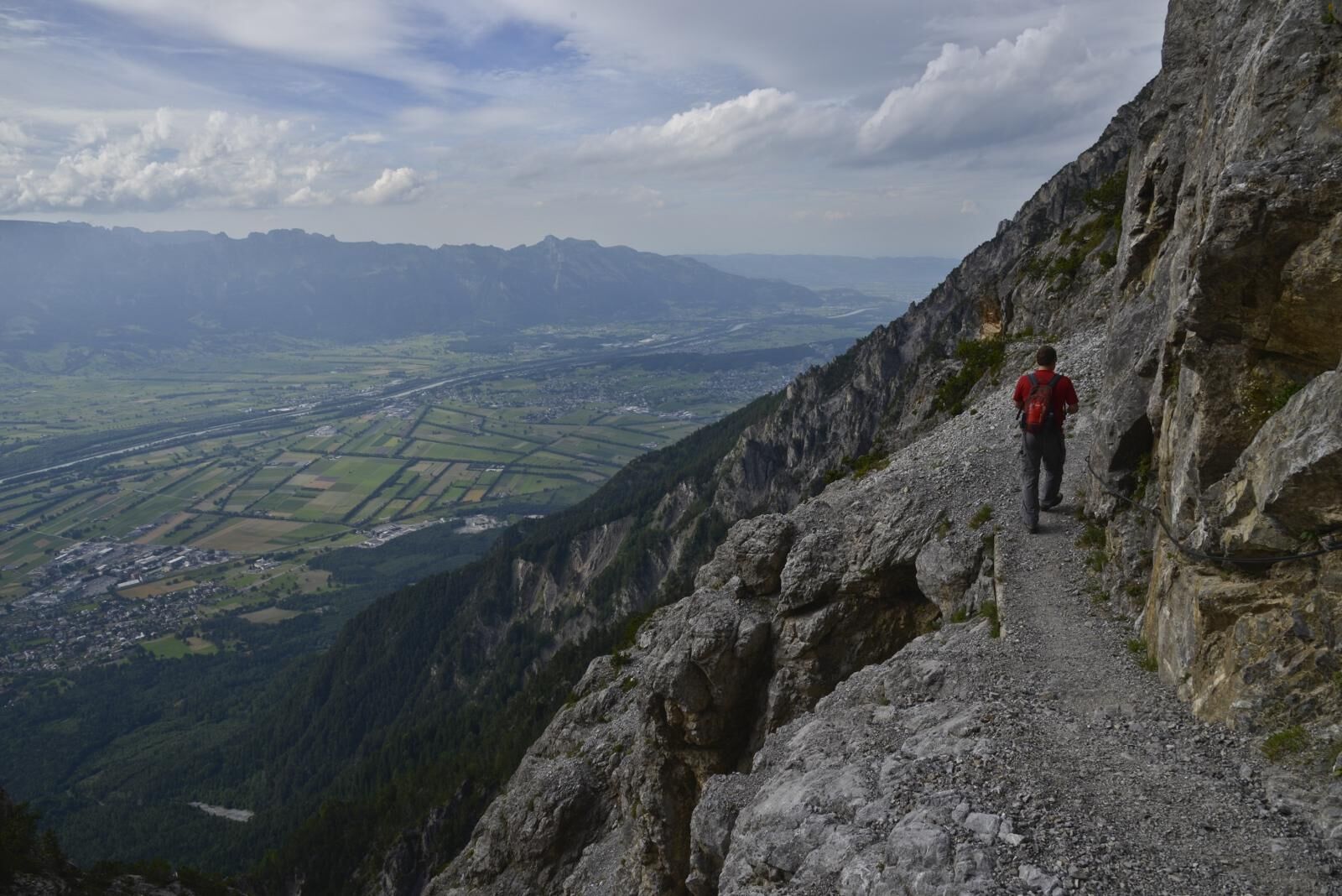
From Gaflei, the alpine trail winds its way through the sloping pastures of the Bargälla Alp up to its saddle where you can view the entire chain of Liechtenstein mountains including all their valleys and summits. Here, the summit of Alpspitz is at your fingertips. Now the trail takes you through the mountain pines, past the geographical center of Liechtenstein and up to the mountain cross - time for a break with a beautiful view at the oldest summit cross in Liechtenstein. In 1944, Martin Bamert, the Chaplain from Vaduz, had the cross erected, which can be seen for miles. From Alpspitz, the trail continues through the mountain pines to the Kamin, also sign posted as «Chemi» (Chimney), down a steep path through a gap below the Helwangs peak, and along the path below the Alpspitz Schrofen to join up with the Panorama Trail (Via Alpine) at the Gaflei saddle. Here you can decide whether you want to continue on and take the Fürstensteig Trail or turn back along the same route to the starting point in Gaflei.
- Highest point
- 1,970 m
- Endpoint
-
Gaflei
- Height profile
-
 © outdooractive.com
 - Safety instructions
-
Sturdy footwear and surefootedness are required.
Going on a tour requires careful planning. We recommend that you discuss the routes and weather conditions with the local information points in advance. Depending on the season and weather conditions, this route may be closed or interrupted.
- Tips
-
Food & drink:
Berggashaus Matu in Gaflei, phone +423 262 38 20

-

-
AuthorThe tour Alpspitz - Liechtenstein's first summit cross is used by outdooractive.com provided.
General info
-
Heidiland
2204
-
Liechtenstein
1287
-
Vaduz
258


