- Brief description
-
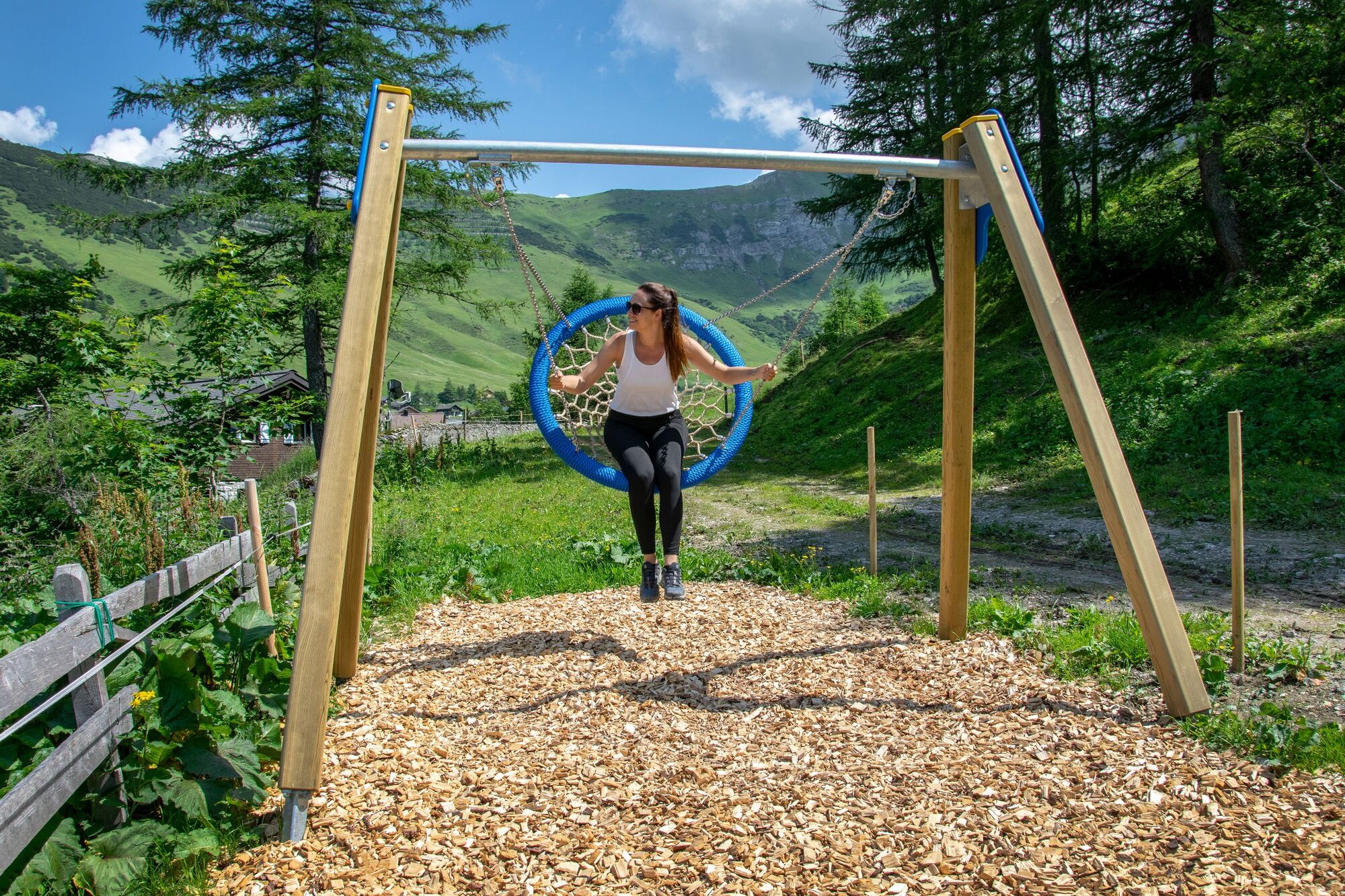
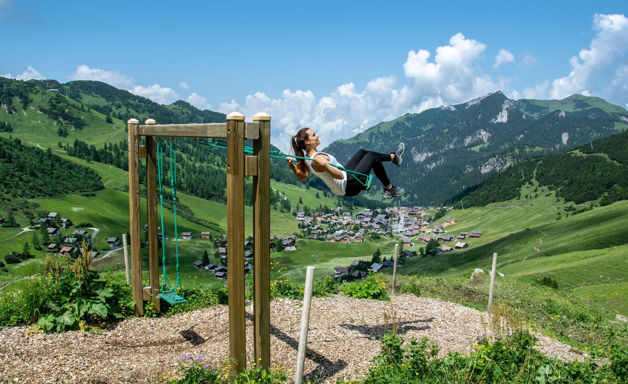
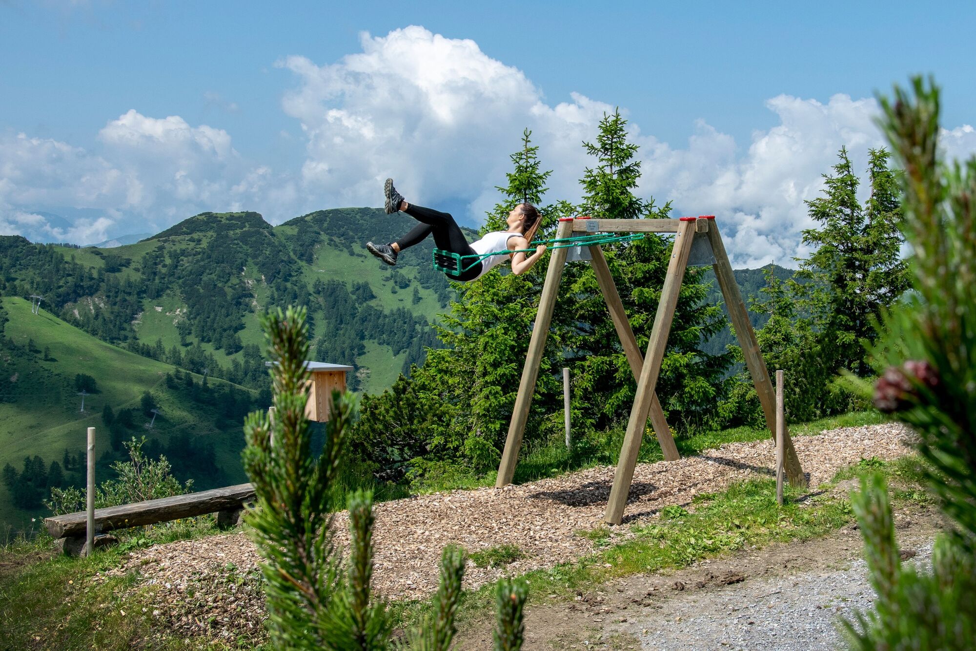
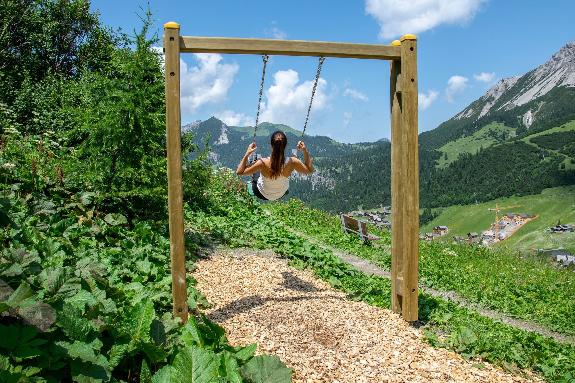
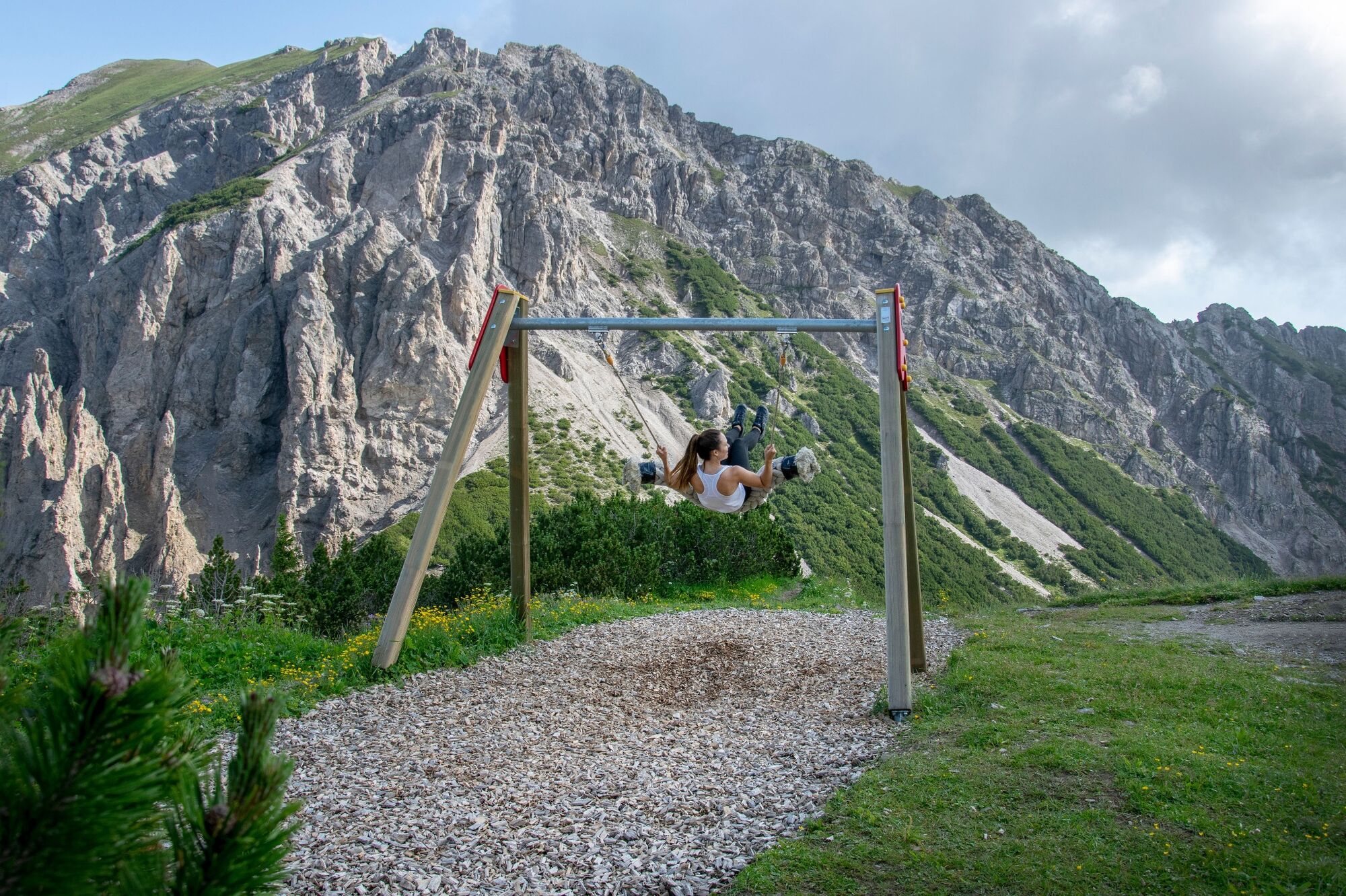
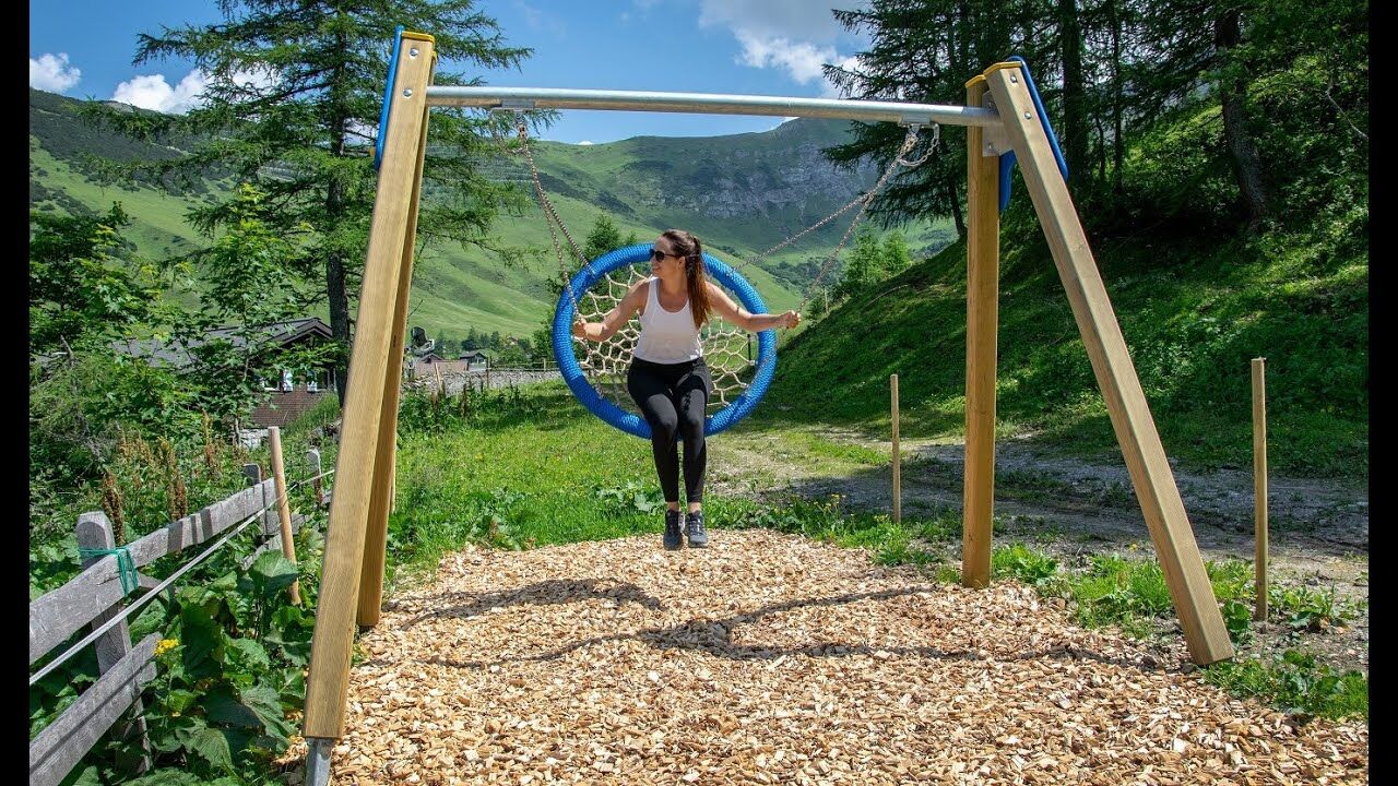
In Malbun, young and old can enjoy spectacular open-air swings with fantastic views along the swing trail. The swing trail is a source of fun for the whole family and the young at heart. In addition, the trail presents a completely different side of the Liechtenstein mountains. The easy hiking route, along which you can catapult yourself into the air on a total of ten swings, extends over 5.5 km and can be completed in around two hours. The trail is also easy to for children from the age of five to master.
- Difficulty
-
easy
- Rating
-
- Starting point
-
Mountain restaurant Sareis
- Route
-
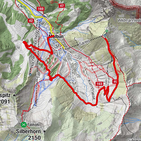
Bergrestaurant SareisMalbun5.4 km
- Best season
-
JanFebMarAprMayJunJulAugSepOctNovDec
- Description
-
The Sareis chairlift takes you to the starting point at the Sareis mountain station at an altitude of 2000 metres above sea level. The swing trail begins just above the mountain station, where the first of the larger swings is located. From the Sareis mountain restaurant, the trail leads to the next swing along the unpaved track to Alpe Turna. Amidst the Malbun landscape, with its stunningly lush and green alpine meadows with dreamy mountain flora and the mountain range of the Malbun valley, we first descend to Turna. Even before the Alpe is reached, the next swing is waiting for you. On this, you can catapult yourself into the air and back again. This is fun not only for children. Adults also enjoy these swings, because they are seemingly transported back to their own childhood.
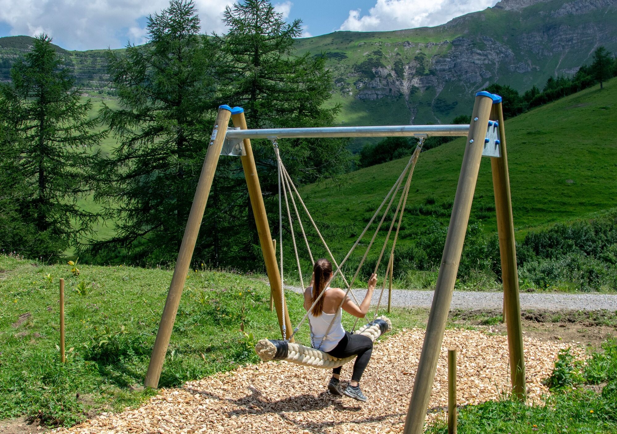
The trail continues leisurely down the valley through meadows, past grazing cows, then continues over the little bridge of the Malbunbach and climbs again up the other side of the valley, the territory of the Municipality of Vaduz. The leisurely and steadily ascending winding trail ascends to Alp Pradamee. Before reaching Pradamee, a large swing awaits, on which three people can actually swing together and which is guaranteed to provide fun and more than a little laughter. From here, the trail descends once again and brings day-trippers back to Malbun, where they can relax and recuperate in one of several restaurants. The swing trail combines a leisurely hike with youthful fun and thrills on swings with different levels of difficulty.
- Highest point
- 1,973 m
- Endpoint
-
Malbun center
- Height profile
-
 © outdooractive.com
 - Safety instructions
-
Going on a tour requires careful planning. We recommend that you discuss the routes and weather conditions with the local information points in advance. Depending on the season and weather conditions, this route may be closed or interrupted.
- Tips
-
The ideal way to reach the Sareis mountain restaurant with ease is to take a ride on the Sareis chairlift.
The mountain restaurant can also be reached on foot in about an hour from Malbun, entailing a gain in altitude of 400 metres.
- Additional information
-
Recommended from June – October
Use is free of charge
- Directions
-
Exit A13 Vaduz, then go into the direction of Triesenberg until Malbun.
- Public transportation
-
Bus line 21 (Triesenberg-Malbun) goes from Vaduz Post to Malbun center.
- Parking
-
Parking is available at the beginning of the village.

-

-
AuthorThe tour Malbun swing trail is used by outdooractive.com provided.


General info
-
Heidiland
2201
-
Liechtenstein
1289
-
Malbun
308