


- Brief description
-
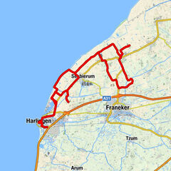
Part 2 of the archaeological route starts and ends in Firdgum, a very small village located on four terps (man-made dwelling mounds).
- Difficulty
-
easy
- Rating
-
- Route
-
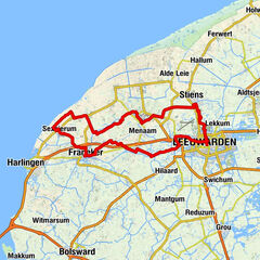
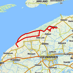
FirdgumDijkshoek1.5 kmWesthoek3.1 kmWaddenherberg ‘The Friezinn’3.2 kmNij Altoenae10.1 kmOudebildtdijk10.5 kmOudebildtzijl14.9 kmEetcafé Het Grauwe Paard15.1 kmFiifhuzen17.9 kmFerwert25.0 kmHegebeintum28.3 kmFerwert30.0 kmMarrum35.0 kmGodeharduskerk35.2 kmKota Radja35.5 kmDe Pannekoektrein36.0 kmWesternijtsjerk36.6 kmZwarte Haan48.4 kmDe Zwarte Haan48.4 kmWaddenherberg ‘The Friezinn’55.8 kmDijkshoek57.4 kmFirdgum58.5 km
- Best season
-
JanFebMarAprMayJunJulAugSepOctNovDec
- Description
-
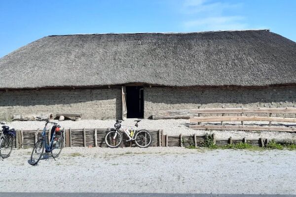
See a turf house at the Yeb Hettinga Museum and experience how the residents lived before there were seawalls. Farms like this were located on small terps that often grew into villages. Good examples of this are Marrum and, in particular, Ferwert which you will encounter further on.
The terp highlight that is Hegebeintum comes after this. A visitor centre shows how people fought against and worked with the sea for centuries. Life was good on terps, surrounded by fertile ground and staying dry and out of reach of the sometimes advancing sea.
Before you get that far, you first cycle from Firdgum through Het Bildt. Flat country. No terps. This is where the Middelzee emptied into the Wadden Sea, but it eventually silted up. The surrounding terp countryside was protected by dikes in the meantime. In 1500, this also became good agricultural land due to the reclamation of Het Bildt.
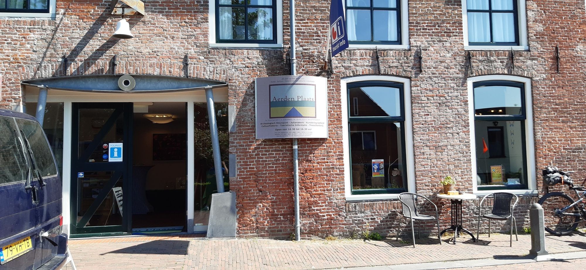
Sint Jacobiparochie and Sint Annaparochie were villages for the mud flat and dike workers, who constructed the Oudebiltdijk. The small houses show that the work was not high-paying. You cycle over the dike to the picturesque Oudebildtzijl, where one of the two locks were created in the dike. This was followed a hundred years later by the Nieuwebiltijk and finally the current seawall. Visit the Archaeological Support Point in the Aerden Plaats visitor centre in Oudebildtzijl to learn more about it.
The new De Heining pumping station makes it clear that water management is continuing to develop. This fish-friendly and safe installation ensures that fresh and salt water can make a better connection, which benefits the salt marsh plants and wading birds. You pass it twice. The salt marsh outside the dikes gives an impression of what the entire Wadden coast once looked like.
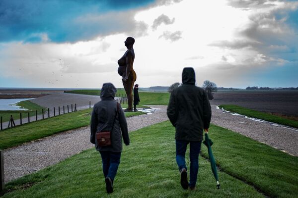
On the way back you cycle along the seawall to Zwarte Haan, which also has a pumping station and the De Slikwerker sculpture. The sculpture is an ode to the men who reclaimed Het Bildt from 1505 onwards. A job that took two and a half centuries on and off. The land was reclaimed from the sea little by little. It was incredibly hard work in often difficult conditions.
Because it was lovely during the spring sunshine or on a warm summer day, but imagine it on a wet, cold autumn day - of which there were many - since the reclamation of 't Bildt coincided with the so-called Little Ice Age, when everywhere in Europe it was just a few degrees colder than it is now - with no shelter whatsoever from the bleak wind that blows mercilessly from across the Wad.
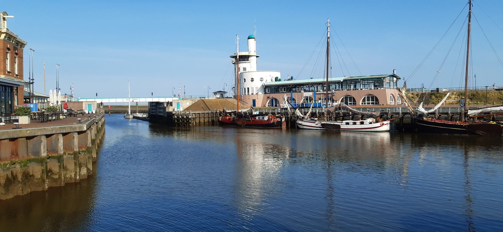
Zwarte Haan is now an example of the good life along the Wadden Sea coast, thanks to the restaurant of the same name at the bottom of the dike. It's a good idea to plan your route so that you arrive here at a good time for a Wadden gold certified lunch or dinner. It is a wonderful prelude to the last ten kilometers back to Firdgum.
Museums of Terpenland (Terpen country)
Four small archaeology museums along the Wadden coast are working together under the name Terpenland. Three are located along this route: in Firdgum, Oude Bildtzijl and Hegebeintum. Want to visit the fourth? It’s in Wijnaldum, on the Archaeological route Wadden coast Friesland part 1.
- Highest point
- 2 m
- Endpoint
-
Camstrawei 21 18, 8852 RH Firdgum
- Height profile
-
 © outdooractive.com


- Author
-
The tour Archaeologicial wadden region - Friesland Part 2 is used by outdooractive.com provided.


General info
-
Ameland
6
-
Leeuwarden
7