
- Brief description
-
There are many different ways to reach the Roßkofel. The following tour description is just one but an interesting and not too difficult option. Starting at Tröpolach, take the Millennium Express for a leisurely uphill ride to the Madritsche. An „environmentally friendly start“ to the most beautiful parts of the Carnic Alps, so to speak.
The car will be left in the valley for the day.
- Difficulty
-
difficult
- Rating
-
- Starting point
-
Madritsche (1.919 m)
- Route
-
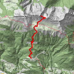
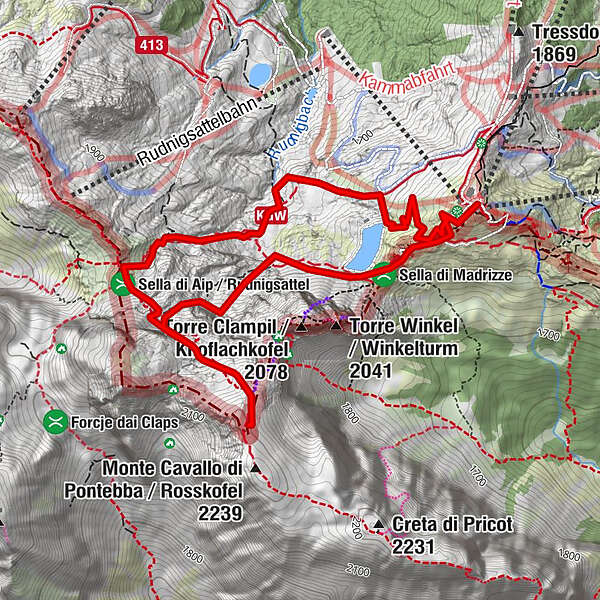
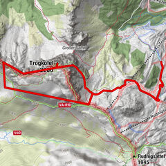
Madritschen (1,918 m)0.0 kmSella di Madrizze (1,832 m)0.6 kmRudnik-Sattel3.5 kmMadritschen (1,918 m)6.0 km
- Best season
-
JanFebMarAprMayJunJulAugSepOctNovDec
- Description
-
There are three mountains that characterise the summit area surrounding the Nassfeld:
The Gartnerkofel (2195 m), the Trogkofel (2280 m) and the Roßkofel (2240 m). Just like at the Trogkofel, the border between Austria and Italy also runs across the Roßkofel. By the way, its Italian name is „Monte Cavallo di Pontebba“.
„Cavallo“ is Italian for the word „horse“ and the town of Pontebba is known to everyone who has already taken a downhill ride from the Nassfeldpass to the Kanaltal Valley. Why our friends in the South gave the mountain this name becomes clear when you see the mountain or when you actually stand on it.
One thing is clear and „rock solid“:
The Roßkofel has some special geological features to offer. Firstly, there is the „summit hood“ which is formed by Carboniferous rocks, which in turn lay on top of older coralline limestone formations from the Devonian period. As the result of mountain forming processes during the earlier Carboniferous period, this limestone formation was bent into a north-turning fold. Just like at the neighbouring Trogkofel, intensive weathering, erosion and karstification set in, leaving only a sort of limestone ruin of the Devonian limestone formation.
Crevices, pockets or small basins, formed during this period and still containing sandy sediments from the Upper Carboniferous age, are crossed during the climb up to the summit.
The „Schneefinkenmulde“ is situated between the Rudnig Saddle and the main summit. The entrance to the „Klondike Cave“, which was discovered at border point p-26 in 1983, is also nearby. It is the largest and longest currently known cave within the four cave systems of the Roßkofel. The cave is 1453 m deep and has a gradient of 677 m. There is plenty of water – karst water worth protecting – which is mainly a benefit to our neighbours in the South.
You can be assured that there are plenty of roaring waters and a widely ramified cave system beneath your mountain boots during your Roßkofel hiking tour. By the way, the karst river in the lower part of the cave has been named „Yukon“ by speleologists and is the most impressive drainage system.
- Directions
-
Ascent :
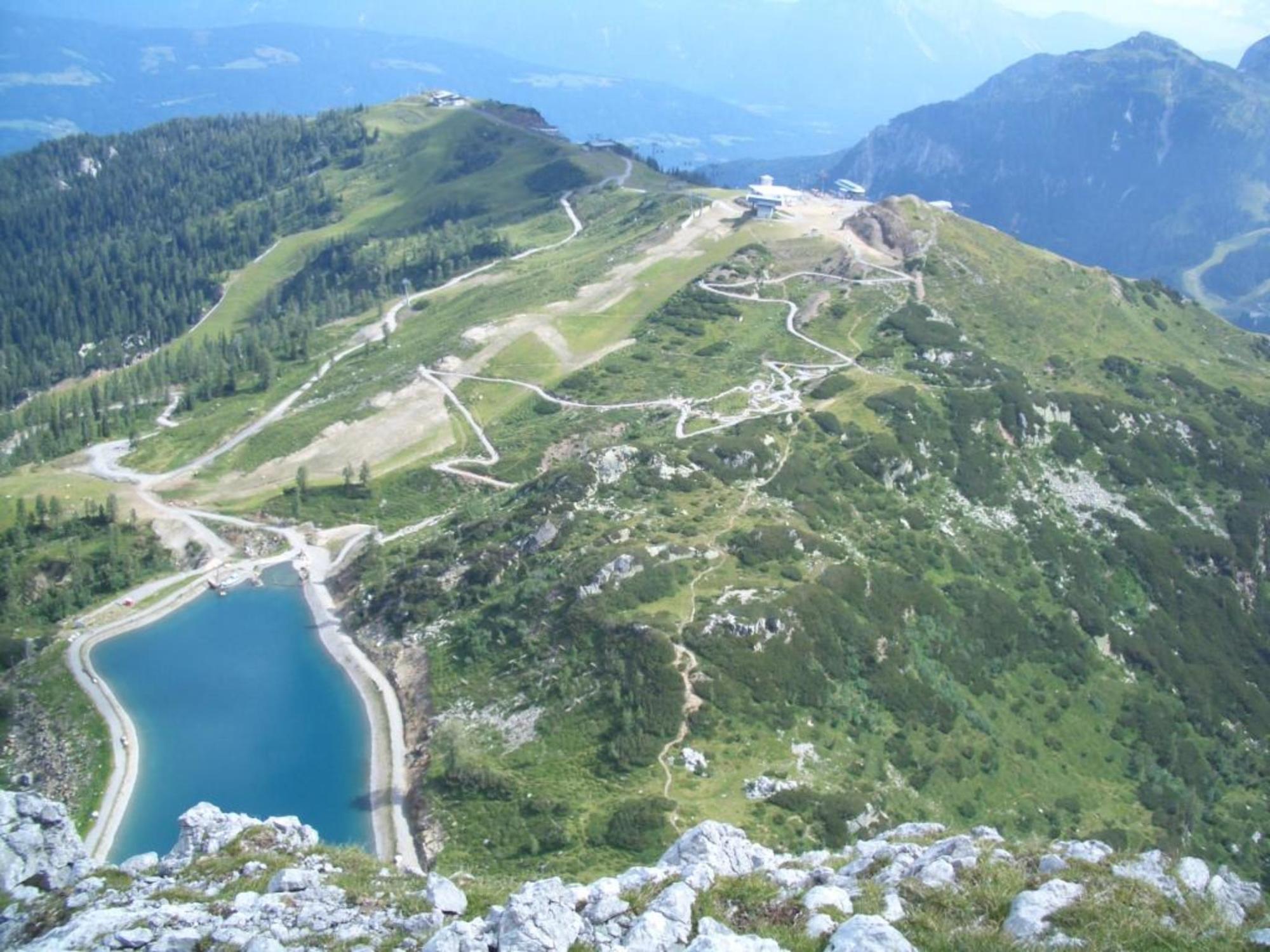
Leave the gondola at the upper terminus „Madritsche“ and turn your view to the south of the plateau. There you will see a portal made of gnarly trees. Walk toward the portal and start the 1.5 km long family adventure trail „Aqua Trail Bergwasser“. From there, you will already see the Roßkofel on the opposite side. Only a few metres in ascent and descent are between you and the Roßkofel.
Walk the many serpentines of the well-maintained hiking trail downhill to the water reservoir. Take your time and enjoy the many artistically arranged features.
Walk around the west side of the reservoir – past a moored sailing boat – and you will reach the south shore of the reservoir from where the ascent begins.
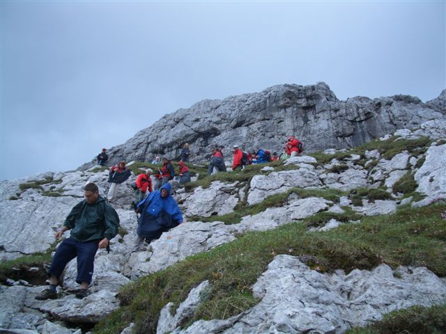
The ascent trail is well-marked and leads through a beautiful chaos of small and large rocks for around 20 minutes. Remain near the signposts since they indicate the easiest route through the rock labyrinth.
Carry on by climbing up a vast area of scree until you reach a rock face. Cross the base of the rock face from left to right. Arriving on a small crest, you can be rest assured that the hardest part of the tour is already behind you.
Stop for a rest and then carry on up the Creta di Pontebba (2223 m), an impressive north face with vertical slopes, just atop of you. There are information boards beneath the rock face. Here you will also find the ascending trail which comes from direction Rudnig Saddle. Turn left in easterly direction on the trail and you will reach the summit of the Roßkofel within half an hour.
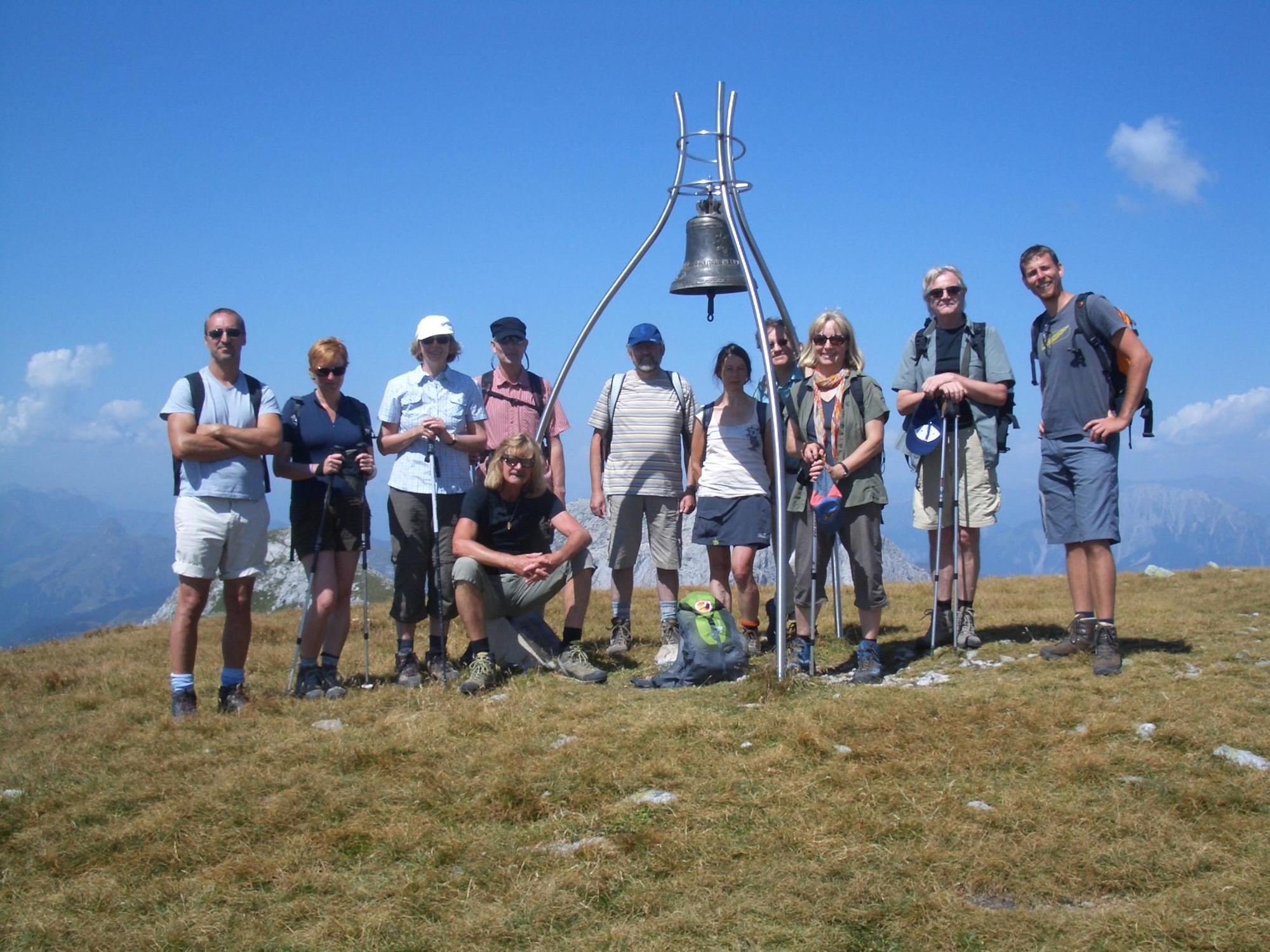
Once arrived at the vast summit plateau, announce your arrival acoustically by using the clapper of the bell installed there. Take a break and enjoy the amazing view whilst eating your packed lunch.
Look south and you can see across the mountain summits of the Julian Alps in Italy. If you are lucky and the weather is fine and clear, you may even see the glittering waves of the Upper Adriatic Sea by turning your view in southerly direction. Turn west and the view opens into Southern Tyrol. The many mountain groups of the Upper Tauern can be seen in northerly direction. The panoramic view is completed by turning in easterly direction where, for example, the Dobratsch, the Triglav, the Mangart or the Montasch can be seen. These are the impressive „mountain colleagues“ of the Roßkofel.
Beneath are the pistes of the Nassfeld. It is easy to imagine that the winter months offer plenty of alternatives to today‘s mountain hiking tour:
Winter sports activities of all sorts on more than one hundred kilometres of well-groomed pistes.
DIRECTIONS (Descent):
Returning to the Madritsche, walk back on the ascending trail until you reach the crossroads beneath the north face, which you climbed earlier. There is a signpost directing to the Rudnig Saddle in westerly direction. Climb through a moderately steep rock passage which provides plenty of gripping points for hands and feet. You will arrive on the Rudnig Saddle (1945 m) just half an hour later. Keeping to the right at all crossroads on the route, carry on walking at a leisurely pace downhill on the Carnic High Altitude Trail until you reach a basin.
Stop for a rest at the small stream before commencing the ascent toward the water reservoir and „Aqua Trail Bergwasser“, thus enjoying a wonderful end to your Roßkofel tour.
- Highest point
- 2,195 m
- Endpoint
-
Roßkofel (2.240 m)
- Height profile
-

- Equipment
-
Depending on season, but the following items are always necessary:
Practical hiking clothes, windbreaker jacket, headwear, rainwear, mountain boots, packed lunch/snacks, plenty of beverages, change of clothes, various personal items like camera and mobile phone, sun screen, sun glasses, hiking sticks, First Aid kit, etc.
- Tips
-
- Additional information
-
- Attractions are the Aqua Trail and the summer tobbogan run "Pendolino"
www.nassfeld.at
- Directions
-
Drive from the edge of the village Tröpolach in direction Nassfeld to the car park on the right hand side of the Nassfeldstraße.
- Parking
-
There are plenty of parking spaces at the lower terminus of the Millennium Express.


- Author
-
The tour Roßkofel is used by outdooractive.com provided.


")