
- Brief description
-
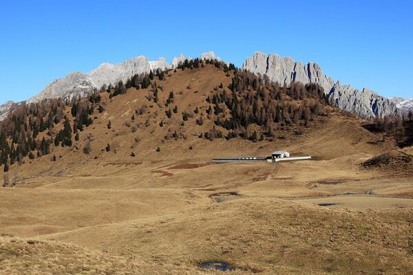
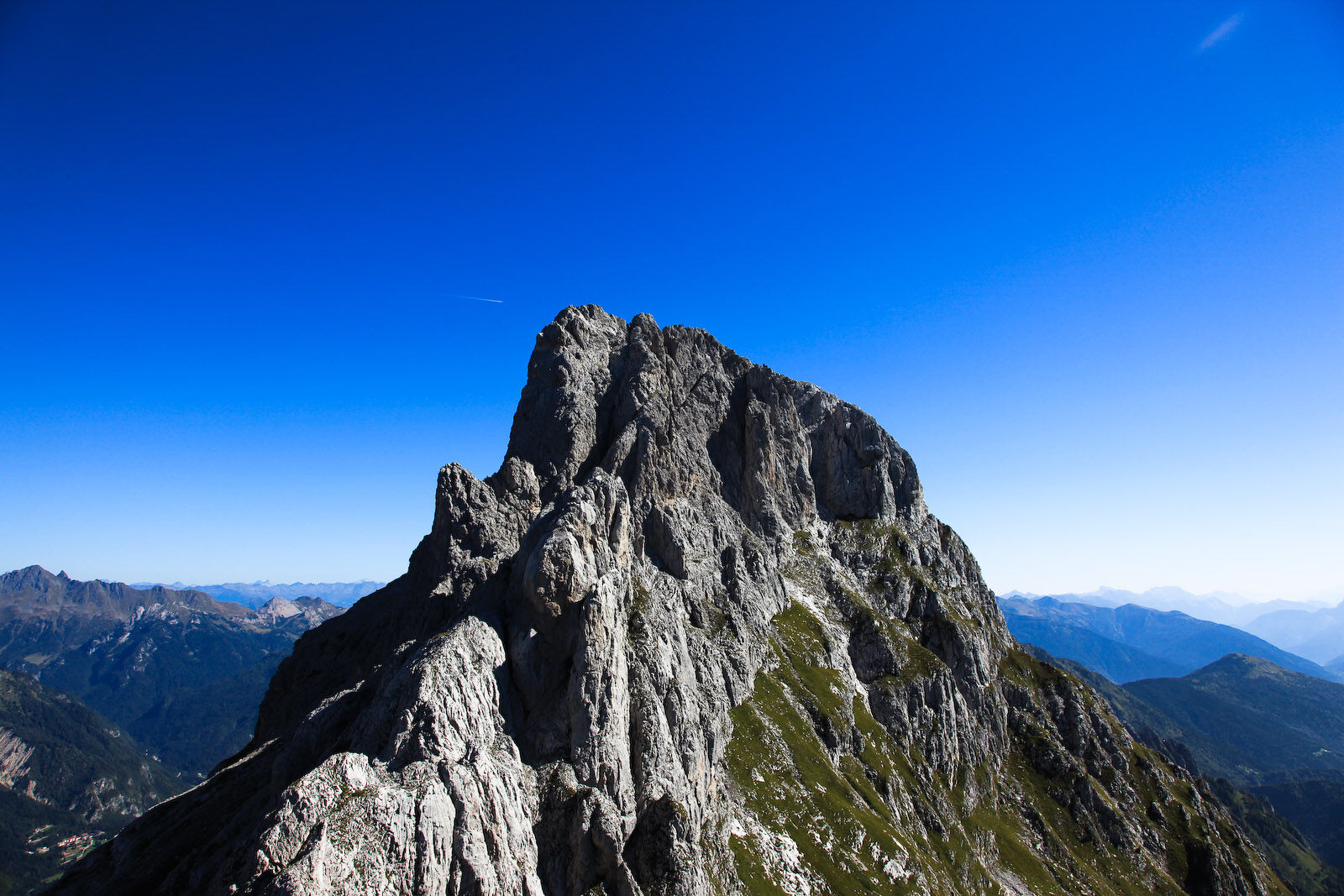
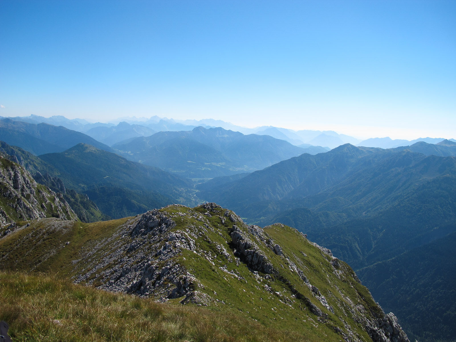
A secondary summit located between Creta Forata and the saddle of the same name, it is one of the few peaks reachable by hikers who only have a little experience. It has a rocky spire summit beneath which extends a wide predominantly grassy ridge that represents the smaller northern peak, which falls away to the underlying valley with a large and steep cliff. To the west there is a high and bold vertical rock-face.
- Difficulty
-
medium
- Rating
-
- Route
-
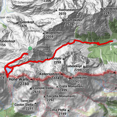
Forcella del Foro (2,192 m)3.1 kmCreton di Tul (2,288 m)3.4 km
- Best season
-
JanFebMarAprMayJunJulAugSepOctNovDec
- Description
-
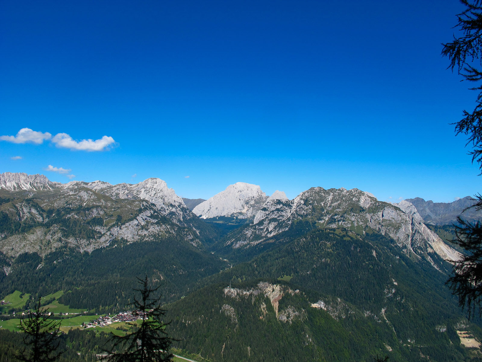
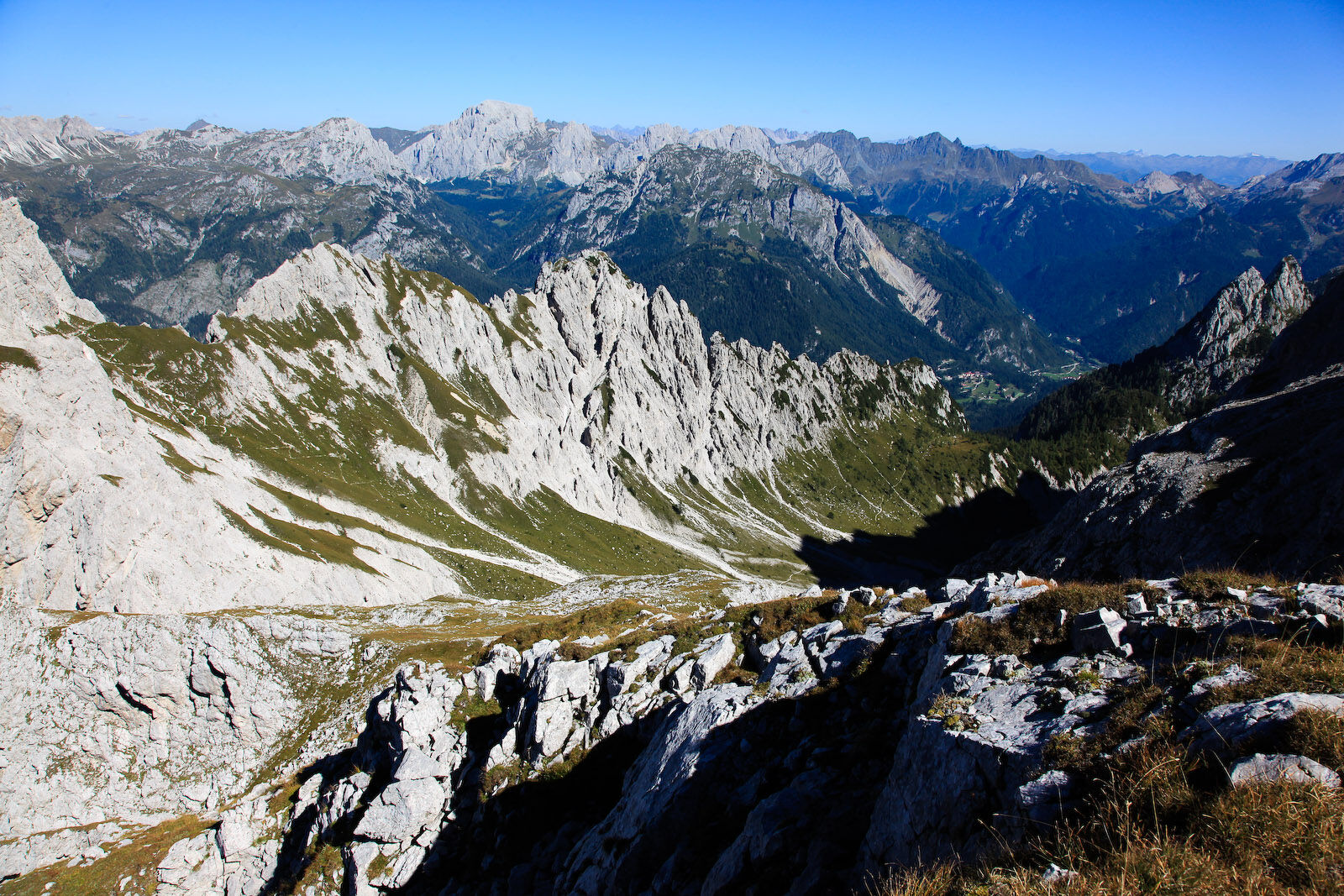
The suggestion deserves consideration because, although a modest peak in altitude and not particularly attractive in its shape (except the western side) and a bit closed in by the massive structures of Creta Forata and the Piccolo Siera, it does have the pleasant surprise of the very broad and unexpected panorama that opens towards the Dolomites of the val Pesarina, Coglians, the Volaia mountains, the Peralba-Chiadènis-Avanza group, the Bivera-Tudaio and even the distant Dolomites beyond the river Piave. The itinerary is, wrongly, very little used due to the presence of the nearby Creta Forata. It is sunny, varied, not tiring and will guide you into another delightful, secluded corner of the mountains of Sappada, in a kingdom of silence and solitude, with the possibility, if you’re lucky, of even seeing some chamois. You’ll also savour a little taste of adventure as the last part of the route has neither a path nor markings.
- Directions
-
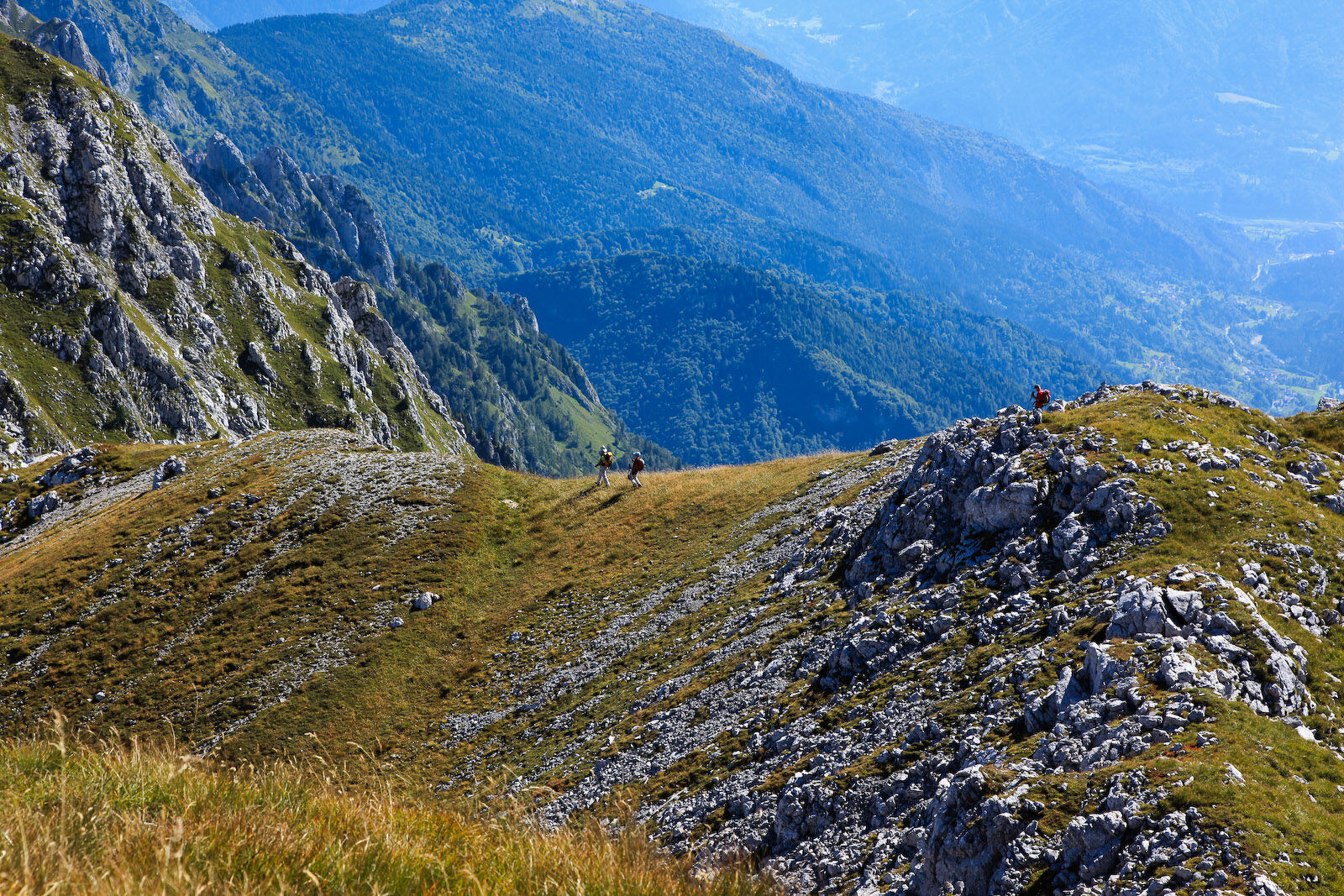
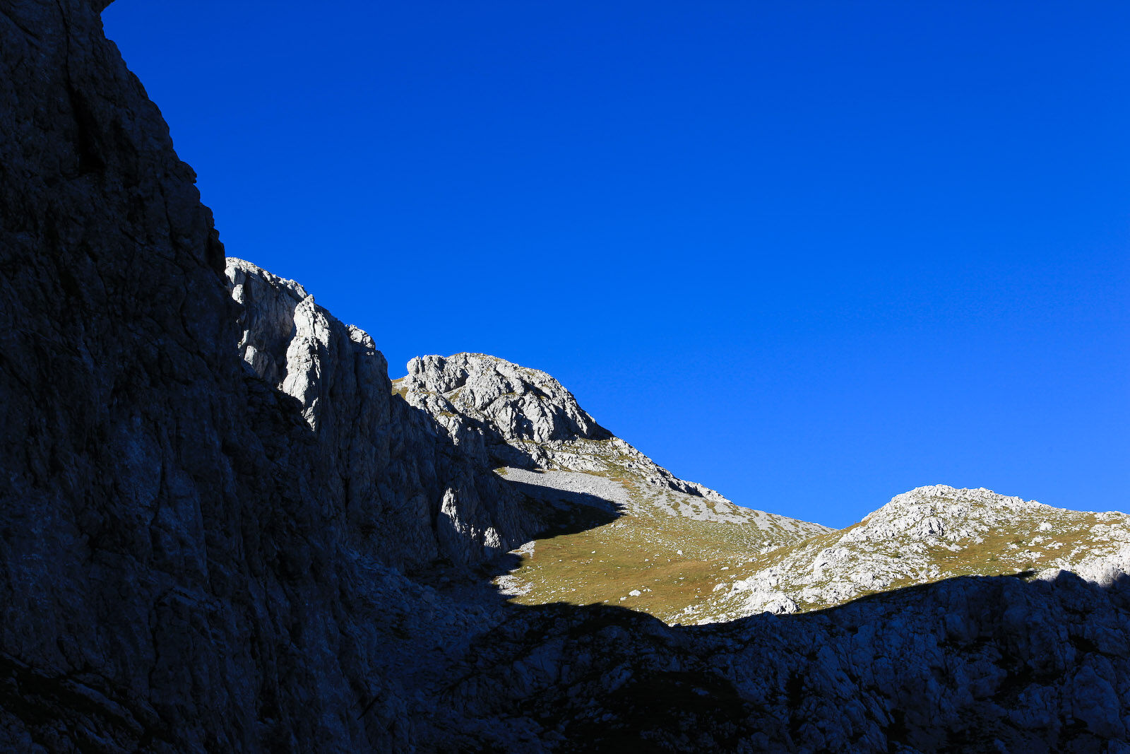
With itineraries ns. 4, 5 or 6 (in the Walking section) climb to the Siera refuge from where, with itinerary n. 15 the walker reaches the upper part of the valley of the Creta Forata below the wall of the secondary peak of our mountain. At a junction (with signs for “Creta Forata - forcella Creta Forata - passo Siera”), ignore the path that rises towards the nearby saddle and take the one that rises to the left, heading for Creta Forata, which goes up a slope of stones and grass. Almost at the top, at another inconspicuous fork, leaving the main track followed thus far to the left and follow the other very inconspicuous one instead, which rises to the right, soon losing itself in a small stony hollow that is crossed in a diagonal aiming for a small, short and shallow detrital gully. Having passed it, continue to the right (west) across the grassy undulating terrain, aiming for the scree below the cusp of the summit. The walker now climbs a grassy slope to the left of the scree itself almost as far as the edge of the ridge. Here, turning right towards rocks and greenery the summit is reached.
Return
The return to the refuge Siera and Cima Sappada is along the same route or, alternatively, via the malga Geu which is reached with the last part of the itinerary n. 17 along the Geu equipped path (see itinerary n. 19 diff. EE). One may also return via a longer but easier route first reaching malga Geu, then malga Tuglia with itinerary n.18 in reverse and from there with the itinerary n.8 (in the Walking section), again in reverse and taking 2:30-2:45 hours.
- Highest point
- 2,251 m
- Endpoint
-
Creton di Tul
- Height profile
-
 © outdooractive.com
 - Safety instructions
-
Difficulty: E/EE

-

-
AuthorThe tour 16 CRETON DI TUL - Sappada is used by outdooractive.com provided.