


- Brief description
-
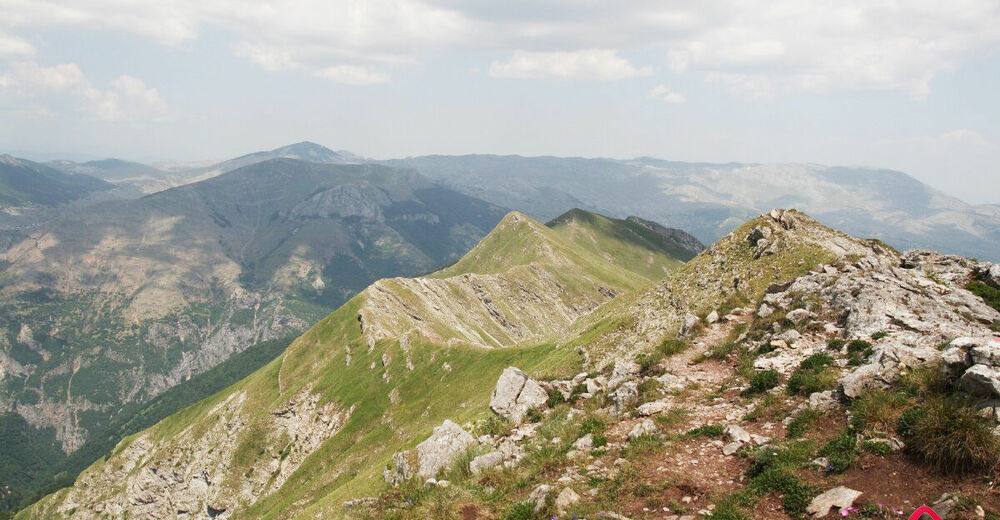
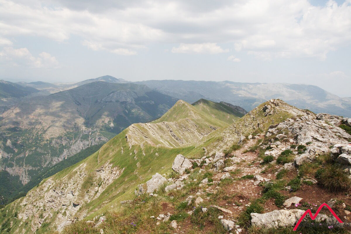
A very nice walk along one of the most beautiful ridges in Bosnia and Herzegovina. Not suitable for those who are afraid of heights as the ridge is rather steep in several places. Great view of the mountains Treskavica and Bjelašnica, and the canyon of the Rakitnica river.
- Starting point
-
Tušila
- Route
-
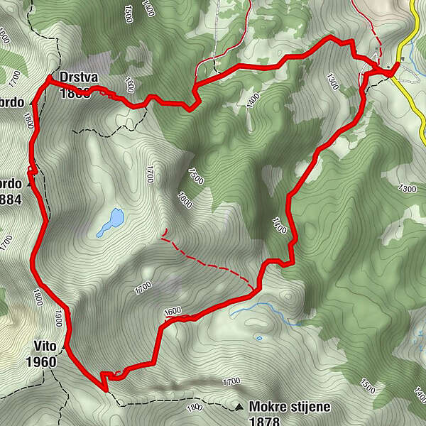
TušilaRestoran Visočica0.0 kmVito (1,960 m)3.7 kmVeliko brdo (1,884 m)5.0 kmMalo brdo5.6 kmDrstva (1,808 m)5.8 kmOčkovica spring6.7 kmTušila8.7 kmRestoran Visočica8.8 kmPlaninarski dom Vrela8.8 km
- Description
-
Mt Visočica, circular track Tušila-Vito-Drstva-Tušila
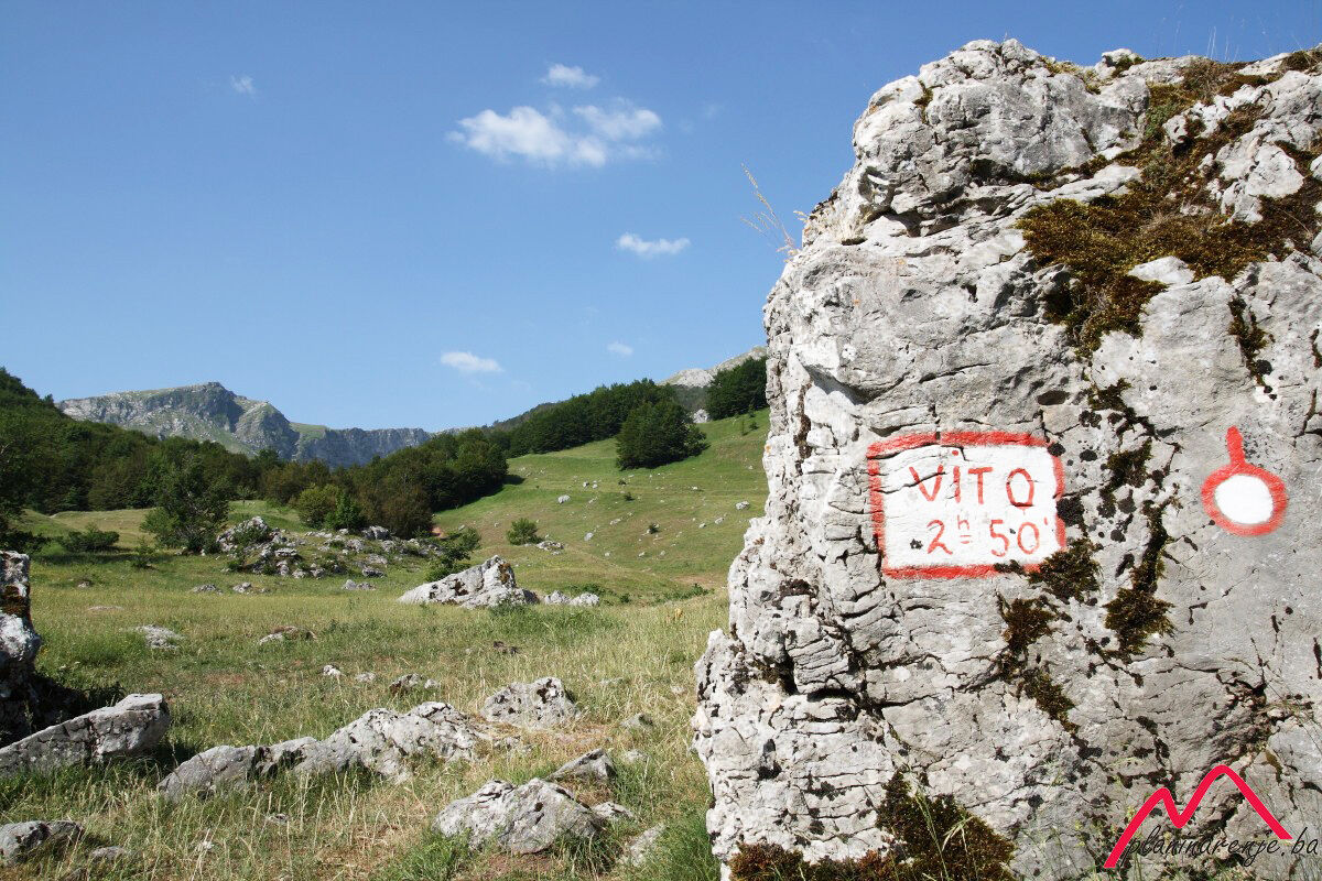
A marked trail goes from the Tušila lodge in Sinanovići to the peak Vito. The first part of the trail passes through the forest. There is a drinking fountain where the trail comes out of the forest. The water barely seeps, and it takes almost 10 minutes to fill a one-litre bottle.
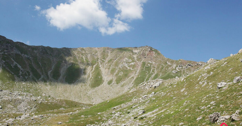
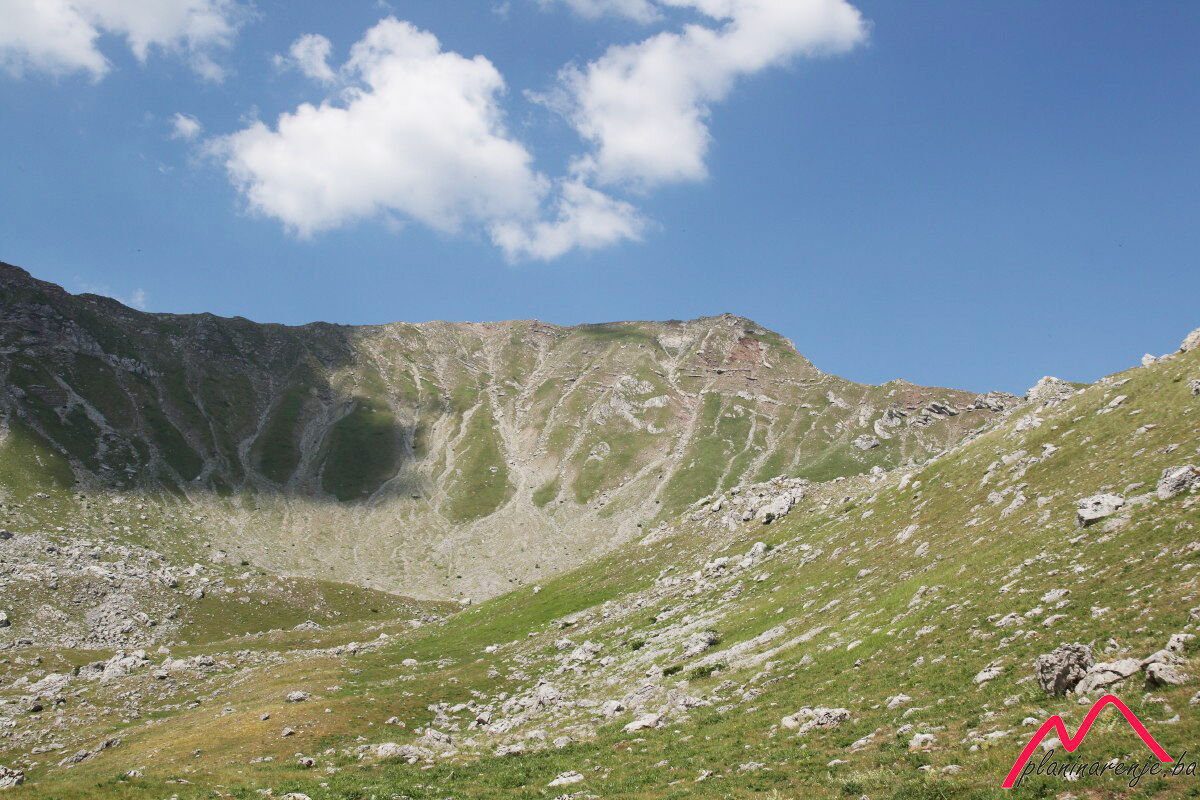
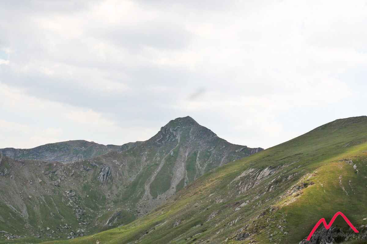
To your right is the peak Subar (1820 MASL), but this time round we will just pass it by and go straight to the beautiful amphetheatre at the very foot of the peak Vito. The way to the top of the ridge is relatively short, but is rather steep and difficult to traverse, as small stones slide form underfoot.
Wonderful view on all sides. The track ascends gently along the edge of the ridge towards Vito and it is 15 min walk. Vito (1960 MASL) is a unique summit whose ridges sprawl around on all four sides, like a spider.
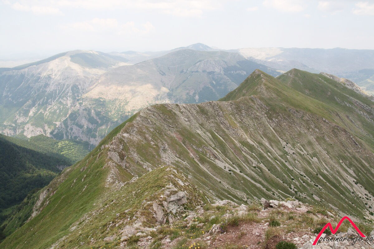
We arrived via the southern ridge. There was a ridge leading westwards towards Parić, straight ahead were the peaks Veliko brdo, Malo brdo and Drstva, and a ridge lead eastwards towards the peak Subar. We took the northern ridge towards Veliko brdu.
The ridge will first take you to Veliko brdo (1884 MASL), then to Malo brdo and finally to Drstva (1808 MASL). At the foot of Drstva, just before you enter a grove, there is another fountain. The road ends in Tušila.
- Directions
-
By the PD Vrela lodge come out to the meadow and head south-west down the marked trail which goes into the forest soon. Follow the trail to the spring and the end of the forest. This is where you enter the large amphitheatre at the foot of the summit Vito and Mokre stijene. Follow the markers straight up the hill, when you reach the top go right along the ridge to the summit Vito. From the summit go straight along the ridge via the hills Veliko and Malo brdo till you reach Drstva, the last peak in the row. From there, go right, downhill (to the east) to the fountain and the beginning of the forest. Here you can take a shortcut by going right on the meadow when you exit the forest, going over the fence and straight to the meadow above the lodge in Tušila. The other option is a few kilometres longer. Descend down the road all the way to the village of Pervizi, then around to Tušila.
- Highest point
- 1,926 m
- Endpoint
-
Vito and Drstva peaks
- Height profile
-
 © outdooractive.com
 - Equipment
-
Standard mountaineering equipment, in accordance with the weather.
- Safety instructions
-
The trail is not technically demanding, except the crossing of the ridge, which is not recommended to people who are afraid of heights. No risk of landmines.
- Additional information
- Directions
-
Take M18 to Krupac, right after the quarry turn right onto R442a towards Mt Bjelašnica and Mt Igman. When you reach Hotel Maršal on Bjelašnica continue straigt ahead, then descend all the way down to Šabići. From Šabići continue to the right till you reach the junction where the road to Umoljani branches off. Take left across the bridge and straight all the way to Tušila.
- Public transportation
-
Van to Sinanovići.
- Parking
-
Park at the lay-by.
-

-
AuthorThe tour Tušila - Vito - Drstva is used by outdooractive.com provided.