


- Brief description
-
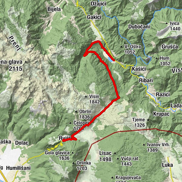
This is the mountain biking and hiking trail that goes from Ruiste to Boracko lake. It passes by two nice necropolises of Bosnian medieval tombstones (called Stecci) and the ruin of Santica Villa.
- Difficulty
-
medium
- Rating
-
- Starting point
-
Ruiste
- Route
-
Snježna kuća0.3 kmRuište0.6 kmLietna Basta23.9 km
- Best season
-
JanFebMarAprMayJunJulAugSepOctNovDec
- Description
-
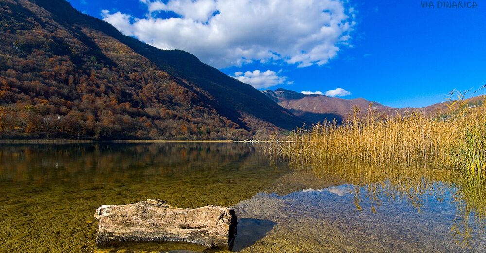
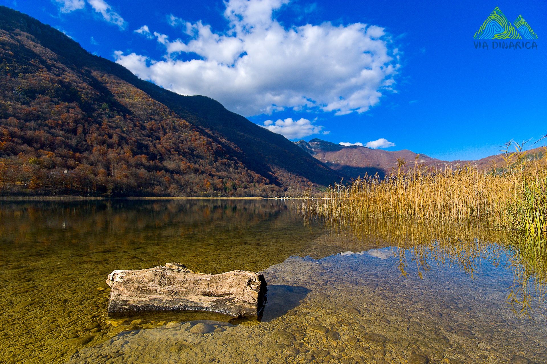
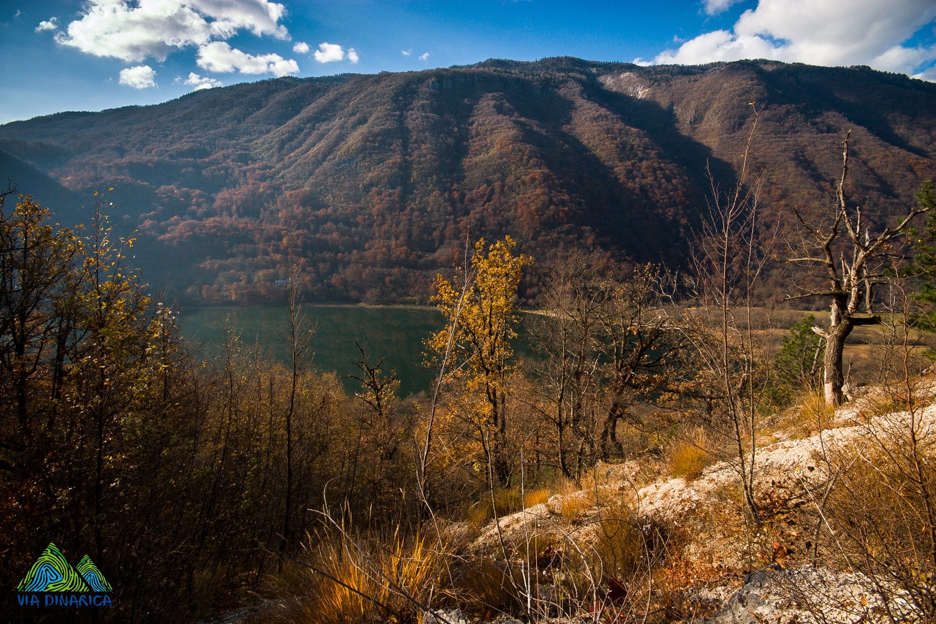
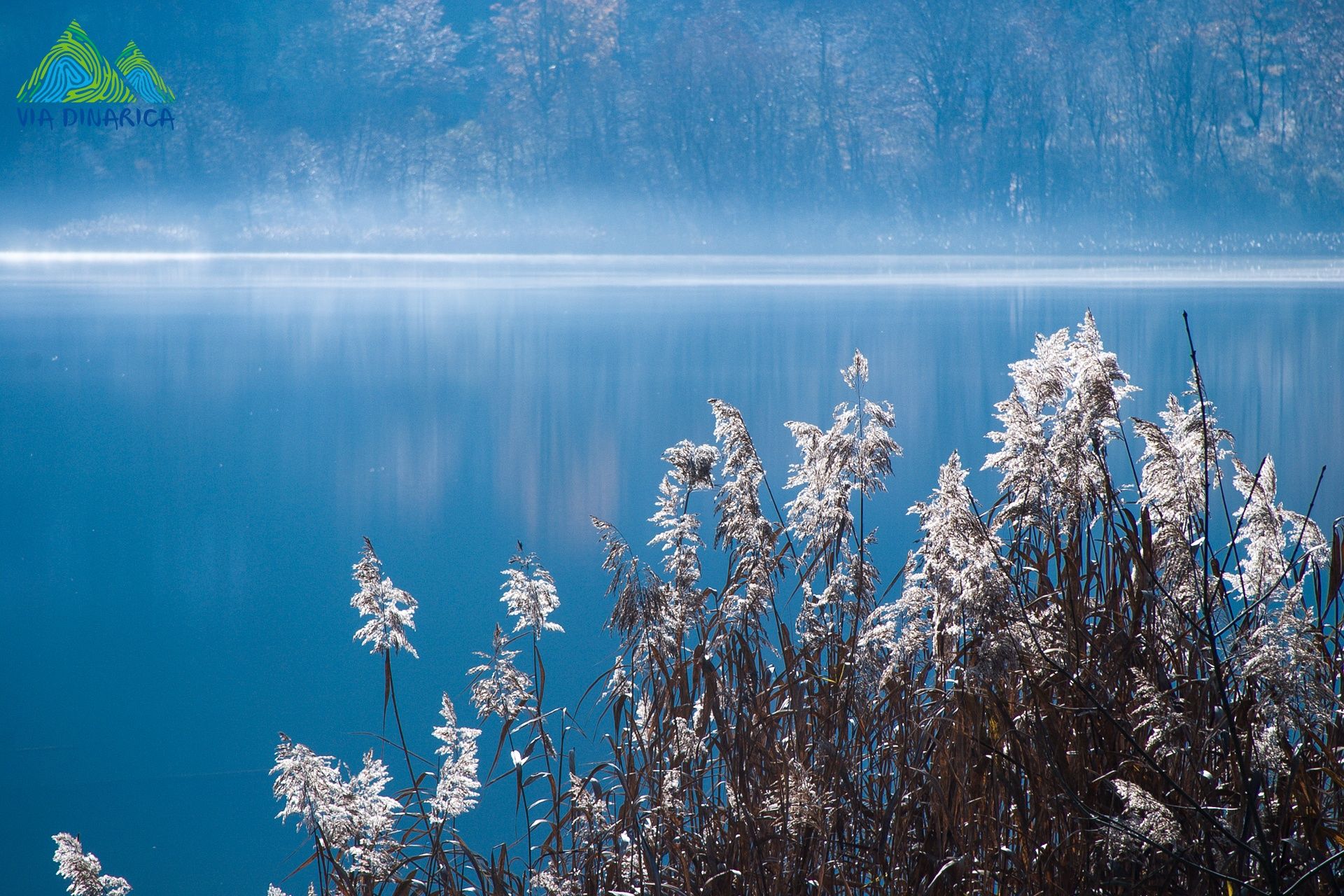
The trail follows the road going from Ruiste to Boracko lake. It follows the easternmost slopes of Mount Prenj, but there are no views of Prenj landscapes. Instead, there are nice views on Crvanj mountain and Boracko lake. The trail passes by two necropolises of medieval tombstones called Stecci: one below the junction to Nevesinje and another in the Bahtijevica area. The second is particularly interesting as there are some nice carvings, including one depicting a sword fight.
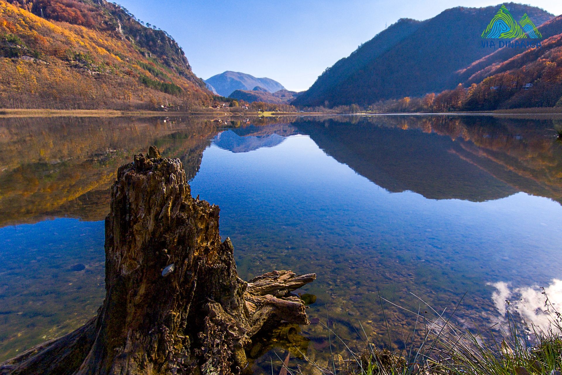
At the far end of Bahtijevica, where the trail turns to the west, there is a nice view point on mount Visocica, and canyons of the Neretva and Rakitnica rivers. The next portion of the Via Dinarica trail is actually visible from this view point.
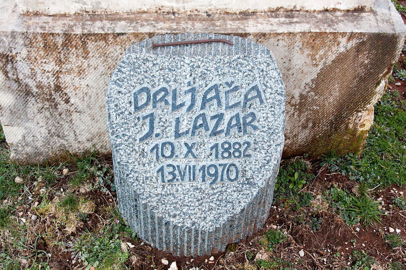
The road and the trail splits at the junction not far from this view point. One is a shorter way directly to Boracko lake via the village of Kula, but the Via Dinarica trail continues straight towards the Boracka Draga and Borasnica mountain to connect with Borci village. At Borci, there is Santica villa and Lazar’s grave, but not far from there is also another fascinating - and one of the most beautiful - Stecci necropolises and a short but attractive canyon of Boracki creek. The trail descends down from Borci to the holiday and recreation area of Boracko lake and goes around to its “administration” center with a shop, restaurants and guesthouses.
- Directions
-
Just follow the road from Ruiste to Borci. Continue straight (left) on the first junction, and keep to the main road. At the junction to Kula, continue straight and on the junction to Crno polje (Prenj) turn right. Just before the cemetery at Borci, there is a trail going right down, but to stay on the Via Dinarica, continue a couple of hundred meters more and then turn to the ruins of Santica villa. The trail continues on the other side of the villa’s garden, behind Lazar’s grave. Once down in the lake's valley, follow the road on the left side of the lake, though going around the lake is also an option as you would pass by the main beach of Boracko.
- Highest point
- 1,165 m
- Endpoint
-
Boracko lake / Boracko jezero
- Height profile
-
 © outdooractive.com
 - Equipment
-
Standard hiking or biking equipment - for one day.
- Safety instructions
-
Mind your step on difficult terrain and watch for snakes when reaching with your hands or sitting on the grass in the shade.
The mountain rescue service is reached by calling 112.
- Tips
-
Before taking this tour, read a little bit about mediaval history of Bosnia. It will be intersting to know more about Stecci, since there are a few necropolises of them on and around this trail.
- Additional information
- Directions
-
Drive from Mostar towards Sarajevo and turn right towards the locality of Potoci.
- Public transportation
-
To trailhead:
Taxi from Mostar ( http://mojtaxi.net/?lang=en )
From arrival point:
"Bjelimici Bus"- +387 36 737 009 (try to book your seat and agree on a pick-up location)
Bjelimići - Konjic - Sarajevo (except weekends) u 8,00 h (sunday 15,00)
Bjelimići - Glavatičevo - Konjic (mon-fri) at 13,30 h (contracted)
Konjic - Glavatičevo - Bjelimići (mon-fri) at 6,10 h (contracted)
Sarajevo -Konjic - Bjelimići (except sundays) at 14,00 - Parking
-
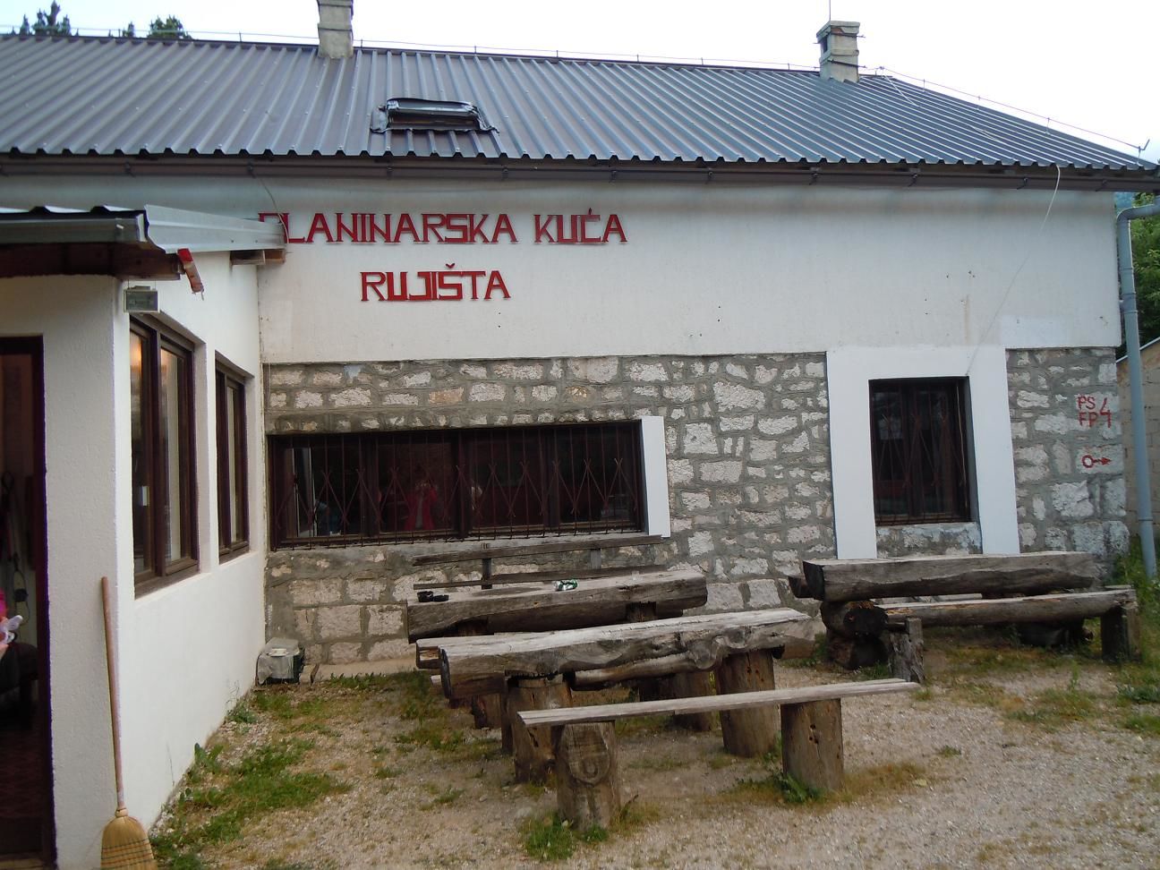
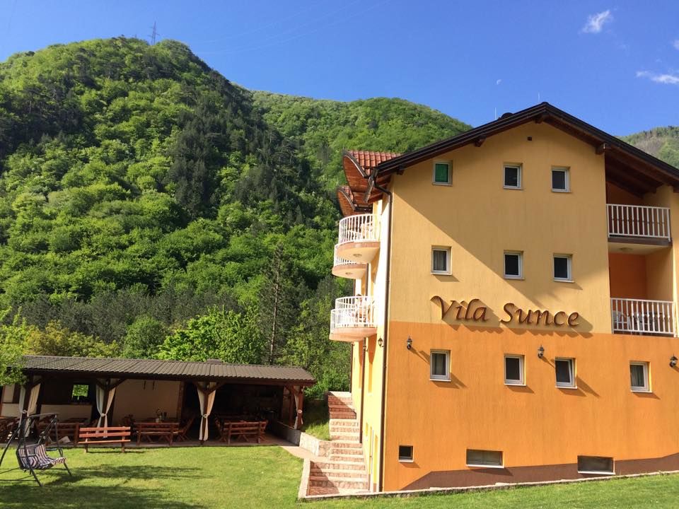
Close by hotel Snjezna kuca (Snow House).

-
-
AuthorThe tour Via Dinarica BH-W-07 Ruište and Boračko lake is used by outdooractive.com provided.