

- Brief description
-
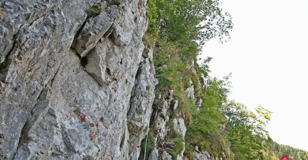
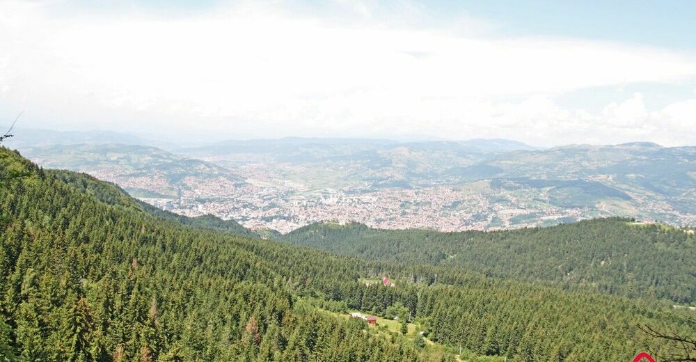
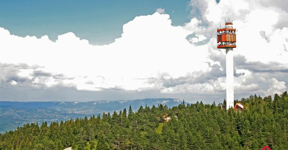
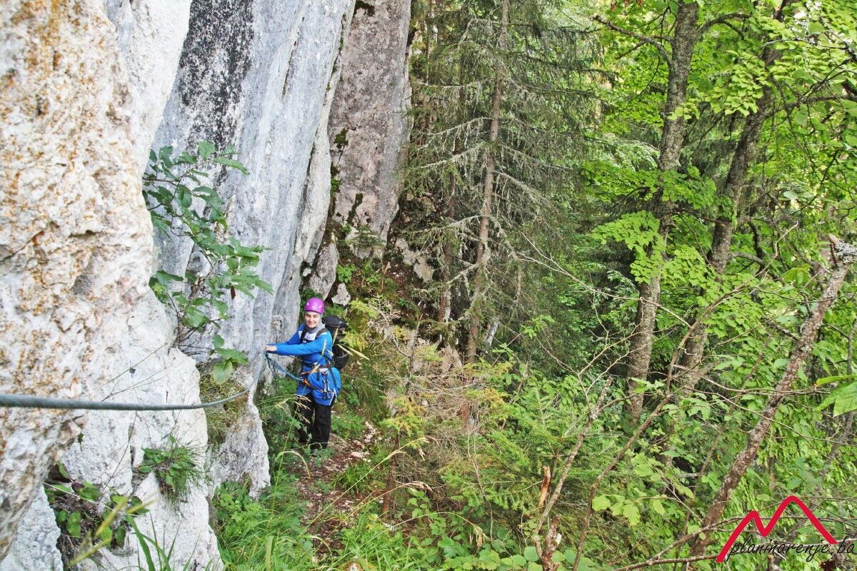
It is a pleasant route, with short but rather attractive feratta. View from the rock is beautiful and it encompasses Romanija to the east, Bukovik to the north and the city of Sarajevo. From the summit of Trebević, Sofe, the view extends even further: climbing the western ridge allows for the view of an entire area of Sarajevo. The reward comes in form of an attractive ridge on the Sofe summit which offers a view of the major area of Bosnia and Herzegovina. Pleasant easily traversable return route via serpentine trails across coniferous forests allows for gradual descent from moderately high altitude.
- Starting point
-
Mounatain Lodge, Mountain Club Napredak
- Route
-
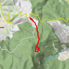
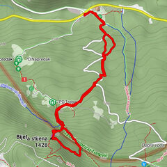
PD Napredak0.0 kmPD Trebević0.6 kmBijele stijene (1,426 m)1.1 kmBijela stijena (1,428 m)1.2 kmTrebević-Sofe (1,627 m)3.3 kmPD Dobre vode5.8 kmTri Budalaša6.4 kmBijela stijena (1,428 m)6.7 kmPD Trebević6.9 kmPD Napredak7.5 km
- Description
-
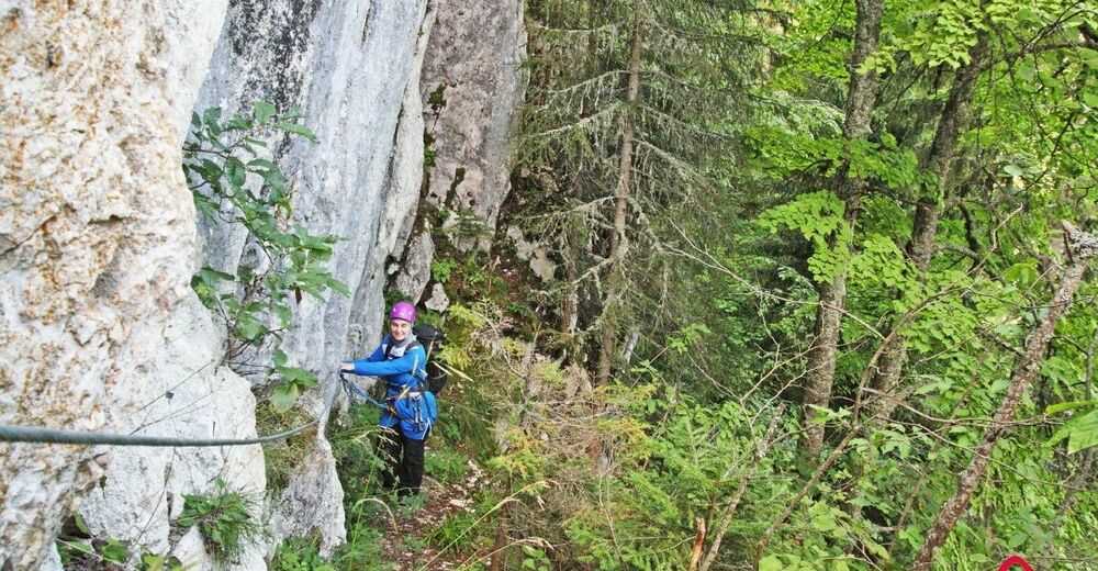
Starting point is the Napredak Lodge from which the route leads under the foot of Bijela Stijena. After only 1 km walk through dense forest, one will reach the foot of the rock. The first part is a bit less demanding, yet, in case of heavy rains it can get muddy and slippery. The second section of the ferrata is a bit more attractive because it leads to a clearing from which it is possible to observe treetops of dense pine forest approximately 50 meters below. The climb is not too demanding and there should be no problems if one is to observe the safety rules. It takes about an hour of easy climbing to reach the summit. You can return via the forest path leading to Dobre Vode.
- Directions
-
Marked route starts at the PD Napredak Mountain Lodge. The entrance to the trail can be found in the woods above the small outbuilding, to the right from the spring with drinking water. It is modestly marked in the beginning. One should move along clearly visible path (parallel paths are subsequently joined into one, and the left one is a better choice) which leads past the clearing with mountain lodges and cottages: Puhova Ravan, offering a clear view of Bijela Stijena. There is a marked trail leading to the left, but one should stick to the logical movement direction which leads to the rock. Next to the fenced cottages, the trail passes to the right of gravel road and leads through the woods. Once again, you have two paths, of which the left one is a better choice. A slightly steeper path leads to an intersection with adequately marked trail. From the intersection, you should follow blue plastic bags until you reach the footpath entry point (5-10 min of slightly steep terrain).
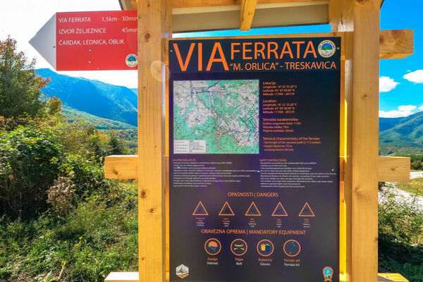
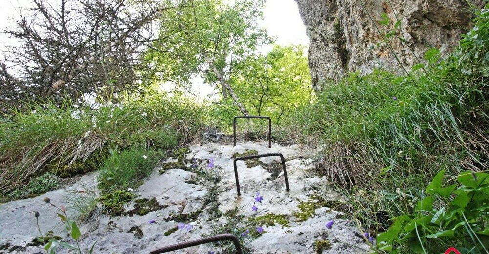
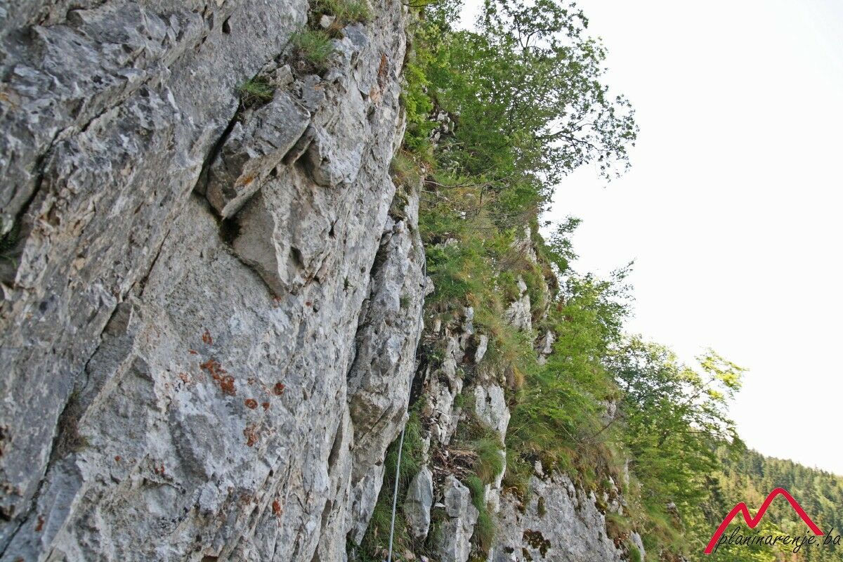
Via ferrata is secured by metal cable and ladders in one short section. After the section with metal ladders, there is a 20-meter section without protective structures leading to the peak and one should choose one of two paths: a longer and a slightly more demanding section between two big rocks (which is more visible) on the right side, or a vertical yet shorter section which leads directly through a gap in the rock.
Upon leaving the ferrata section, proceed to the top of the rock and proceed along a modestly marked forest path which leads to better marked trail between Dobra Voda and the western ridge. Proceed to the right and cross the road after you have passed 150m by following the markings (it is possible to take a tour of Austro-Hungarian artillery positions). The markings lead to the western ridge all the way to the summit of Sofe. You should proceed north and turn left towards the evergreen forest while following the trail markers. Serpentine trail leads to Dobre Vode which is the point where you should turn left under the ruins of the mountain resort for postal workers and reach the path which leads to the Napredak Lodge next to the spring named "Tri Budalaša".
- Highest point
- 1,599 m
- Endpoint
-
Baščaršija, Latinska ćuprija
- Height profile
-
 © outdooractive.com
 - Equipment
-
When climbing the via ferrata, protective gear is mandatory: helmet, climbing belt and a via ferrata set (a prusik with two carabiners can be used as well). Standard mountaineering equipment.
- Safety instructions
-
There is no risk of landmines.
- Tips
-
Lookout on the east side of the ridge and the serpentine trails below. Austro-Hungarian artillery positions may be of interest as well. PD Progress Mountain Lodge offers refreshments and food.
- Additional information
- Directions
-
Take a car, taxi or van via Grbavica district all the way to Vrace, all the way to the parking lot Ravne (Pino Nature Hotel). Next, follow the signs pointing in the direction of "Napretkov dom" along the asphalt road which is 15 minutes away from the Lodge as the starting point.
- Public transportation
-
Take a taxi or city van from the Latin bridge to the "Pino Nature Hotel" station.
- Parking
-
Parking lot in front of the PD Napredak Mountain Lodge.


-

-
AuthorThe tour Trebević ferata is used by outdooractive.com provided.