
- Brief description
-
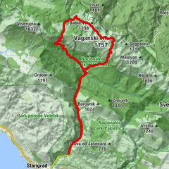
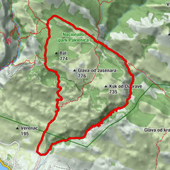
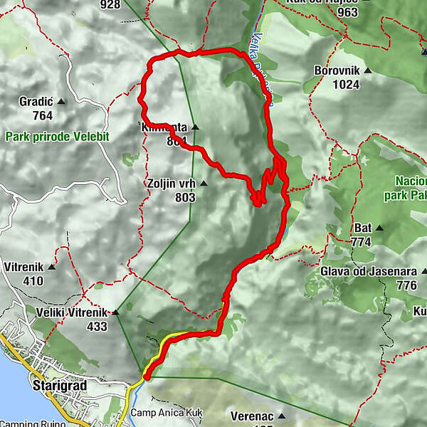
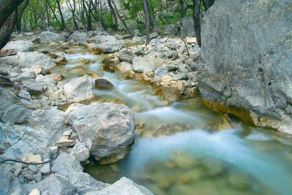
The path leads along the canyon of Velika Paklenica until it branches off towards Manita peć. The top of Vidakov kuk offers the opportunity to enjoy views of the entire archipelago and the peaks on the other side.
- Difficulty
-
difficult
- Rating
-
- Route
-
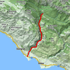
Klanci2.4 kmCrljena greda2.8 kmManita peć (550 m)5.9 kmZoljin kuk (847 m)6.9 kmRamići9.2 kmKatići11.2 kmCrljena greda13.6 kmKlanci14.0 km
- Best season
-
JanFebMarAprMayJunJulAugSepOctNovDec
- Description
-
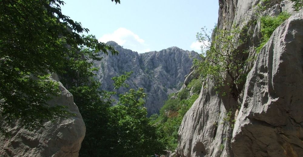
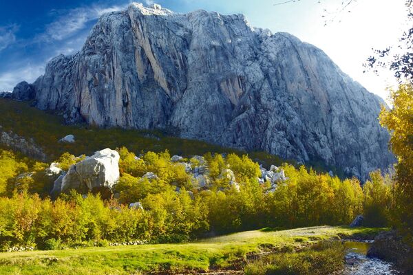
Among the pre-historical caves arranged for visitors Manita Peć in Paklenica National Park stands out as a milestone known for its impressive halls and richness of its flowstone formations. Path itself is an easy trail-hike up the serpentines. It is well built to cross over the talus which would otherwise be quite impassable. Higher you hike up the path, the greater are the views, spreading over the course of canyon in both directions. At the opposite side, the eastern edge, stone giant of Anića Kuk rises surreal from the bottom of the valley. Just looking at it makes you feel small compared to creation capabilities of Mother Nature. In case you feel adventurous, the mountaineer path continues further from the cave taking you to Vidakov Kuk, but from that point beware - gone is an easy trail-hike, welcome the true hiking challenge of Paklenica.
- Highest point
- 809 m
- Height profile
-
 © outdooractive.com
 - Safety instructions
-
After Manita peć, the surface of the path becomes exceptionally rocky and the path itself becomes steeper. At times, you will have to use your hands to master the steps. In addition, there is a smaller via ferrata on the route. It is not dangerous, and it represents an interesting addition to the trail. Vidakov kuk is easy to master, but the descent also features a via ferrata with ropes, demanding extra caution.
- Tips
-
The route begins with a groomed path, which is rocky in the beginning and later segues into a well-trodden earthen path of excellent quality. After it branches off towards Manita peć, the path narrows, but its quality remains good.

- Author
-
The tour NP Paklenica/ V. Paklenica - Manita peć - Vidakov kuk is used by outdooractive.com provided.


")