- Brief description
-
Adventurous contrast programme
.Hiking with scrambling under high cliffs and through forests with UNESCO World Heritage status – what a contrast to the coast down by the sea!
- Difficulty
-
medium
- Rating
-
- Starting point
-
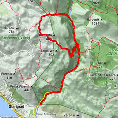
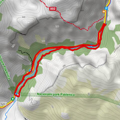
P at entrance 2 (Ulaz 2) Mala Paklenica, 35 m.
- Route
-
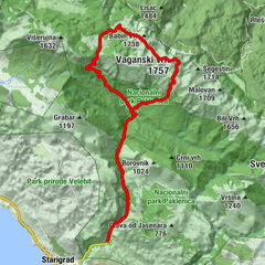
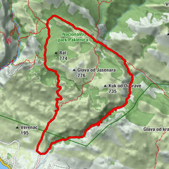
Pozdravača2.0 kmKapljuvača2.8 kmStaro vrilo8.0 kmSamardžinovac9.3 kmSuva peć9.5 kmJukića vrila10.6 kmParići11.6 kmIvančev dom11.8 kmRamića Dvori12.0 kmPlaninarski dom Paklenica12.3 kmStrmac12.9 kmLugarnica Foresters house13.8 kmKatići14.9 kmCrljena greda17.4 kmKlanci17.8 km
- Best season
-
JanFebMarAprMayJunJulAugSepOctNovDec
- Description
-
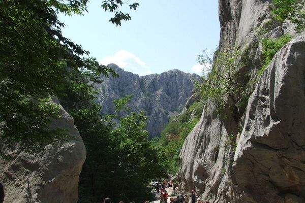
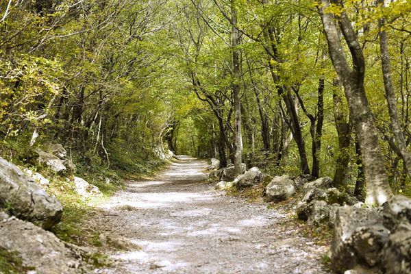
Many – especially climbers – only know the entrance area of Velika Paklenica, the "big gorge". There is the climbing area and the most impressive rock walls up to 350 metres high. It is the most easily accessible part of the entire national park. You can push the pram right up to the sport climbing routes. But if you invest a little time in exploring the rest of the area on foot, you will be surprised at how varied Paklenica is. The hike through the much less visited Mala Paklenica gorge to the large Velika Paklenica gorge is adventurous. It leads through the often dry stream bed, you climb huge rocky outcrops, walk through shady black pine forests and unique UNESCO World Heritage beech forests. Along the always water-flowing Velika Paklenica, you reach a place to stop for refreshments and then take a good path through the large gorge back to the valley, to the day tourists and sport climbers.
- Directions
-
From car park 2 on a mostly very well marked red-white trail into the valley. On the way there are several possibilities to change the tour, shorten it or hike directly back to the starting point. Our route in the sequence of marked junctions: left - right - left - right - left - right, reaching the small collection of mini-mountain villages Parici, Ivancev and Ramici or the Alpine Club hut Planinarski Dom on both the right and left of the river on the last stage. Up to here 5:30 hrs (with breaks). Now either return to the valley (1:30 h, 6 km) or (best after an overnight stay) continue with another hike, e.g. an ascent of Veganski Vrh, at 1757 m the highest mountain of Velebit.
- Highest point
- 885 m
- Endpoint
-
Rear car park and entrance 1 (Ulaz 1) at Velika Paklenica, 145 m.
- Height profile
-
 © outdooractive.com
 - Equipment
-
Sturdy shoes, sun hat, sunglasses. Sticks can be pleasant over long distances, but are rather a hindrance on some sections of the Mala Paklenica.
This is a must for every hike: The ALPIN checklist for mountain hiking.
Good footwear is a must for a hike in the mountains. 10 hiking boots in the ALPIN test.
.All other ALPIN tests for mountain hikers can be found here.
Everything you need for this tour is available in the ALPIN-Shop.
- Safety instructions
-
Depending on the season, take enough water, sun protection and long clothing/windbreaker. In Mala Paklenica you may need to use your hands in some places. Weather and temperature are extremely variable depending on the season. When the bora blows, it can be freezing cold and there is a high risk of falling rocks and breaking trees.
Safe mountain hiking: 10 recommendations from the DAV.
Safely on the move in boulder terrain. Tips for walking in pathless terrain can be found here.
. . - Tips
-
The starting and ending points are about 7 km apart. It is best to leave the bikes at Velika Paklenica before the tour.
- Additional information
- Directions
-
On the E71 motorway through Croatia, exit 15 Maslenica to Seline. Or on the coastal road from Rijeka, takes about 1 hour longer.
- Parking


- Author
-
The tour Hike through the Paklenica gorges in Velebit is used by outdooractive.com provided.


")