
- Brief description
-
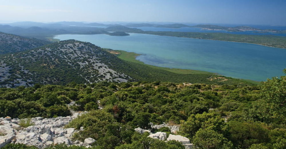
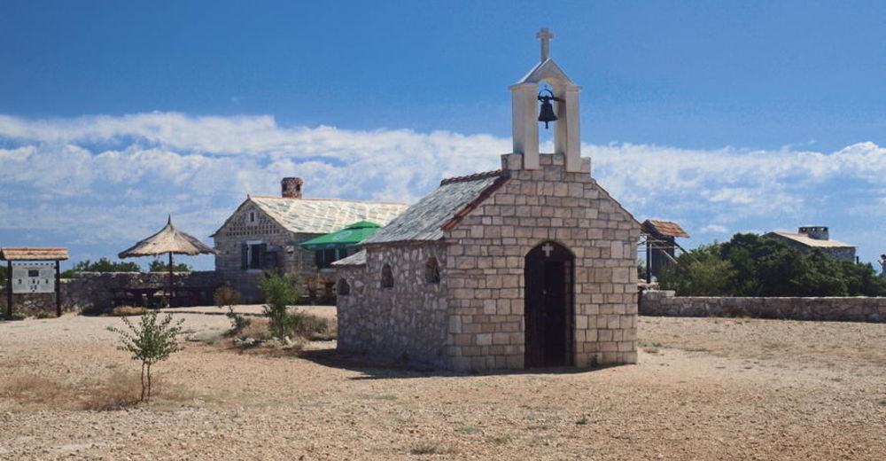
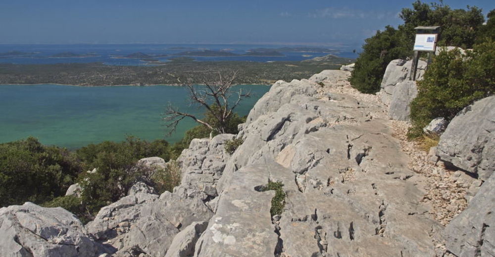
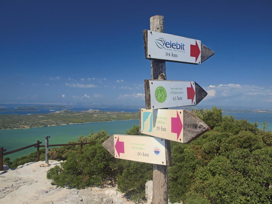
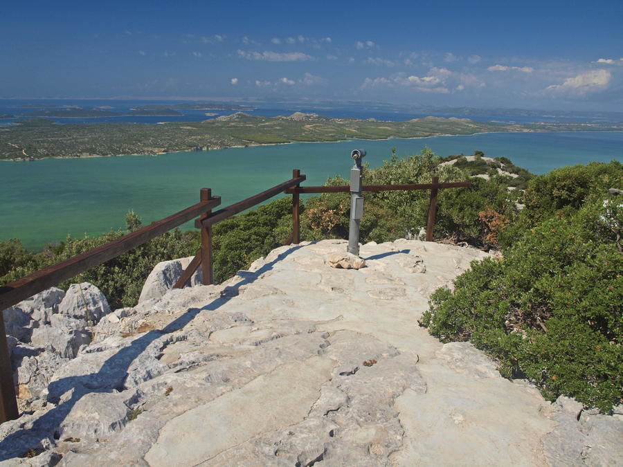
A curious traveler exploring northern Dalmatia on the trip between two cities rich in history – Šibenik and Zadar – will undoubtedly be attracted by an intriguing natural phenomenon along the way. On one side, the traveler's attention will be drawn by the low Adriatic coast, and on the other side, just few hundred meters away from the coast – by a large natural lake with typical wetland characteristics. There are few sites as small as this one, where one can experience three totally different landscapes: sea coast with a rich archipelago in front; Mediterranean wetland with a unique landscape and a rare wetland ecosystem; finally, the idyllic rural setting of the settlements of Ravni kotari right behind the hill.
- Difficulty
-
easy
- Rating
-
- Starting point
-
Park prirode Vransko jezero
- Route
-
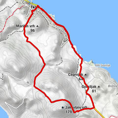
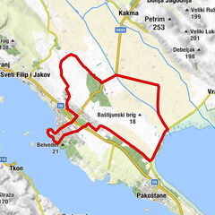
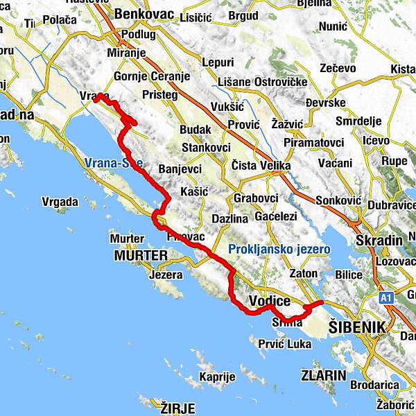
Aurana0.1 kmMarina0.2 kmPećina1.0 kmVrana1.4 kmMeđuvoda1.9 kmGradina2.5 kmGrabovac3.2 kmŽenska špilja3.7 kmMali Bak4.4 kmŠpilja pod Bakom4.6 kmOton5.6 kmVila6.1 kmZamina (194 m)7.1 kmKrklješove kuće7.6 kmOton8.6 kmŠkorobić9.5 kmPodgorom14.4 kmProsika24.4 kmTranquilo25.1 kmSlosella29.2 kmMartin32.2 kmMarin32.5 kmSovlje38.7 kmBlažene djevice Marije40.2 kmTrebocconi40.4 kmBlata42.3 kmDolac42.7 kmPlimica43.1 kmSv.Križa43.3 kmDulcin43.5 kmVodizze43.7 kmVruje44.3 kmLovetovo45.4 kmSrima46.5 kmgrill Popaj46.6 kmGuberina51.6 km
- Best season
-
JanFebMarAprMayJunJulAugSepOctNovDec
- Description
-
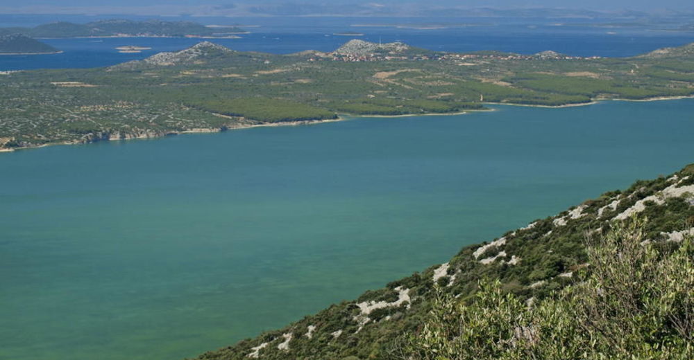
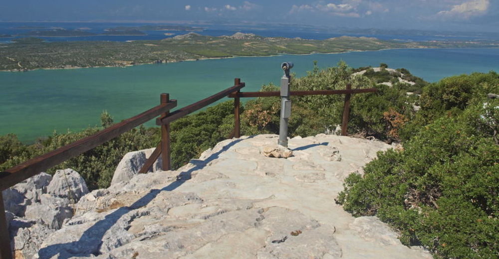
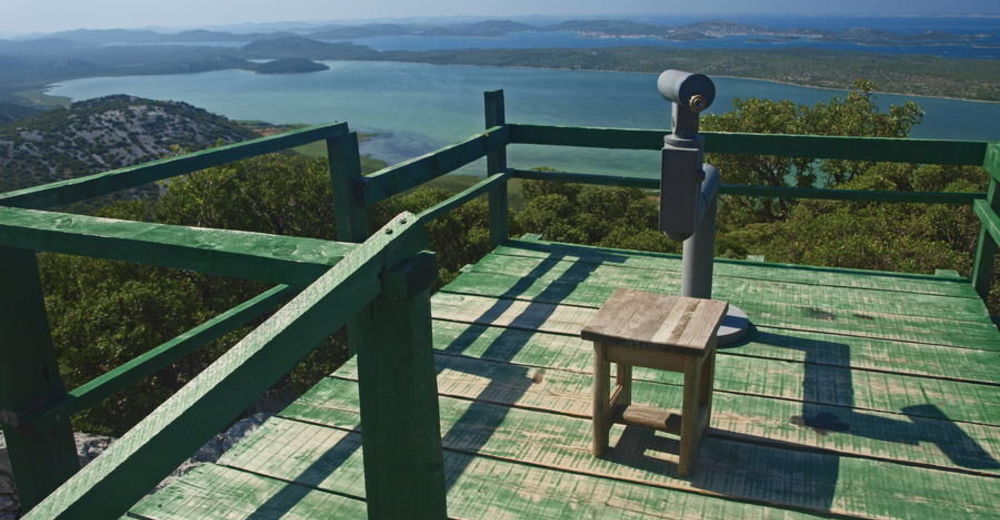
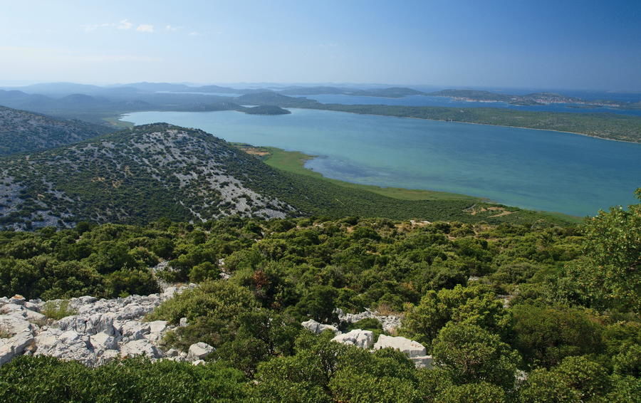
Vransko Lake is the largest natural lake in Croatia, and also a rare natural habitat of water birds in the Mediterranean part of Croatia. The area became a nature park in 1999, and it has been listed as a Wetland of International Importance in the framework of the Ramsar Convention since 2013. The lake is 13.6 kilometers long and 1.4 kilometers to 3.4 kilometers wide. Extending in the northwest to southeast direction, parallel to the sea coast, it is separated from the sea by a thin strip of land, occasionally narrower than one kilometer. The average depth of the lake is 390 centimeters; however, this is sufficient for it to be a cryptodepression (a lake with the bottom below the sea level). Vransko Lake receives water from the creek of Skorobić and from several springs. The excess water flows from the lake into the sea through the manmade channel of Prosika that connects the lake with the bay of Pirovački zaljev.
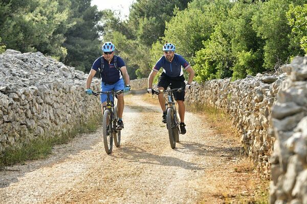
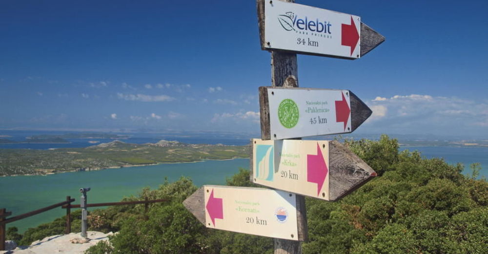
In addition to birdwatching enthusiasts, visitors interested in sport fishing will also find a lot to enjoy as they rest and relax in this area, since fishing is available along the lake and its shores almost throughout the year. Cyclists and hikers can explore a cycling trail 40 kilometers long leading around the lake. Via Dinarica Blue Line includes a longitudinal tour of the Vransko Jezero Nature Park. After the Nature Park, the route continues towards Vodice and the city of Šibenik. Visitors coming to this area are warmly recommended to visit the nearby Kornati National Park that includes a unique archipelago of 150 islands and islets – the most diverse and indented archipelago in the Adriatic.
- Highest point
- 214 m
- Endpoint
-
Šibenik
- Height profile
-
 © outdooractive.com


-

-
AuthorThe tour Via Dinarica HR-B-12 Vransko Jezero Nature Park is used by outdooractive.com provided.