


- Brief description
-
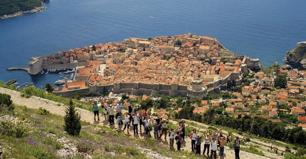
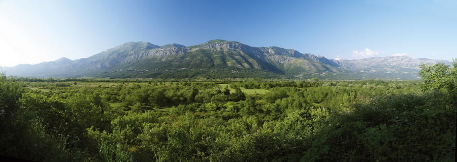
The far southern area of Croatia from the valley of the Neretva River to Cape Oštro on the peninsula of Prevlaka abounds in small and large karst hills. To the northeast, the area is bordered by the hills of Herzegovina; to the east, it borders the Montenegrin section of the massif of Orjen; to the south and west, the boundary is the Adriatic Sea. The most picturesque features of this narrow strip of land are fertile fields in karst terrain, many of them cultivated. Tourism is highly developed and prominent in the area, primarily due to the major tourist importance of the city of Dubrovnik.
- Difficulty
-
easy
- Rating
-
- Starting point
-
Dubrovnik
- Route
-
DubrovnikGravosa0.3 kmDubrovnik1.4 kmBorgo Pile2.5 kmSanta Croce2.7 kmCittà Vecchia2.9 kmSv. Jakov Pipunar3.0 kmBorgo Plonche3.4 kmViktorija4.1 kmForte Imperiale4.2 kmZlatni potok4.4 kmSveti Jakov4.9 kmOrsula5.7 kmGospa od obrane7.1 kmDubac8.4 kmČibača10.1 kmKupari11.4 kmBrašina11.8 kmSrebreno12.0 kmSaint Rocco13.0 kmChurch of Saint Hillarus13.0 kmMlini13.0 kmZavrelje13.2 kmSoline14.2 kmZupcica14.7 kmPlat15.7 kmGornji Obod19.8 kmZvekovica20.7 kmRajčevići22.0 kmBijelići23.4 kmUskoplje24.0 kmVlahutini24.3 kmGabrili25.4 kmKlečaci26.2 kmPrihodnje27.4 kmDrvenik27.8 kmMihanići29.7 kmRudež30.3 kmNartiće31.6 kmPridvorje31.8 kmLovorno32.8 kmArbansi33.3 kmVrelo34.7 kmGornja Ljuta35.4 kmButkovine37.8 kmDubravka39.5 km
- Best season
-
JanFebMarAprMayJunJulAugSepOctNovDec
- Description
-
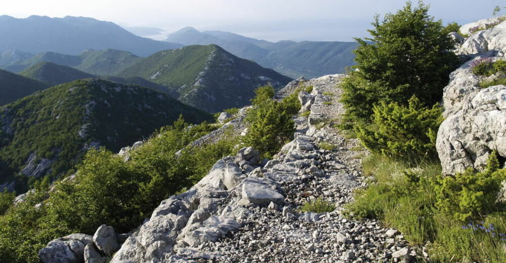
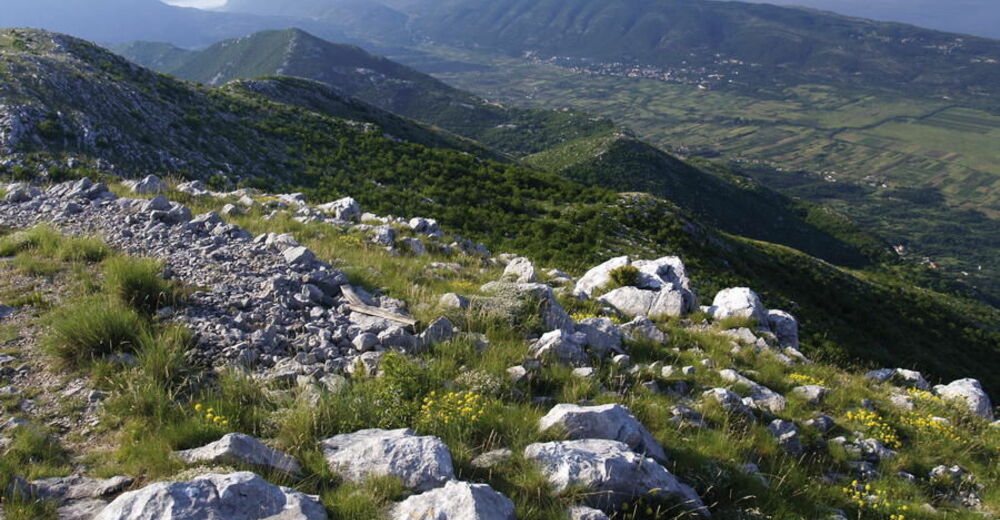
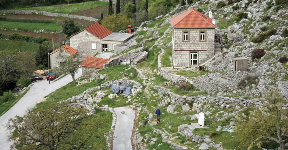
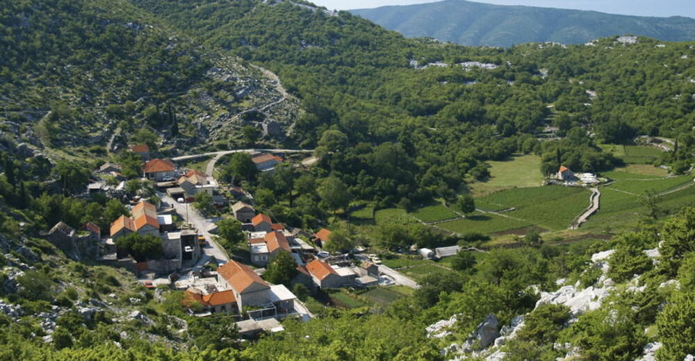
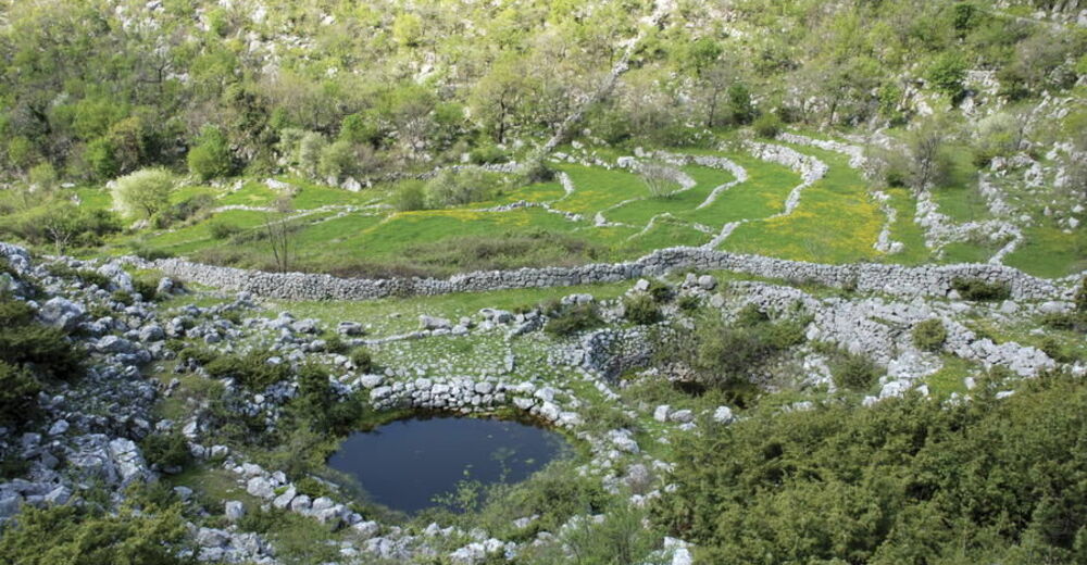
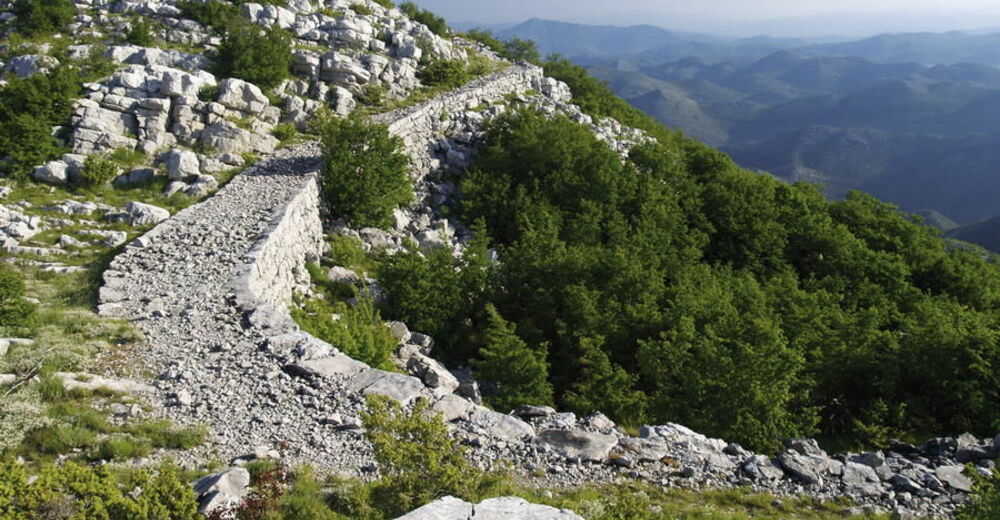
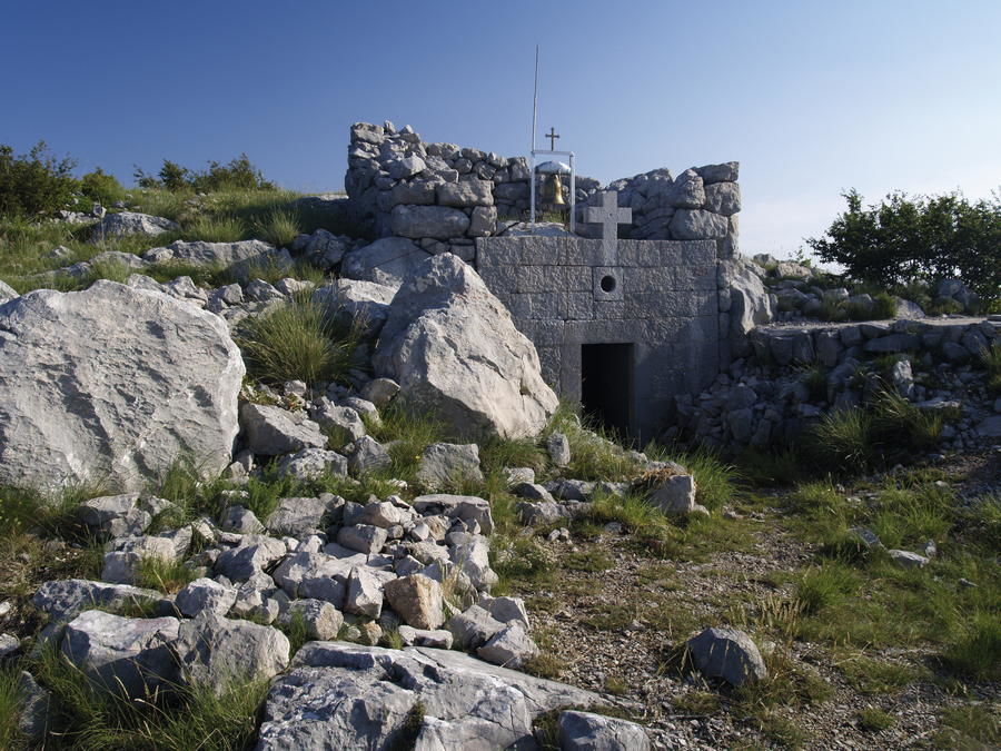
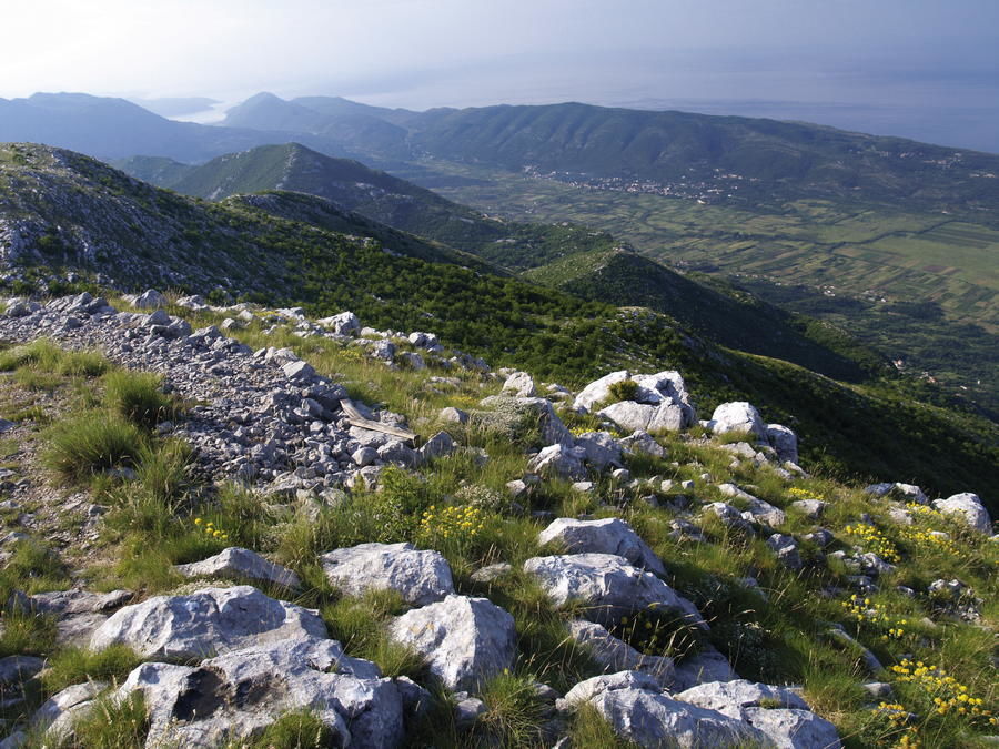
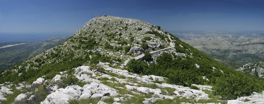
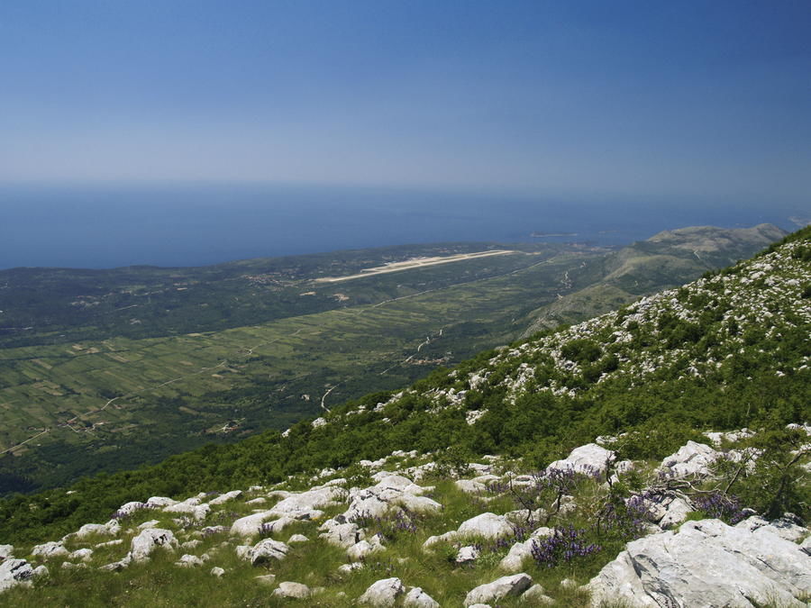
A particularly interesting area is the area of Konavle in the far southeastern part of Croatia, south of Dubrovnik. To the northeast, the area of Konavle is bordered by the hills of Herzegovina; to the east, it borders the Montenegrin section of Orjen; to the south, it borders the Adriatic, and to the west – the city of Cavtat with the area of Župa dubrovačka and the settlement of Zvekovica. Konavle is an elongated area approximately 40 kilometers long and 2 kilometers to 15 kilometers wide. Above the wide field of Konavosko polje, we see picturesque hills with the ridge of Sniježnica dominating the landscape as the southernmost Croatian mountain exceeding the 1000-meter mark. The mountain of Sniježnica is a typical karst mountain with rocky limestone terrain and scarce Mediterranean vegetation. The mountain's name, with the word snijeg (snow) in its root, stems from the fact that snow sometimes remains in the peak area of the mountain for quite a long time, even until May. The reason is significant precipitation in the area, coupled with climate impact from the north and the accompanying low temperatures despite the closeness of the sea.
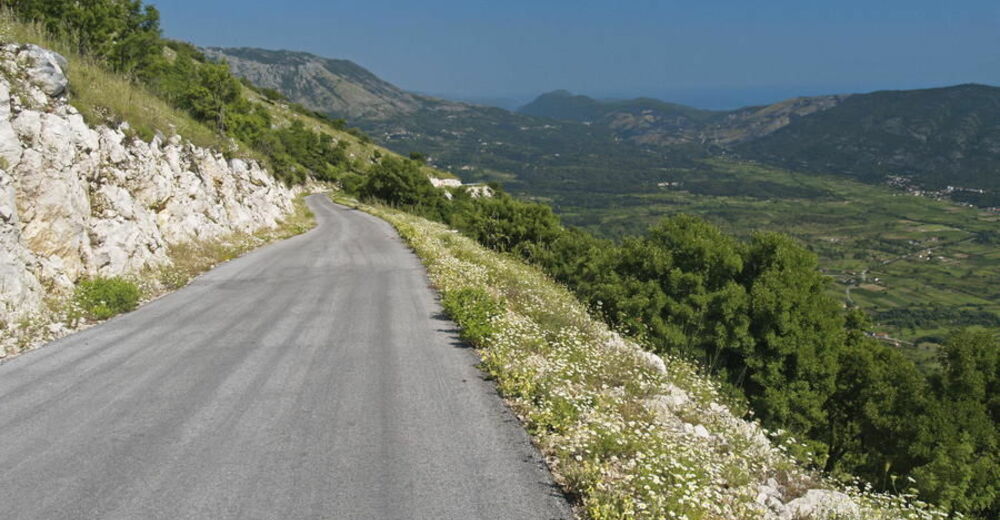
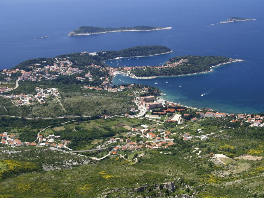
Via Dinarica reaches Dubrovnik from the island of Mljet, with boat transfer available in the summer months. From the city of Dubrovnik, we first proceed to Cavtat either by coastal route or by sea (boat transfer). From Cavtat, the Blue Line of Via Dinarica continues through Konavle. There is a hiking trail available from Pridvorje to the mountain of Sniježnica (through the village of Kuna Konavoska; 3 hours of climbing). However, after a tour of Sniježnica, hikers need to descend along the same route back to Pridvorje. Via Dinarica continues southwards through Konavle, reaching Ljuta where it branches into two route options. The main route of Via Dinarica proceeds from Ljuta along the road through the village of Dubravka towards the border area of Croatia, Bosnia and Herzegovina and Montenegro at the site of Jablan do. This is where the Blue Line briefly enters Bosnia and Herzegovina, but then proceeds to Montenegro after only several kilometers (border crossing point Jablan do - Sitnica). Given the fact that border crossing points in the area are local border crossings with a specific control regime, visitors are recommended to look for precise information on border crossing procedures for the two state borders between the localities of Dubravka, Jablan do and Stinica. Alternatively, visitors can use the optional route of the Blue Line that leads to the international border crossing point Debeli brijeg / Karasovići, where Via Dinarica enters Montenegro.
- Highest point
- 687 m
- Endpoint
-
(Sniježnica)
- Height profile
-
 © outdooractive.com


-

-
AuthorThe tour Via Dinarica HR-B-22 Area of Dubrovnik is used by outdooractive.com provided.