


- Brief description
-
This is a low mountain hiking route with a low level of technical difficulty. Nevertheless, the circular hiking trail has considerable positive differences in altitude. A minimum level of physical fitness is therefore required to complete the route in 5 stages.
- Difficulty
-
medium
- Rating
-
- Starting point
-
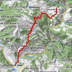
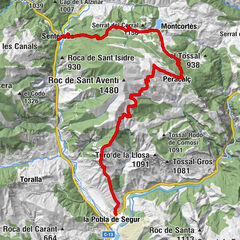
La Pobla de Segur
- Route
-
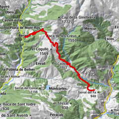
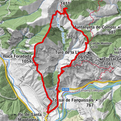
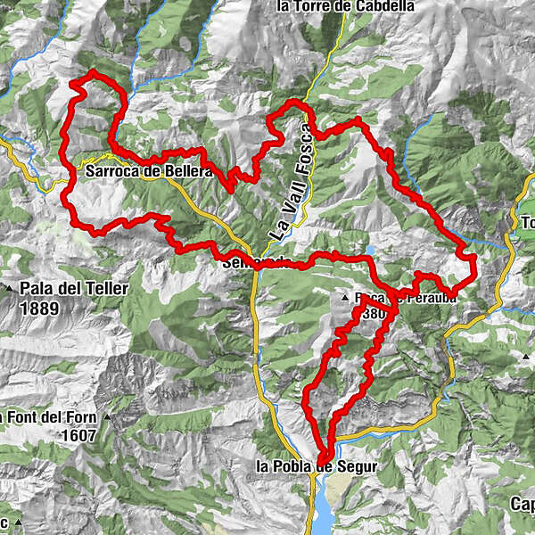
la Pobla de Segur (526 m)Coll de Montsor (1,070 m)5.3 kmEnsolera8.8 kmPeracalç (1,190 m)10.0 kmCortscastell15.1 kmPeramea (901 m)18.8 kmSant Sebastià18.9 kmFont Vella19.1 kmla Sea22.3 kmSellui (977 m)23.4 kmlo Castell (1,053 m)23.9 kmSolana de Comacastell24.3 kmColl de la Serreta (1,283 m)25.2 kmFont de la Roca26.0 kmels Planells27.4 kmCous27.8 kmCollada del Clot d'Andol28.3 kmels Graons31.5 kmBeranui32.9 kmAreny de Mar34.0 kmla Plana de Mont-ros34.1 kmBar Restaurant Casa Gallart34.2 kmGaleria inferior35.1 kmGaleria intermèdia35.2 kml'Horta35.3 kmGaleria Superior35.9 kmFont del Poble36.0 kmSant Pere de Castell36.1 kmCastell-estaó36.1 kmels Quadros36.5 kmPrat de Viles36.7 kmlo Tossal37.9 kmla Font de la Plana38.1 kmFont del Poble38.8 kmAntist (1,244 m)38.9 kmles Eiroles39.4 kmEstavill41.3 kmes Closos41.7 kmObaga del Grau42.5 kmTossal dels Camps (1,165 m)44.6 kmla Bastida de Bellera45.4 kmColl de Fades (1,267 m)46.6 kmErdo (1,223 m)47.6 kmPlana dels Torents49.4 kmVilella (1,174 m)49.9 kmXerallo (973 m)52.2 kmla Creueta53.1 kmMare de Déu de Castellgermà53.3 kmles Esglésies55.0 kmSant Joan Baptista55.0 kmels Cabulls55.4 kmla Vinya56.5 kmSolà de Sentís57.0 kmRaval de Santís57.6 kmSentís (1,269 m)57.9 kmSant Julià de Sentís57.9 kmFont de les Fontanelles59.0 kmTossal del Caubo (1,471 m)59.5 kmCollada de les Terres (1,465 m)60.8 kmColl d'Art (1,321 m)62.3 kmla Creu64.2 kmRoca del Vedat del Mas (1,402 m)64.9 kmla Casa Encantada71.2 kmSolà de Cadolla72.9 kmCadolla74.1 kmel Serrat de les Boïgues74.7 kmles Serretes75.8 kmFont del Pou76.3 kmNaens (992 m)76.4 kmSenterada (727 m)79.0 kmMare de Déu de Gràcia79.2 kmla Creu82.5 kmla Cultia83.8 kmMentui (1,038 m)83.9 kmels Solans84.2 kmColl de Mentui (1,098 m)84.5 kmSolana del Vicent84.9 kmFont de Corts85.2 kmPrat del Comú85.3 kmles Costes86.7 kmPeracalç (1,190 m)89.0 kmCampavila89.3 kmlo Solà92.9 kmMontsor94.7 kmFont del Poble95.1 kmRoca Foradada (1,054 m)97.8 kmPas del Llop97.9 kmCinglera de la Roca Foradada (1,023 m)98.2 kmla Pobla de Segur (526 m)101.2 km
- Best season
-
JanFebMarAprMayJunJulAugSepOctNovDec
- Description
-
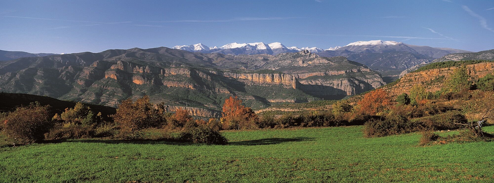
The El Cinquè Llac route is a circular hiking trail in the Pyrenees. It is a "medium altitude" route, suitable for all types of hikers, with 5 signposted stages through the Pallars, the Alta Ribagorça and along the foothills of the Aigüestortes i Sant Maurici National Park.
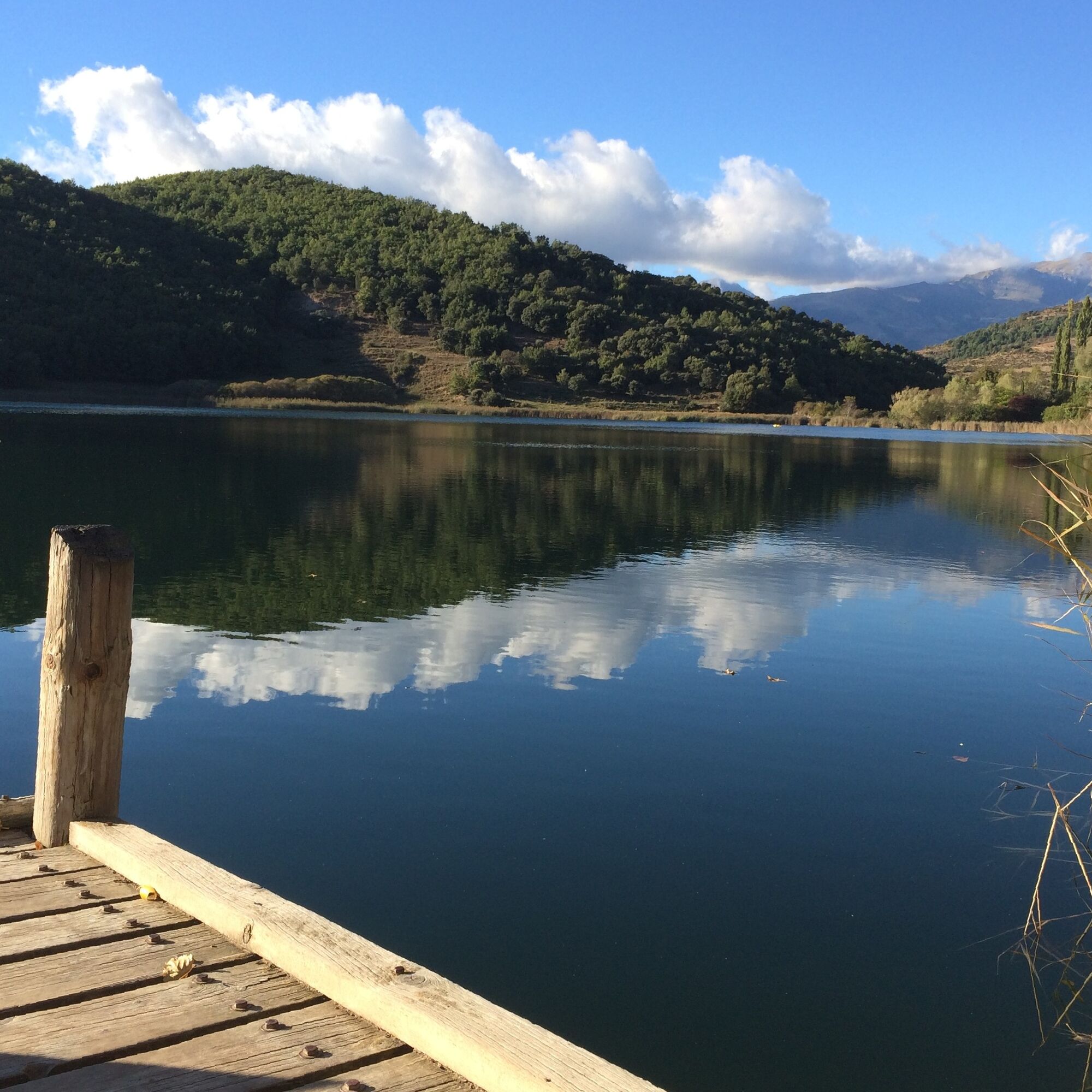
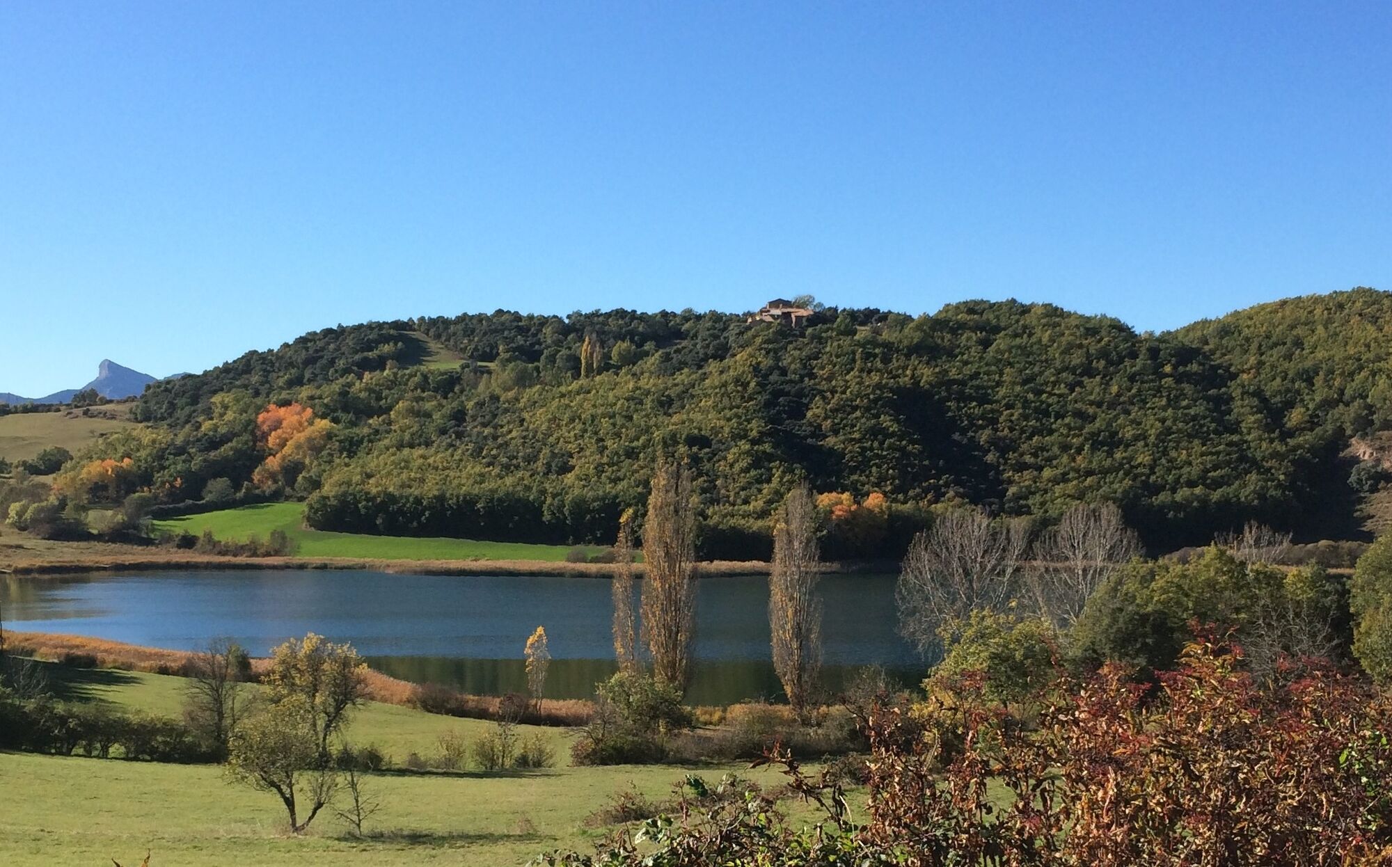
For more than 100 km, the hiker overcomes a changing orography offered by nature while discovering the most unknown and impressive part of the Pyrenees, including: the Corts plain, the Fosca valley and the Manyanet valley, and the Montcortès lake, the Fifth Lake. From various peaks along the route, you can see it in the distance, as if it were a drop of water, until it appears in all its splendor during the last stage.
Detailed information can be found at www.pirineuemocio.com/en.
Tourist board of the Lleida region:
www.aralleida.cat/en
- Directions
-
The majority of the route runs along mountain paths and trails, some of which have been prepared for the route, while others are already signposted by the district. Each stage includes sections on both dirt tracks and roads. During the hike, you will notice time and again that this region has been inhabited since prehistoric times and still is today. The hiking trail presents us with dolmens, chapels, churches, fortified villages, monasteries, bridges and Romanesque ruins, barns, country houses and shepherds' huts. The latter are examples of dry-stone architecture, a rich treasure of our history, as are the ancient shepherds' paths.
The Cinquè Llac route allows the hiker to move through a rural natural space that is largely unknown but accessible to man. Its villages have retained their original character and preserve their festivals, customs, legends and traditions. The legends accompany us on our way and give each stage its name. It is precisely these legends that give our journey through the mountains its magic, with the aim of discovering the Fifth Lake (El Cinquè Llac).
The route is divided into five stages:
Stage 1: The Sleeping Giantess
Stage 2: The Witches' Sabbath of Serraspina
Stage 3: The Devil's Bridge
Stage 4: The enchanted house
Stage 5: Lake Montcortès
- Highest point
- 1,551 m
- Endpoint
-
La Pobla de Segur
- Height profile
-
 © outdooractive.com
 - Additional information

-

-
AuthorThe tour El Cinquè Llac | The fifth lake is used by outdooractive.com provided.