- Brief description
-
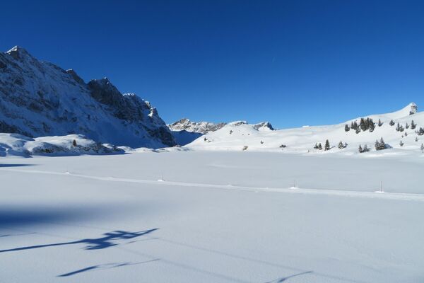
Escape the nearby hustle and bustle along forest paths on the Ursifluh.
- Difficulty
-
medium
- Rating
-
- Starting point
-
Twing
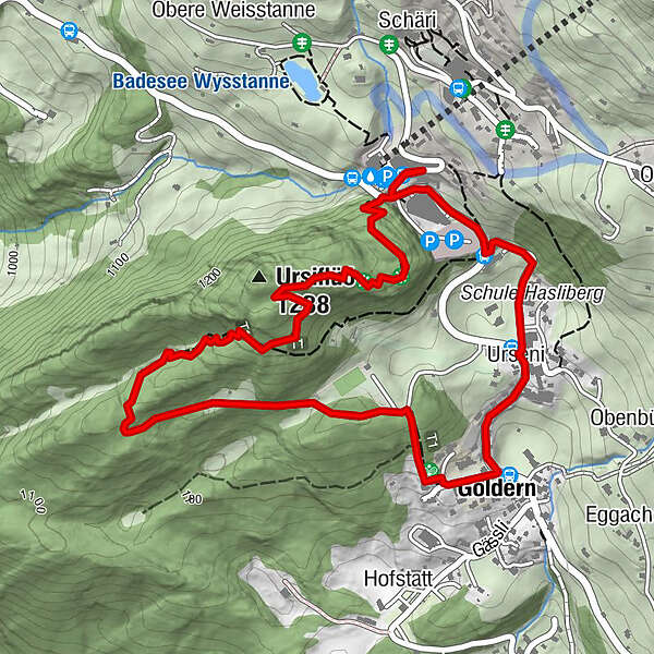
- Route
-
Hasliberg Wasserwendi (1,217 m)Ursiflüö (1,238 m)0.7 kmHasliberg Goldern (1,082 m)2.2 kmUrseni2.5 kmGletscherblick2.8 kmTwing3.0 kmHippie Mountain3.2 km
- Best season
-
AugSepOctNovDecJanFebMarAprMayJunJul
- Description
-
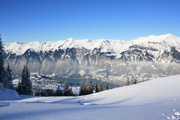
In the area of the walking park, often on narrow paths, wander through secluded sections of forest. Sunny conditions are to be found even though long stretches are in the forest (up on the rocky ridge, much deciduous forest). Beautiful viewpoints at the top of the Ursifluh rocky ridge.
- Directions
-
Twing - Ursifluh - École d'Humanité - im Urseni - Twing
- Highest point
- 1,222 m
- Endpoint
-
Twing
- Height profile
-
 © outdooractive.com
 - Equipment
-
Solar radiation is increased in the mountains. Sun cream with a high protection factor, a sun hat and sunglasses with UV protection should definitely be in your luggage Also in summer and in good «starting weather», warm clothing and rain protection must be with you. The layering principle with different layers of clothing is recommended Charged mobile phone Pocket pharmacy Winter shoes with non-slip soles Drinks and food If available Telescopic poles If available: Snowshoes
- Safety instructions
-
Entirely at your own responsibility Any game tracks are a call for considerate behaviour Do not leave the summer hiking trail (yellow) Dogs on a leash The paths to the summer "Ursifuh Walking Park" are not specially marked The first to appear after a snowfall takes the lead for those coming after Access from Twing is via stairs
- Tips
-
Insider tip for private snowshoeing.
- Directions
-
There are different ways to reach the region by car. The fastest way from Basel and Geneva is via Berne. The fastest route from Zurich is through Lucerne and the Brünig Pass. The pass is open in summer and winter.
From the south, the route goes over the Grimsel or Susten Pass into the region. Both passes are only open in summer. Alternatively, you can take the Simplon Pass and then Lötschberg car transport.
- Public transportation
-
Thanks to its central location in Europe, Switzerland is served by international trains from over 12 countries. Within Switzerland, Intercity trains run directly from Basel and Lucerne to the Jungfrau Region. Travellers from Zurich have to change in Berne. The trains run every half hour.
- Parking
-
The town of Meiringen has 835 public parking spaces in the village centre and at the valley station of the Bergbahnen Meiringen-Hasliberg. All parking spaces are regulated daily (Sundays too) by parking meters from 8.00 am to 7.00 pm. The exception is the Casino AEH (car park) which is operated around the clock.
- Author
-
The tour Ursifluh on traces in the snow is used by outdooractive.com provided.