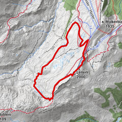
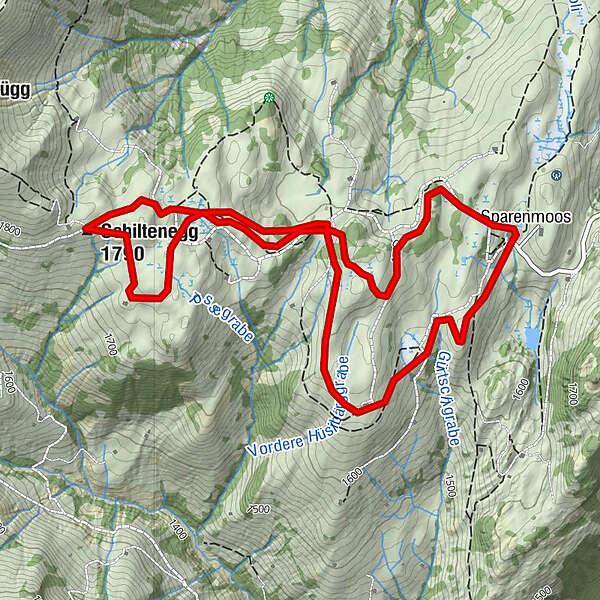
Sparenmoos - Hüsliberg - Schiltenegg - Sparenmoos NR. 770

Winter hiking


- Brief description
-
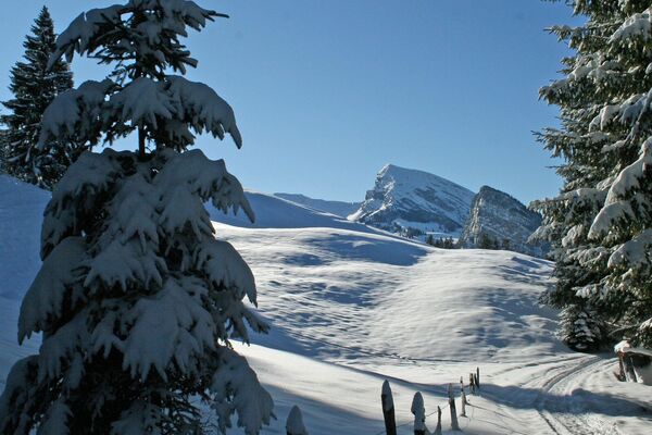
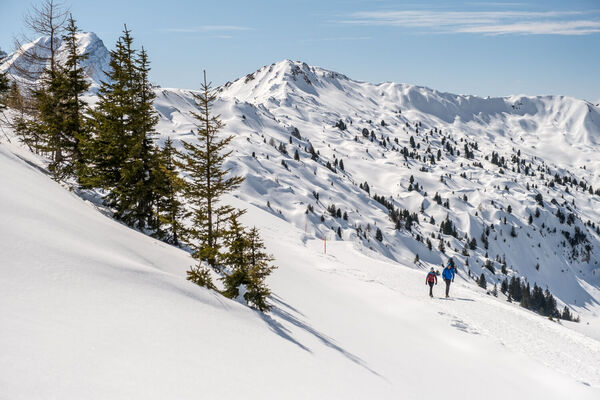
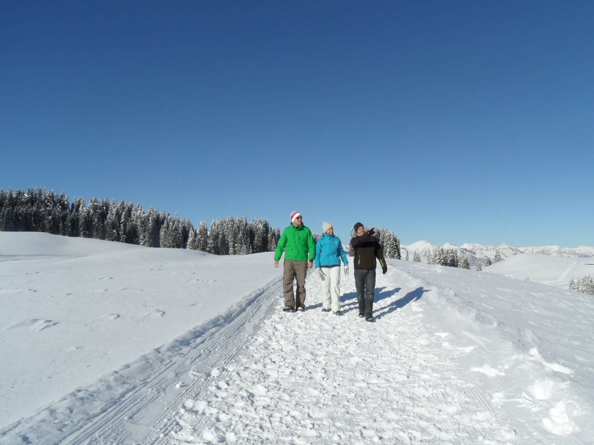
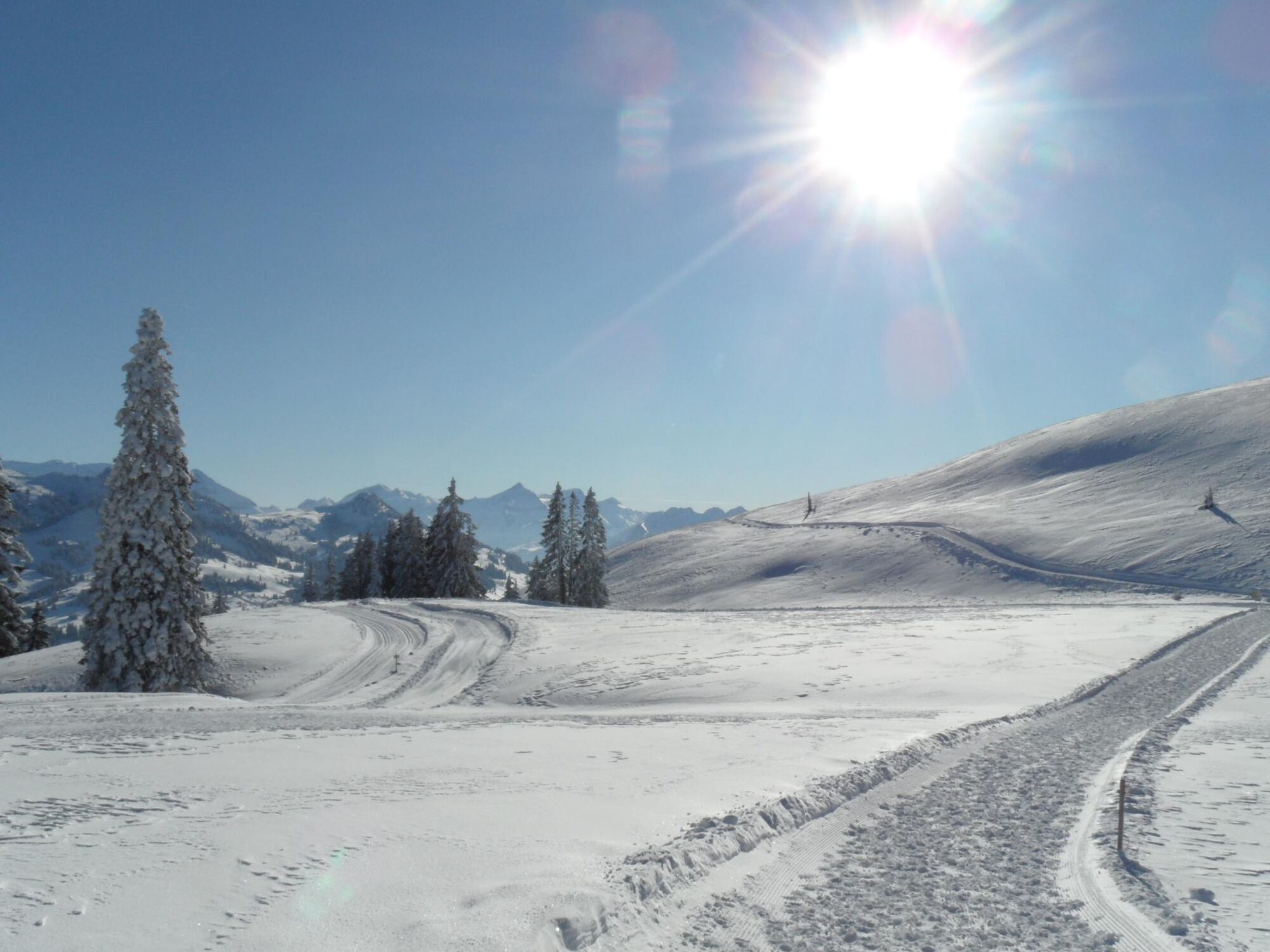
This hike affords beautiful views into the Simmental, western Bernese Oberland and the Vaud Alps. Equally as pleasing are the delightful meadows and quiet, clear pine forests on this peaceful plateau.
- Difficulty
-
medium
- Rating
-
- Starting point
-
Sparenmoos, Berghotel
- Route
-
Schiltenegg (1,790 m)3.5 kmSparenmoos6.3 km
- Best season
-
AugSepOctNovDecJanFebMarAprMayJunJul
- Description
-
Zweisimmen is the gateway to the world-renowned Gstaad-Saanenland region. Sparenmoos is located above this cosy village on a mountain terrace with several elongated hills. This panoramic winter hiking trail on high moorland countryside starts to the west of the Berghotel Sparenmoos.
An easy ascent takes you towards Hüsliberg. This section affords spectacular views of the Simmental and the Vaud Alps. If you stop for a break at the Hüsliberg Alpine hut and take a good look you can even see the skiers on the Rinderberg zooming down the slopes. After this it is uphill now: facing the mighty Hundsrügg, you proceed upwards to the turning point at the Schiltenegg. Near Nüjeberg/Uf em Hubel, you turn to the east - and now encounter meadows, high moorland terrain and majestic fir trees in their winter dress. After a steep descent and a walk along the edge of the forest and along an Alpine road, you find yourself back at the starting point. - Directions
-
Sparenmoos - Hüsliberg - Schiltenegg - Sparenmoos
- Highest point
- 1,782 m
- Endpoint
-
Sparenmoos, Berghotel
- Height profile
-
 © outdooractive.com
 - Tips
-
After your walk, which will take you about three hours, it is time to sample the local dishes on offer at the Berghotel Sparenmoos. You also have the option of tobogganing back to Zweisimmen.
- Additional information
- Directions
-
The Destination Gstaad is located in the south-west of Switzerland right on the border to the French-speaking part of the country. The Destination is easily accessed by rail or car from the regions around Lake Thun and Lake Geneva and the Gruyere region Direct connections to the European high-speed rail network and all international airports in Switzerland guarantee a time-saving and pleasant journey. The main means of transport in the destination of Gstaad are the "MOB" (Montreux-Oberland Bernois) train and numerous post bus lines.
- Public transportation
- Parking
-
Parking Sparenmoos
Attention!
From Heimchueweid: One way road drivable with snow chains or 4x4.
Way up: xx:30 - xx:45
Way down: xx:00 - xx:15
Due to the limited number of parking spaces, we recommend parking at the train station in Zweisimmen and then taking the bus.
-

-
AuthorThe tour Sparenmoos - Hüsliberg - Schiltenegg - Sparenmoos NR. 770 is used by outdooractive.com provided.
GPS Downloads


General info
Refreshment stop
Other tours in the regions
-
Alpes Vaudoises
91
-
Lenk-Simmental
140
-
Saanenmöser
67