


- Brief description
-
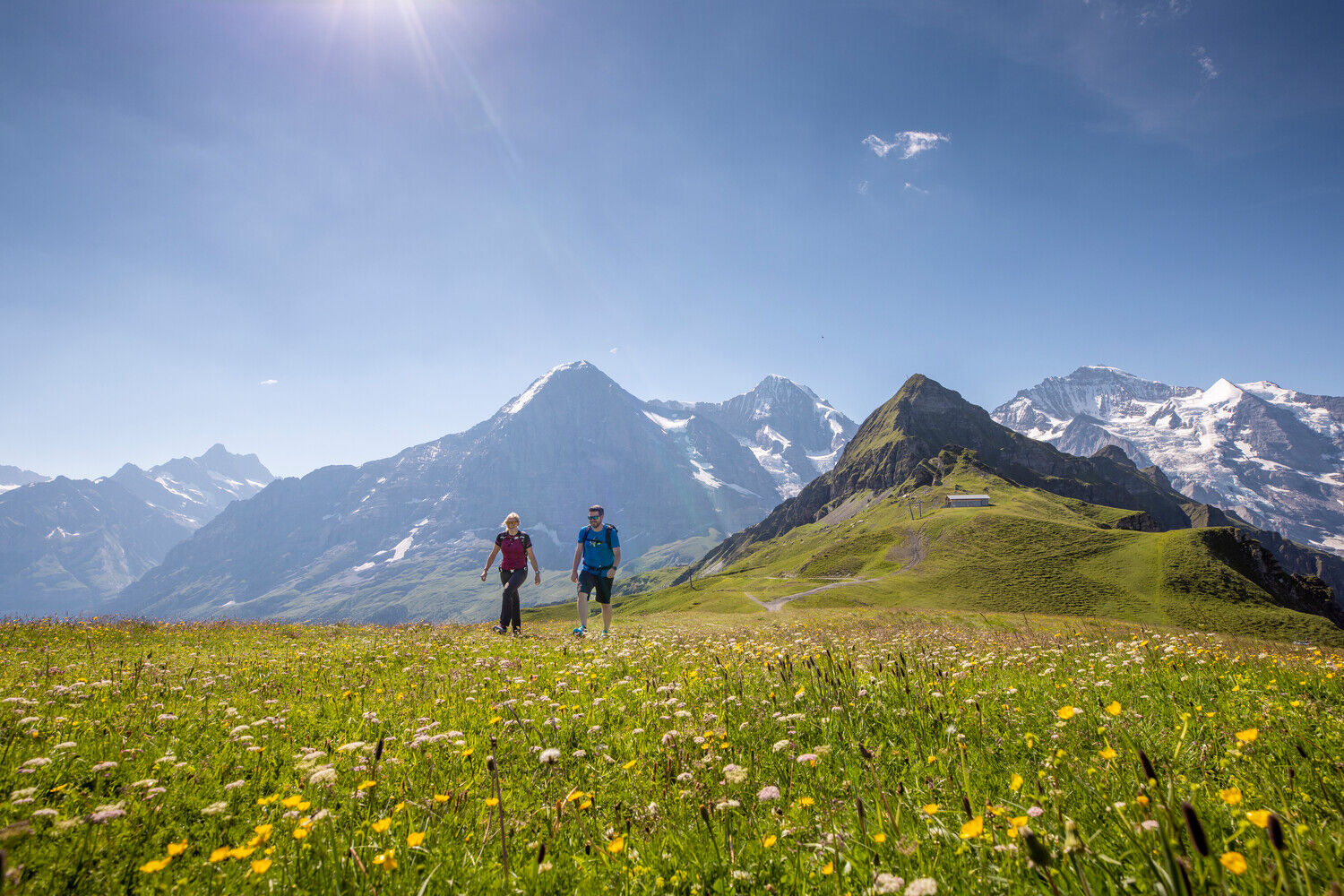
High altitude hike for all nature lovers
- Difficulty
-
medium
- Rating
-
- Starting point
-
Männlichen
- Route
-
Männlichen0.1 kmArven Garde Bar4.1 kmBerghaus Alpiglen7.3 km
- Best season
-
JanFebMarAprMayJunJulAugSepOctNovDec
- Description
-
The gondola lift takes you up to Männlichen, from where the Romantic Trail starts. Ascending and descending the path winds its way over wild and romantic mountain pastures with anemones, troll flowers, gentians, alpine roses and cotton grass. At the southernmost point of the Männlichen Plateau, the Romantic Trail branches off towards the Teufenschlucht. Having reached Alp Gummi, the trail continues to Alp Bustiglen and past the Arvengarten to Alpiglen. Those who have hiked enough take the Wengerenalpbahn back down to Grindelwald.
The Romantic Trail can also be started on Alpiglen, with the destination Männlichen.
- Directions
-
Bergstation Männlichen - Arvengarten - Alpiglen
- Highest point
- 2,222 m
- Endpoint
-
Alpiglen
- Height profile
-
 © outdooractive.com
 - Equipment
-
hiking daypack (approx. 20 liters) with rain cover
comfortable and sturdy footwear
adequate and durable outdoor clothing in multiple layers
sun and rain protection
snacks and drinking water
first aid kit
penknife
mobile phone
if necesessary: telescope sticks, headlight, maps - Safety instructions
- Tips
-
There is a place to stop for refreshments on Männlichen, as well as on Alpiglen.
- Additional information
- Directions
-
From Basel and Geneva, the fastest route to the Jungfrau Region is via Bern. From Zurich, the route via Lucerne and the Brünig Pass is recommended. The pass is open all year round.
From the south, travel to the Jungfrau Region via the Grimsel or Susten Pass. Both passes are only open in summer. An alternative is the Simplon Pass with subsequent car transport through the Lötschberg tunnel.
Grindelwald
From Interlaken we follow the main road to Zweilütschinen. Here we turn left towards Grindelwald. The whole trip takes about 30 minutes and leads over a partly winding road.
Wengen
Wengen is car-free. If we arrive by car, we have to leave it in Lauterbrunnen and take the train. The journey from Interlaken to Lauterbrunnen takes about 20 minutes.
- Arrival Grindelwald
- Arrival Lauterbrunnen
- Arrival by car video Jungfrau Region
- Lötschberg car transport
- Public transportation
-
Thanks to its central location in Europe, Switzerland is served by international trains from over 12 countries. Within Switzerland, Intercity trains run directly from Basel and Lucerne to the Jungfrau Region. Travellers from Zurich have to change in Berne. The trains run every half hour.
Grindelwald
From Interlaken Ost railway station we reach Grindelwald without changing trains on the Bernese Oberland Bahn (BOB). Important: Get on the rear part of the train, as it splits in Zweilütschinen. If you get on at the front, you will end up in Lauterbrunnen. The journey takes 30 minutes to Grindelwald Terminal (V-Bahn). Three minutes later we are at the terminal in the village.
There are three stations in Grindelwald (Terminal, Grund and Dorf). The terminal station (Dorf) is in the centre of Grindelwald.
Wengen
From Interlaken Ost station we reach Wengen in 44 minutes. The blue and yellow train of the Berner Oberland Bahn (BOB) takes us to Lauterbrunnen. Important: We sit in the front part of the train, as it splits in Zweilütschinen. If you take a seat at the back, you will make a detour to Grindelwald. In Lauterbrunnen we change to the yellow-green train of the Wengernalp Bahn (WAB). This takes us to Wengen in 12 minutes.
- Parking
-
Grindelwald
Grindelwald has public car parks with covered parking spaces: Eiger+ car park (252 parking spaces) and Sportzentrum car park (160 parking spaces). They cannot be reserved in advance. Uncovered parking spaces are available everywhere in the village.
Wengen
There is a multi-storey car park directly below Lauterbrunnen station. Alternatively, you can use the car park at the Lauterbrunnen church. From here, a bus leaves for the station every half hour. On foot we need about 10 minutes.
Lauterbrunnen multi-storey car park
A covered passage leads from the Lauterbrunnen car park to the cable cars to Wengen.
- Author
-
The tour «Romantic Trail» Männlichen - Alpiglen No. 35 is used by outdooractive.com provided.


-
Aletsch Arena
1475
-
Jungfrau Region
1010
-
Grindelwald - Männlichen
470


