


- Brief description
-
One of the Bernese Oberland’s most impressive ridge trails. The varied hike along the ridge, the majestic view over the Oberland’s monolithic mountains, the thrilling view into the Justis valley and the fascinating vista of the craggy limestone landscape of the Sieben Hengste and Seefeld are utterly unique. The path between the Burgfeldstand and Gemmenalphorn is exposed in places and sometimes equipped with cables; nevertheless, surefootedness and a head for heights are essential. Natural paths throughout.
- Difficulty
-
medium
- Rating
-
- Route
-
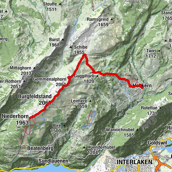
Niederhorn (1,963 m)0.2 kmBurgfeldstand (2,063 m)2.2 kmGemmenalphorn (2,061 m)3.8 kmStutzmad9.4 kmBin Öuste10.8 kmMoosgaden10.9 kmZäundli11.1 kmTraubenegg11.1 kmFahrenbühl11.1 kmNeuenstadel11.1 kmBärenmatte11.2 kmHolzmatte11.2 kmHabkern11.3 kmGasthof Bären11.3 kmIm Holz11.4 kmGruebi11.4 km
- Best season
-
JanFebMarAprMayJunJulAugSepOctNovDec
- Description
-
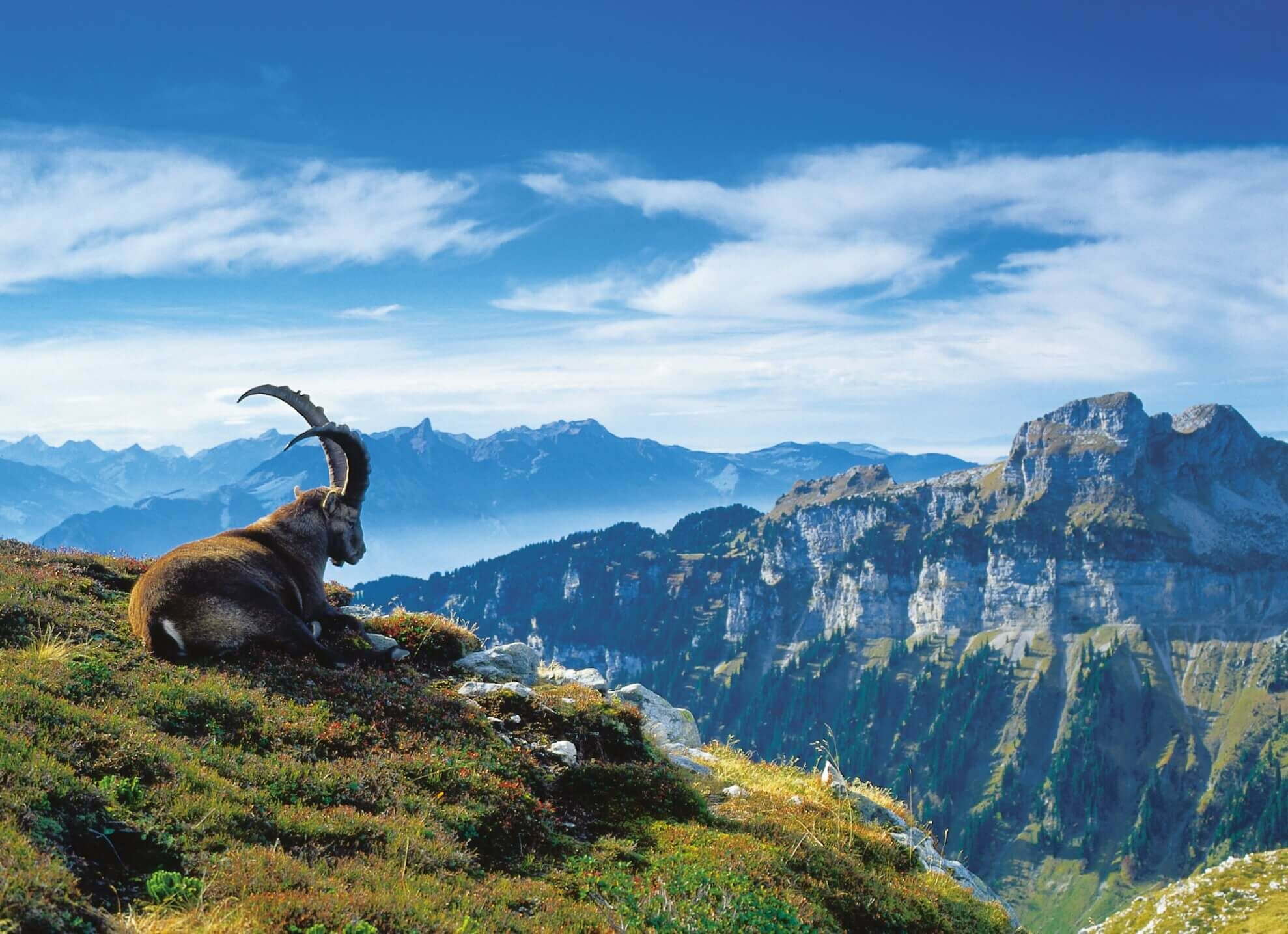
As the first distinctive point in the lengthy Güggisgrat arête, and despite its relatively modest height, the Niederhorn offers a boundless panorama on three sides. Far beneath the summit lies Lake Thun, which is bound by a chain of villages and imposing forests. Beyond the zigzagging prealpine peaks of the Stockhorn, Niesen, Schwalmere and Faulhorn loom the ice-crested giants of the Alps, from the Wildhorn to the Tödi. The view into the Justis valley 800 metres below and over Lake Thun into Frutigland is just as stunning. Over lush alpine meadows the path initially dips to point 1915. Towards the Burgfeldstand, the highest summit in the Güggisgrat, the path continues along the edge of the arête. Caution is advised on the trail approaching the Gemmenalphorn, which is very exposed in parts. Despite the cables, the rock faces on the left and right aren't going to appeal to everyone. The trained eye will spot chamois goats as they feed and rest, and as you make your way along the path, you’ll occasionally encounter ibex as well. The Gemmenalphorn with its panoramic view is another great place to stop and reflect. The descent is safe, provided that it is approached with the appropriate care. In the valley in front of the cabins at Seefeld Oberberg, the path branches. Bearing east and then south, you follow an indistinct, gently sloping path across the rear of the Gemmenalp. The landscape is characterised by limestone hills, cleaved rocks and alpine rhododendrons. At the Bäreney cabin, keep east at an acute angle. By the northern flank of the Guggihürli , the flat trail continues to the Ufem Stand observation point, where you can enjoy the view over the Lombachtal to the nearby Harder. The path now descends steeply over the ridge to Bodmi where you can reach Post Habkern bus stop in just a few minutes.
- Highest point
- 2,060 m
- Endpoint
-
Habkern
- Height profile
-
 © outdooractive.com
 - Parking
-
To Beatenbucht base station You can park your car easily and safely in the car park next to the Beatenbucht base station for CHF 7.00 per day.
To Beatenberg Station Parking spaces can be found at Beatenberg Station for CHF 7.00 per day or in Lood car park for CHF 5.00 per day (12 hours respectively).
If the car park at Beatenberg Station is full, Niederhornbahn AG operates a free shuttle service between Lood car park and the base station for the Niederhorn Mountain Railway.
-

-
AuthorThe tour Panoramic trail over the Güggisgrat is used by outdooractive.com provided.


General info
-
Obwalden
2028
-
Interlaken
1112
-
Beatenberg
395


